No products
Categories
-
Antique Maps and Views
- Africa
-
America
- America (continent)
- Antilles (West Indies)
- Argentina
- Bermuda
- Brazil
- Canada
- Central America and Antilles (West Indies)
- Chile
- Columbia
- Florida
- Guyana
- Hawaiian Islands
- Honduras
- Louisiana
- Mexico
- New York
- North America
- Panama
- Paraguay
- Peru
- South America
- Straits of Magellan
- United states (USA)
- Venezuela
- Virginia
- Asia and Australia
- Atlasy
-
Europe
- Austria
-
Belgium, the Netherlands, Luxembourg
- Amsterdam
- Antwerp
- Belgium and Luxembourg
- Bergen op Zoom
- Blokzijl
- Bommenede
- Brabant
- Brugge
- Brussels
- Charleroi
- Courtrai
- Delft
- Dinant
- Dordrecht
- Elburg
- Flandres
- Fort Rammekens
- Friesland
- Friesland and Groningen
- Gelderland
- Geraardsbergen
- Grave
- Groningen
- Hainaut
- Harderwijk
- Harlingen
- Holland
- Hulst
- Huy
- Liege
- Lier
- Limbourg
- Limburg
- Louvain
- Luxemburg
- Maastricht
- Mechelen
- Middelburg
- Mons
- Namur
- Netherlands
- Netherlands and Belgium
- Nijmegen
- Ostend
- Overijssel
- Rotterdam
- Spa
- Stavoren
- The Hague
- Tiel
- Utrecht
- Veere
- Veurne
- Ypres
- Zaltbommel
- Zeeland
- Zieriksee
- Zierikzee
- Zutphen
- Zype
-
Bohemia, Moravia and Silesia
- Beroun
- Bohemia
- Brandýs nad Labem
- Branná (okr. Šumperk)
- Brno
- Brodce (okr. Mladá Boleslav)
- Broumov
- Carlsbad
- Čáslav
- Čelákovice
- Český Krumlov
- Cheb
- Chlumec nad Cidlinou
- Chomutov
- Děčín
- Dolní Olešnice - Nové Zámky
- Dvůr Králové nad Labem
- Františkovy Lázně
- Frýdlant
- Hasištejn
- Házmburk
- Hostinné
- Hradec Králové
- Hřensko
- Jáchymov
- Jaroměř
- Jihlava
- Jindřichův Hradec
- Jižní Čechy
- Kamýk u Litoměřic
- Karlštejn
- Kolín
- Konopiště
- Kostelec nad Labem
- Křivoklát
- Krkonoše
- Krupka
- Kunětická Hora
- Kutna Hora
- Kyšperk
- Lednice
- Liberec
- Libochovany
- Litoměřice
- Litoměřicko
- Litomyšl
- Loket
- Louny
- Lovosice
- Lysá nad Labem
- Mariánské Lázně
- Mělník
- Mladá Boleslav
- Mladoboleslavsko
- Moravia
- Most
- Náchod
- Nymburk
- Okoř
- Olomouc
- Ostrov nad Ohří
- Pardubice
- Plzeň
- Poděbrady
- Polná
- Prácheňsko
- Prague
- Přelouč
- Rabí
- Rakovnicko
- Rakovník
- Roudnice nad Labem
- Rožmberk
- Rožnov pod Radhoštěm
- Rychmburk
- Sedlec
- Slaný
- Smečno
- Smiřice
- Štětí
- Šumava
- Švamberk (Krasíkov)
- Tábor
- Tepl
- Teplice
- Terezín
- Třeboň
- Týnec nad Labem
- Uničov
- Valdštejn
- Vinec
- Vrabinec
- Vrchlabí
- Vyšší Brod
- Zákupy
- Žampach (zámek)
- Želiv
- Žireč
- Žleby
- Znojmo
- Zvíkov
- Central Europe
- Danube
- Eastern and Southeastern Europe, Balkan
- Europe (continent)
-
France
- Albi
- Anjou
- Artois
- Bar-le-Duc
- Berry
- Blois
- Bourbourg
- Bourgogne-Franche-Comté
- Bresse
- Cambrai
- Cassel
- Château de Lichtenberg
- Chaumont
- Compiegne and Noyon
- Corsica
- Dauphiné
- Elsass
- Gascogne
- Gâstinais and Senonais
- Gravelines
- Hauts-de-France
- Ile de France
- La Bassée - Hesdin
- Languedoc
- Lille
- Limoges
- Lorraine
- Lyon
- Maine
- Marseille
- Metz
- Montmélian
- Mulhouse
- Nancy
- Nice
- Normandie
- Paris
- Perche
- Picardy
- Poitou
- Provence
- Re and Oleron
- Reims - Rethel
- Saint-Omer
- Saintonge and Aunis
- Savoy
- Strasbourg
- Tarn (department)
- Vexin
- Germany
-
Great Britain and Ireland
- Bedford and Buckinghamshire
- Berkshire and Hampshire
- Cambridgeshire
- Cornwall
- Cumberland
- Denbigh and Flint
- Derbyshire
- Devon
- Dorset
- Durham (County)
- England
- Essex
- Gloucestershire
- Great Britain and Ireland
- Herefordshire
- Hertfordshire
- Hertfordshire and Middlesex
- Huntingdonshire
- Ireland
- Isle of Wight
- Kent
- Leicestershire
- Lincolnshire
- London
- Middlesex
- Norfolk
- Northampton
- Northeastern England
- Northern England
- Northumberland
- Northwestern England
- Nottinghamshire
- Oxfordshire
- Scotland
- Shropshire and Staffordshire
- Somerset
- Southeastern England
- Southwestern England
- Staffordshire
- Surrey
- Sussex
- Wales
- Westmorland
- Wiltshire
- Worcestershire and Warwickshire
- Yorkshire
- Greece, Mediterranean Sea
-
Italy
- Abruzzo
- Ancona
- Apulia (Puglia)
- Arcevia
- Bari and Basilicata
- Bergamo
- Bologna
- Brescia
- Brescia and Crema
- Cadore
- Cagliari
- Caiazzo
- Calabria
- Campania
- Capitanata
- Carmagnola
- Catania
- Central Italy
- Civitavecchia
- Crema
- Cremona
- Cuneo
- Elba
- Emilia Romagna
- Faenza
- Fano
- Ferrara
- Florence
- Fondi
- Friuli
- Gaeta
- Gallipoli
- Genoa
- Ischia
- Italy
- Lazio
- Lerici
- Liguria (Italian Riviera)
- Livorno
- Lombardia
- Loreto
- Lucca
- Mantua
- Mantua
- Marche (Ancona)
- Merano
- Messina
- Milan
- Mirandola
- Modena
- Molise
- Monferrato
- Naples
- Netuno
- Nocera Umbra
- Northern Italy
- Orvieto
- Orvieto and Loreto
- Otranto
- Padua
- Palermo
- Parma
- Pavia
- Perugia
- Pesaro
- Piacenza
- Piedmont
- Pinerolo
- Piombino
- Pisa
- Po
- Pozzuoli
- Reggio di Calabria
- Reggio Emilia
- Rimini
- Rome
- Rovigo
- San Marino
- Sardinia
- Sicily
- Sicily and Malta
- Sicily and Sardinia
- Siena
- Southern Italy
- Spoleto
- Sulmona
- Taranto
- Terracina
- Tivoli
- Torino
- Tortona
- Trapani
- Trentino-Alto Adige / Südtirol
- Trento
- Treviso
- Tuscany
- Tyrol
- Udine
- Umbria
- Urbino
- Velletri
- Venice
- Vercelli
- Verona
- Vicenza
- Viterbo
- Labe
- Mediterranean Sea
- Monaco
- Poland, Silesia, Russia and the Baltic republics
- Rhine
- Scandinavia and Iceland
- Spain and Portugal
- Switzerland
- Islands (Special Catalogue)
- World, Oceans, Poles and Celestial Maps
-
Books
- 17., 18. a 19. století - Bohemika, Moravika, České národní obrození
- 17th, 18th and 19th cent. - literature, illustrated etc. - foreign
- 20th cent. - literature, poetry, bibliophile books, illustrated etc. - foreign
- 20th cent. - literature, poetry, illustrated, bibliophile books, bookbindings etc. - Czech
- Children, youth and adventure books
- Fine arts & Architecture
- History and Law
- History of Culture, Varia
- Nature & Natural Sciences
- Old prints (15th and 16th century)
- Philosophy, Theology, Pedagogy, Economy, Sociology
- Topography, Travel and Geography
-
Drawings and Prints
- Antique engravings, drawings and decorative prints
-
Czech Art of 20th century (graphics, bookplates, drawings)
- Bouda, Cyril (1901-1984)
- Fischerová-Kvěchová, Marie (1892-1984)
- Hodek, Josef mladší (1888-1973)
- Holler, Josef (1903-1982)
- Jiřincová, Ludmila (1912-1994)
- Konůpek, Jan (1883-1950)
- Lhoták, Kamil (1912-1990)
- Obrátil, Karel Jaroslav
- Rambousek, Jan (1895-1976)
- Seydl, Zdenek (1916-1978)
- Stretti, Viktor (1878-1957)
- Švabinský, Max (1873-1962)
- Váchal, Josef (1884-1969)
- Vondrouš, Jan Charles (1884-1970)
- Devotional pictures, greeting cards etc.
- European modern art (graphics, bookplates, drawings)
- Japanese woodblocks
- Old-masters graphics
- Varia
List of works by author Bellin, Jacques Nicolas
Jacques Nicolas Bellin (1703 in Paris - 1772 in Versailles) was a French hydrographer, geographer, and member of the French intellectual group called the philosophes. He was hydrographer of France's hydrographic office, member of the Académie de Marine and of the Royal Society of London. Over a 50-year career, he produced many maps of particular interest to the Ministère de la Marine. His maps of Canada and of French territories in North America (New France, Acadia, Louisiana) are particularly valuable.
-
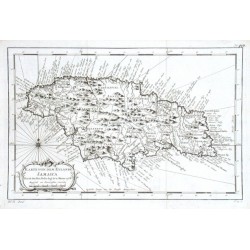
Bellin, Jacques Nicolas Karte von dem Eylande JamaicaCatalog No.: 17655
Jamaica."Karte von dem Eylande Jamaica". Orig. copper-engraving, J. N. Bellin, dated 1758. Published in Leipzig, ca. 1760. With ornamental title-cartouche. 20,5:31,5 cm (8 x 12 1/2 inch.).
-
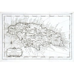
Bellin, Jacques Nicolas Karte von dem Eylande JamaicaCatalog No.: 11721
"Karte von dem Eylande Jamaica". Orig. copper-engraving, J. N. Bellin, dated 1758. Published in Leipzig, ca. 1760. With ornamental title-cartouche. 20,5:31,5 cm (8 x 12 1/2 inch.).
-
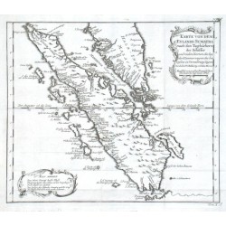
Bellin, Jacques Nicolas Karte von dem Eylande SumatraCatalog No.: 11013
"Karte von dem Eylande Sumatra nach den Tagebüchern der Schiffer". Orig. copper-engraving, J. N. Bellin (1703-1772), published ca. 1750. With ornamental title-cartouche and another ornamental cartouche with explanatory notes. 24,5:28,5 cm (9 3/4...
-
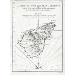
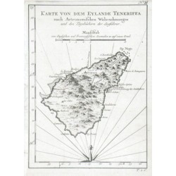
Bellin, Jacques Nicolas Karte von dem Eylande TeneriffaCatalog No.: 18003
Tenerife (Canary Islands)."Karte von dem Eylande Teneriffa nach Astronomischen Wahrnehmungen und den Tagebüchern der Seefahrer". Orig. copper-engraving, J. N. Bellin. Published in Leipzig, ca. 1760. With title and the scale of map ("Maaßstab")....
-
Bellin, Jacques Nicolas Karte von dem Eylande TeneriffaCatalog No.: 11718
"Karte von dem Eylande Teneriffa nach Astronomischen Wahrnehmungen und den Tagebüchern der Seefahrer". Orig. copper-engraving, J. N. Bellin. Published in Leipzig, ca. 1760. With title and the scale of map ("Maaßstab"). 20,5:15 cm (8 x 6 inch.).
-
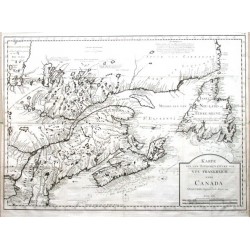
Bellin, Jacques Nicolas Karte von dem Ostlichen-Stucke von Neu...Catalog No.: 03492
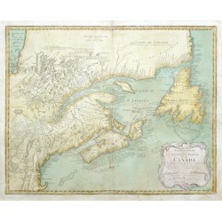
Canada."Karte von dem Ostlichen-Stucke von Neu Frankreich oder Canada". Copper-engraving according to J. N. Bellin's map from 1744, published by L'Abbe Prevost in "Allgemeine Histoire Der Reisen Zu Wasser Und Zu Lande", 1758. With title cartouche...
-
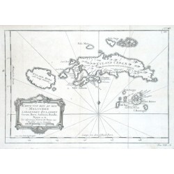
Bellin, Jacques Nicolas Karte von den an den Molucken liegenden...Catalog No.: 11679
"Karte von den an den Molucken liegenden Eylanden Ceram, Buro, Amboina, Banda, Neyra u. a.". Orig. copper-engraving, J. N. Bellin, dated 1750. Published in Leipzig, ca. 1760. With decorative title cartouche. 20,5:29,5 cm (8 x 11 3/4 inch.).
-
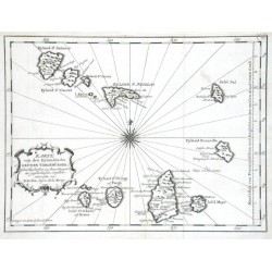
Bellin, Jacques Nicolas Karte von den Eylanden des Grünen VorgebürgesCatalog No.: 11670
Cape Verde Islands."Karte von den Eylanden des Grünen Vorgebürges". Orig. copper-engraving, J. N. Bellin, dated 1747. Published in Leipzig, ca. 1760. With decorative title cartouche and a wind-rose. 21:28 cm (8 1/4 x 11 inch.).
-
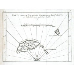
Bellin, Jacques Nicolas Karte von den Eylanden Madera und Porto SantoCatalog No.: 11745
"Karte von den Eylanden Madera und Porto Santo". Orig. copper-engraving, J. N. Bellin. Published in Leipzig, ca. 1760. With title and the scale of map. 16:22 cm (6 1/4 x 8 3/4 inch.).
-
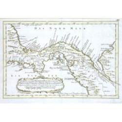
Bellin, Jacques Nicolas Karte von der Erdenge PanamaCatalog No.: 07926
Central America."Karte von der Erdenge Panama und den Provinzen Vergua, Terra Firma und Darien". Orig. copper-engraving published by J. N. Bellin, 1754. Coloured in outline. With ornament. title-cartouche. 19,5:29,5 cm (7 3/4 x 11 3/4 inch.).
-
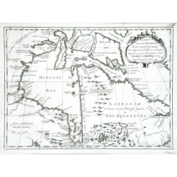
Bellin, Jacques Nicolas Karte von der Hudsons Bay und StrasseCatalog No.: 11664
"Karte von der Hudsons Bay und Strasse". Orig. copper-engraving, J. N. Bellin, dated 1757. Published in Leipzig, ca. 1760. With decorative title cartouche. 21,5:29,5 cm (8 1/2 x 11 3/4 inch.).
-
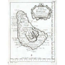
Bellin, Jacques Nicolas Karte von der Insel BarbadeCatalog No.: 11649
"Karte von der Insel Barbade". Orig. copper-engraving, J. N. Bellin. Published in Leipzig, ca. 1760. With decorative title cartouche. 19,5:15 cm (7 3/4 x 6 inch.).
-
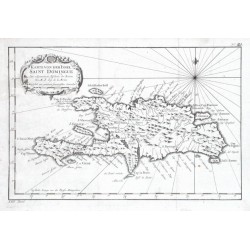
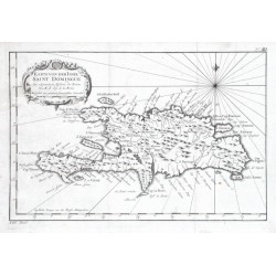
Bellin, Jacques Nicolas Karte von der Insel Saint DomingueCatalog No.: 17649
Hispaniola (Haiti/Dominican Republic) and Martinique."Karte von der Insel Saint Domingue". Orig. copper-engraving, J. N. Bellin. Published in Leipzig, ca. 1760. With ornamental title-cartouche. 19:29 cm (7 1/2 x 11 1/2 inch.).
-
Bellin, Jacques Nicolas Karte von der Insel Saint DomingueCatalog No.: 11730
"Karte von der Insel Saint Domingue". Orig. copper-engraving, J. N. Bellin. Published in Leipzig, ca. 1760. With ornamental title-cartouche. 19:29 cm (7 1/2 x 11 1/2 inch.).
-
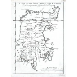
Bellin, Jacques Nicolas Karte von der Jnsel Celebes oder MacassarCatalog No.: 11637
"Karte von der Jnsel Celebes oder Macassar". Orig. copper-engraving, J. N. Bellin. Published in Leipzig, ca. 1760. With title and the scale of map ("Maass-stab"). 20,5:14,5 cm (8 x 5 3/4 inch.).
-
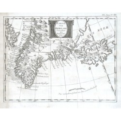
Bellin, Jacques Nicolas Karte von GroenlandCatalog No.: 17979
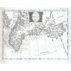
Greenland and Iceland."Karte von Groenland. Gezeichnet von Laurent". Orig. copper-engraving after Laurent for J. N. Bellin, dated 1770. Published in Leipzig, ca. 1770. With decorative title-cartouche. 19:25,5 cm (7 1/2 x 10 inch.).
-
Bellin, Jacques Nicolas Karte von GroenlandCatalog No.: 11751
Greenland and Iceland."Karte von Groenland. Gezeichnet von Laurent". Orig. copper-engraving after Laurent for J. N. Bellin, dated 1770. Published in Leipzig, ca. 1770. With decorative title-cartouche. 19:25,5 cm (7 1/2 x 10 inch.).
-
Bellin, Jacques Nicolas Karte von JslandCatalog No.: 17970
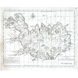
Iceland."Karte von Island". Orig. copper-engraving, J. N. Bellin. Published in Leipzig, ca. 1760. With title-cartouche, another cartouche with explanatory notes ("Erklaerungen") and a wind-rose. 29,5:38 cm (11 3/4 x 15 inch.).
-
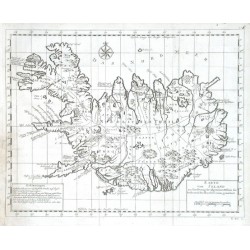
Bellin, Jacques Nicolas Karte von JslandCatalog No.: 11673
"Karte von Island". Orig. copper-engraving, J. N. Bellin. Published in Leipzig, ca. 1760. With title-cartouche, another cartouche with explanatory notes ("Erklaerungen") and a wind-rose. 29,5:38 cm (11 3/4 x 15 inch.).
-
Bellin, Jacques Nicolas Karte von Luisiana, dem Laufe des...Catalog No.: 03489
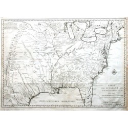
United states (USA)."Karte von Luisiana, dem Laufe des Mississipi und den benachbarten Laendern". Copper-engraving according to J. N. Bellin's map from 1744, published by L'Abbe Prevost in "Allgemeine Histoire Der Reisen Zu Wasser Und Zu Lande",...
-
Bellin, Jacques Nicolas Partie Orientale de la Nouvelle France ou...Catalog No.: 20517
Canada."Partie Orientale de la Nouvelle France ou du Canada". Orig. copper-engraving after J. N. Bellin's map of the region. Published by Homann Heirs, 1755. Original old colouring. With ornamental title-cartouche with the scale of map...
-
Bellin, Jacques Nicolas Vorstellung von dem Eylaned JavaCatalog No.: 17712
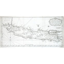
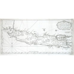
Java (Indonesia)."Vorstellung von dem Eylaned Java". Orig. copper-engraving, J. N. Bellin. Published in Leipzig, ca. 1760. With ornamental title-cartouche. 20,5:43 cm (8 x 17 inch.).
-
Bellin, Jacques Nicolas Vorstellung von dem Eylaned JavaCatalog No.: 11769
"Vorstellung von dem Eylaned Java". Orig. copper-engraving, J. N. Bellin. Published in Leipzig, ca. 1760. With ornamental title-cartouche. 20,5:43 cm (8 x 17 inch.).
-
Bellin, Jacques Nicolas Zusammen gezogene Karte von den Nord-MeerenCatalog No.: 11676
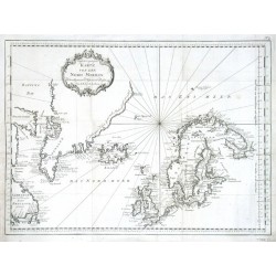
"Zusammen gezogene Karte von den Nord-Meeren". Orig. copper-engraving, J. N. Bellin, dated 1758. Published in Leipzig, ca. 1760. With ornamental title-cartouche. 33:44,5 cm (13 x 17 1/2 inch.).
-
Bellin, Jacques Nicolas Zusammen gezogene Karte von den Nordlichen...Catalog No.: 11772
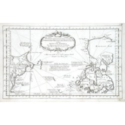
Arctic Circle."Zusammen gezogene Karte von den Nordlichen Theilen der Erd-kugel zwischen Asien und America". Orig. copper-engraving, J. N. Bellin, dated 1758. Published in Leipzig, ca. 1760. With ornamental title-cartouche and depiction of the...

