Keine Artikel
Kategorien
-
Alte Landkarten und Stadtansichten
- Afrika
- Amerika
- Asien und Australien
- Atlases
-
Europa
-
Belgien, Niederlande, Luxemburg
- Amsterdam
- Antwerpen
- Belgien und Luxemburg
- Bergen op Zoom
- Blokzijl
- Bommenede
- Brabant
- Brugge
- Brüssel
- Charleroi
- Delft
- Den Haag
- Dinant
- Dordrecht
- Elburg
- Flandern
- Fort Rammekens
- Friesland
- Friesland und Groningen
- Gelderland
- Geraardsbergen
- Grave
- Groningen
- Hainaut
- Harderwijk
- Harlingen
- Holland
- Hulst
- Huy
- Kortryk
- Lier
- Limbourg
- Limburg
- Löwen
- Lüttich
- Luxemburg
- Maastricht
- Mechelen
- Middelburg
- Mons
- Namur
- Niederlande
- Niederlande und Belgien
- Nijmegen
- Ostende
- Overijssel
- Rotterdam
- Spa
- Stavoren
- Tiel
- Utrecht
- Veere
- Veurne
- Ypern
- Zaltbommel
- Zeeland
- Zieriksee
- Zierikzee
- Zutphen
- Zype
-
Böhmen, Mähren und Schlesien
- Arnau
- Beraun
- Böhmen
- Brandýs nad Labem
- Branná (okr. Šumperk)
- Brodce (okr. Mladá Boleslav)
- Broumov
- Brünn
- Bürglitz
- Čáslav
- Čelákovice
- Český Krumlov
- Cheb
- Chlumec nad Cidlinou
- Chomutov
- Děčín
- Dolní Olešnice - Nové Zámky
- Dvůr Králové nad Labem
- Františkovy Lázně
- Frýdlant
- Graupen
- Hassenstein
- Házmburk
- Herrnskretschen
- Hohenelbe
- Hradec Králové
- Jáchymov
- Jaromirsch
- Jihlava
- Jižní Čechy
- Kamaick
- Karlsbad
- Karlstein
- Kolín
- Konopiště
- Kostelec nad Labem
- Krkonoše
- Kunětická Hora
- Kuttenberg
- Kyšperk
- Laun
- Lednice
- Liberec
- Libochovany
- Lipnice nad Sázavou
- Litoměřice
- Litoměřicko
- Litomyšl
- Lobositz
- Loket
- Lysá nad Labem
- Mähren
- Marienbad
- Melnik
- Mladá Boleslav
- Mladoboleslavsko
- Most
- Náchod
- Neuhaus
- Nimburg
- Okoř
- Olmütz
- Ostrov nad Ohří
- Pardubice
- Plzeň
- Podiebrad
- Polná
- Prácheňsko
- Prag
- Przelautsch
- Rabí
- Rakovnicko
- Rakovník
- Roudnice nad Labem
- Rožmberk
- Rožnov pod Radhoštěm
- Rychmburk
- Schlan
- Schwamberg
- Sedlec
- Smečna
- Smirschitz
- Šumava
- Tábor
- Teplá
- Teplice
- Theresienstadt
- Třeboň
- Týnec nad Labem
- Uničov
- Valdštejn
- Vinec
- Vrabinec
- Vyšší Brod
- Wegstädtl
- Zákupy
- Žampach (zámek)
- Želiv
- Žireč
- Žleb
- Znojmo
- Zvíkov
- Deutschland
- Donau
- Europa (Kontinent)
-
Frankreich
- Albi
- Anjou
- Artois
- Bar-le-Duc
- Berry
- Blois
- Bourbourg
- Bresse
- Burgund-Freigrafschaft
- Cambrai
- Cassel
- Château de Lichtenberg
- Chaumont
- Compiegne und Noyon
- Dauphiné
- Département Tarn
- Elsass
- Gascogne
- Gâstinais and Senonais
- Gravelines
- Hauts-de-France
- Ile de France
- Korsika
- La Bassée - Hesdin
- Languedoc
- Lille
- Limoges
- Lothringen
- Lyon
- Maine
- Marseille
- Metz
- Montmélian
- Mülhausen
- Nancy
- Nice
- Normandie
- Paris
- Perche
- Picardie
- Poitou
- Provence
- Re und Oleron
- Reims - Rethel
- Saint-Omer
- Saintonge und Aunis
- Savoyen
- Strassburg
- Vexin
- Griechenland, Mittelmeer
-
Grossbritannien und Irland
- Bedford und Buckinghamshire
- Berkshire und Hampshire
- Cambridgeshire
- Cornwall
- Cumberland
- Denbigh und Flint
- Derbyshire
- Devon
- Dorset
- Durham (Grafschaft)
- England
- Essex
- Gloucestershire
- Großbritannien und Irland
- Herefordshire
- Hertfordshire
- Hertfordshire and Middlesex
- Huntingdonshire
- Irland
- Isle of Wight
- Kent
- Leicestershire
- Lincolnshire
- London
- Middlesex
- Nordengland
- Nordostengland
- Nordwestengland
- Norfolk
- Northampton
- Northumberland
- Nottinghamshire
- Oxfordshire
- Schottland
- Shropshire und Staffordshire
- Somerset
- Staffordshire
- Südostengland
- Südwestengland
- Surrey
- Sussex
- Wales
- Westmorland
- Wiltshire
- Worcestershire und Warwickshire
- Yorkshire
-
Italien
- Abruzzen
- Ancona
- Apulien (Puglia)
- Arcevia
- Bari und Basilikata
- Bergamo
- Bologna
- Brescia
- Brescia und Crema
- Cadore
- Cagliari
- Caiazzo
- Capitanata
- Carmagnola
- Catania
- Civitavecchia
- Crema
- Cremona
- Cuneo
- Elba
- Emilia Romagna
- Faenza
- Fano
- Ferrara
- Florenz
- Fondi
- Friaul
- Gaeta
- Gallipoli
- Genua
- Ischia
- Italien
- Kalabrien
- Kampanien
- Lazio
- Lerici
- Ligurien (Italienische Riviera)
- Livorno
- Lombardei
- Loreto
- Lucca
- Mailand
- Mantua
- Mantua
- Marche (Ancona)
- Meran
- Messina
- Mirandola
- Mittelitalien
- Modena
- Molise
- Monferrato
- Neapel
- Netuno
- Nocera Umbra
- Norditalien
- Orvieto
- Orvieto und Loreto
- Otranto
- Padua
- Palermo
- Parma
- Pavia
- Perugia
- Pesaro
- Piacenza
- Piemont
- Pinerolo
- Piombino
- Pisa
- Po
- Pozzuoli
- Reggio di Calabria
- Reggio Emilia
- Rimini
- Rom
- Rovigo
- San Marino
- Sardinien
- Siena
- Sizilien
- Sizilien und Malta
- Sizilien und Sardinien
- Spoleto
- Süditalien
- Sulmona
- Taranto
- Terracina
- Tirol
- Tivoli
- Tortona
- Toskana
- Trapani
- Trentino
- Trentino-Alto Adige / Südtirol
- Treviso
- Turin
- Udine
- Umbria
- Urbino
- Velletri
- Venedig
- Vercelli
- Verona
- Vicenza
- Viterbo
- Labe
- Mitteleuropa
- Mittelmeer
- Monaco
- Österreich
- Polen, Schlesien, Rußland, Blatikum
- Rhein
- Schweiz
- Skandinavien und Island
- Spanien und Portugal
- Südost- und Osteuropa, Balkan
-
Belgien, Niederlande, Luxemburg
- Inseln (Sonderkatalog)
- Welt, Ozeane, Pole und Sternbildkarten
-
Bücher
- 17., 18. a 19. století - Bohemika, Moravika, České národní obrození
- 17., 18. und 19. Jhdt. - Literatur, Illustrierte etc. - Ausland
- 20. Jhdt. - Literatur, Poesie, Pressendrucke etc. - Ausland
- 20. Jhdt. - Literatur, Poesie, Pressendrucke, Buchbinderei etc. - Tschechisch
- Alte Drucke (15. - 16. Jahrhundert)
- Bildende Kunst und Architektur
- Geschichte und Recht
- Kinder- und Jugendbücher
- Kulturgeschichte, Varia
- Natur und Naturwissenschaften
- Philosophie, Theologie, Pädagogik, Ökonomie, Soziologie
- Topographie, Reisen und Geographie
-
Graphik und Zeichnungen
- Alte Graphik, Zeichnungen und dekorative
- Alte Meistergrafik
- Devotionalien und kleine Gebrauchsgrafiken (Andachtsbilder, Glückwünsche usw.)
- Europeische moderne Kunst (Graphik, Ex-libris, Zeichnungen)
- Japanische Holzschnitte
-
Tschechische Kunst des 20. Jhdt. (Graphik, Ex-libris, Zeichnungen)
- Bouda, Cyril (1901-1984)
- Fischerová-Kvěchová, Marie (1892-1984)
- Hodek, Josef mladší (1888-1973)
- Holler, Josef (1903-1982)
- Jiřincová, Ludmila (1912-1994)
- Konůpek, Jan (1883-1950)
- Lhoták, Kamil (1912-1990)
- Obrátil, Karel Jaroslav
- Rambousek, Jan (1895-1976)
- Seydl, Zdenek (1916-1978)
- Stretti, Viktor (1878-1957)
- Švabinský, Max (1873-1962)
- Váchal, Josef (1884-1969)
- Vondrouš, Jan Charles (1884-1970)
- Varia
Liste der Werke von Autor: Bellin, Jacques Nicolas
Jacques-Nicolas Bellin (1703 in Paris - 1772 in Versailles) war ein französischer Kartograph, Ingenieur-Geograph, Hydrograph der Marine. Als Beiträger zur Encyclopédie verfasste er mehr als tausend Artikel über maritime Themen.
Als Kartograph zeichnete Bellin sich vor allem auf dem Gebiet der Seekartographie aus. Ab 1721 arbeitete er für das Dépot des Cartes et Plans de la Marine, von 1741 bis zu seinem Tod als Ingenieur-Hydrograph der Marine. Im Jahr 1753 erschien sein Atlas Neptune français, der alle Küsten Frankreichs abbildete, 1756 die alle Meere der Erde betreffende Hydrographie françoise. Im Jahr 1764 erschien der fünfbändige Petit Atlas maritime, den Bellin auf Befehl des Marineministers Choiseul anfertigte. Darüber hinaus verfasste er eine Reihe geographischer Werke und mit Nouvelle méthode pour apprendre la géographie (1769) ein geographisches Lehrbuch für den Unterricht. Seine Karten illustrierten unter anderem Bougainvilles 1771 erschienenes Werk Voyage autour du monde.
Als Mitautor der von Diderot und d'Alembert herausgegebenen Encyclopédie verfasste Bellin mehr als tausend Artikel aus dem Gebiet der Schifffahrt und Marine; seine Beiträge sind mit „(Z)“ gekennzeichnet.
-
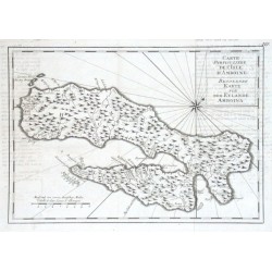
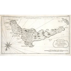
Bellin, Jacques Nicolas Carte Particuliere de l'Isle d'Amboine -...Bestell-Nr .: 17697
Ambon (Molukken)."Carte Particuliere de l'Isle d'Amboine - Besondere Karte von dem Eylande Amboina". Orig. copper-engraving, J. N. Bellin. Published in Leipzig, ca. 1760. With Fr.-Ger. title-cartouche and the scale of map. 20,5:30 cm.
1 500,00 KčZu verkaufen -
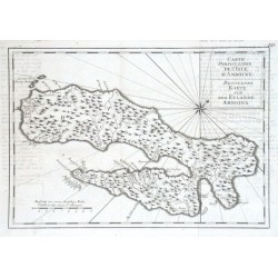
Bellin, Jacques Nicolas Carte Particuliere de l'Isle d'Amboine -...Bestell-Nr .: 11727
"Carte Particuliere de l'Isle d'Amboine - Besondere Karte von dem Eylande Amboina". Orig. copper-engraving, J. N. Bellin. Published in Leipzig, ca. 1760. With Fr.-Ger. title-cartouche and the scale of map. 20,5:30 cm.
1 500,00 KčZu verkaufen -
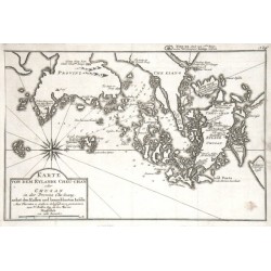
Bellin, Jacques Nicolas Karte von dem Eylande Cheu-chan oder...Bestell-Nr .: 11694
China (Zhejiang). "Karte von dem Eylande Cheu-chan oder Chusan in der Provinz Che-kiang, nebst den Kusten und benachtbarten Inseln". Orig. copper-engraving, J. N. Bellin. Published in Leipzig, ca. 1760. With decorative title-cartouche and a wind-rose. 21:31,5 cm.
1 800,00 KčZu verkaufen -
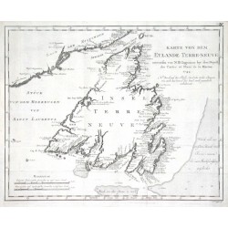
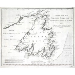
Bellin, Jacques Nicolas Karte von dem Eylande Terre-neuveBestell-Nr .: 17691
Newfoundland (Kanada)."Karte von dem Eylande Terre-neuve". Orig. copper-engraving, J. N. Bellin, dated 1744. Published in Leipzig, ca. 1760. With title and the scale of map. 28,5:36 cm.
2 400,00 KčZu verkaufen -
Bellin, Jacques Nicolas Karte von dem Eylande Terre-neuveBestell-Nr .: 11700
"Karte von dem Eylande Terre-neuve". Orig. copper-engraving, J. N. Bellin, dated 1744. Published in Leipzig, ca. 1760. With title and the scale of map. 28,5:36 cm.
2 400,00 KčZu verkaufen -
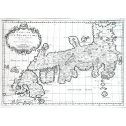
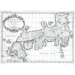
Bellin, Jacques Nicolas Karte von dem Reiche JaponBestell-Nr .: 17751
Japan."Karte von dem Reiche Japon". Orig. copper-engraving, J. N. Bellin. Published in Leipzig, ca. 1760. With ornamental title-cartouche. 21,5:31 cm.
4 800,00 KčZu verkaufen -
Bellin, Jacques Nicolas Karte von dem Reiche JaponBestell-Nr .: 11739
Japan."Karte von dem Reiche Japon". Orig. copper-engraving, J. N. Bellin. Published in Leipzig, ca. 1760. With ornamental title-cartouche. 21,5:31 cm.
4 800,00 KčZu verkaufen -
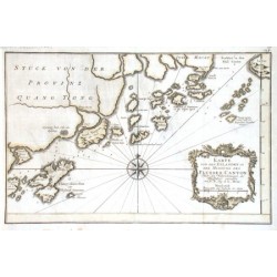
Bellin, Jacques Nicolas Karte von den Eylanden in der Mundung des...Bestell-Nr .: 04416
"Karte von den Eylanden in der Mundung des Flusses Canton". Copper-engraving published by N. Bellin, ca. 1745, outline colouring. With ornamental title-cartouche and windrose. 20,5:32 cm.
2 100,00 KčZu verkaufen -
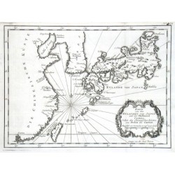
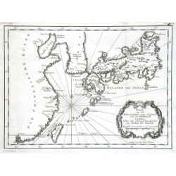
Bellin, Jacques Nicolas Karte von den Eylanden von JaponBestell-Nr .: 17787
Japan."Karte von den Eylanden von Japon und der Halbinsel Corea, Nebst den Chinesischen Küsten von Pekin bis Canton". Orig. copper-engraving, J. N. Bellin. Published in Leipzig, ca. 1760. With decorative title-cartouche. 21:28 cm.
5 400,00 KčZu verkaufen -
Bellin, Jacques Nicolas Karte von den Eylanden von JaponBestell-Nr .: 11682
Japan, Korea und China."Karte von den Eylanden von Japon und der Halbinsel Corea, Nebst den Chinesischen Küsten von Pekin bis Canton". Orig. copper-engraving, J. N. Bellin. Published in Leipzig, ca. 1760. With decorative title-cartouche. 21:28 cm.
5 400,00 KčZu verkaufen -
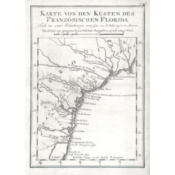
Bellin, Jacques Nicolas Karte von den Küsten des Französischen...Bestell-Nr .: 11643
Florida."Karte von den Küsten des Französischen Florida". Orig. copper-engraving, J. N. Bellin. Published in Leipzig, ca. 1760. With title and the scale of map ("Masasstab") above the map. 20,5:14,5 cm.
2 500,00 KčZu verkaufen -
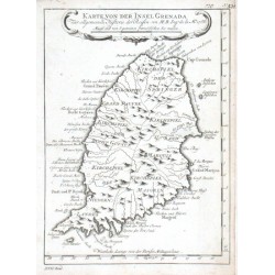
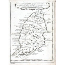
Bellin, Jacques Nicolas Karte von der Insel GrenadaBestell-Nr .: 17634
Grenada."Karte von der Insel Grenada". Orig. copper-engraving, J. N. Bellin. Published in Leipzig, ca. 1760. With decorative title cartouche. 21:15,5 cm.
1 200,00 KčZu verkaufen -
Bellin, Jacques Nicolas Karte von der Insel GrenadaBestell-Nr .: 11655
"Karte von der Insel Grenada". Orig. copper-engraving, J. N. Bellin. Published in Leipzig, ca. 1760. With decorative title cartouche. 21:15,5 cm.
1 200,00 KčZu verkaufen -
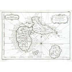
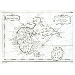
Bellin, Jacques Nicolas Karte von der Insel GuadelupeBestell-Nr .: 17637
Guadeloupe."Karte von der Insel Guadelupe". Orig. copper-engraving, J. N. Bellin, dated 1758. Published in Leipzig, ca. 1760. With ornamental title-cartouche and another ornamental cartouche with the scale of map. 21:30,5 cm.
1 500,00 KčZu verkaufen -
Bellin, Jacques Nicolas Karte von der Insel GuadelupeBestell-Nr .: 11703
"Karte von der Insel Guadelupe". Orig. copper-engraving, J. N. Bellin, dated 1758. Published in Leipzig, ca. 1760. With ornamental title-cartouche and another ornamental cartouche with the scale of map. 21:30,5 cm.
1 500,00 KčZu verkaufen -
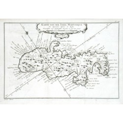
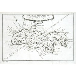
Bellin, Jacques Nicolas Karte von der Insel MartiniqueBestell-Nr .: 17673
Martinique."Karte von der Insel Martinique". Orig. copper-engraving, J. N. Bellin, dated 1758. Published in Leipzig, ca. 1760. With decorative title cartouche. 20:30 cm.
2 500,00 KčZu verkaufen -
Bellin, Jacques Nicolas Karte von der Insel MartiniqueBestell-Nr .: 11667
"Karte von der Insel Martinique". Orig. copper-engraving, J. N. Bellin, dated 1758. Published in Leipzig, ca. 1760. With decorative title cartouche. 20:30 cm.
2 500,00 KčZu verkaufen -
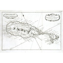
Bellin, Jacques Nicolas Karte von der Inset St. ChristophBestell-Nr .: 17679
St. Kitts."Karte von der Inset St. Christoph". Orig. copper-engraving, J. N. Bellin. Published in Leipzig, ca. 1760. With decorative title-cartouche and another cartouche with the scale of map. 19,5:30,5 cm.
1 500,00 KčZu verkaufen -
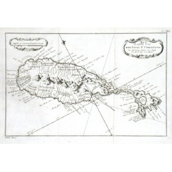
Bellin, Jacques Nicolas Karte von der Inset St. ChristophBestell-Nr .: 11712
"Karte von der Inset St. Christoph". Orig. copper-engraving, J. N. Bellin. Published in Leipzig, ca. 1760. With decorative title-cartouche and another cartouche with the scale of map. 19,5:30,5 cm.
1 500,00 KčZu verkaufen -
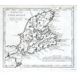
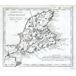
Bellin, Jacques Nicolas Karte von L'Isle RoyaleBestell-Nr .: 17688
Cape Breton Island (Kanada)."Karte von L'Isle Royale". Orig. copper-engraving, J. N. Bellin, dated 1744. Published in Leipzig, ca. 1760. With title and the scale of map ("Maass-stab"). 24:27,5 cm.
1 500,00 KčZu verkaufen -
Bellin, Jacques Nicolas Karte von L'Isle RoyaleBestell-Nr .: 11724
"Karte von L'Isle Royale". Orig. copper-engraving, J. N. Bellin, dated 1744. Published in Leipzig, ca. 1760. With title and the scale of map ("Maass-stab"). 24:27,5 cm.
1 500,00 KčZu verkaufen -
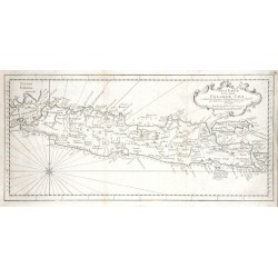
Bellin, Jacques Nicolas Neue Karte von dem Eylane JavaBestell-Nr .: 17709
Java (Indonesien)."Neue Karte von dem Eylane Java". Orig. copper-engraving, J. N. Bellin. Published in Leipzig, ca. 1760. With decorative title cartouche and a wind-rose. 20:43 cm.
2 100,00 KčZu verkaufen -
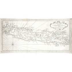
Bellin, Jacques Nicolas Neue Karte von dem Eylane JavaBestell-Nr .: 11661
"Neue Karte von dem Eylane Java". Orig. copper-engraving, J. N. Bellin. Published in Leipzig, ca. 1760. With decorative title cartouche and a wind-rose. 20:43 cm.
2 100,00 KčZu verkaufen -
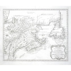
Bellin, Jacques Nicolas Partie Orientale de la Nouvelle France ou...Bestell-Nr .: 10629
Kanada."Partie Orientale de la Nouvelle France ou du Canada". Orig. copper-engraving after J. N. Bellin's map of the region. Published by Homann Heirs, 1755. With ornamental title-cartouche with the scale of map ("Echelles"). 43:54 cm.
12 500,00 KčZu verkaufen -
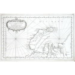
Bellin, Jacques Nicolas Stück von dem Eis-meere welches Neu Zembla...Bestell-Nr .: 17850
Nowaja Semlja (Russland)."Stück von dem Eis-meere welches Neu Zembla und das Land der Samoieden entaelt". Orig. copper-engraving, J. N. Bellin, dated 1758. Published in Leipzig, ca. 1760. With ornamental title-cartouche. 21,5:34,5 cm.
1 800,00 KčZu verkaufen -
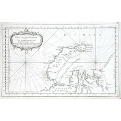
Bellin, Jacques Nicolas Stück von dem Eis-meere welches Neu Zembla...Bestell-Nr .: 11742
"Stück von dem Eis-meere welches Neu Zembla und das Land der Samoieden enthelt". Orig. copper-engraving, J. N. Bellin, dated 1758. Published in Leipzig, ca. 1760. With ornamental title-cartouche. 21,5:34,5 cm.
1 800,00 KčZu verkaufen -
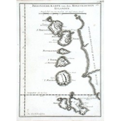
Bellin, Jacques Nicolas Besondere Karte von den Moluckischen EylandenBestell-Nr .: 11652
"Besondere Karte von den Moluckischen Eylanden". Orig. copper-engraving, J. N. Bellin. Published in Leipzig, ca. 1760. With title in map and the scale of map. 21,5:15,5 cm.
-
Bellin, Jacques Nicolas Besondere Karte von der Insel Juan FernandesBestell-Nr .: 11658
"Besondere Karte von der Insel Juan Fernandes aus der Reise beschreibung des Amiral Anson". Orig. copper-engraving, J. N. Bellin. Published in Leipzig, ca. 1760. With decorative title cartouche, a cartouche with French title, the scale-of-map and...
-
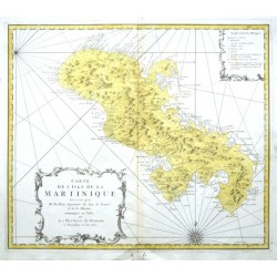
Bellin, Jacques Nicolas Carte de l'Isle de la MartiniqueBestell-Nr .: 11385
"Carte de l'Isle de la Martinique". Orig. copper-engraving after J. N. Bellin's map of Martinique. Published by Homann Heirs in Nuremberg, 1762. Orig. old colouring. With ornamental title-cartouche, another ornamentla cartouche with explanatory...
-
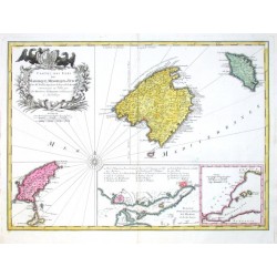
Bellin, Jacques Nicolas Carte des Isles de Maiorque, Minorque et...Bestell-Nr .: 00624
"Carte des Isles de Maiorque, Minorque et Yvice". Copper-engreving after J. N. Bellin's map of Balearic Isles, published by Homann's Heirs, 1756. Original old colouring. With great ornamental title-cartouche with coat-of-arms held by 2 eagles,...
-
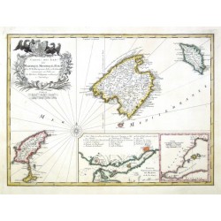
Bellin, Jacques Nicolas Carte des Isles de Maiorque, Minorque et...Bestell-Nr .: 11565
"Carte des Isles de Maiorque, Minorque et Yvice". Copper-engreving after J. N. Bellin's map. Published by Homann Heirs in Nuremberg, 1756. Original old colouring. With ornamental title-cartouce with a coat-of-arms held by 2 eagles, a wind rose...
-
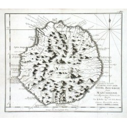
Bellin, Jacques Nicolas Carte von der Insel Bourbon sonst MascaregneBestell-Nr .: 11715
Réunion."Carte von der Insel Bourbon sonst Mascaregne". Orig. copper-engraving, J. N. Bellin. Published in Leipzig, ca. 1760. With title and the scale of map. 20,5:24 cm.
-
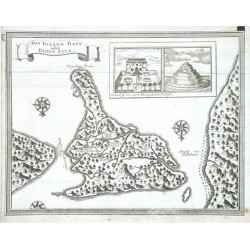
Bellin, Jacques Nicolas Das Eyland Baly oder Klein JavaBestell-Nr .: 11646
"Das Eyland Baly oder Klein Java". Orig. copper-engraving, J. N. Bellin. Published in Leipzig, ca. 1760. With decorative title cartouche, inset view of the Royal Palace and a Balinese temple and 2 wind-roses. 17:22 cm.
-
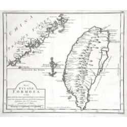
Bellin, Jacques Nicolas Das Eyland Formosa und ein Stück von den...Bestell-Nr .: 11691
"Das Eyland Formosa und ein Stück von den Küsten von China". Orig. copper-engraving, J. N. Bellin. Published in Leipzig, ca. 1760. With decorative title-cartouche. 23:28 cm.
-
Bellin, Jacques Nicolas Die Carolinische oder Neü-Philippinische...Bestell-Nr .: 11766
"Die Carolinische oder Neü-Philippinische Inseln- Welches sonst auch das Seeland Palaos oder S. Lazari heissen". Orig. copper-engraving after J. A. Cantova for J. N. Bellin, dated 1722. Engraved by C. Dietell. Published in Leipzig, ca. 1760....
-
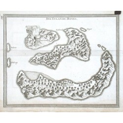
Bellin, Jacques Nicolas Die Eylande BandaBestell-Nr .: 11640
"Die Eylande Banda". Orig. copper-engraving, J. N. Bellin. Published in Leipzig, ca. 1760. With title in the map. 16,5:20,5 cm.
-
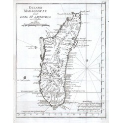
Bellin, Jacques Nicolas Eyland Madagascar sonst Insel St LaurentiusBestell-Nr .: 11685
Madagaskar."Eyland Madagascar sonst Insel St Laurentius". Orig. copper-engraving, J. N. Bellin, dated 1747. Published in Leipzig, ca. 1760. With title, scale of map ("Maaßstab") and notes ("Anmerkung"). 29:23 cm.
-
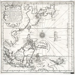
Bellin, Jacques Nicolas Fortsetzung der Karte von dem...Bestell-Nr .: 11688
Ostasien."Fortsetzung der Karte von dem Morgenlaendischen Ocean, die Eylande Sonda, die Küsten von Tunquin und China, die Eylande Japon, die Philippinischen und Molukkischen Eylande in sich enthaltend". Orig. copper-engraving, J. N. Bellin,...
-
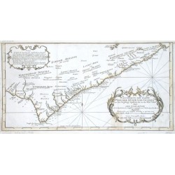
Bellin, Jacques Nicolas Fortsetzung der Karte von der Küste von...Bestell-Nr .: 07923
Ghana. "Fortsetzung der Karte von der Küste von Guinea von dem Vorgebirge Apollonia bis an den Fluß Volta oder Der Gold Küste". Grenzkol. Kupf.-Kte. bei J. N. Bellin, um 1750. Mit ornament. Titelkart und andere ornament. Kart. mit Erklärungen...
-
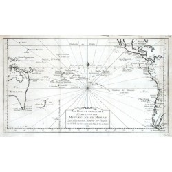
Bellin, Jacques Nicolas Jns Kleine gebrachte Karte von dem...Bestell-Nr .: 11709
Pazifik."Ins Kleine gebrachte Karte von dem Mittaeglichen Meere". Orig. copper-engraving, J. N. Bellin, dated 1753. Published in Leipzig, ca. 1760. With decorative title-cartouche. 21:35,5 cm.
-
Bellin, Jacques Nicolas Karte der Insel St. LuciaBestell-Nr .: 17676
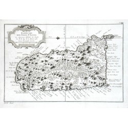
St. Lucia."Karte von der Insel St. Lucia". Orig. copper-engraving, J. N. Bellin, dated 1758. Published in Leipzig, ca. 1760. With ornamental title-cartouche. 19,5:30 cm.
-
Bellin, Jacques Nicolas Karte der Insel St. LuciaBestell-Nr .: 11733
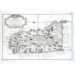
"Karte von der Insel St. Lucia". Orig. copper-engraving, J. N. Bellin, dated 1758. Published in Leipzig, ca. 1760. With ornamental title-cartouche. 19,5:30 cm.
-
Bellin, Jacques Nicolas Karte der Kurillischen InselnBestell-Nr .: 11019
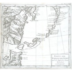
"Karte der Kurillischen Inseln nach der Russischen Karte Gezeichnet von Laurent". Orig. copper-engraving, ca. 1750. With a title-cartouche. 24:26,5 cm.
-
Bellin, Jacques Nicolas Karte von AccadiaBestell-Nr .: 11736
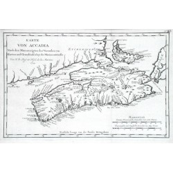
"Karte von Accadia". Orig. copper-engraving, J. N. Bellin, dated 1744. Published in Leipzig, ca. 1760. With title and the scale of map ("Maassstab"). 20,5:32 cm.
-
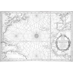
Bellin, Jacques Nicolas Karte von dem Abendlaendischen OceanBestell-Nr .: 11748
Atlantik."Karte von dem Abendlaendischen Ocean". Orig. copper-engraving, J. N. Bellin, dated 1746. Published in Leipzig, ca. 1760. With ornamental title-cartouche and a wind-rose in the centre. 31,5:45,5 cm.
-
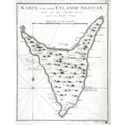
Bellin, Jacques Nicolas Karte von dem Eylande AnjouanBestell-Nr .: 11706
"Karte von dem Eylande Anjouan". Orig. copper-engraving, J. N. Bellin. Published in Leipzig, ca. 1760. With title and the scale of map. 21:16,5 cm.
-
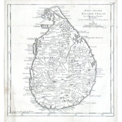
Bellin, Jacques Nicolas Karte von dem Eylande CeylanBestell-Nr .: 17781
Ceylon."Karte von dem Eylande Ceylan". Orig. copper-engraving, J. N. Bellin, dated 1750. Published in Leipzig, ca. 1760. With title and the scale of map. 25,5:24,5 cm.
-
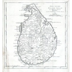
Bellin, Jacques Nicolas Karte von dem Eylande CeylanBestell-Nr .: 11697
Sri Lanka (Ceylon)."Karte von dem Eylande Ceylan". Orig. copper-engraving, J. N. Bellin, dated 1750. Published in Leipzig, ca. 1760. With title and the scale of map. 25,5:24,5 cm.
-
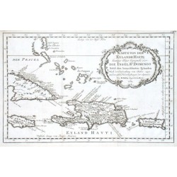
Bellin, Jacques Nicolas Karte von dem Eylande HaytiBestell-Nr .: 07965
"Karte von dem Eylande Hayti heutiges Tages Espagnola oder die Insel St. Domingo Nebst den benachbarten Eylanden. Nach der Entdeckung vom Jahre 1492 und den ersten Niederlaßungen der Spanier". Orig. copper-engraving, J. N. Bellin, 1754. With...
-
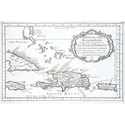
Bellin, Jacques Nicolas Karte von dem Eylande HaytiBestell-Nr .: 17646
Hispaniola (Haiti/Dominikanische Republik) und Martinique."Karte von dem Eylande Hayti heutiges Tages Espagnola oder die Insel St. Domingo Nebst den benachbarten Eylanden. Nach der Entdeckung vom Jahre 1492 und den ersten Niederlaßungen der...

