No products
Categories
- Antique Maps and Views
- Africa
- America
- America (continent)
- Antilles (West Indies)
- Argentina
- Bermuda
- Brazil
- California
- Canada
- Central America and Antilles (West Indies)
- Chile
- Columbia
- Florida
- Guyana
- Hawaiian Islands
- Honduras
- Louisiana
- Mexico
- New Englang
- New York
- North America
- North Carolina
- Panama
- Paraguay
- Pennsylvania
- Peru
- South America
- Straits of Magellan
- United states (USA)
- Alabama
- Arkansas
- Boston
- Connecticut
- Florida
- Georgia
- Illinois
- Iowa
- Kentucky
- Louisiana
- Maine
- Maryland and Delaware
- Massachusetts and Rhode Island
- Michigan
- Mississippi
- Missouri
- New Hampshire and Vermont
- New Jersey
- New York
- Ohio
- Pennsylvania
- Philadelphia
- Rhode Island
- South Carolina
- Tennessee
- Texas
- U.S. East Coast
- Virginia
- Wisconsin
- Uruguay
- Venezuela
- Virginia
- Asia and Australia
- Asia (continent)
- Australia
- Burma
- China
- East Asia
- East Indies
- French Polynesia
- Gulf of Bengal
- India
- India, China, Nepal
- Indian ocean
- Indonesia
- Israel / Palestine
- Japan
- Korea
- Malaysia
- Micronesia
- Middle East
- New Zealand
- North-east Asia
- Pakistan
- Philippines
- Polynesia
- Southwest Asia
- Sri Lanka (Ceylon)
- The Caspian Sea
- Turkey
- Atlasy
- Europe
- Austria
- Baltic Sea
- Belgium, the Netherlands, Luxembourg
- Alkmaar
- Amsterdam
- Antwerp
- Arnhem
- Belgium and Luxembourg
- Bergen op Zoom
- Blokzijl
- Bommenede
- Brabant
- Breda
- Brielle
- Brugge
- Brussels
- Charleroi
- Courtrai
- Delft
- Dinant
- Dordrecht
- Drenthe
- Drenthe and Overijseel
- Elburg
- Flandres
- Fort Rammekens
- Friesland
- Friesland and Groningen
- Geertruidenberg
- Gelderland
- Geraardsbergen
- Grave
- Groningen
- Haarlem
- Hainaut
- Hannut
- Harderwijk
- Harlingen
- Holland
- Hulst
- Huy
- Leeuwarden
- Leiden
- Liége
- Lier
- Limbourg
- Limburg
- Louvain
- Luxemburg
- Luxemburg (city)
- Maastricht
- Mechelen
- Menin
- Middelburg
- Mons
- Namur
- Netherlands
- Netherlands and Belgium
- Nijmegen
- Ostend
- Overijssel
- Rotterdam
- Ruremonde
- s-Hertogenbosch
- Spa
- Stavoren
- Steenwijk
- The Hague
- Tiel
- Tournai
- Utrecht
- Veere
- Veurne
- Vlissingen
- Ypres
- Zaltbommel
- Zeeland
- Zieriksee
- Zierikzee
- Zutphen
- Zwolle
- Zype
- Bohemia, Moravia, Silesia and Lusatia
- Adršpach
- Andělská Hora (hrad)
- Bad Liebwerda
- Bechyňsko
- Bedřichov
- Beroun
- Berounsko
- Berounsko a Plzeňsko
- Bezděz
- Bílina
- Blansko
- Blatná
- Bohemia
- Bohemia, Moravia and Silesia
- Bolechovice
- Borotín
- Boskovice
- Bouzov
- Brandýs nad Labem
- Branná (okr. Šumperk)
- Břeclav
- Březnice
- Brněnsko
- Brněnsko a Uherskohardišťsko
- Brno
- Brodce (okr. Mladá Boleslav)
- Broumov
- Brtnice
- Budeč (hradiště)
- Buštěhrad
- Buzice (tvrz)
- Carlsbad
- Čáslav
- Čáslavsko
- Čelákovice
- Česká Lípa
- České Budějovice
- České Švýcarsko
- Český Brod
- Český Dub
- Český Krumlov
- Český Šternberk
- Cheb
- Chebsko a Loketsko
- Chebsko a Žatecko
- Chlum (okr. Kutná Hora)
- Chlum Svaté Máří
- Chlumec nad Cidlinou
- Chodová Planá
- Chomutov
- Choustníkovo Hradiště (zřícenina hradu)
- Chrudim
- Chrudimsko
- Chrudimsko, Čáslavsko, Kouřimsko
- Cornštejn
- Děčín
- Dívčí Hrad
- Doksany (okr. Litoměřice)
- Dolní Olešnice - Nové Zámky
- Dolní Životice (okr. Opava)
- Doupov
- Dubí
- Duchcov
- Dvojhradí (Mstišov)
- Dvůr Králové nad Labem
- Egerberk
- Egerberk (Klášterec nad Ohří)
- Felixburg (Klášterec nad Ohří)
- Františkovy Lázně
- Frenštát pod Radhošťem
- Frýdlant
- Habrovany
- Hartenberg (Hřebeny, okr. Sokolov)
- Hasištejn
- Hauenštejn (Horní hrad, okr. Karlovy Vary)
- Házmburk
- Helfštýn
- Hlavačov (Hlaváčov, Rakovník)
- Hluboká nad Vltavou
- Hořice (v Podkrkonoší)
- Hostinné
- Hradec Králové
- Hranice na Moravě
- Hřensko
- Hrubá Skála
- Hukvaldy
- Jáchymov
- Jankov
- Jánské Lázně
- Jánský Vrch
- Jánský Vrch (Javorník)
- Jaroměř
- Jenštejn
- Jeseník
- Jestřebí
- Jezeří
- Jičín
- Jihlava
- Jindřichův Hradec
- Jižní Čechy
- Kaceřov (Plzeň-sever)
- Kadaň
- Kamýk u Litoměřic
- Karlštejn
- Kasejovice - Řesanice
- Klabava (Ejpovice, okr. Rokycany)
- Kladno
- Kladruby
- Klatovy
- Kokořín
- Kolín
- Kondrac
- Konojedy (u Litoměřic)
- Konopiště
- Kopidlno (okr. Jičín)
- Kost
- Kostelec nad Labem
- Kostomlaty pod Milešovkou
- Kouřimsko
- Krakovec
- Králíky
- Královéhradecko
- Krásný Dvůr (okr. Louny)
- Krašov (hrad)
- Kratochvíle (zámek)
- Křečov (okr. Louny)
- Křepenice
- Křivoklát
- Krkonoše
- Krnov
- Kroměříž
- Krupka
- Krušné hory
- Kuks
- Kumburk
- Kunětická Hora
- Kunžvart (Šumava)
- Kutna Hora
- Kynšperk nad Ohří
- Kynžvart (zámek)
- Kyselka
- Kyšperk
- Lanšperk
- Ledeč nad Sázavou
- Lednice
- Libá (okr. Cheb)
- Libějovice
- Liberec
- Liběšice
- Liblín (okr. Rokycany)
- Libochovany
- Libochovice
- Libštejn
- Lina (Vroutek, okr. Louny)
- Lipnice nad Sázavou
- Litice
- Litoměřice
- Litoměřicko
- Litomyšl
- Loket
- Louny
- Lovosice
- Luhačovice
- Lužice
- Lysá nad Labem
- Mariánské Lázně
- Mělník
- Mikulov
- Milčany
- Milešov (Velemín)
- Milešovka
- Miletín
- Milíčeves (okr. Jičín)
- Mírov
- Mladá Boleslav
- Mladoboleslavsko
- Mladoboleslavsko a Litoměřicko
- Mnichovo Hradiště
- Moravia
- Most
- Mšec
- Náchod
- Napajedla
- Návarov
- Nelahozeves
- Nepomuk
- Nové Hrady (okr. Ústí nad Orlicí)
- Nový Bor
- Nymburk
- Okoř
- Olomouc
- Olomoucko
- Ondrášov (Moravský Beroun)
- Opava
- Orlík nad Vltavou
- Osek
- Ostrov nad Ohří
- Pacov
- Pardubice
- Pavlov
- Pecka (hrad)
- Pernštejn
- Petrohrad (Petršpurk, okr. Louny)
- Písek
- Plaňany
- Plasy
- Plzeň
- Plzeňsko
- Poděbrady
- Police
- Polná
- Prachatice
- Prácheňsko
- Prague
- Praha - Cheb
- Praha a okolí
- Přelouč
- Přerov
- Přerovsko
- Pressnitz
- Proboštov
- Proseč u Pošné (okr. Pelhřimov)
- Protivín
- Raabstein
- Rabí
- Račice (Vyškov)
- Radim (okr. Kolín)
- Rájec nad Svitavou
- Rajhrad
- Rakovnicko
- Rakovník
- Řečkovice
- Ronov (okr. Česká Lípa)
- Ronov nad Sázavou
- Roštejn
- Roudnice nad Labem
- Rožmberk nad Vltavou
- Rožnov pod Radhoštěm
- Rudolfov (České Budějovice)
- Rychmburk
- Rychnov nad Kněžnou
- Rýzmburk (hrad)
- Sedlec
- Šelmberk
- Severní Čechy
- Skuteč
- Slaný
- Slavkov u Brna
- Sloup (hrad)
- Smečno
- Smidary (okr. Hradec Králové)
- Smiřice
- Sovinec (hrad)
- Šternberk (Ledce)
- Štětí
- Strakonice
- Štramberk
- Střekov
- Šumava
- Šumburk (Šumná)
- Šumperk
- Švamberk (Krasíkov)
- Svatý Jan pod Skalou
- Svojanov (hrad)
- Svojšice
- Tábor
- Táborsko a Českobudějovicko
- Tachov
- Telenice - Varvažov
- Tepl
- Teplice
- Terezín
- Toužetín
- Třebel
- Třeboň
- Trhanov (okr. Domažlice)
- Trosky
- Tuchoraz
- Týn nad Vltavou
- Týnec nad Labem
- Uherské Hradiště
- Újezdec (hrad)
- Uničov
- Ústí nad Labem
- Úvaly
- Valdštejn
- Valkeřice
- Valtice
- Vartenberk - Stráž pod Ralskem (okr. Česká Lípa)
- Velehrad
- Velhartice
- Velké Meziříčí
- Velké Žernoseky
- Veveří
- Vimperk
- Vinec
- Višňová (okr. Liberec)
- Vlastislav
- Vlkava
- Vltava
- Vrabinec
- Vrchlabí
- Vřeskovice
- Východní a Severovýchodní Čechy
- Vysoké Mýto
- Vyšší Brod
- Žacléř
- Zahájí
- Zákupy
- Žampach (zámek)
- Zámrsk
- Západní Čechy
- Žatec
- Žatecko
- Žebrák a Točník
- Želiv
- Žireč
- Žleby
- Zlenice (Hláska)
- Znojemsko a Jihlavsko
- Znojmo
- Zvíkov
- Zvířetice
- Central Europe
- Danube
- Eastern and Southeastern Europe, Balkan
- Europe (continent)
- France
- Albi
- Anjou
- Arras
- Artois
- Auvergne
- Avignon
- Bar-le-Duc
- Beauce
- Beauvais
- Berry
- Blois
- Bordeaux
- Bourbonnais
- Bourbourg
- Bourgogne-Franche-Comté
- Bresse
- Brie
- Calais
- Cambrai
- Cassel
- Champagne
- Château de Lichtenberg
- Chaumont
- Compiegne and Noyon
- Corsica
- Dauphiné
- Dombes
- Douai
- Dunkerque
- Elsass
- Fontainebleau
- Gascogne
- Gâstinais and Senonais
- Gravelines
- Hauts-de-France
- Hondschoote
- Ile de France
- La Bassée - Hesdin
- La Rochelle
- Languedoc
- Lérins Islands
- Lille
- Limoges
- Lorraine
- Lyon
- Maine
- Marseille
- Metz
- Montmélian
- Mulhouse
- Nancy
- Nice
- Nivernais
- Normandie
- Orange
- Paris
- Perche
- Perpignan
- Picardy
- Poitou
- Provence
- Quercy
- Re and Oleron
- Reims - Rethel
- Rethel
- Saint-Germain-en-Laye
- Saint-Omer
- Saintonge and Aunis
- Sarlat
- Savoy
- Savoy and Eastern Burgundy (Franche - Comte)
- South France
- Southeast France
- Strasbourg
- Tarn (department)
- Thérouanne
- Touraine
- Valenciennes
- Vexin
- Western France
- Wissembourg
- Germany
- Great Britain and Ireland
- Bedford and Buckinghamshire
- Berkshire and Hampshire
- Cambridgeshire
- Cheshire
- Cornwall
- Cumberland
- Denbigh and Flint
- Derbyshire
- Devon
- Dorset
- Durham (County)
- England
- Essex
- Exeter
- Gloucestershire
- Great Britain and Ireland
- Hampshire
- Herefordshire
- Hertfordshire
- Hertfordshire and Middlesex
- Holy Island and Farne Island
- Huntingdonshire
- Ireland
- Isle of Man
- Isle of Wight
- Kent
- Lancashire
- Leicestershire
- Lincolnshire
- London
- Middlesex
- Norfolk
- Northampton
- Northeastern England
- Northern England
- Northumberland
- Northwestern England
- Nottinghamshire
- Orkney and Shetland
- Oxfordshire
- Portsmouth
- Rutland
- Scotland
- Shropshire
- Shropshire and Staffordshire
- Somerset
- Southeastern England
- Southwestern England
- Staffordshire
- Surrey
- Sussex
- Wales
- Westmorland
- Wiltshire
- Worcestershire and Warwickshire
- Yorkshire
- Greece, Mediterranean Sea
- Italy
- Abruzzo
- Acquapendente
- Ancona
- Apulia (Puglia)
- Arcevia
- Assisi
- Bari and Basilicata
- Belluno and Feltre
- Bergamo
- Bologna
- Bracciano
- Brescia
- Brescia and Crema
- Cadore
- Cagliari
- Caiazzo
- Calabria
- Camerino
- Campania
- Capitanata
- Carmagnola
- Catania
- Central Italy
- Civitavecchia
- Crema
- Cremona
- Cuneo
- Elba
- Emilia Romagna
- Faenza
- Fano
- Ferrara
- Florence
- Fondi
- Friuli
- Gaeta
- Gallipoli
- Genoa
- Ischia
- Italy
- Lago di Como
- Lago Maggiore
- Lazio
- Lerici
- Liguria (Italian Riviera)
- Livorno
- Lombardia
- Loreto
- Lucca
- Mantua
- Mantua
- Marche (Ancona)
- Merano
- Messina
- Milan
- Mirandola
- Modena
- Molise
- Monferrato
- Naples
- Netuno
- Nocera Umbra
- Northern Italy
- Orvieto
- Orvieto and Loreto
- Otranto
- Padua
- Palermo
- Parma
- Parma and Piacenza
- Pavia
- Perugia
- Pesaro
- Piacenza
- Piedmont
- Pinerolo
- Piombino
- Pisa
- Po
- Pozzuoli
- Puglia and Calabria
- Ravenna
- Reggio di Calabria
- Reggio Emilia
- Rimini
- Romagna
- Rome
- Rovereto
- Rovigo
- San Marino
- Sardinia
- Sicily
- Sicily and Malta
- Sicily and Sardinia
- Siena
- Southern Italy
- Spoleto
- Sulmona
- Taranto
- Terracina
- Tivoli
- Torino
- Tortona
- Trapani
- Trentino-Alto Adige / Südtirol
- Trento
- Treviso
- Tricarico
- Trieste
- Tuscany
- Tyrol
- Udine
- Umbria
- Urbino
- Velletri
- Venice
- Vercelli
- Verona
- Vicenza
- Viterbo
- Labe
- Mediterranean Sea
- Monaco
- Northern Europe
- Poland, Silesia, Russia and the Baltic republics
- Rhine
- Scandinavia and Iceland
- Spain and Portugal
- Andalucia
- Andalucia and Granada
- Aragon
- Azores
- Balearic Islands
- Barcelona
- Barcelona and Ecija
- Burgos
- Cadiz
- Canary Islands
- Castile
- Catalonia
- Cordoba
- Extremadura
- Galicia
- Gibraltar
- Granada
- Leon and Asturias
- Lisbon
- Madeira
- Madrid
- Navarra
- Northeastern Spain
- Northern Spain
- Northwestern Spain
- Portugal
- Roses
- Sevilla
- Spain
- Toledo and Valladolid
- Valencia
- Switzerland
- Islands (Special Catalogue)
- World, Oceans, Poles and Celestial Maps
- Books
- 17., 18. a 19. století - Bohemika, Moravika, České národní obrození
- 17th, 18th and 19th cent. - literature, illustrated etc. - foreign
- 20th cent. - literature, poetry, bibliophile books, illustrated etc. - foreign
- 20th cent. - literature, poetry, illustrated, bibliophile books, bookbindings etc. - Czech
- Children, youth and adventure books
- Fine arts & Architecture
- History and Law
- History of Culture, Varia
- Nature & Natural Sciences
- Old prints (15th and 16th century)
- Philosophy, Theology, Pedagogy, Economy, Sociology
- Topography, Travel and Geography
- Drawings and Prints
- Antique engravings, drawings and decorative prints
- Czech Art of 20th century (graphics, bookplates, drawings)
- Balcar, Jiří (1929-1968)
- Bílek, František (1872-1941)
- Bím, Tomáš (1946)
- Born, Adolf (1930)
- Bouda, Cyril (1901-1984)
- Chadima, Jiří (nar. 1923)
- Demel, Karel
- Fischerová-Kvěchová, Marie (1892-1984)
- Gross, František (1909-1985)
- Hodek, Josef mladší (1888-1973)
- Holler, Josef (1903-1982)
- Hudeček, František (1909-1990)
- Jiřincová, Ludmila (1912-1994)
- Kobliha, František (1877-1962)
- Konůpek, Jan (1883-1950)
- Lada, Josef (1887-1957)
- Lhoták, Kamil (1912-1990)
- Malich, Karel (1924-2019)
- Mrkvicka, Otakar (1898-1957)
- Mucha, Alfons
- Obrátil, Karel Jaroslav
- Orlik, Emil (1870-1932)
- Preissig, Vojtěch
- Rambousek, Jan (1895-1976)
- Sekora, Ondřej (1899-1967)
- Seydl, Zdenek (1916-1978)
- Šimon, Tavík František (1877-1942)
- Sladek, Jan (1906-1982)
- Stretti, Viktor (1878-1957)
- Stretti-Zamponi, Jaromír (1882-1959)
- Švabinský, Max (1873-1962)
- Tichý, František (1896-1961)
- Tomanová, Emilie (1933-1994)
- Trnka, Jiří (1912-1969)
- Uprka, Joža (1861-1940)
- Váchal, Josef (1884-1969)
- Vik, Karel (1883-1969)
- Vondrouš, Jan Charles (1884-1970)
- Wenig, Josef (1885-1939)
- Zrzavý, Jan (1890-1977)
- Devotional pictures, greeting cards etc.
- European modern art (graphics, bookplates, drawings)
- Japanese woodblocks
- Old-masters graphics
- Varia
List of works by author Schenk, Peter & Valck, Gerard
Schenk, Peter & Valck, Gerard
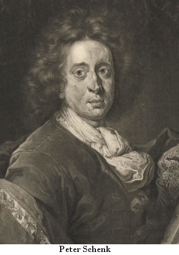
Peter Schenk (also Petrus Schenk; 1660, Elberfeld - 1711, Leipzig) and Gerard Valck (also Gerardus Valk; 1652, Amsterdam - 1726, ibid.) were engravers, cartographers and publishers in Amstedam. Schenk's son, Peter Schenk the Younger (1693, Amsterdam - 1775, ibid.), was also an engraver and map publisher who is regarded as the most important publisher of special maps of Saxony in the first half of the 18th century.
- Schenk, Peter & Valck, Gerard Radnoriensis comitatus Vulgo The Countie...Catalog No.: 05598
Radnorshire. "Radnoriensis comitatus Vulgo The Countie of Radnor". Orig. copperplate engraving, P. Schenk and G. Valck, Amsterdam, ca. 1690. Original old colouring. With figure title-cartouche. 37:47,5 cm.
4 800,00 KčFor sale - Schenk, Peter & Valck, Gerard Saxony - Wurzen - Eilenburg - Bad Düben -...Catalog No.: 15384
Wurzen - Eilenburg - Bad Düben. "Accurate Geographische Delineation des Stiffts Ambts Wurtzen". Altkol. Kupferstich Karte, P. Schenk Jun., Amsterdam, ca. 1760. 48:58,5 cm.
4 800,00 KčFor sale - Schenk, Peter & Valck, Gerard Somersettensis Comitatus. Somerset ShireCatalog No.: 16428
Somerset county. "Somersettensis Comitatus. Somerset Shire". Orig. copperplate engraving, P. Schenk and G. Valck, Amsterdam, ca. 1700. Orig. old colouring. 37,5:49 cm.
4 000,00 KčFor sale - Schenk, Peter & Valck, Gerard Suthsexia vernacule SussexCatalog No.: 12546
Sussex. "Suthsexia vernacule Sussex". Orig. copperplate engraving, P. Schenk & G. Valck, ca. 1690. Orig. old colouring. With figure title-cartouche, a cartouche with the British coat of arms, figure cartouche with the scale of map. 38:50,5 cm.
10 500,00 KčFor sale - Schenk, Peter & Valck, Gerard Tabula MoscoviaeCatalog No.: 22166
Northwestern Russia. "Tabula Moscoviae". Original copperplate engraving. Published by P. Schenk in Amsterdam, ca. 1700. Original old colouring. With decorative title cartouche with a coat of arms. 50:61 cm (19 3/4 x 24 inch.).
7 000,00 KčFor sale - Schenk, Peter & Valck, Gerard Territorium FrancofurtenseCatalog No.: 16395
Frankfurt am Main. "Territorium Francofurtense". Altkol. Kupf.-Kte., P. Schenk und G. Valck, Amsterdam, um 1700. Mit ornament. Titelkart, gr. Wappen und ornament. Kart mit Verlegers Adresse. 37,:48 cm.
4 000,00 KčFor sale - Schenk, Peter & Valck, Gerard Wiltonia sive Comitatus Wiltoniensis....Catalog No.: 16413
Wiltshire. "Wiltonia sive Comitatus Wiltoniensis. Anglis Wilshire". Orig. copperplate engraving, P. Schenk and G. Valck, Amsterdam, ca. 1700. Orig. old colouring. 39,5:49 cm.
4 000,00 KčFor sale - Schenk, Peter & Valck, Gerard A general Plott and description of the FennesCatalog No.: 16443
"A general Plot and description of the Fennes and Surounded grounds in the Sixe Counties of Norfolke, Suffolke, Cambridge, with in the Isle of Ely, Huntington, Northamp:ton and Lincolne etc.". Orig. copper-engraving, P. Schenk and G. Valck,...
Sold - Schenk, Peter & Valck, Gerard Accurata Utopiae Tabula ......Catalog No.: 22214
Utopia. "Accurata Utopiae Tabula ... Schlarraffenlandes ... Land tabell". Orig. copper-engraving (by P. Schenk, ca. 1700). Orig. old colouring. With decorative figure title cartouche. 48:56 cm.
Sold - Schenk, Peter & Valck, Gerard Accurate Delineatio des Egerischen CreissesCatalog No.: 09609
"Accurate Geograph. Delineatio des zu dem Koenigreich Boehmen gehoerigen Egerischen Creisses nebst allen darinnen befindlichen Staedten u. Dörffern auch allen daran grenzenden Gegenden". Pův., staře kolorovaný mědiryt, P. Schenk, Amsterdam,...
Sold - Schenk, Peter & Valck, Gerard Accurate Delineation der Gefürsteten...Catalog No.: 13491
"Accurate Geographische Delineation der Gefürsteten Graffschafft Hennerg, Chursaechsischen Antheils bestehet in denen Aemmtern Schleusingen, Sula, Kühndorff mit Bennshausen". Altkol. Kupf.-Kte. bei P. Schenk, Amsterdam, 1755. Mit dekorative...
Sold - Schenk, Peter & Valck, Gerard Accurate Delineation des Ammtes FreyburgCatalog No.: 13485
"Accurate Delineation des zu dem Thüringischen Creisse gehörigen Ammtes Freyburg". Altkol. Kupf.-Kte. bei P. Schenk, Amsterdam, 1754. Mit dekorative Titelkart., Kart. mit "Erklaerung derer Zeichen" und dem Ortsregister bei der Seiten. 49:55 cm.
Sold - Schenk, Peter & Valck, Gerard Accurate Geograph. Delineation derer...Catalog No.: 14889
Bitterfeld - Delitzsch - Zörbig. "Accurate Geograph. Delineation derer Aemter Bitterfeld, Delitzsch u. Zoerbig". Altkol. Kupferstich Karte, P. Schenk, Amsterdam, 1758. 50:58 cm.
Sold - Schenk, Peter & Valck, Gerard Accurate Geographische Delineation der...Catalog No.: 03712
"Accurate Geographische Delineation derer zu dem Meissnischen Creisse gehörigen Aemter, Pirna, Hohnstein, mit Lohmenund Grüllenburg Nebst andern daran grentzenden Aemter u. Gegenden". Grenzkol. Kupf.-Kte. von P. Schenk, jun., dat 1757. Mit...
Sold - Schenk, Peter & Valck, Gerard Accurate Geographische Delineation der...Catalog No.: 03718
"Accurate Geographische Delineation der In Dem Meissnischen Creisse des Churfürstums Sachsen Liegenden Dioeces Oder Des Ammtes Grossen Hayn ...". Grenzkol. Kupf. von P. Schenk, jun. nach Adam Friedrich Zuerner, ca. 1755. Mit Titelkart.,...
Sold - Schenk, Peter & Valck, Gerard Accurate Geographische Delineation der...Catalog No.: 01654
"Accurate Geographische Delineation der Dioeces und des Ammtes Dresden mit allen ihren und denen angraentzenden Staedten, Flecken und Dorffschaften ...". Altkol. Kupf.-Kte. von P. Schenk jr. bei M. Adam Friedrich Zürner, (1760). Links und rechts...
Sold - Schenk, Peter & Valck, Gerard Accurate geographische Delineation derer...Catalog No.: 01642
"Accurate geographische Delineation derer Emmter Wittenberg und Graeffenhaynichen Nebst den Ammt Seyda zur Chur Sachsen gehörig ...". Altkol. Kupf.-Kte. bei P. Schenk, dat. 1749. Oben links Titelkartusche. Unten rechts Erklärungen. Unten links...
Sold - Schenk, Peter & Valck, Gerard Accurate geographische delineation derer...Catalog No.: 03775
"Accurate geographische delineation derer zu dem Meissnischen Creisse gehörigen Aemmter Stolpen und Raderberg mit Lausiz. Nebst andern dar angrentzende Aemter und Gegenden". Altkol. Kupf-Kte von P. Schenk, 1740. Mit Ammtregister (16,5:20 cm) und...
Sold - Schenk, Peter & Valck, Gerard (author) Zürner, Adam Friedrich (other authors) Americae tam Septentrionalis quam...Catalog No.: 23365
America. "Americae tam Septentrionalis quam Meridionalis in Mappa Geographica Delineatio". Orig. copper engraving after A. F. Zurner's map of America. Published by P. Schenk in Amsterdam, ca. 1715. Orig. old colouring. With figure title cartouche, another figure cartouche with explanatory notes and the scale of map. 50:56 cm.
Sold - Schenk, Peter & Valck, Gerard Angusia Provincia Scotiae Sive The Shire...Catalog No.: 06969
"Angusia Provincia Scotiae Sive The Shire of Angus". Orig. copper-engraving published by P. Schenk and G. Valk in Amsterdam, ca. 1700. Original old colouring. With figure title-catouche and ornamental cartouche with great coat-of-arms. 43:51 cm...
Sold - Schenk, Peter & Valck, Gerard Belgii pars septentrionalis vulgo HollandiaCatalog No.: 00212
"Belgii pars septentrionalis ... vulgo Hollandia ...". Altkol. Kupf.-Kte. von P. Schenk, (um 1710). Mit Kopftitel, gr. herald. Kart. (mit 7 Wappen), 2 kl. Nebenkarten von Indonesien (12:13 cm) u. der Ostküste Nordamerikas (7,5:16 cm) mit je...
Sold - Schenk, Peter & Valck, Gerard Candia olim CretaCatalog No.: 00830
"Candia olim Creta". Copper-engraving published by P. Schenk & G Valk, ca. 1700. Original hand coloring. With two colored ornamental and figure cartouches, ships and colored coat-of-arms. 37,5:52 cm (14 3/4 x 20 1/2 inch.).
Sold - Schenk, Peter & Valck, Gerard Clivia DucatusCatalog No.: 09216
Duchy of Cleves. "Clivia Ducatus". Altkol. Kupf.-Kte. bei P. Schenk und G. Valck, in Amsterdam, um 1700. Mit ornament. Titelkart., ornament. Kart. mit von Putti gehaltenen Meillenanzeiger und Wappen. 39,5:48 cm.
Sold - Schenk, Peter & Valck, Gerard Conspectus Regii aedificii, cui nomen...Catalog No.: 01040
"Conspectus Regii aedificii, cui nomen Castrum Augusti - Gezicht van het Koninklyk slot Augustusburg". Gesamtansicht. Kupf. nach Pöppelman von P. Schenk, um 1755. Mit gr. Wappenkart. u. Trachtenfiguren. 48:58 cm.
Sold - Schenk, Peter & Valck, Gerard Continentis Italiae ... Ecclesiae status...Catalog No.: 24378
Central Italy. Papal States and Tuscany. "Continentis Italiae ... Ecclesiae status ... et Magni Ducatus Toscani ...". Orig. copperplate engraving published by P. Schenk in Amsterdam, 1703. With ornamental title cartouche with a coat of arms and papal insignia. 48:57 cm.
Sold - Schenk, Peter & Valck, Gerard DELINEATIONEM LIBERAE IN SILESIA DYNASTIAE...Catalog No.: 02079
"Delineationem liberae in Silesia dynastiae Drachenberg". Orig. kol. Kupf.-Kte von P. Schenk, ca 1700. Zeigt die Umgebung von Stadt Trachenberg (heute Zmigrod). Mit Auslegung der Zeichen. 48.5x60 cm.
Sold - Schenk, Peter & Valck, Gerard (author) Zürner, Adam Friedrich (other authors) Die Herschaft ToeplitzCatalog No.: 05046
Teplice a okolí. "Die Herschaft Toeplitz Im Leitmeritzer Creise Des Königreichs Boehmen". Původní, staře kol. mědirytina. Podle M. A. F. Zürnerovy mapy ryl a vydal P. Schenk, Amsterdam, ca. 1725. 49:60 cm.
Sold - Schenk, Peter & Valck, Gerard Ducatus Bracciani et Anguillariae...Catalog No.: 00590
"Ducatus Bracciani et Anguillariae comitatus, olim Sabatia". Altkol. Kupf.-Kte. von J. Janssonius bei G. Valk & P. Schenk, (um 1700). Mit 2 ausgem. fig. Kart. u. gr. farb. Wappen. 41,5:51 cm.
Sold - Schenk, Peter & Valck, Gerard Ducatus Breslanus sive WratislaviensisCatalog No.: 00304
"Ducatus Breslanus sive Wratislaviensis". Altkol. Kupf.-Kte. von P. Schenk & G. Valk nach J. van den Aveele (bei Covens & Mortier, 1707-1741). Mit 4 fig. u. herald. Rollwerkskart. u. kl. Stadtplan von Breslau (12,5:19,5 cm). 40:49 cm.
Sold - Schenk, Peter & Valck, Gerard Ducatus in Silesia Inferiore OlsnensisCatalog No.: 07140
"Ducatus in Silesia Inferiore Olsnensis Novissima Delineatio Wratislaviae". Orig. copper-engraving published by P. Schenk jun. (1698-1775) in Amsterdam, ca. 1740. Orig. old colouring. With decorative title-cartouche, another cartouche with...
Sold - Schenk, Peter & Valck, Gerard Ducatus Silesiae IauranusCatalog No.: 00305
"Ducatus Silesiae Iauranus". Altkol. Kupf.-Kte. von P. Schenk nach F. Kühnow (bei Covens & Mrotier, 1707-1741). Mit herald. Titelkart., 2 fig. u. ornament. Kart. u. kl. Stadtansichten von Jauer (ca. 11:19 cm) u. Hirschberg (ca. 10:12,5 cm)....
Sold - Schenk, Peter & Valck, Gerard Ducatus Slesvicensis australisCatalog No.: 00911
"Ducatus Slesvicensis australis". Altkol. Kupf.-Kte. von G. Valck & P. Schenk, um 1700. Mit 2 ausgem. fig. Kart. 43:53 cm.
Sold - Schenk, Peter & Valck, Gerard Ducatus Slesvicensis pars septentrionalisCatalog No.: 04000
"Ducatus Slesvicensis pars septentrionalis". Altkol. Kupf.-Kte. von P. Schenk u. G. Valk, ca. 1690. Mit Figur. Kart. 43x53 cm.
Sold - Schenk, Peter & Valck, Gerard Dvcatvs Eboracensis pars borealis. The...Catalog No.: 05607
"Ducatus Eboracensis pars borealis. The Northridinge of Yorkeshire". Orig. copper-engraving published in Amsterdam by P. Schenk & G. Valk, ca. 1690. Original old colouring. With coloured figure title-cartouche, ornamental cartouche with the scale...
Sold - Schenk, Peter & Valck, Gerard Eclipse os Solis totalis cum mora a. d....Catalog No.: 00720
"Eclipse os Solis totalis cum mora a. d. 12. Maji 1706 horis autem: in Europa celebrata ...". Copper-engraving by J. Doppelmeier and S. Moolen published by P. Schenk, ca. 1710. With head-title and 2 inset charts with a depiction of the eclipse of...
Sold - Schenk, Peter & Valck, Gerard Episcopatus Tervelae, et AlbarrasinCatalog No.: 07179
"Episcopatus Teruelae, et Albarrasin". Orig. copper-engraving. Published by P. Schenk and G. Valk in Amsterdam, ca. 1690. Original old colouring. With great ornamental title-cartouche with 5 cherubs and another ornamental cartoche with the scale...
Sold - Schenk, Peter & Valck, Gerard Flandriae Teutonicae pars orientaliorCatalog No.: 01328
"Flandriae Teutonicae pars orientalior". Copper-engraving published by P. Schenk & G. Valk, ca 1710. Original old colouring. With 2 figure cartouches and several ships. 41,5:51 cm (16.3:20").
Sold - Schenk, Peter & Valck, Gerard Geographischer Entwurf der Stadt und...Catalog No.: 00899
"Geographischer Entwurf der Stadt und Gegend ... Carlsbades". Kol. mědiryt podle A. F. Zürnera vydaný P. Schenkem jr., 1715. Uprostřed mapa okolí Karlových Varů (29:38 cm- se 2 fig. kartušema) se 3 sloupci rejstříků po stranách- pod i...
Sold - Schenk, Peter & Valck, Gerard (author) Zürner, Adam Friedrich (other authors) Geographischer Entwurff der Stadt und...Catalog No.: 24476
Karlovy Vary a okolí. "Geographischer Entwurff der Stadt und Gegend des Welt-berühmten Kaeyser Carlsbades in Königreich Böhmen". Pův., staře kol. mědirytina. Podle A. F. Zürnerovy mapy ryl a vydal P. Schenk jun., Amsterdam, 1715. 53:59 cm.
Sold - Schenk, Peter & Valck, Gerard (author) Sanson, Nicolas (other authors) Gouvernement general du Duche de...Catalog No.: 04083
"Gouvernement general du Duché de Bourgogne, Comté de Bresse, Pays de Buge Valromey, et Gex etc.". Copper-engraving. Old colouring. According to Sanson's ("Par Mr Sanson Geographe du Roy") map of the region published by P. Schenk and G. Valk,...
Sold - Schenk, Peter & Valck, Gerard Groninga DominiumCatalog No.: 00594
Groningen. "Groninga Dominium". Orig. copperplate engraving after B. Wicheringe's map of the region. Published by P. Schenk & G. Valk in Amsterdam, ca. 1700. Original old colouring. 38:49 cm.
Sold - Schenk, Peter & Valck, Gerard Holsatiae Tabula Generalis in qua sunt...Catalog No.: 01052
"Holsatiae Tabula Generalis in qua sunt Ducatus Holsatiae, Ditmarsiae, Stormariae et Wagriae". Altkol. Kupf.-Kte. von P. Schenk, 1707. Mit Titelkart mit Wappen der 4 Herzogtümer.
Sold - Schenk, Peter & Valck, Gerard Illustrissimo Principi Joanni Geogio Duci...Catalog No.: 01058
"Illustrissimo Principi Joanni Geogio Duci Saxoniae Hanc Thuringiae Landgraviatus Tabulam ...". Altkol. Kupf.-Kte. von P. Schenk, um 1750. Mit Titelleiste, gr. Wappen und Meilenzeiger mit Putti. 50:57,5 cm.
Sold - Schenk, Peter & Valck, Gerard (author) Sanson, Nicolas (other authors) Imperium Turcicum Complectens Europae,...Catalog No.: 00678
Southeast Europe, Middle East, Arabian Peninsula. "Imperium Turcicum Complectens Europae, Asiae et Africae, Arabiae ...". Orig. copperplate engraving, P. Schenk, Amsterdam, ca. 1705 after N. Sanson's map of the region. Orig. old colouring. 49:57,5 cm.
Sold


tats de l'Empire")