No products
Categories
-
Antique Maps and Views
- Africa
-
America
- America (continent)
- Antilles (West Indies)
- Argentina
- Bermuda
- Brazil
- Canada
- Central America and Antilles (West Indies)
- Chile
- Columbia
- Florida
- Guyana
- Hawaiian Islands
- Honduras
- Louisiana
- Mexico
- New York
- North America
- Panama
- Paraguay
- Peru
- South America
- Straits of Magellan
- United states (USA)
- Venezuela
- Virginia
- Asia and Australia
- Atlasy
-
Europe
- Austria
-
Belgium, the Netherlands, Luxembourg
- Amsterdam
- Antwerp
- Belgium and Luxembourg
- Bergen op Zoom
- Blokzijl
- Bommenede
- Brabant
- Brugge
- Brussels
- Charleroi
- Courtrai
- Delft
- Dinant
- Dordrecht
- Elburg
- Flandres
- Fort Rammekens
- Friesland
- Friesland and Groningen
- Gelderland
- Geraardsbergen
- Grave
- Groningen
- Hainaut
- Harderwijk
- Harlingen
- Holland
- Hulst
- Huy
- Liege
- Lier
- Limbourg
- Limburg
- Louvain
- Luxemburg
- Maastricht
- Mechelen
- Middelburg
- Mons
- Namur
- Netherlands
- Netherlands and Belgium
- Nijmegen
- Ostend
- Overijssel
- Rotterdam
- Spa
- Stavoren
- The Hague
- Tiel
- Utrecht
- Veere
- Veurne
- Ypres
- Zaltbommel
- Zeeland
- Zieriksee
- Zierikzee
- Zutphen
- Zype
-
Bohemia, Moravia and Silesia
- Beroun
- Bohemia
- Brandýs nad Labem
- Branná (okr. Šumperk)
- Brno
- Brodce (okr. Mladá Boleslav)
- Broumov
- Carlsbad
- Čáslav
- Čelákovice
- Český Krumlov
- Cheb
- Chlumec nad Cidlinou
- Chomutov
- Děčín
- Dolní Olešnice - Nové Zámky
- Dvůr Králové nad Labem
- Františkovy Lázně
- Frýdlant
- Hasištejn
- Házmburk
- Hostinné
- Hradec Králové
- Hřensko
- Jáchymov
- Jaroměř
- Jihlava
- Jindřichův Hradec
- Jižní Čechy
- Kamýk u Litoměřic
- Karlštejn
- Kolín
- Konopiště
- Kostelec nad Labem
- Křivoklát
- Krkonoše
- Krupka
- Kunětická Hora
- Kutna Hora
- Kyšperk
- Lednice
- Liberec
- Libochovany
- Litoměřice
- Litoměřicko
- Litomyšl
- Loket
- Louny
- Lovosice
- Lysá nad Labem
- Mariánské Lázně
- Mělník
- Mladá Boleslav
- Mladoboleslavsko
- Moravia
- Most
- Náchod
- Nymburk
- Okoř
- Olomouc
- Ostrov nad Ohří
- Pardubice
- Plzeň
- Poděbrady
- Polná
- Prácheňsko
- Prague
- Přelouč
- Rabí
- Rakovnicko
- Rakovník
- Roudnice nad Labem
- Rožmberk
- Rožnov pod Radhoštěm
- Rychmburk
- Sedlec
- Slaný
- Smečno
- Smiřice
- Štětí
- Šumava
- Švamberk (Krasíkov)
- Tábor
- Tepl
- Teplice
- Terezín
- Třeboň
- Týnec nad Labem
- Uničov
- Valdštejn
- Vinec
- Vrabinec
- Vrchlabí
- Vyšší Brod
- Zákupy
- Žampach (zámek)
- Želiv
- Žireč
- Žleby
- Znojmo
- Zvíkov
- Central Europe
- Danube
- Eastern and Southeastern Europe, Balkan
- Europe (continent)
-
France
- Albi
- Anjou
- Artois
- Bar-le-Duc
- Berry
- Blois
- Bourbourg
- Bourgogne-Franche-Comté
- Bresse
- Cambrai
- Cassel
- Château de Lichtenberg
- Chaumont
- Compiegne and Noyon
- Corsica
- Dauphiné
- Elsass
- Gascogne
- Gâstinais and Senonais
- Gravelines
- Hauts-de-France
- Ile de France
- La Bassée - Hesdin
- Languedoc
- Lille
- Limoges
- Lorraine
- Lyon
- Maine
- Marseille
- Metz
- Montmélian
- Mulhouse
- Nancy
- Nice
- Normandie
- Paris
- Perche
- Picardy
- Poitou
- Provence
- Re and Oleron
- Reims - Rethel
- Saint-Omer
- Saintonge and Aunis
- Savoy
- Strasbourg
- Tarn (department)
- Vexin
- Germany
-
Great Britain and Ireland
- Bedford and Buckinghamshire
- Berkshire and Hampshire
- Cambridgeshire
- Cornwall
- Cumberland
- Denbigh and Flint
- Derbyshire
- Devon
- Dorset
- Durham (County)
- England
- Essex
- Gloucestershire
- Great Britain and Ireland
- Herefordshire
- Hertfordshire
- Hertfordshire and Middlesex
- Huntingdonshire
- Ireland
- Isle of Wight
- Kent
- Leicestershire
- Lincolnshire
- London
- Middlesex
- Norfolk
- Northampton
- Northeastern England
- Northern England
- Northumberland
- Northwestern England
- Nottinghamshire
- Oxfordshire
- Scotland
- Shropshire and Staffordshire
- Somerset
- Southeastern England
- Southwestern England
- Staffordshire
- Surrey
- Sussex
- Wales
- Westmorland
- Wiltshire
- Worcestershire and Warwickshire
- Yorkshire
- Greece, Mediterranean Sea
-
Italy
- Abruzzo
- Ancona
- Apulia (Puglia)
- Arcevia
- Bari and Basilicata
- Bergamo
- Bologna
- Brescia
- Brescia and Crema
- Cadore
- Cagliari
- Caiazzo
- Calabria
- Campania
- Capitanata
- Carmagnola
- Catania
- Central Italy
- Civitavecchia
- Crema
- Cremona
- Cuneo
- Elba
- Emilia Romagna
- Faenza
- Fano
- Ferrara
- Florence
- Fondi
- Friuli
- Gaeta
- Gallipoli
- Genoa
- Ischia
- Italy
- Lazio
- Lerici
- Liguria (Italian Riviera)
- Livorno
- Lombardia
- Loreto
- Lucca
- Mantua
- Mantua
- Marche (Ancona)
- Merano
- Messina
- Milan
- Mirandola
- Modena
- Molise
- Monferrato
- Naples
- Netuno
- Nocera Umbra
- Northern Italy
- Orvieto
- Orvieto and Loreto
- Otranto
- Padua
- Palermo
- Parma
- Pavia
- Perugia
- Pesaro
- Piacenza
- Piedmont
- Pinerolo
- Piombino
- Pisa
- Po
- Pozzuoli
- Reggio di Calabria
- Reggio Emilia
- Rimini
- Rome
- Rovigo
- San Marino
- Sardinia
- Sicily
- Sicily and Malta
- Sicily and Sardinia
- Siena
- Southern Italy
- Spoleto
- Sulmona
- Taranto
- Terracina
- Tivoli
- Torino
- Tortona
- Trapani
- Trentino-Alto Adige / Südtirol
- Trento
- Treviso
- Tuscany
- Tyrol
- Udine
- Umbria
- Urbino
- Velletri
- Venice
- Vercelli
- Verona
- Vicenza
- Viterbo
- Labe
- Mediterranean Sea
- Monaco
- Poland, Silesia, Russia and the Baltic republics
- Rhine
- Scandinavia and Iceland
- Spain and Portugal
- Switzerland
- Islands (Special Catalogue)
- World, Oceans, Poles and Celestial Maps
-
Books
- 17., 18. a 19. století - Bohemika, Moravika, České národní obrození
- 17th, 18th and 19th cent. - literature, illustrated etc. - foreign
- 20th cent. - literature, poetry, bibliophile books, illustrated etc. - foreign
- 20th cent. - literature, poetry, illustrated, bibliophile books, bookbindings etc. - Czech
- Children, youth and adventure books
- Fine arts & Architecture
- History and Law
- History of Culture, Varia
- Nature & Natural Sciences
- Old prints (15th and 16th century)
- Philosophy, Theology, Pedagogy, Economy, Sociology
- Topography, Travel and Geography
-
Drawings and Prints
- Antique engravings, drawings and decorative prints
-
Czech Art of 20th century (graphics, bookplates, drawings)
- Bouda, Cyril (1901-1984)
- Fischerová-Kvěchová, Marie (1892-1984)
- Hodek, Josef mladší (1888-1973)
- Holler, Josef (1903-1982)
- Jiřincová, Ludmila (1912-1994)
- Konůpek, Jan (1883-1950)
- Lhoták, Kamil (1912-1990)
- Obrátil, Karel Jaroslav
- Rambousek, Jan (1895-1976)
- Seydl, Zdenek (1916-1978)
- Stretti, Viktor (1878-1957)
- Švabinský, Max (1873-1962)
- Váchal, Josef (1884-1969)
- Vondrouš, Jan Charles (1884-1970)
- Devotional pictures, greeting cards etc.
- European modern art (graphics, bookplates, drawings)
- Japanese woodblocks
- Old-masters graphics
- Varia
List of works by author Zürner, Adam Friedrich
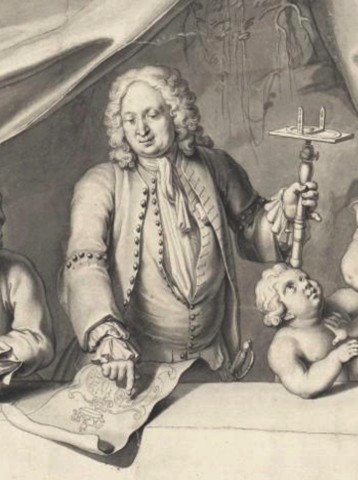
Adam Friedrich Zürner (1679 in Marieney - 1742 in Dresden) was a German cartographer and geometrician. In the 18th century, he served as the royal commissioner for lands and boundaries of the Electorate of Saxony. He produced more than 900 maps.
-
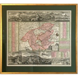
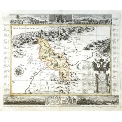
Zürner, Adam Friedrich Teplice - Die Herschaft ToeplitzCatalog No.: 26503
Teplice a okolí. "Die Herschaft Toeplitz Im Leitmeritzer Creise Des Königreichs Boehmen". Pův., staře kol. mědirytina. Podle M. A. F. Zürnerovy mapy ryl a vydal P. Schenk ml., Amsterdam, 1757. S dekorativní tit. kartuší. 49:60 cm.
7 500,00 KčFor sale -
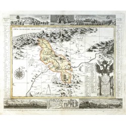
Seutter, Matthäus (author) Zürner, Adam Friedrich (other authors) Accurate abbildung der Statt Kayser CarlsbadCatalog No.: 16566
"Accurate abbildung der Statt Kayser Carlsbad". Staře kol. mědiryt podle A. F. Zürnerovy mapy regionu. Vyd. M. Seutter v Augsburku, ca. 1740. Mapa Karlových Varů a okolí (Cheb, Sokolov, Loket, Ostrov) s fig. tit. kartuší, kartuší s...
-
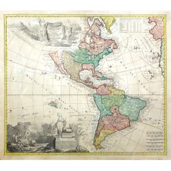
Schenk, Peter & Valck, Gerard (author) Zürner, Adam Friedrich (other authors) Americae tam Septentrionalis quam...Catalog No.: 23365
America. "Americae tam Septentrionalis quam Meridionalis in Mappa Geographica Delineatio". Orig. copper engraving after A. F. Zurner's map of America. Published by P. Schenk in Amsterdam, ca. 1715. Orig. old colouring. With figure title cartouche, another figure cartouche with explanatory notes and the scale of map. 50:56 cm.
-
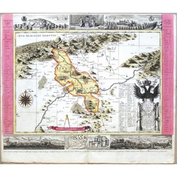
Zürner, Adam Friedrich Die Herschaft ToeplitzCatalog No.: 21937
Teplice a okolí. "Die Herschaft Toeplitz Im Leitmeritzer Creise Des Königreichs Boehmen". Pův., staře kol. mědirytina. Podle M. A. F. Zürnerovy mapy ryl a vydal P. Schenk, Amsterdam, ca. 1725. S dekorativní tit. kartuší. 49:60 cm.
-
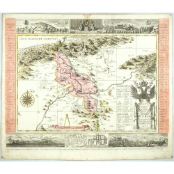
Schenk, Peter & Valck, Gerard (author) Zürner, Adam Friedrich (other authors) Die Herschaft ToeplitzCatalog No.: 05046
Teplice a okolí. "Die Herschaft Toeplitz Im Leitmeritzer Creise Des Königreichs Boehmen". Původní, staře kol. mědirytina. Podle M. A. F. Zürnerovy mapy ryl a vydal P. Schenk, Amsterdam, ca. 1725. 49:60 cm.
-
Zürner, Adam Friedrich Die Herschaft ToeplitzCatalog No.: 26337
Teplice a okolí. "Die Herschaft Toeplitz Im Leitmeritzer Creise Des Königreichs Boehmen". Pův., staře kol. mědirytina. Podle M. A. F. Zürnerovy mapy ryl a vydal P. Schenk ml., Amsterdam, 1757. S dekorativní tit. kartuší. 49:60 cm.
-
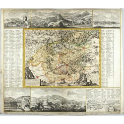
Schenk, Peter & Valck, Gerard (author) Zürner, Adam Friedrich (other authors) Geographischer Entwurff der Stadt und...Catalog No.: 24476
Karlovy Vary a okolí. "Geographischer Entwurff der Stadt und Gegend des Welt-berühmten Kaeyser Carlsbades in Königreich Böhmen". Pův., staře kol. mědirytina. Podle A. F. Zürnerovy mapy ryl a vydal P. Schenk jun., Amsterdam, 1715. 53:59 cm.

