No products
Antique Maps and Views
- Africa
-
America
- America (continent)
- Antilles (West Indies)
- Argentina
- Bermuda
- Brazil
- Canada
- Central America and Antilles (West Indies)
- Chile
- Columbia
- Florida
- Guyana
- Hawaiian Islands
- Honduras
- Louisiana
- Mexico
- New York
- North America
- Panama
- Paraguay
- Peru
- South America
- Straits of Magellan
- United states (USA)
- Venezuela
- Virginia
- Asia and Australia
- Atlasy
-
Europe
- Austria
-
Belgium, the Netherlands, Luxembourg
- Amsterdam
- Antwerp
- Belgium and Luxembourg
- Bergen op Zoom
- Blokzijl
- Bommenede
- Brabant
- Brugge
- Brussels
- Charleroi
- Courtrai
- Delft
- Dinant
- Dordrecht
- Elburg
- Flandres
- Fort Rammekens
- Friesland
- Friesland and Groningen
- Gelderland
- Geraardsbergen
- Grave
- Groningen
- Hainaut
- Harderwijk
- Harlingen
- Holland
- Hulst
- Huy
- Liege
- Lier
- Limbourg
- Limburg
- Louvain
- Luxemburg
- Maastricht
- Mechelen
- Middelburg
- Mons
- Namur
- Netherlands
- Netherlands and Belgium
- Nijmegen
- Ostend
- Overijssel
- Rotterdam
- Spa
- Stavoren
- The Hague
- Tiel
- Utrecht
- Veere
- Veurne
- Ypres
- Zaltbommel
- Zeeland
- Zieriksee
- Zierikzee
- Zutphen
- Zype
-
Bohemia, Moravia and Silesia
- Beroun
- Bohemia
- Brandýs nad Labem
- Branná (okr. Šumperk)
- Brno
- Brodce (okr. Mladá Boleslav)
- Broumov
- Carlsbad
- Čáslav
- Čelákovice
- Český Krumlov
- Cheb
- Chlumec nad Cidlinou
- Chomutov
- Děčín
- Dolní Olešnice - Nové Zámky
- Dvůr Králové nad Labem
- Františkovy Lázně
- Frýdlant
- Hasištejn
- Házmburk
- Hostinné
- Hradec Králové
- Hřensko
- Jáchymov
- Jaroměř
- Jihlava
- Jindřichův Hradec
- Jižní Čechy
- Kamýk u Litoměřic
- Karlštejn
- Kolín
- Konopiště
- Kostelec nad Labem
- Křivoklát
- Krkonoše
- Krupka
- Kunětická Hora
- Kutna Hora
- Kyšperk
- Lednice
- Liberec
- Libochovany
- Lipnice nad Sázavou
- Litoměřice
- Litoměřicko
- Litomyšl
- Loket
- Louny
- Lovosice
- Lysá nad Labem
- Mariánské Lázně
- Mělník
- Mladá Boleslav
- Mladoboleslavsko
- Moravia
- Most
- Náchod
- Nymburk
- Okoř
- Olomouc
- Ostrov nad Ohří
- Pardubice
- Plzeň
- Poděbrady
- Polná
- Prácheňsko
- Prague
- Přelouč
- Rabí
- Rakovnicko
- Rakovník
- Roudnice nad Labem
- Rožmberk
- Rožnov pod Radhoštěm
- Rychmburk
- Sedlec
- Slaný
- Smečno
- Smiřice
- Štětí
- Šumava
- Švamberk (Krasíkov)
- Tábor
- Tepl
- Teplice
- Terezín
- Třeboň
- Týnec nad Labem
- Uničov
- Valdštejn
- Vinec
- Vrabinec
- Vrchlabí
- Vyšší Brod
- Zákupy
- Žampach (zámek)
- Želiv
- Žireč
- Žleby
- Znojmo
- Zvíkov
- Central Europe
- Danube
- Eastern and Southeastern Europe, Balkan
- Europe (continent)
-
France
- Albi
- Anjou
- Artois
- Bar-le-Duc
- Berry
- Blois
- Bourbourg
- Bourgogne-Franche-Comté
- Bresse
- Cambrai
- Cassel
- Château de Lichtenberg
- Chaumont
- Compiegne and Noyon
- Corsica
- Dauphiné
- Elsass
- Gascogne
- Gâstinais and Senonais
- Gravelines
- Hauts-de-France
- Ile de France
- La Bassée - Hesdin
- Languedoc
- Lille
- Limoges
- Lorraine
- Lyon
- Maine
- Marseille
- Metz
- Montmélian
- Mulhouse
- Nancy
- Nice
- Normandie
- Paris
- Perche
- Picardy
- Poitou
- Provence
- Re and Oleron
- Reims - Rethel
- Saint-Omer
- Saintonge and Aunis
- Savoy
- Strasbourg
- Tarn (department)
- Vexin
-
Germany
-
Baden-Württemberg
- Bad Teinach-Zavelstein
- Balingen
- Biberach an der Riß
- Böblingen
- Bodensee
- Breisgau
- Calw
- Dornhan
- Esslingen
- Geislingen an der Steige
- Grafschaft Limpurg
- Heidelberg
- Heilbronn
- Hohenlohe
- Karlsruhe
- Mannheim
- Möckmühl
- Nagold
- Neuenbürg
- Nord-Württemberg
- Oberschwaben
- Offenburg
- Reutlingen
- Rheinpfalz
- Schwäbisch Gmünd
- Schwäbisch Hall
- Singen
- St. Blasien
- Stuttgart
- Swabia
- Tübingen
- Ulm
- Vaihingen a. d. Enz
- Wangen im Allgäu
- Weinheim
- Württemberg
-
Bavaria
- Aschaffenburg
- Augsburg
- Aurach
- Bad Abbach
- Bamberg
- Bogenberg (Wallfahrtskirche)
- Cham
- Coburg
- Donauwörth
- Eichstätt
- Forchheim
- Franken
- Freising
- Friedberg (Schwaben)
- Füssen
- Gräfenberg (Oberfranken)
- Höchstädt an der Donau
- Ingolstadt
- Kelheim
- Kempten
- Lauingen
- Lenggries
- Lindau
- Memmingen
- Mindelheim
- Mühldorf am Inn
- München
- Nabburg
- Natternberg (Schloss)
- Neuburg an der Donau
- Neumarkt in der Oberpfalz
- Neuötting
- Neustadt an der Donau
- Nördlingen
- Nürnberg
- Oberpfalz
- Pappenheim
- Passau
- Pfaffenhofen
- Pöttmes
- Rain am Lech
- Regensburg
- Saal an der Donau
- Schongau
- Schrobenhausen
- Straubing
- Thurnau
- Velden
- Vilshofen an der Donau
- Wackerstein
- Wasserburg am Inn
- Weilheim / links Polling
- Weissenburg in Bayern
- Weltenburg
- Würzburg
- Berlin
- Brandenburg
- Bremen
- Hamburg
- Hessen
- Mecklenburg-Vorpommern/Pommern
-
Niedersachsen
- Aurich
- Bad Bentheim
- Bad Gandersheim
- Bodenwerder
- Braunschweig
- Braunschweig-Lüneburg
- Celle
- Cuxhaven
- Emden
- Hann. Münden
- Hannover
- Hildesheim
- Hoya
- Liebenau an der Weser
- Lüneburg
- Niedersächsischer Kreis
- Nienburg a. d. Weser
- Oldenburg
- Osnabrück
- Osterode
- Osterwieck
- Ostfriesland
- Schnackenburg
- Schöppenstedt
- Stolzenau
- Walsrode
- Winsen an der Luhe
- Wolfenbüttel
- Nordrhein-Westfalen
- Northern Germany
- Rheinland-Pfalz
- Sachsen
- Sachsen-Anhalt
- Schleswig-Holstein
- Thüringen
-
Baden-Württemberg
-
Great Britain and Ireland
- Bedford and Buckinghamshire
- Berkshire and Hampshire
- Cambridgeshire
- Cornwall
- Cumberland
- Denbigh and Flint
- Derbyshire
- Devon
- Dorset
- Durham (County)
- England
- Essex
- Gloucestershire
- Great Britain and Ireland
- Herefordshire
- Hertfordshire
- Hertfordshire and Middlesex
- Huntingdonshire
- Ireland
- Isle of Wight
- Kent
- Leicestershire
- Lincolnshire
- London
- Middlesex
- Norfolk
- Northampton
- Northeastern England
- Northern England
- Northumberland
- Northwestern England
- Nottinghamshire
- Oxfordshire
- Scotland
- Shropshire and Staffordshire
- Somerset
- Southeastern England
- Southwestern England
- Staffordshire
- Surrey
- Sussex
- Wales
- Westmorland
- Wiltshire
- Worcestershire and Warwickshire
- Yorkshire
- Greece, Mediterranean Sea
-
Italy
- Abruzzo
- Ancona
- Apulia (Puglia)
- Arcevia
- Bari and Basilicata
- Bergamo
- Bologna
- Brescia
- Brescia and Crema
- Cadore
- Cagliari
- Caiazzo
- Calabria
- Campania
- Capitanata
- Carmagnola
- Catania
- Central Italy
- Civitavecchia
- Crema
- Cremona
- Cuneo
- Elba
- Emilia Romagna
- Faenza
- Fano
- Ferrara
- Florence
- Fondi
- Friuli
- Gaeta
- Gallipoli
- Genoa
- Ischia
- Italy
- Lazio
- Lerici
- Liguria (Italian Riviera)
- Livorno
- Lombardia
- Loreto
- Lucca
- Mantua
- Mantua
- Marche (Ancona)
- Merano
- Messina
- Milan
- Mirandola
- Modena
- Molise
- Monferrato
- Naples
- Netuno
- Nocera Umbra
- Northern Italy
- Orvieto
- Orvieto and Loreto
- Otranto
- Padua
- Palermo
- Parma
- Pavia
- Perugia
- Pesaro
- Piacenza
- Piedmont
- Pinerolo
- Piombino
- Pisa
- Po
- Pozzuoli
- Reggio di Calabria
- Reggio Emilia
- Rimini
- Rome
- Rovigo
- San Marino
- Sardinia
- Sicily
- Sicily and Malta
- Sicily and Sardinia
- Siena
- Southern Italy
- Spoleto
- Sulmona
- Taranto
- Terracina
- Tivoli
- Torino
- Tortona
- Trapani
- Trentino-Alto Adige / Südtirol
- Trento
- Treviso
- Tuscany
- Tyrol
- Udine
- Umbria
- Urbino
- Velletri
- Venice
- Vercelli
- Verona
- Vicenza
- Viterbo
- Labe
- Mediterranean Sea
- Monaco
- Poland, Silesia, Russia and the Baltic republics
- Rhine
- Scandinavia and Iceland
- Spain and Portugal
- Switzerland
- Islands (Special Catalogue)
- World, Oceans, Poles and Celestial Maps
Antique Maps and Views There are 2154 items.
Subcategories
-
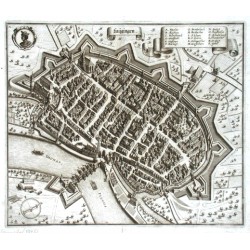
Merian, Matthäus LaugingenCatalog No.: 00452
Laugingen. "Laugingen". Orig. Kupferstich, M. Merian, Topographia Bavariae, 1644. Mit Titelkart., einem Wappen und Kart. mit Erklärungen (A.-S.). 28,5:33cm.
2 400,00 KčFor sale -
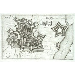
Merian, Matthäus Vesalia - Nider WeselCatalog No.: 00450
Wesel. "Vesalia - Nider Wesel". Orig. Kupferstich, M. Merian, Topographia Westphaliae, 1647. 20:32 cm.
750,00 KčFor sale -
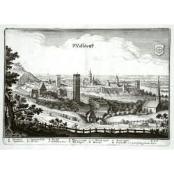
Merian, Matthäus MülldorffCatalog No.: 00447
Mühldorf am Inn. "Mülldorff". Orig. Kupferstich, M. Merian, Topographia Bavariae, 1644. 22:31 cm.
3 500,00 KčFor sale -
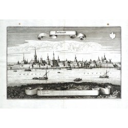
Merian, Matthäus DüsseldorffCatalog No.: 00444
Düsseldorf. "Düsseldorff". Orig. copperplate engraving, M. Merian, 1647. With decorative title, a cartouche with explanatory notes and many ships. 20:32 cm.
18 000,00 KčFor sale -
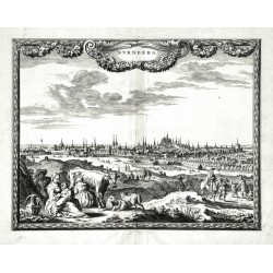
Visscher, Nicolaes NurnbergCatalog No.: 00441
Nuremberg. "Nurnberg". Orig. copperplate engraving after P. H. Schut drawing. Published by N. Visscher, 1658. With ornamental title cartouche and figures in the foreground. 21,5:28 cm.
8 500,00 KčFor sale -
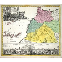
Homann, Johann Baptist Statuum Maroccanorum RegnorumCatalog No.: 00437
Morocco and Canary Islands. "Statuum Maroccanorum Regnorum". Orig. copper-engraving, J. B. Homann, 1728 in Nuremberg. Original old colouring. With great figure title cartouche and views of Marrakesh and Méknes (each one 11:27 cm) at the bottom. 48,5:56 cm.
6 500,00 KčFor sale -
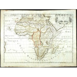
Sanson, Nicolas AfriqueCatalog No.: 00436
Africa. "Afrique". Orig. copperplate engraving, Nicolas Sanson. Orig. old colouring. Published by Pierre Mariette, Paris, 1650. With ornamental title-cartouche. 39,5:56 cm (15 1/2 x 22 inch.).
9 500,00 KčFor sale -
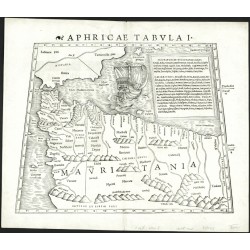
Münster, Sebastian Aphricae tabula ICatalog No.: 00428
North Africa. "Aphricae Tabula I". Orig. woodblock from the first edition of S. Münster's Geographia. Published by Henricus Petrus in Basel, 1540. With latin title above the map, a cartouche and depiction of a ship. 25,5:33 cm (10 x 13 inch.).
9 000,00 KčFor sale -
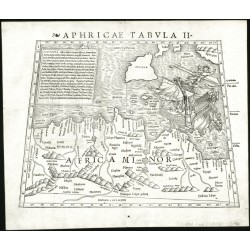
Münster, Sebastian Aphricae Tabula IICatalog No.: 00427
North Africa. "Aphricae Tabula II". Orig. woodblock from the first edition of S. Münster's Geographia. Published by Henricus Petrus in Basel, 1540. With latin title above the map, a cartouche and a depiction of the Apostle Paul's shipwreck near Malta. 25,5:33,5 cm (10 x 13 1/4 inch.).
10 000,00 KčFor sale -
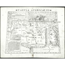
Münster, Sebastian Tabula Aphricae IIICatalog No.: 00426
Northeast Africa (Egypt). "Tabula Aphricae III". Orig. woodblock from the S. Münster's Geographia. Published by Henricus Petrus in Basel, 1542. With latin title above the map, 2 cartouches and a depiction of a sea monster devouring a sailor. 25,5:34 cm (10 x 13 1/2 inch.).
8 000,00 KčFor sale -
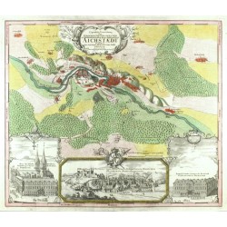
Homann, Johann Baptist Eigentliche Verzeichnung der Gegend und...Catalog No.: 00421
Eichstätt. "Eigentliche Verzeichnung der Gegend und Prospecten der ... Stadt Aichstaedt". Orig. copperplate engraving. Published by Homann Heirs in Nuremberg, 1730. Orig. old colouring. 50:58,5 cm.
14 500,00 KčFor sale -
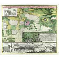
Homann, Johann Baptist Accurater Prospect u. Grundris der Gegend...Catalog No.: 00420
Weißenburg in Bayern. "Accurater Prospect u. Grundris der Gegend der Kayserl. Freyen Reichs Stadt Weissenburg am Nordgau". Orig. copperplate engraving. Published by J. B. Homann in Nuremberg, ca. 1720. Orig. old colouring. 49:56,5 cm.
7 500,00 KčFor sale -
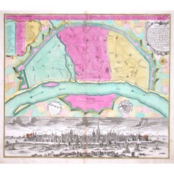
Homann, Johann Baptist Plan du Mayence - Accurater Plan der...Catalog No.: 00416
Mainz. "Plan du Mayence - Accurater Plan der ... Stadt Maynz". Orig. copperplate engraving. Published by Homann Heirs in Nuremberg, ca. 1735. Orig. old colouring. 58:48 cm.
11 000,00 KčFor sale -
Seutter, Matthäus Cologne - Colonia Agrippina - Cölln am RheinCatalog No.: 00415
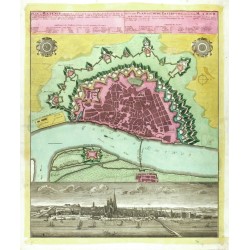
Cologne. "Colonia Agrippina - Cölln am Rhein". Gesamtansicht (13,5:56 cm) u. Stadtplan (mit Befestigungsanlage) von Köln. Altkol. Kupf. bei M. Seutter, um 1740. Mit ausgem. lat.-dt. Kopftitel, 2 ornament. Kart. (davon eine ausgem.) u. 2 Wappen. 49,5:57 cm.
30 000,00 KčFor sale -
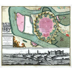
Seutter, Matthäus Mannheim - Manheimium Munitißimum Oppidum...Catalog No.: 00414
Mannheim. "Manheimium Munitißimum Oppidum et hodierno die Residentia Electoris Palatini, ... ". A panoramic view (15:56,5 cm) and fortification plan of Mannheim. Orig. copperplate engraving, M. Seutter, ca. 1740. Orig. old colouring. 50:58 cm.
21 000,00 KčFor sale -
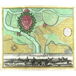
Homann, Johann Baptist Hodierna Sedes Electoris Palatini ManheimiumCatalog No.: 00413
Mannheim. "Hodierna Sedes Electoris Palatini Manheimium". Orig. copperplate engraving. Published by Homann Heirs in Nuremberg, ca. 1730. Orig. old colouring. 48:57,5 cm.
15 000,00 KčFor sale -
Homann, Johann Baptist Abbildung der Keysrl....Catalog No.: 00411
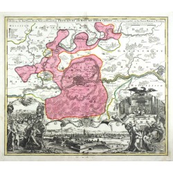
Frankfurt am Main. "Abbildung der Keysrl. ... Handelstatt Franckfurt am Mayn mit ihrem Gebiet und Gräntzen". Orig. copperplate engraving, J. B. Homann, ca. 1715. Orig. old colouring. 50:58,5 cm.
10 500,00 KčFor sale -
Homann, Johann Baptist Abbildung der Keysrl....Catalog No.: 00410
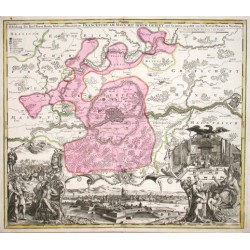
"Abbildung der Keysrl. Freyen-Reichs-Wahl-und-Handelstatt Franckfurt am Mayn mit ihrem Gebit und Gräntzen". Altkol. Grundriß mit Umgebung, darunter unkol. Prospekt (ca. 10:31 cm), flankiert von Allegorien sowie 2 kl. Detailans. (Keiserkrönung...
21 000,00 KčFor sale -
Seutter, Matthäus Erfurt - Celeberrima ac Spatiosißima...Catalog No.: 00408
Erfurt. "Celeberrima ac Spatiosißima Thuringiae Metropolis Erfurtum ... Erfurt Die Hoch Berühmt und Größeste Haupt Stadt Thüringens". Orig. copperplate engraving after E. G. König. Publised by M. Seutter in Augsburg, 1740. Orig. old colouring. 50:57,5 cm.
18 000,00 KčFor sale -
Homann Die Königl. Preus: u. Churf. Brandenburg....Catalog No.: 00407
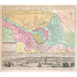
"Die Königl. Preus: u. Churf. Brandenburg. Residenz-Stadt Berlin". Altkol. Kupf.-Stadtplan von Berlin. Bei Homann Erben, um 1740. Mit Titelkart., Legende u. gr. Gesamtansicht der Stadt (13:55,5 cm). 49:56,5 cm.
50 000,00 KčFor sale -
Homann, Johann Baptist Prospect und Grundris der Stadt Bremen...Catalog No.: 00405
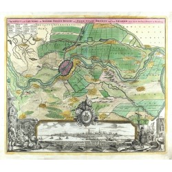
Bremen. "Prospect und Grundris der ... Stadt Bremen samt ihrer Gegend". Orig. copperplate engraving, J. B. Homann, Nuremberg, ca. 1720. Orig. old colouring. 48:57,5 cm.
16 000,00 KčFor sale -
Blaeu, Joan EmdaCatalog No.: 00401
Emden. "Emda". Orig. copperplate engraving, J. Blaeu, Amsterdam, 1649. With engraved title and 2 coats-of-arms. 42,5:53 cm.
8 000,00 KčFor sale -
Janssonius, Johannes (author) Braun, Georg - Hogenberg, Frans (other authors) Chilonum, vulgo KyellCatalog No.: 00396
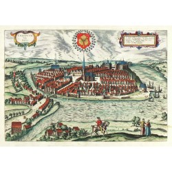
Kiel. "Chilonum, vulgo Kyell". Orig. copperplate engraving after Braun & Hogenberg. From: J. Janssonius "Theatrum praecipuarum urbium ... Europae ...", Amsterdam, Janssonis, 1657. Orig. old colouring. 33:48 cm.
16 000,00 KčFor sale -
Seutter, Matthäus Stiria DucatusCatalog No.: 00390
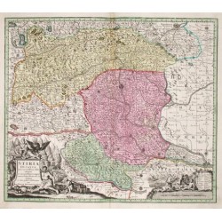
Steiermark. "Stiria Ducatus". Altkol. Kupf.-Kte. bei M. Seutter, um 1730. Mit gr. fig. titelkart. mit Wappen u. fig. kart. mit Meilanzeiger u. Erklärungen. 49,5:57 cm.
4 000,00 KčFor sale -
Janssonius, Johannes Insulae de Cabo Verde olim Hesperides,...Catalog No.: 00386
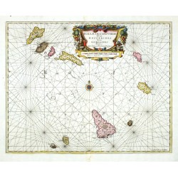
Cape Verde Islands. "Insulae de Cabo Verde olim Hesperides, sive Gorgades: Belgice de Zoute Eylanden". Orig. copperplate engraving, J. Janssonius. Published in Amsterdam by G. Valk & P. Schenk, ca. 1700. Orig. old colouring. 43:54,5 cm.
9 000,00 KčFor sale -
Ortelius, Abraham Salisburgensis Iurisdictionis vera descriptioCatalog No.: 00381
Salzburg. "Salisburgensis Iurisdictionis ... vera descriptio". Orig. copper-engraving, A. Ortelius, 1570 after M. Setznagel's map of the region. With 2 small coats of arms and great view of the city of Salzburg lower right. 33,5:43,5 cm.
12 000,00 KčFor sale -
Blaeu, Willem Janszoon Fezzae et Marocchi regna Africae celeberrimaCatalog No.: 00375
Morocco. "Fezzae et Marocchi regna Africae celeberrima, describebat Abrah: Ortelius". Orig. copper-engraving after A. Ortelius' map of the region. Published by W. J. Blaeu in Amsterdam, ca. 1635. With great figure title-cartouche. 38,5:50 cm.
8 500,00 KčFor sale -
Ortelius, Abraham Fessae, et Marocchi Regna Africae celeberr.Catalog No.: 00374
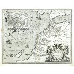
Morocco. "Fessae, et Marocchi Regna Africae celeberr.". Orig. copperplate engraving, A. Ortelius, 1595. With figure title cartouche, several ships and an ornament. cartouche with inset map of Kingdom of Congo. 39:50,5 cm.
7 200,00 KčFor sale -
Blaeu, Willem Janszoon Aethiopia Inferior, vel ExteriorCatalog No.: 00373
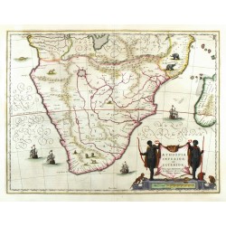
Southern Africa and Madagascar. "Aethiopia Inferior, vel Exterior". Orig. copperplate engraving, W. J. Blaeu, 1634. Orig. old colouring. 38:49,5 cm.
8 500,00 KčFor sale -
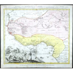
d'Anville, Jean Baptiste Bourguignon Guinea propria, nec non Nigritiae vel...Catalog No.: 00371
West Africa. "Guinea propria, nec non Nigritiae vel Terrae Nigrorum maxima pars ...". Orig. copperlate engraving. Published by Homann Heirs, Nuremberg, 1753. Orig. old coluring. With title above the map and large figure cartouche. 50,5:56 cm.
6 800,00 KčFor sale -
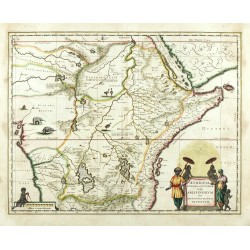
Blaeu, Willem Janszoon Aethiopia Superior vel Interior, vulgo...Catalog No.: 00370
Central Africa. "Aethiopia Superior vel Interior; vulgo Abissinorum sive Presbiteri Ioannis Imperium". Orig. copperplate engraving, W. J. Blaeu, 1634. Orig. old colouring. 38,5:50 cm.
12 500,00 KčFor sale -
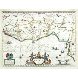
Blaeu, Willem Janszoon GuineaCatalog No.: 00368
West Africa. "Guinea". Orig. copperplate engraving, W. J. Blaeu, 1634. Orig. old colouring. With figure title cartouche, a cartouche with coat-of-arms and dedication, 2 black cherubs holding an elephant tusk, many ships and animals. 38,5:52,5 cm.
10 500,00 KčFor sale -
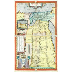
Ortelius, Abraham Aegyptus AntiquaCatalog No.: 00363
Egypt. "Aegyptus Antiqua". Orig. copper-engraving, A. Ortelius, Antwerp, 1584. Orig. old colouring. With 3 decorative cartouches (one with inset map of Alexandria with its environs, 8,5:11 cm) and great architectural cartouche with 2 pyramids....
55 000,00 KčFor sale -
Schenk, Peter & Valck, Gerard (author) Ludolf, Job (other authors) Jobi Ludolfi Habessinia seu Abassia...Catalog No.: 00359
Ethiopia. "Jobi Ludolfi Habessinia Seu Abassia Presbyteri Johannis Regio ... 1683". Orig. copperplate engraving after J. Ludolf's map of the region. Published by P. Schenk & G. Valck in Amsterdam, ca. 1690. Orig. old colouring. 44:54,5 cm.
16 000,00 KčFor sale -
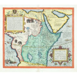
Ortelius, Abraham Africa - Presbiteri Johannis, sive,...Catalog No.: 00356
Central and northeastern Africa (Ethiopia). "Presbiteri Iohannis, sive, Abissinorum Imperii descriptio". Orig. copper-engraving, Abraham Ortelius (1527-1598), Antwerp, 1572. Original old colouring. With ornamental title-cartouche (with a coat-of-arms), 4...
25 000,00 KčFor sale -
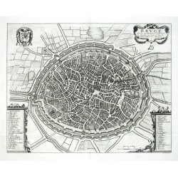
Wit, Frederik de BrugeCatalog No.: 00338
Bruges. "Bruge. Een der vornaamste Steeden van Vlandren". Orig. copperplate engraving. F. de Wit. Published by Van der Kloot in the Hague, 1729 in 'Histoire militaire du prince Eugène de Savoie'. With ornamental title-cartouche. 40:50,5 cm.
6 500,00 KčFor sale -
Lotter, T. C. Le Landgraviat De Hesse-CasselCatalog No.: 00337
Hessen. "Le Landgraviat De Hesse-Cassel Meridional et Septentr. avec ..." Altkol. Kupf.-Kte. von T. C. Lotter, dat. 1761. Von 4 Platten gedruckt und zussamengeklebt. Mit Kopftitel, gr. fig. Titelkart u. ornament. Kart. mit Erklärungen. 98:84 cm.
18 000,00 KčFor sale -
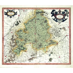
Mercator, Gerardus Wirtenberg DucatusCatalog No.: 00331
Württemberg. "Wirtenberg Ducatus". Orig. copper engraving, G. Mercator, 1585. With ornamental title cartouche and another ornament. cartouche with the scale of map. 37:44,5 cm.
8 000,00 KčFor sale -
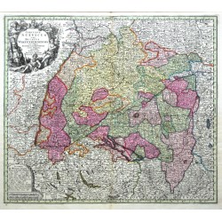
Seutter, Matthäus Circulus Suevicus in quo Ducatus...Catalog No.: 00330
Württemberg and Swabia. "Circulus Suevicus in quo Ducatus Wirtenbergensis cum reliquis Statibus et Provinciis curate designatus proponitur". Altkol. Kupf.-Kte. von M. Seutter, Augsburg, um 1730. Mit fig. Titelkart. und ornament. Kart. mit Legende und Meilanzeiger....
4 000,00 KčFor sale -
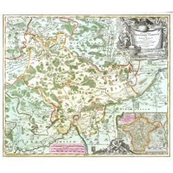
Homann, Johann Baptist Nova et accurata Territorii Ulmensis cum...Catalog No.: 00329
Ulm. "Nova et accurata Territorii Ulmensis cum Dominio Wainensi Descriptio". Orig. copper-engraving, Johann Baptist Homann (1663-1724), ca. 1720 in Nurnberg. Original old colouring. 48,5:57 cm.
5 200,00 KčFor sale -
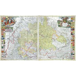
Homann, Johann Baptist Ducatus WürtenbergiciCatalog No.: 00326
Württemberg. "Ducatus Würtenbergici". Orig. copperplate engraving, J. B. Homann, ca. 1710. Orig. old colouring. With 2 figure and herald. cartouches with small views of Stuttgart and Tübingen and total 76 coats of arms by the sides. 57,5:95 cm.
12 000,00 KčFor sale -
Homann, Johann Baptist Nova Territorii Erfordiensis ... descriptioCatalog No.: 00325
Erfurt. "Nova Territorii Erfordiensis in suas Praefecturas accuratie divisi descriptio cui accedit Erfordiae Urbis ...". Altkol. Kupf.-Karte von J. B. Homann, (1712). Unten rechts große fig. Titelkartusche mit einem Wappen. Unter der Karte Gesamtansicht...
4 500,00 KčFor sale -
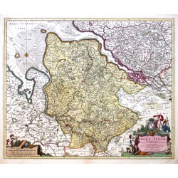
Visscher, Nicolaes Ducatus Bremae et Ferdae maximaeque partis...Catalog No.: 00319
Bremen-Verden. "Ducatus Bremae et Ferdae maximaeque partis Ducatus Stormariae, Comitatus Oldenburgi, Albis, Visurgisque fluminum novissima descriptio". Orig. copperplate engraving, N. Visscher, ca. 1680. Orig. old colouring. 46,5:56,5 cm.
7 200,00 KčFor sale -
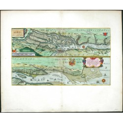
Blaeu, Joan Celeberrimi Fluvii Albis nova delineatioCatalog No.: 00317
Elbe. "Celeberrimi Fluvii Albis nova delineatio". Orig. copperplate engraving after Ch. Moller's map. Published by J. Blaeu, 1659. Orig. old colouring. With ornament. title cartouche, another cartouch with dedication, scale of map and many ships. 31:53,5 cm.
16 000,00 KčFor sale -
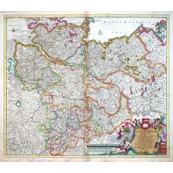
Danckerts, Justus Circulus Saxoniae Inferioris, in quo sunt...Catalog No.: 00315
Niedersachsen. "Circulus Saxoniae Inferioris, in quo sunt Ducatus Holsatiae. Meklenburgi, Lauwenburgi ...". Altkol. Kupf.-Kte., J. Danckerts, um 1690. Mit ausgem. fig. Wappenkart. 49,5:57 cm.
6 000,00 KčFor sale -
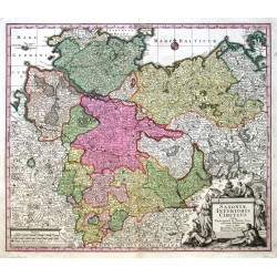
Seutter, Matthäus Saxoniae Inferioris CirculusCatalog No.: 00314
Niedersachsen. "Saxoniae Inferioris Circulus". Altkol. Kupf.-Kte. bei M. Seutter, (um 1740). Mit fig. Titelkart. u. Rollwerkskart. mit Meilanzeiger. 50:58 cm.
3 200,00 KčFor sale -
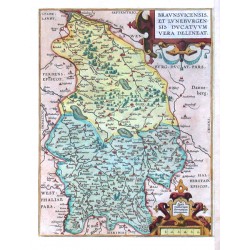
Ortelius, Abraham Braunsvicensis, et Luneburgensis Ducatuum...Catalog No.: 00313
Braunschweig and Lüneburg. "Braunsvicensis, et Luneburgensis Ducatuum vera delineat.". Altkol. Kupf.-Kte., A. Ortelius, 1590. Mit 2 ausgem. Rollwerkskart. 31:23,5 cm.
3 500,00 KčFor sale -
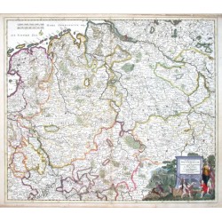
Danckerts, Justus Circulus Westphaliae cumCatalog No.: 00299
"Circulus Westphaliae cum Omnibus Suis Subjacentibus Provinciis Novissima Delinetio". Altkol. Kupf.-Kte. von J. Danckerts, ca. 1695. Mit ausgem. fig. Kart. 51:58 cm.
7 500,00 KčFor sale -
Lotter, T. C. Mappa Geographica exhibens Electoratum...Catalog No.: 00297
"Mappa Geographica exhibens Electoratum Brandenburgensem, sive Marchiam Veterem, Mediam et Novam". Altkol. Kupf.-Kte. bei T. C. Lotter, Augsburg, dat. 1758. Mit fig. und herald. Titelkart, Kart. mit Erklärungen ("Signorum Explicatio") und...
10 500,00 KčFor sale -
Homann, Johann Baptist Prospect, Grundris und Gegent der Königl....Catalog No.: 00295
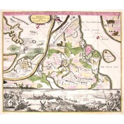
"Prospect, Grundris und Gegent der Königl. Schwed. Vestung Stralsund wie solche den 15 July 1715 von den Nordischen Hohen Allyrten ist belagert worden". Altkol. Kupf.-Kte. nach D. Heer bei J. B. Homann, (1716). Umgebungskte. von Stralsund mit...
11 000,00 KčFor sale

