No products
Antique Maps and Views
- Africa
-
America
- America (continent)
- Antilles (West Indies)
- Argentina
- Bermuda
- Brazil
- Canada
- Central America and Antilles (West Indies)
- Chile
- Columbia
- Florida
- Guyana
- Hawaiian Islands
- Honduras
- Louisiana
- Mexico
- New York
- North America
- Panama
- Paraguay
- Peru
- South America
- Straits of Magellan
- United states (USA)
- Venezuela
- Virginia
- Asia and Australia
- Atlasy
-
Europe
- Austria
-
Belgium, the Netherlands, Luxembourg
- Amsterdam
- Antwerp
- Belgium and Luxembourg
- Bergen op Zoom
- Blokzijl
- Bommenede
- Brabant
- Brugge
- Brussels
- Charleroi
- Courtrai
- Delft
- Dinant
- Dordrecht
- Elburg
- Flandres
- Fort Rammekens
- Friesland
- Friesland and Groningen
- Gelderland
- Geraardsbergen
- Grave
- Groningen
- Hainaut
- Harderwijk
- Harlingen
- Holland
- Hulst
- Huy
- Liege
- Lier
- Limbourg
- Limburg
- Louvain
- Luxemburg
- Maastricht
- Mechelen
- Middelburg
- Mons
- Namur
- Netherlands
- Netherlands and Belgium
- Nijmegen
- Ostend
- Overijssel
- Rotterdam
- Spa
- Stavoren
- The Hague
- Tiel
- Utrecht
- Veere
- Veurne
- Ypres
- Zaltbommel
- Zeeland
- Zieriksee
- Zierikzee
- Zutphen
- Zype
-
Bohemia, Moravia and Silesia
- Beroun
- Bohemia
- Bohemia, Moravia and Silesia
- Brandýs nad Labem
- Branná (okr. Šumperk)
- Břeclav
- Brněnsko a Uherskohardišťsko
- Brno
- Brodce (okr. Mladá Boleslav)
- Carlsbad
- Čáslav
- Čelákovice
- Cheb
- Chlumec nad Cidlinou
- Chomutov
- Děčín
- Dolní Olešnice - Nové Zámky
- Dvůr Králové nad Labem
- Františkovy Lázně
- Frýdlant
- Hasištejn
- Házmburk
- Hostinné
- Hradec Králové
- Hřensko
- Jáchymov
- Jaroměř
- Jihlava
- Jindřichův Hradec
- Jižní Čechy
- Kamýk u Litoměřic
- Karlštejn
- Kolín
- Kostelec nad Labem
- Kostomlaty pod Milešovkou
- Křivoklát
- Krkonoše
- Krupka
- Kunětická Hora
- Kutna Hora
- Kyšperk
- Lednice
- Libochovany
- Litoměřice
- Loket
- Louny
- Lovosice
- Lysá nad Labem
- Mariánské Lázně
- Mělník
- Mladá Boleslav
- Mladoboleslavsko
- Moravia
- Most
- Náchod
- Nymburk
- Okoř
- Olomouc
- Ostrov nad Ohří
- Pardubice
- Plzeň
- Poděbrady
- Polná
- Prachatice
- Prácheňsko
- Prague
- Přelouč
- Rabí
- Rakovnicko
- Rakovník
- Roudnice nad Labem
- Rožmberk
- Rožnov pod Radhoštěm
- Rychmburk
- Sedlec
- Slaný
- Smečno
- Smiřice
- Štětí
- Střekov
- Šumava
- Švamberk (Krasíkov)
- Tábor
- Tepl
- Teplice
- Terezín
- Třeboň
- Týnec nad Labem
- Ústí nad Labem
- Valdštejn
- Vinec
- Vrabinec
- Vrchlabí
- Vyšší Brod
- Zákupy
- Žampach (zámek)
- Žireč
- Žleby
- Zvíkov
- Central Europe
- Danube
- Eastern and Southeastern Europe, Balkan
- Europe (continent)
-
France
- Albi
- Anjou
- Artois
- Bar-le-Duc
- Berry
- Blois
- Bourbourg
- Bourgogne-Franche-Comté
- Bresse
- Cambrai
- Cassel
- Château de Lichtenberg
- Chaumont
- Compiegne and Noyon
- Corsica
- Dauphiné
- Elsass
- Gascogne
- Gâstinais and Senonais
- Gravelines
- Hauts-de-France
- Ile de France
- La Bassée - Hesdin
- Languedoc
- Lille
- Limoges
- Lorraine
- Lyon
- Maine
- Marseille
- Metz
- Montmélian
- Mulhouse
- Nancy
- Nice
- Normandie
- Paris
- Perche
- Picardy
- Poitou
- Provence
- Re and Oleron
- Reims - Rethel
- Saint-Omer
- Saintonge and Aunis
- Savoy
- Strasbourg
- Tarn (department)
- Vexin
-
Germany
-
Baden-Württemberg
- Bad Teinach-Zavelstein
- Balingen
- Biberach an der Riß
- Böblingen
- Bodensee
- Breisgau
- Calw
- Dornhan
- Esslingen
- Geislingen an der Steige
- Grafschaft Limpurg
- Heidelberg
- Heilbronn
- Hohenlohe
- Karlsruhe
- Konstanz
- Mannheim
- Möckmühl
- Nagold
- Neuenbürg
- Nord-Württemberg
- Oberschwaben
- Offenburg
- Reutlingen
- Rheinpfalz
- Schwäbisch Gmünd
- Schwäbisch Hall
- Singen
- St. Blasien
- Stuttgart
- Swabia
- Tübingen
- Ulm
- Vaihingen a. d. Enz
- Wangen im Allgäu
- Weinheim
- Württemberg
-
Bavaria
- Aschaffenburg
- Augsburg
- Aurach
- Bad Abbach
- Bamberg
- Bogenberg (Wallfahrtskirche)
- Cham
- Coburg
- Donauwörth
- Eichstätt
- Forchheim
- Franken
- Freising
- Friedberg (Schwaben)
- Füssen
- Gräfenberg (Oberfranken)
- Höchstädt an der Donau
- Ingolstadt
- Kelheim
- Kempten
- Lauingen
- Lenggries
- Lindau
- Memmingen
- Mindelheim
- Mühldorf am Inn
- München
- Nabburg
- Natternberg (Schloss)
- Neuburg an der Donau
- Neumarkt in der Oberpfalz
- Neuötting
- Neustadt an der Donau
- Nördlingen
- Nürnberg
- Oberpfalz
- Pappenheim
- Passau
- Pfaffenhofen
- Pöttmes
- Rain am Lech
- Regensburg
- Saal an der Donau
- Schongau
- Schrobenhausen
- Straubing
- Thurnau
- Velden
- Vilshofen an der Donau
- Wackerstein
- Wasserburg am Inn
- Weilheim / links Polling
- Weissenburg in Bayern
- Weltenburg
- Würzburg
- Berlin
- Brandenburg
- Bremen
- Hamburg
- Hessen
- Mecklenburg-Vorpommern/Pommern
-
Niedersachsen
- Aurich
- Bad Bentheim
- Bad Gandersheim
- Bodenwerder
- Braunschweig
- Braunschweig-Lüneburg
- Celle
- Cuxhaven
- Emden
- Hann. Münden
- Hannover
- Hildesheim
- Hoya
- Liebenau an der Weser
- Lüneburg
- Niedersächsischer Kreis
- Nienburg a. d. Weser
- Oldenburg
- Osnabrück
- Osterode
- Osterwieck
- Ostfriesland
- Schnackenburg
- Schöppenstedt
- Stolzenau
- Walsrode
- Winsen an der Luhe
- Wolfenbüttel
- Nordrhein-Westfalen
- Northern Germany
- Rheinland-Pfalz
- Sachsen
- Sachsen-Anhalt
- Schleswig-Holstein
- Thüringen
-
Baden-Württemberg
-
Great Britain and Ireland
- Bedford and Buckinghamshire
- Berkshire and Hampshire
- Cambridgeshire
- Cheshire
- Cornwall
- Cumberland
- Denbigh and Flint
- Derbyshire
- Devon
- Dorset
- Durham (County)
- England
- Essex
- Gloucestershire
- Great Britain and Ireland
- Herefordshire
- Hertfordshire
- Hertfordshire and Middlesex
- Huntingdonshire
- Ireland
- Isle of Man
- Isle of Wight
- Kent
- Lancashire
- Leicestershire
- Lincolnshire
- London
- Middlesex
- Norfolk
- Northampton
- Northeastern England
- Northern England
- Northumberland
- Northwestern England
- Nottinghamshire
- Oxfordshire
- Scotland
- Shropshire and Staffordshire
- Somerset
- Southeastern England
- Southwestern England
- Staffordshire
- Surrey
- Sussex
- Wales
- Westmorland
- Wiltshire
- Worcestershire and Warwickshire
- Yorkshire
- Greece, Mediterranean Sea
-
Italy
- Abruzzo
- Ancona
- Apulia (Puglia)
- Arcevia
- Bari and Basilicata
- Belluno and Feltre
- Bergamo
- Bologna
- Brescia
- Brescia and Crema
- Cadore
- Cagliari
- Caiazzo
- Calabria
- Campania
- Capitanata
- Carmagnola
- Catania
- Central Italy
- Civitavecchia
- Crema
- Cremona
- Cuneo
- Elba
- Emilia Romagna
- Faenza
- Fano
- Ferrara
- Florence
- Fondi
- Friuli
- Gaeta
- Gallipoli
- Genoa
- Ischia
- Italy
- Lazio
- Lerici
- Liguria (Italian Riviera)
- Livorno
- Lombardia
- Loreto
- Lucca
- Mantua
- Mantua
- Marche (Ancona)
- Merano
- Messina
- Milan
- Mirandola
- Modena
- Molise
- Monferrato
- Naples
- Netuno
- Nocera Umbra
- Northern Italy
- Orvieto
- Orvieto and Loreto
- Otranto
- Padua
- Palermo
- Parma
- Pavia
- Perugia
- Pesaro
- Piacenza
- Piedmont
- Pinerolo
- Piombino
- Pisa
- Po
- Pozzuoli
- Reggio di Calabria
- Reggio Emilia
- Rimini
- Rome
- Rovigo
- San Marino
- Sardinia
- Sicily
- Sicily and Malta
- Sicily and Sardinia
- Siena
- Southern Italy
- Spoleto
- Sulmona
- Taranto
- Terracina
- Tivoli
- Torino
- Tortona
- Trapani
- Trentino-Alto Adige / Südtirol
- Trento
- Treviso
- Tuscany
- Tyrol
- Udine
- Umbria
- Urbino
- Velletri
- Venice
- Vercelli
- Verona
- Vicenza
- Viterbo
- Labe
- Mediterranean Sea
- Monaco
- Poland, Silesia, Russia and the Baltic republics
- Rhine
- Scandinavia and Iceland
- Spain and Portugal
- Switzerland
- Islands (Special Catalogue)
- World, Oceans, Poles and Celestial Maps
Antique Maps and Views There are 2156 items.
Subcategories
-
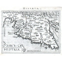
Ortelius, Abraham Istria - HistriaCatalog No.: 14427
Istria (Croatia). "Histria". Orig. copper-engraving from the French edition of A. Ortelius' Epitome, published in Antwerp by Plantin Press for F. Galle, 1598. With ornamental title-cartouche and Latin title above the map. 8:11 cm (3 1/4 x 4 1/4 inch.).
1 800,00 KčFor sale -
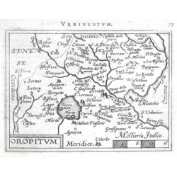
Ortelius, Abraham Terni - Orvieto - OropitumCatalog No.: 14421
Terni - Orvieto. "Oropitum". Orig. copper-engraving from the French edition of A. Ortelius' Epitome, published in Antwerp by Plantin Press for F. Galle, 1598. With decorative title-cartouche, the scale of map ("Milliaria Italica") and Latin title ("Vrbiventvm")...
1 500,00 KčFor sale -
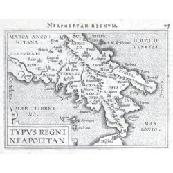
Ortelius, Abraham South Italy - Typus Regni Neapolitan.Catalog No.: 14412
South Italy. "Typus Regni Neapolitan.". Orig. copper-engraving from the French edition of A. Ortelius' Epitome, published in Antwerp by Plantin Press for F. Galle, 1598. With ornamental title-cartouche and Latin title ("Neapolitan. regnvm") above the map....
1 500,00 KčFor sale -
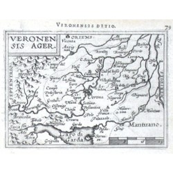
Ortelius, Abraham Verona - Veronensis AgerCatalog No.: 14409
Verona (province). "Veronensis Ager". Orig. copper-engraving from the French edition of A. Ortelius' Epitome, published in Antwerp by Plantin Press for F. Galle, 1598. With decorative title-cartouche, the scale of map and Latin title ("Veronensis ditio") above the...
1 500,00 KčFor sale -
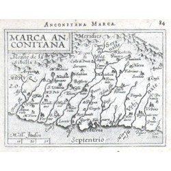
Ortelius, Abraham Marche - Marca AnconitanaCatalog No.: 14400
Marche. "Marca Anconitana". Orig. copper-engraving from the French edition of A. Ortelius' Epitome, published in Antwerp by Plantin Press for F. Galle, 1598. With decorative title-cartouche, the scale of map ("Mill. Italica") and Latin title ("Anconitana...
1 800,00 KčFor sale -
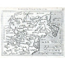
Ortelius, Abraham SienaCatalog No.: 14397
Siena (province). "Siena". Orig. copper-engraving from the French edition of A. Ortelius' Epitome, published in Antwerp by Plantin Press for F. Galle, 1598. With ornamental title-cartouche with the scale of map and Latin title ("Senense territorivm") above the...
1 500,00 KčFor sale -
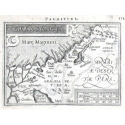
Ortelius, Abraham Holy Land - Terra SanctaCatalog No.: 14394
Holy Land (Israel / Palestine). "Terra Sancta". Orig. copper-engraving from the French edition of A. Ortelius' Epitome, published in Antwerp by Plantin Press for F. Galle, 1598. With ornamental title-cartouche, scale of map and Latin title ("Palaestina")...
2 000,00 KčFor sale -
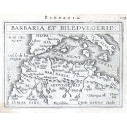
Ortelius, Abraham Africa - Barbaria, et BiledulgeridCatalog No.: 14391
Northwest Africa. "Barbaria, et Biledvlgerid". Orig. copper-engraving from the French edition of A. Ortelius' Epitome, published in Antwerp by Plantin Press for F. Galle, 1598. With title-cartouche and Latin title above the map. 8:10,5 cm (3 1/4 x 4...
2 000,00 KčFor sale -
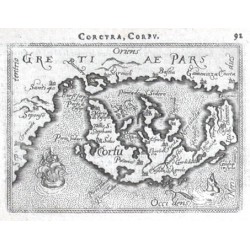
Ortelius, Abraham CorfuCatalog No.: 14376
Corfu. "Corfu". Orig. copper-engraving from the French edition of A. Ortelius' Epitome, published in Antwerp by Plantin Press for F. Galle, 1598. With title in map, a ship, a sea-crature and Latin title ("Corcyra, Corfv") above the map. 8:11 cm (3 1/4 x...
2 300,00 KčFor sale -
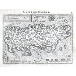
Ortelius, Abraham Crete - Candia olim CretaCatalog No.: 14373
Crete. "Candia olim Creta". Orig. copper-engraving from the French edition of A. Ortelius' Epitome, published in Antwerp by Plantin Press for F. Galle, 1598. With ornamental title-cartouche, scale of map ("Scala miliarium Italicoru"), 2 ships, a...
2 500,00 KčFor sale -
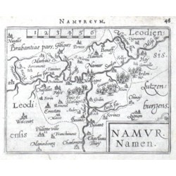
Ortelius, Abraham Belgium - Namur. Namen.Catalog No.: 14358
Belgium - Namur. "Namur. Namen". Orig. copper-engraving from the French edition of A. Ortelius' Epitome, published in Antwerp by Plantin Press for F. Galle, 1598. With title-cartouche, scale of map and Latin title ("Namvrcvm") above the map. 8:10,5 cm (3 1/4 x 4...
1 300,00 KčFor sale -
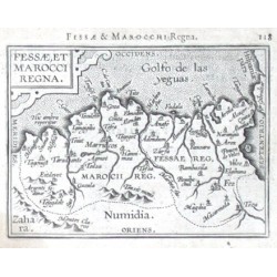
Ortelius, Abraham Fessae, et Marocci RegnaCatalog No.: 14352
Morocco. "Fessae, et Marocci Regna". Orig. copper-engraving from the French edition of A. Ortelius' Epitome, published in Antwerp by Plantin Press for F. Galle, 1598. With ornamental title-cartouche and Latin title ("Fessae & Marocchi Regna")...
1 800,00 KčFor sale -
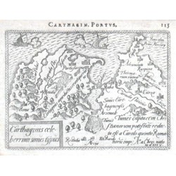
Ortelius, Abraham Carthage - Carthaginis celeberrimi sinus...Catalog No.: 14349
Carthage. "Carthaginis celeberrimi sinus typus". Orig. copper-engraving from the French edition of A. Ortelius' Epitome, published in Antwerp by Plantin Press for F. Galle, 1598. With decorative title-cartouche, 2 ships and French title...
1 500,00 KčFor sale -
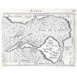
Ortelius, Abraham Cádiz - Baia de CadizCatalog No.: 14343
Cádiz. "Baia de Cadiz". Orig. copper-engraving from the French edition of A. Ortelius' Epitome, published in Antwerp by Plantin Press for F. Galle, 1598. With title upper right, scale of map ("Scala milliarium"), several ships and French title ("Gades")...
1 500,00 KčFor sale -
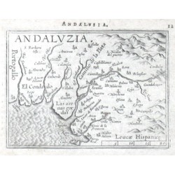
Ortelius, Abraham Andalusia - AndaluziaCatalog No.: 14337
Andalusia. "Andaluzia". Orig. copper-engraving from the French edition of A. Ortelius' Epitome, published in Antwerp by Plantin Press for F. Galle, 1598. With title in upper left corner, scale of map ("Leucae Hispanice") and Latin title above the map....
1 500,00 KčFor sale -
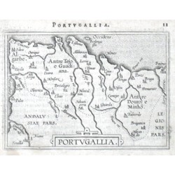
Ortelius, Abraham Portugal - PortugalliaCatalog No.: 14328
Portugal. "Portugallia". Orig. copper-engraving from the French edition of A. Ortelius' Epitome, published in Antwerp by Plantin Press for F. Galle, 1598. With title-cartouche and Latin title above the map. 8:11 cm (3 1/4 x 4 1/4 inch.).
1 500,00 KčFor sale -
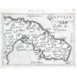
Ortelius, Abraham ApuliaCatalog No.: 14313
Apulia (Puglia). "Apulia". Orig. copper-engraving from the French edition of A. Ortelius' Epitome, published in Antwerp by Plantin Press for F. Galle, 1598. With ornamental title-cartouche and Latin title above the map. 8:11 cm (3 1/4 x 4 1/4 inch.).
1 800,00 KčFor sale -
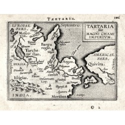
Ortelius, Abraham Tartaria sive Magni Chami ImperiumCatalog No.: 14307
Northeast Asia. "Tartaria sive Magni Chami Imperivm". Orig. copper-engraving from the French edition of A. Ortelius' Epitome, published in Antwerp by Plantin Press for F. Galle, 1598. With title-cartouche and Latin title above the map. 8:10,5 cm...
4 000,00 KčFor sale -
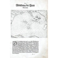
Bry, Theodor de Abbildung der Statt BantamCatalog No.: 14298
Banten (Indonesia). "Abbildung der Statt Bantam". Orig. copper-engraving, J. T. de Bry. Published in Frankfurt am Main by M. Becker, ca. 1600. With many ships. 14:18 cm (the picture).
2 500,00 KčFor sale -
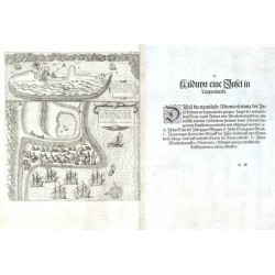
Linschoten, Jan Huygen van Kilduyn eine Insel in LappenlandtCatalog No.: 14295
"Kilduyn eine Insel in Lappenlandt" (title on verso). Orig. copper-engraving after details from two of J. H. van Linschoten's maps taken from his account of the three expeditions undertaken by Willem Barents in 1594, 1595 and 1596, in an attempt...
12 000,00 KčFor sale -
Bry, Theodor de Contrafeytung unnd Bildtnuss dess Königs...Catalog No.: 14292
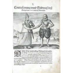
Ceylon (Sri Lanka). "Contrafeytung unnd Bildtnuss dess Königs von Candij und dess Admirals". Orig. copper-engraving from T. de Bry's Grosse Reisen (German edition of Grand Voyages). Published in Frankfurt am Main by M. Becker, 1599. With the king (Fimala Derma...
3 500,00 KčFor sale -
Bry, Theodor de The WorldCatalog No.: 14277
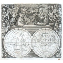
The World.Orig. copper-engraving by M. Merian after T. de Bry map of W. C. Schouten's voyage around the world. From J. L. Gottfried's "Historia Antipodum, oder Newe Welt". Published in Frankfurt am Main by Merian's Heirs, 1655. A map of the world...
9 500,00 KčFor sale -
Merian, Matthäus Amboyna. M. Ganapus. I. NeraCatalog No.: 14268
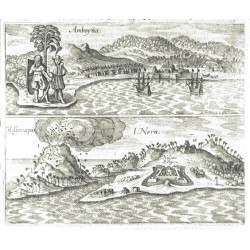
Ambon, Banda Neira and Banda Api (Moluccas). "Amboyna. M. Ganapus. I. Nera". Orig. copperplate engraving, M. Merian from J. L. Gottfried's "Historia Antipodum, oder Newe Welt". Published in Frankfurt am Main by Merian's Heirs, 1655. 15,5:18,5 cm.
2 500,00 KčFor sale -
Delisle, Guillaume L'Amerique SeptentrionaleCatalog No.: 14178
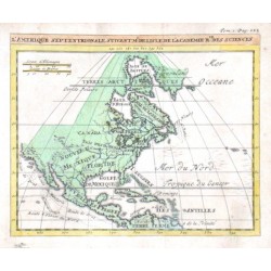
North America."L'Amerique Septentrionale". Orig. copper-engraving. after G. Delisle map. Published in Paris, ca. 1700. Orig. old colouring. With title above the map. 14:17 cm (5 1/2 x 6 3/4 inch.).
5 000,00 KčFor sale -
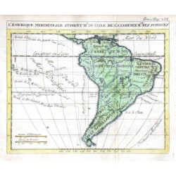
Delisle, Guillaume L'Amerique MeridionalCatalog No.: 14172
South America."L'Amerique Meridional". Orig. copper-engraving. after G. Delisle map. Published in Paris, ca. 1700. Orig. old colouring. With title above the map. 14:17 cm (5 1/2 x 6 3/4 inch.).
3 500,00 KčFor sale -
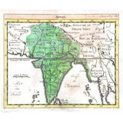
Delisle, Guillaume MogolCatalog No.: 14163
India and Pakistan. "Mogol". Orig. copper-engraving. after G. Delisle map. Published in Paris, ca. 1700. Orig. old colouring. With title above the map. 14:17 cm (5 1/2 x 6 3/4 inch.).
1 800,00 KčFor sale -
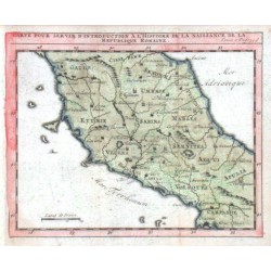
Delisle, Guillaume Carte de la Republique RomaineCatalog No.: 14157
"Carte ... de la Republique Romaine". Orig. copper-engraving. after G. Delisle map. Published in Paris, ca. 1700. Orig. old colouring. With title above the map. 14:17 cm (5 1/2 x 6 3/4 inch.).
1 500,00 KčFor sale -
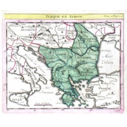
Delisle, Guillaume Turquie en EuropeCatalog No.: 14154
"Turquie en Europe". Orig. copper-engraving. after G. Delisle map. Published in Paris, ca. 1700. Orig. old colouring. With title above the map. 14:17 cm (5 1/2 x 6 3/4 inch.).
1 800,00 KčFor sale -
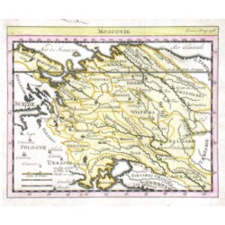
Delisle, Guillaume MoscovieCatalog No.: 14148
Western Russia."Moscovie". Orig. copper-engraving. after G. Delisle map. Published in Paris, ca. 1700. Orig. old colouring. With title above the map. 14:17 cm (5 1/2 x 6 3/4 inch.).
2 700,00 KčFor sale -
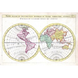
Delisle, Guillaume Mappe MondeCatalog No.: 14142
The World."Mappe Monde ou description generale du Globe Terrestre". Orig. copper-engraving after G. Delisle map of the World. Published in Paris, ca. 1700. Orig. old colouring. With title above the map. 14:21 cm (5 1/2 x 8 1/4 inch.).
6 500,00 KčFor sale -
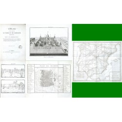
Bourgoing, Jean Francois Atlas pour servir au tableau de l'Espagne...Catalog No.: 14061
Bourgoing, Jean Francois(1748-1811). "Atlas pour servir au tableau de l'Espagne moderne". Paris: Tourneisen fils, 1807. 4to. (4) pp. and XXVIII copper plates (6 of them folded). Orig. brochure.
15 000,00 KčFor sale -
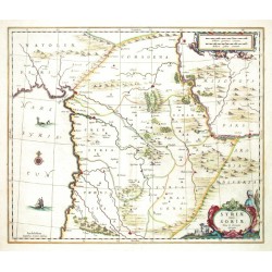
Janssonius, Johannes Syriae sive Soriae. Nova et Accurata...Catalog No.: 14049
Syria and Libanon. "Syriae sive Soriae. Nova et Accurata descriptio". Orig. copperplate engraving, J. Janssonius, Amsterdam, 1664. Orig. old colouring. 44:52 cm.
15 000,00 KčFor sale -
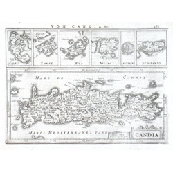
Mercator, Gerardus Candia, Corfu, Zante, Milo, Nicsia,...Catalog No.: 13986
Kreta und die Ägäischen Inseln."Candia, Corfu, Zante, Milo, Nicsia, Santorini, Scarpanto". Orig. copper-engraving from G. Mercator's Atlas Minor. Published in Amsterdam by J. Janssonius, 1648. With German title above the map ("Von Candia,...
4 000,00 KčFor sale -
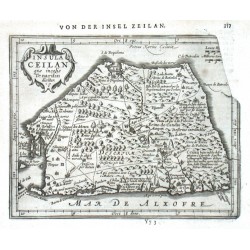
Keere, Pieter van den (Petrus Kaerius) (author) Mercator, Gerardus (other authors) Insula Ceilan quae incolis Tenarisin diciturCatalog No.: 13983
Ceylon (Sri Lanka). "Insula Ceilan quae incolis Tenarisin dicitur". Orig. copperplate engraving, P. van den Keere from G. Mercator's Atlas Minor. Published in Amsterdam by J. Janssonius, 1651. With ornamental title cartouche. 14,5:18,5 cm.
3 200,00 KčFor sale -
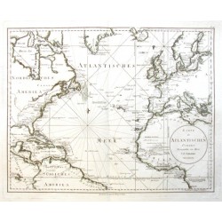
Schrämbl, Franz Anton Karte des Atlantischen OceansCatalog No.: 13968
Atlantic."Karte des Atlantischen Oceans". Orig. copper-engraving. Published in Vienna by F. A. Schraembl, 1788. Coloured in outline. With oval title-cartouche. 49:62 cm (19 1/4 x 24 1/2 inch.).
10 000,00 KčFor sale -
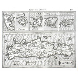
Mercator, Gerardus Candia, I. Corfu, Zante, Milo, Nicsia,...Catalog No.: 13962
Crete and Aegean Islands."Candia, I. Corfu, Zante, Milo, Nicsia, Scarpanto". Orig. copper-engraving from G. Mercator's Atlas Minor. Published in Amsterdam by J. Hondius, 1609. With French title above the map ("Crete, ou Candie"), 5...
3 500,00 KčFor sale -
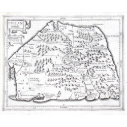
Mercator, Gerardus Ceilan insulaCatalog No.: 13959
Ceylon."Ceilan insula". Orig. copper-engraving from G. Mercator's Atlas Minor. Published in Amsterdam by J. Hondius, 1607. With ornamental title-cartouche with the scale of map. 14,5:18,5 cm (5 3/4 x 7 1/4 inch.).
3 800,00 KčFor sale -
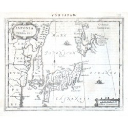
Mercator, Gerardus Iaponia et Terra EsoCatalog No.: 13956
Japan."Iaponia et Terra Eso". Orig. copper-engraving from G. Mercator's Atlas Minor. Published by J. Janssonius in Amsterdam, 1651. With German title ("Von Iapan") above the map, ornamental title-cartouche, another cartouche with the scale of map...
12 500,00 KčFor sale -
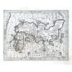
Mercator, Gerardus Iapan I.Catalog No.: 13953
Japan."Iapan I.". Orig. copper-engraving from G. Mercator's Atlas Minor. Published by J. Hondius in Amsterdam, 1609. With great ornamental title-cartouch with the scale of map and a wind-rose. 13:17 cm (5 1/4 x 6 3/4 inch.).
9 500,00 KčFor sale -
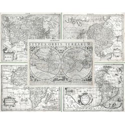
Hondius, Jodocus (author) Mercator, Gerardus (other authors) Typus Orbis Terrarum, Africae descriptio,...Catalog No.: 13923
The World and the Continents. "Typus Orbis Terrarum" + "Africae descriptio" + "Americae descrip." + "Asia" + "Europa". Orig. copperplate engravings after G. Mercator's maps published by J. Hondius in Amsterdam, 1609.
50 000,00 KčFor sale -
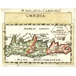
Duval, Pierre CandiaCatalog No.: 13902
Crete. "Candia". Orig. copperplate engraving, P. Duval, 'Geographiae Universalis', J. Hoffman, Nuremberg, 1679. Original old colouring. With title above the map. 9,5:12,5 cm.
2 100,00 KčFor sale -
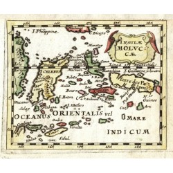
Duval, Pierre Insulae MolucaeCatalog No.: 13890
Maluku Islands. "Insulae Molucae". Orig. copperplate engraving, P. Duval, 'Geographiae Universalis', J. Hoffman, Nuremberg, 1679. Original old colouring. With decorative title-cartouche. 10:12,5 cm.
1 800,00 KčFor sale -
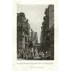
St. Johannesstrasse in La ValettaCatalog No.: 13836
Valletta. "St. Johannesstrasse in La Valetta". Orig. steel engraving. Published by G. Haase Söhne, Prague, ca. 1840. With a procession in the foreground and a German title under the picture. 14,5:10 cm.
1 800,00 KčFor sale -
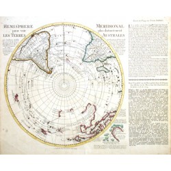
l'Isle, Guillaume de Hemisphere MeridionalCatalog No.: 13776
South Pole (Antarctica)."Hemisphere Meridional pour voir plus distinctement les Terres Australes". Orig copper-engraving after G de l'Isle's map. Publisehd in Amsterdam by R. & J. Ottens, ca. 1740. With French title, small inset map of the Bouvet...
12 500,00 KčFor sale -
de Fer, Nicolas Coni ou CuneoCatalog No.: 13734
"Coni ou Cuneo Ville de Piemont". Orig. copper-engraving. Published in Paris by N. de Fer, 1691. With decorative title-cartouche and the scale of map ("Eschelle"). 21:28,5 cm (8 1/4 x 11 1/4 inch.).
1 800,00 KčFor sale -
de Fer, Nicolas GeneveCatalog No.: 13731
"Geneve". Orig. copper-engraving. Published in Paris by N. de Fer, ca. 1690. With ornamental title-cartouche, another 2 decorative cartouches and the scale of map ("Eschelle"). 20,5:28,5 cm (8 x 11 1/4 inch.).
1 200,00 KčFor sale -
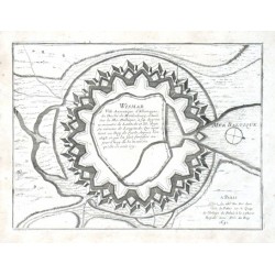
de Fer, Nicolas WismarCatalog No.: 13728
"Wismar Ville Anseatique d'Allemagne, ... Situee Sur la Mer Baltique". Orig. copper-engraving. Published in Paris by N. de Fer, 1691. With title and publisher's address. 19:25,5 cm (7 1/2 x 10 inch.).
1 400,00 KčFor sale -
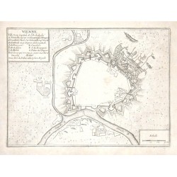
de Fer, Nicolas VienneCatalog No.: 13719
"Vienne". Orig. copper-engraving. Published in Paris by N. de Fer, ca. 1690. With title-cartouche and the scale of map ("Echelle"). 20,5:28 cm (8 x 11 inch.).
800,00 KčFor sale -
de Fer, Nicolas Roses, Ville forte d'EspagneCatalog No.: 13710
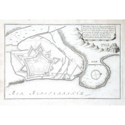
"Roses, Ville forte d'Espagne du Paiis de Lampourdan dans la Province de Catalogne". Orig. copper-engraving. Published in Paris by N. de Fer, ca. 1695. With decorative title-cartouche and the scale of map. 18,5:28,5 cm (7 1/4 x 11 1/4 inch.).
1 400,00 KčFor sale -
de Fer, Nicolas Isle, Ville et Port de CadisCatalog No.: 13707
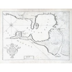
"Isle, Ville et Port de Cadis". Orig. copper-engraving. Published in Paris by N. de Fer, ca. 1695. With ornamental title-cartouche and the scale of map. 21:28,5 cm (8 1/4 x 11 1/4 inch.).
1 500,00 KčFor sale

