No products
Antique Maps and Views
- Africa
-
America
- America (continent)
- Antilles (West Indies)
- Argentina
- Bermuda
- Brazil
- Canada
- Central America and Antilles (West Indies)
- Chile
- Columbia
- Florida
- Guyana
- Hawaiian Islands
- Honduras
- Louisiana
- Mexico
- New York
- North America
- Panama
- Paraguay
- Peru
- South America
- Straits of Magellan
- United states (USA)
- Venezuela
- Virginia
- Asia and Australia
- Atlasy
-
Europe
- Austria
-
Belgium, the Netherlands, Luxembourg
- Amsterdam
- Antwerp
- Belgium and Luxembourg
- Bergen op Zoom
- Blokzijl
- Bommenede
- Brabant
- Brugge
- Brussels
- Charleroi
- Courtrai
- Delft
- Dinant
- Dordrecht
- Elburg
- Flandres
- Fort Rammekens
- Friesland
- Friesland and Groningen
- Gelderland
- Geraardsbergen
- Grave
- Groningen
- Hainaut
- Harderwijk
- Harlingen
- Holland
- Hulst
- Huy
- Liege
- Lier
- Limbourg
- Limburg
- Louvain
- Luxemburg
- Maastricht
- Mechelen
- Middelburg
- Mons
- Namur
- Netherlands
- Netherlands and Belgium
- Nijmegen
- Ostend
- Overijssel
- Rotterdam
- Spa
- Stavoren
- The Hague
- Tiel
- Utrecht
- Veere
- Veurne
- Ypres
- Zaltbommel
- Zeeland
- Zieriksee
- Zierikzee
- Zutphen
- Zype
-
Bohemia, Moravia and Silesia
- Beroun
- Bohemia
- Brandýs nad Labem
- Branná (okr. Šumperk)
- Brno
- Brodce (okr. Mladá Boleslav)
- Broumov
- Carlsbad
- Čáslav
- Čelákovice
- Český Krumlov
- Cheb
- Chlumec nad Cidlinou
- Chomutov
- Děčín
- Dolní Olešnice - Nové Zámky
- Dvůr Králové nad Labem
- Františkovy Lázně
- Frýdlant
- Hasištejn
- Házmburk
- Hostinné
- Hradec Králové
- Hřensko
- Jáchymov
- Jaroměř
- Jihlava
- Jindřichův Hradec
- Jižní Čechy
- Kamýk u Litoměřic
- Karlštejn
- Kolín
- Konopiště
- Kostelec nad Labem
- Křivoklát
- Krkonoše
- Krupka
- Kunětická Hora
- Kutna Hora
- Kyšperk
- Lednice
- Liberec
- Libochovany
- Lipnice nad Sázavou
- Litoměřice
- Litoměřicko
- Litomyšl
- Loket
- Louny
- Lovosice
- Lysá nad Labem
- Mariánské Lázně
- Mělník
- Mladá Boleslav
- Mladoboleslavsko
- Moravia
- Most
- Náchod
- Nymburk
- Okoř
- Olomouc
- Ostrov nad Ohří
- Pardubice
- Plzeň
- Poděbrady
- Polná
- Prácheňsko
- Prague
- Přelouč
- Rabí
- Rakovnicko
- Rakovník
- Roudnice nad Labem
- Rožmberk
- Rožnov pod Radhoštěm
- Rychmburk
- Sedlec
- Slaný
- Smečno
- Smiřice
- Štětí
- Šumava
- Švamberk (Krasíkov)
- Tábor
- Tepl
- Teplice
- Terezín
- Třeboň
- Týnec nad Labem
- Uničov
- Valdštejn
- Vinec
- Vrabinec
- Vrchlabí
- Vyšší Brod
- Zákupy
- Žampach (zámek)
- Želiv
- Žireč
- Žleby
- Znojmo
- Zvíkov
- Central Europe
- Danube
- Eastern and Southeastern Europe, Balkan
- Europe (continent)
-
France
- Albi
- Anjou
- Artois
- Bar-le-Duc
- Berry
- Blois
- Bourbourg
- Bourgogne-Franche-Comté
- Bresse
- Cambrai
- Cassel
- Château de Lichtenberg
- Chaumont
- Compiegne and Noyon
- Corsica
- Dauphiné
- Elsass
- Gascogne
- Gâstinais and Senonais
- Gravelines
- Hauts-de-France
- Ile de France
- La Bassée - Hesdin
- Languedoc
- Lille
- Limoges
- Lorraine
- Lyon
- Maine
- Marseille
- Metz
- Montmélian
- Mulhouse
- Nancy
- Nice
- Normandie
- Paris
- Perche
- Picardy
- Poitou
- Provence
- Re and Oleron
- Reims - Rethel
- Saint-Omer
- Saintonge and Aunis
- Savoy
- Strasbourg
- Tarn (department)
- Vexin
-
Germany
-
Baden-Württemberg
- Bad Teinach-Zavelstein
- Balingen
- Biberach an der Riß
- Böblingen
- Bodensee
- Breisgau
- Calw
- Dornhan
- Esslingen
- Geislingen an der Steige
- Grafschaft Limpurg
- Heidelberg
- Heilbronn
- Hohenlohe
- Karlsruhe
- Mannheim
- Möckmühl
- Nagold
- Neuenbürg
- Nord-Württemberg
- Oberschwaben
- Offenburg
- Reutlingen
- Rheinpfalz
- Schwäbisch Gmünd
- Schwäbisch Hall
- Singen
- St. Blasien
- Stuttgart
- Swabia
- Tübingen
- Ulm
- Vaihingen a. d. Enz
- Wangen im Allgäu
- Weinheim
- Württemberg
-
Bavaria
- Aschaffenburg
- Augsburg
- Aurach
- Bad Abbach
- Bamberg
- Bogenberg (Wallfahrtskirche)
- Cham
- Coburg
- Donauwörth
- Eichstätt
- Forchheim
- Franken
- Freising
- Friedberg (Schwaben)
- Füssen
- Gräfenberg (Oberfranken)
- Höchstädt an der Donau
- Ingolstadt
- Kelheim
- Kempten
- Lauingen
- Lenggries
- Lindau
- Memmingen
- Mindelheim
- Mühldorf am Inn
- München
- Nabburg
- Natternberg (Schloss)
- Neuburg an der Donau
- Neumarkt in der Oberpfalz
- Neuötting
- Neustadt an der Donau
- Nördlingen
- Nürnberg
- Oberpfalz
- Pappenheim
- Passau
- Pfaffenhofen
- Pöttmes
- Rain am Lech
- Regensburg
- Saal an der Donau
- Schongau
- Schrobenhausen
- Straubing
- Thurnau
- Velden
- Vilshofen an der Donau
- Wackerstein
- Wasserburg am Inn
- Weilheim / links Polling
- Weissenburg in Bayern
- Weltenburg
- Würzburg
- Berlin
- Brandenburg
- Bremen
- Hamburg
- Hessen
- Mecklenburg-Vorpommern/Pommern
-
Niedersachsen
- Aurich
- Bad Bentheim
- Bad Gandersheim
- Bodenwerder
- Braunschweig
- Braunschweig-Lüneburg
- Celle
- Cuxhaven
- Emden
- Hann. Münden
- Hannover
- Hildesheim
- Hoya
- Liebenau an der Weser
- Lüneburg
- Niedersächsischer Kreis
- Nienburg a. d. Weser
- Oldenburg
- Osnabrück
- Osterode
- Osterwieck
- Ostfriesland
- Schnackenburg
- Schöppenstedt
- Stolzenau
- Walsrode
- Winsen an der Luhe
- Wolfenbüttel
- Nordrhein-Westfalen
- Northern Germany
- Rheinland-Pfalz
- Sachsen
- Sachsen-Anhalt
- Schleswig-Holstein
- Thüringen
-
Baden-Württemberg
-
Great Britain and Ireland
- Bedford and Buckinghamshire
- Berkshire and Hampshire
- Cambridgeshire
- Cornwall
- Cumberland
- Denbigh and Flint
- Derbyshire
- Devon
- Dorset
- Durham (County)
- England
- Essex
- Gloucestershire
- Great Britain and Ireland
- Herefordshire
- Hertfordshire
- Hertfordshire and Middlesex
- Huntingdonshire
- Ireland
- Isle of Wight
- Kent
- Leicestershire
- Lincolnshire
- London
- Middlesex
- Norfolk
- Northampton
- Northeastern England
- Northern England
- Northumberland
- Northwestern England
- Nottinghamshire
- Oxfordshire
- Scotland
- Shropshire and Staffordshire
- Somerset
- Southeastern England
- Southwestern England
- Staffordshire
- Surrey
- Sussex
- Wales
- Westmorland
- Wiltshire
- Worcestershire and Warwickshire
- Yorkshire
- Greece, Mediterranean Sea
-
Italy
- Abruzzo
- Ancona
- Apulia (Puglia)
- Arcevia
- Bari and Basilicata
- Bergamo
- Bologna
- Brescia
- Brescia and Crema
- Cadore
- Cagliari
- Caiazzo
- Calabria
- Campania
- Capitanata
- Carmagnola
- Catania
- Central Italy
- Civitavecchia
- Crema
- Cremona
- Cuneo
- Elba
- Emilia Romagna
- Faenza
- Fano
- Ferrara
- Florence
- Fondi
- Friuli
- Gaeta
- Gallipoli
- Genoa
- Ischia
- Italy
- Lazio
- Lerici
- Liguria (Italian Riviera)
- Livorno
- Lombardia
- Loreto
- Lucca
- Mantua
- Mantua
- Marche (Ancona)
- Merano
- Messina
- Milan
- Mirandola
- Modena
- Molise
- Monferrato
- Naples
- Netuno
- Nocera Umbra
- Northern Italy
- Orvieto
- Orvieto and Loreto
- Otranto
- Padua
- Palermo
- Parma
- Pavia
- Perugia
- Pesaro
- Piacenza
- Piedmont
- Pinerolo
- Piombino
- Pisa
- Po
- Pozzuoli
- Reggio di Calabria
- Reggio Emilia
- Rimini
- Rome
- Rovigo
- San Marino
- Sardinia
- Sicily
- Sicily and Malta
- Sicily and Sardinia
- Siena
- Southern Italy
- Spoleto
- Sulmona
- Taranto
- Terracina
- Tivoli
- Torino
- Tortona
- Trapani
- Trentino-Alto Adige / Südtirol
- Trento
- Treviso
- Tuscany
- Tyrol
- Udine
- Umbria
- Urbino
- Velletri
- Venice
- Vercelli
- Verona
- Vicenza
- Viterbo
- Labe
- Mediterranean Sea
- Monaco
- Poland, Silesia, Russia and the Baltic republics
- Rhine
- Scandinavia and Iceland
- Spain and Portugal
- Switzerland
- Islands (Special Catalogue)
- World, Oceans, Poles and Celestial Maps
Antique Maps and Views There are 2151 items.
Subcategories
-
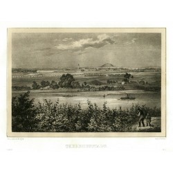
Bürger, Robert - Semmler, C. G. Terezín - TheresienstadtCatalog No.: 25964
Terezín. "Theresienstadt". Pův. tónovaná litografie. Podle vlastní kresby litografoval R. Bürger. Z: C. G. Semmler - 'Der Elbstrom, von seinem Ursprunge bis zu seiner Mündung in die Nordsee ...'. Drážďany: Semmler, 1845. S figurami a čluny v popředí. 18:24 cm.
1 500,00 KčFor sale -
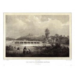
Arldt, Carl Wilhelm - Semmler, C. G. Dolní Olešnice - Nové Zámky- Die erste...Catalog No.: 25963
Dolní Olešnice - Nové Zámky. "Die erste steinerne Brücke bei Neuschloss". Pův. tónovaná litografie. Podle C. Müllerovy kresby litografoval C. W. Arldt. Z: C. G. Semmler - 'Der Elbstrom, von seinem Ursprunge bis zu seiner Mündung in die Nordsee ...'. Drážďany: Semmler, 1845. S figurami v popředí. 19:24,5 cm.
1 100,00 KčFor sale -
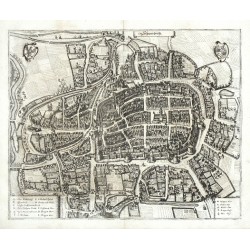
Merian, Matthäus Swidnica - Schweidnitz - copperplate...Catalog No.: 25952
Świdnica. "Schweidnitz". Orig. copperplate engraving from "Topographia Bohemiae, Moraviae et Silesiae", M. Merian, Frankfurt am Main, 1650. With decorative title-cartouche, 2 coats-of arms and another cartouche with explanatory notes (A.-Q.). 28:34 cm (11 x 13...
2 400,00 KčFor sale -
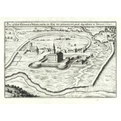
Merian, Matthäus Das Schloß Chlumnitz in BöhmenCatalog No.: 25950
Chlumec nad Cidlinou. "Das Schloß Chlumnitz in Böhmen, welches die Kays. den Schweden mit gwalt abgenohmen im Februario 1640". Pův. mědiryt podle C. Cappiho. M. Merian, Topographiae Bohemiae, 1650. S titulní lištou nahoře. 18:26 cm.
750,00 KčFor sale -
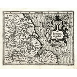
Hondius, Jodocus (author) Mercator, Gerardus (other authors) Eboracum, Lincolnia, Derbia, Stafford, etcCatalog No.: 25943
North East England. "Eboracum, Lincolnia, Derbia, Stafford, etc.". Orig. copperplate engraving from Mercator's Atlas Minor. Published by J. Hondius in Amsterdam, 1607. With ornamental title cartouche. 13:17 cm.
1 600,00 KčFor sale -
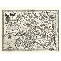
Hondius, Jodocus (author) Mercator, Gerardus (other authors) Northumbr. Cumberlandia Dunelm. Episcop.Catalog No.: 25942
North England. "Northumbr. Cumberlandia Dunelm. Episcop.". Orig. copperplate engraving from Mercator's Atlas Minor. Published by J. Hondius in Amsterdam, 1609. With ornamental title cartouche and French title above the map. 13,5:19 cm.
1 600,00 KčFor sale -
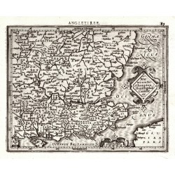
Hondius, Jodocus (author) Mercator, Gerardus (other authors) Warwicum Northampton, Huntington Cantabr etc.Catalog No.: 25940
South-east England - London, Essex, Kent ... "Warwicum Northampton, Huntington Cantabr etc.". Orig. copperplate engraving from Mercator's Atlas Minor. Published by J. Hondius in Amsterdam, 1609. With ornamental title cartouche and French title above the map. 14:18 cm.
1 600,00 KčFor sale -
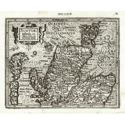
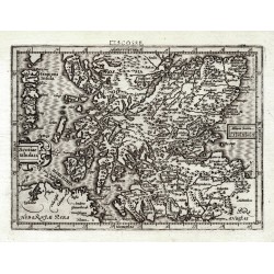
Hondius, Jodocus (author) Mercator, Gerardus (other authors) Scotiae tabula III.Catalog No.: 25939
Northern Scotland. "Scotiae tabula III.". Orig. copperplate engraving from Mercator's Atlas Minor. Published by J. Hondius in Amsterdam, 1609. With ornamental title cartouche with the scale of map, a ship and French title above the map. 14,5:18,5 cm.
2 400,00 KčFor sale -
Hondius, Jodocus (author) Mercator, Gerardus (other authors) Scotiae tabula II.Catalog No.: 25938
Southern Scotland. "Scotiae tabula II.". Orig. copperplate engraving from Mercator's Atlas Minor. Published by J. Hondius in Amsterdam, 1609. With ornamental title cartouche, another cartouche with the scale of map and French title above the map. 13,5:18,5 cm.
2 400,00 KčFor sale -
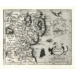
Hondius, Jodocus (author) Mercator, Gerardus (other authors) Ultonia Oriental.Catalog No.: 25937
North East Ireland. "Ultonia Oriental.". Orig. copperplate engraving from Mercator's Atlas Minor. Published by J. Hondius in Amsterdam, 1607. With ornamental title cartouche with the scale of map, a ship and a sea monster. 13,5:16,5 cm.
2 100,00 KčFor sale -
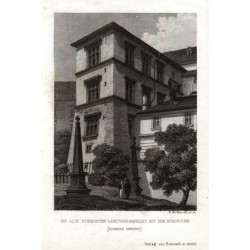
Merklas, Václav Die alte Ständische Landtags-Kanzley auf...Catalog No.: 25935
Praha. Pražský hrad - Česká dvorská kancelář. "Die alte Ständische Landtags-Kanzley auf dem Hradschin". Původní ocelorytina, V. Merklas. Vyd. Borrosch a André v Praze, 1852. S půvabnou figurální stafáží v popředí a německým titulem pod obrázkem. 10:7,3 cm.
750,00 KčFor sale -
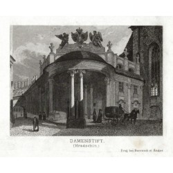
Merklas, Václav Damenstift (Hradschin)Catalog No.: 25930
Praha. Ústav šlechtičen na Pražském hradě - Rožmberský palác. "Damenstift (Hradschin)". Původní ocelorytina, V. Merklas. Vyd. Borrosch a André v Praze, 1852. S půvabnou figurální stafáží v popředí a německým titulem pod obrázkem. 7,2:10 cm.
750,00 KčFor sale -
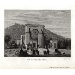
Merklas, Václav Die KettenbrückeCatalog No.: 25929
Praha. Most císaře Františka I. (Řetězový most). "Die Kettenbrücke". Původní ocelorytina, V. Merklas. Vyd. Borrosch a André v Praze, 1852. S půvabnou figurální stafáží v popředí a německým titulem pod obrázkem. 7:9,8 cm.
900,00 KčFor sale -
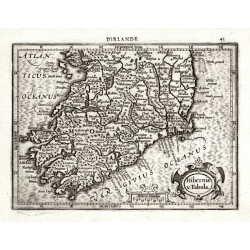
Mercator, Gerardus Hiberniae v. TabulaCatalog No.: 25916
Ireland. "Hiberniae v. Tabula". Orig. copperplate engraving, 1607 from Mercator's Atlas Minor published by J. Hondius in Amsterdam. With ornamental title cartouche and French title above the map. 13,8:18,8 cm.
2 800,00 KčFor sale -
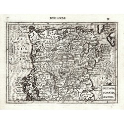
Mercator, Gerardus Ultonia Conatia et MediaCatalog No.: 25915
Ireland. "Ultonia Conatia et Media". Orig. copperplate engraving, 1607 from Mercator's Atlas Minor published by J. Hondius in Amsterdam. With ornamental title cartouche and French title above the map. 13,5:18,5 cm.
2 800,00 KčFor sale -
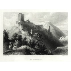
Payne, Albert Henry (author) Richter, L. (other authors) KarlsteinCatalog No.: 25891
Karlštejn. "Karlstein". Pův. ocelorytina. Podle L. Richterovy kresby ryl A. H. Payne. Vydal G. Wigand v Lipsku, 1841. S něm. titulem pod obrázkem. 10:15 cm (obrázek).
1 200,00 KčFor sale -
Schmidl, Adolf Anton JungbunzlauCatalog No.: 25885
Mladá Boleslav. "Jungbunzlau". Původní ocelorytina z A. A. Schmidl, Das Königreich Böhmen. Vyd. J. Scheible ve Stuttgartu, 1843. S figurami v popředí a německým titulem pod obrázkem. 7,5:10 cm (obrázek).
800,00 KčFor sale -
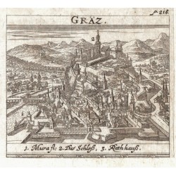
Krekwitz, Georg GräzCatalog No.: 25836
Graz. "Gräz". Orig. copperplate engraving from G. Krekwitz "Totius Regni Hungariae ... Descriptio". Published in Frankfurt am Main and Nuremberg by L. Loschge, 1686. With engraved title. 7,5:8,5 cm.
750,00 KčFor sale -
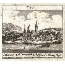
Krekwitz, Georg YpsCatalog No.: 25835
Ybbs an der Donau. "Yps". Orig. copperplate engraving from G. Krekwitz "Totius Regni Hungariae ... Descriptio". Published in Frankfurt am Main and Nuremberg by L. Loschge, 1686. With engraved title. 7,5:8,5 cm.
600,00 KčFor sale -
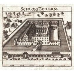
Krekwitz, Georg Schloss ZeilernCatalog No.: 25834
Zeillern. "Schloss Zeilern". Orig. copperplate engraving from G. Krekwitz "Totius Regni Hungariae ... Descriptio". Published in Frankfurt am Main and Nuremberg by L. Loschge, 1686. With engraved title. 7,5:8,5 cm.
450,00 KčFor sale -
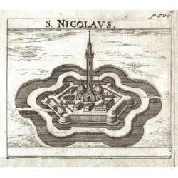
Krekwitz, Georg S. NicolausCatalog No.: 25832
Törökszentmiklós. "S. Nicolaus". Orig. copperplate engraving from G. Krekwitz "Totius Regni Hungariae ... Descriptio". Published in Frankfurt am Main and Nuremberg by L. Loschge, 1686. With engraved title. 7,5:8,5 cm.
600,00 KčFor sale -
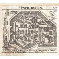
Krekwitz, Georg FünfkirchenCatalog No.: 25831
Pécs. "Fünfkirchen". Orig. copperplate engraving from G. Krekwitz "Totius Regni Hungariae ... Descriptio". Published in Frankfurt am Main and Nuremberg by L. Loschge, 1686. With engraved title. 7,5:8,5 cm.
600,00 KčFor sale -
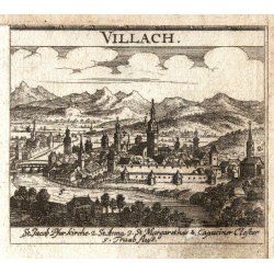
Krekwitz, Georg VillachCatalog No.: 25830
Villach. "Villach". Orig. copperplate engraving from G. Krekwitz "Totius Regni Hungariae ... Descriptio". Published in Frankfurt am Main and Nuremberg by L. Loschge, 1686. With engraved title. 7,5:8,5 cm.
750,00 KčFor sale -
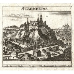
Krekwitz, Georg StarnbergCatalog No.: 25829
Starhemberg. "Starnberg". Orig. copperplate engraving from G. Krekwitz "Totius Regni Hungariae ... Descriptio". Published in Frankfurt am Main and Nuremberg by L. Loschge, 1686. With engraved title. 7,5:8,5 cm.
450,00 KčFor sale -
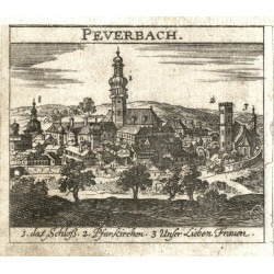
Krekwitz, Georg PeuerbachCatalog No.: 25827
Peuerbach. "Peuerbach". Orig. copperplate engraving from G. Krekwitz "Totius Regni Hungariae ... Descriptio". Published in Frankfurt am Main and Nuremberg by L. Loschge, 1686. With engraved title. 7,5:8,5 cm.
600,00 KčFor sale -
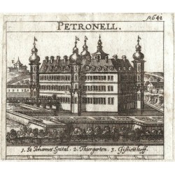
Krekwitz, Georg PetronellCatalog No.: 25826
Petronell-Carnuntum. "Petronell". Orig. copperplate engraving from G. Krekwitz "Totius Regni Hungariae ... Descriptio". Published in Frankfurt am Main and Nuremberg by L. Loschge, 1686. With engraved title. 7,5:8,5 cm.
450,00 KčFor sale -
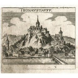
Krekwitz, Georg ThonaustauffCatalog No.: 25825
Donaustauf. "Thonaustauff". Orig. copperplate engraving from G. Krekwitz "Totius Regni Hungariae ... Descriptio". Published in Frankfurt am Main and Nuremberg by L. Loschge, 1686. With engraved title. 7,5:8,5 cm.
600,00 KčFor sale -
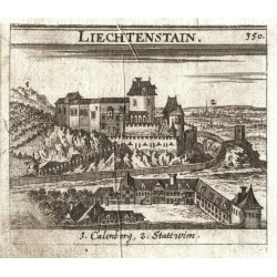
Krekwitz, Georg LiechtenstainCatalog No.: 25824
Liechtenstein (Vienna). "Liechtenstain". Orig. copperplate engraving from G. Krekwitz "Totius Regni Hungariae ... Descriptio". Published in Frankfurt am Main and Nuremberg by L. Loschge, 1686. With engraved title. 7,5:8,5 cm.
450,00 KčFor sale -
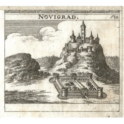
Krekwitz, Georg NovigradCatalog No.: 25823
Novigrad. "Novigrad". Orig. copperplate engraving from G. Krekwitz "Totius Regni Hungariae ... Descriptio". Published in Frankfurt am Main and Nuremberg by L. Loschge, 1686. With engraved title. 7,5:8,5 cm.
600,00 KčFor sale -
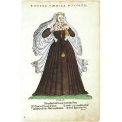
Amman, Jost Romana Foemina HonestaCatalog No.: 18993
Jost Amman. "Romana Foemina Honesta". Orig. woodcut, J. Amman from the first edition of his work 'Habitus praecipuorum populorum ...'. Published by H. Weigel in Nuremberg, 1577. 22,5:16,5 cm.
4 000,00 KčFor sale -
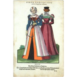
Amman, Jost Virgo Nobilis sive patricia Augustana in...Catalog No.: 19287
Jost Amman. "Virgo Nobilis sive patricia Augustana in Suecia". Orig. woodcut, J. Amman from the first edition of his work 'Habitus praecipuorum populorum ...'. Published by H. Weigel in Nuremberg, 1577. 23:17 cm.
4 000,00 KčFor sale -
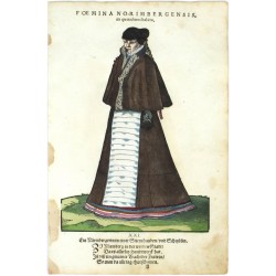
Amman, Jost Foemina Norimbergensis, in quotidiano habituCatalog No.: 19281
Jost Amman. "Foemina Norimbergensis, in quotidiano habitu". Orig. woodcut, J. Amman from the first edition of his work 'Habitus praecipuorum populorum ...'. Published by H. Weigel in Nuremberg, 1577. 23,5:17 cm.
3 500,00 KčFor sale -
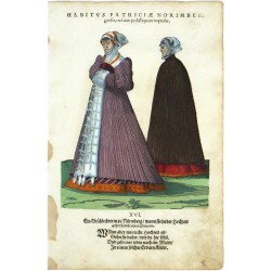
Amman, Jost Habitus Patriciae Norimbergensis, una cum...Catalog No.: 19269
Jost Amman. "Habitus Patriciae Norimbergensis, una cum pedissequam nuptialis". Orig. woodcut, J. Amman from the first edition of his work 'Habitus praecipuorum populorum ...'. Published by H. Weigel in Nuremberg, 1577. 21:17 cm.
4 000,00 KčFor sale -
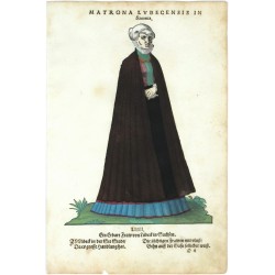
Amman, Jost Matrona Lubecensis in SaxoniaCatalog No.: 19251
Jost Amman. "Matrona Lubecensis in Saxonia". Orig. woodcut, J. Amman from the first edition of his work 'Habitus praecipuorum populorum ...'. Published by H. Weigel in Nuremberg, 1577. 23:16,5 cm.
3 500,00 KčFor sale -
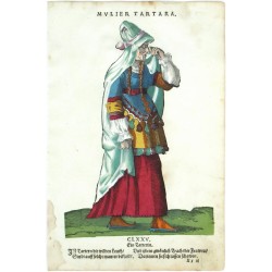
Amman, Jost Mulier TartaraCatalog No.: 19257
Jost Amman. "Mulier Tartara. Ein Tatterin". Orig. woodcut, J. Amman from the first edition of his work 'Habitus praecipuorum populorum ...'. Published by H. Weigel in Nuremberg, 1577. 25:17 cm.
4 000,00 KčFor sale -
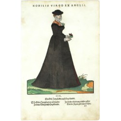
Amman, Jost Nobilis Virgo ex AngliaCatalog No.: 19227
Jost Amman. "Nobilis Virgo ex Anglia. Ein Edle Jungfraw auß Engellandt". Orig. woodcut, J. Amman from the first edition of his work 'Habitus praecipuorum populorum ...'. Published by H. Weigel in Nuremberg, 1577. 22:17 cm.
4 000,00 KčFor sale -
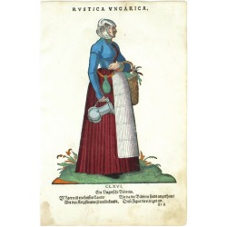
Amman, Jost Rustica UngaricaCatalog No.: 19245
Jost Amman. "Rustica Ungarica. Ein Ungarische Bäwrin". Orig. woodcut, J. Amman from the first edition of his work 'Habitus praecipuorum populorum ...'. Published by H. Weigel in Nuremberg, 1577. 23:17 cm.
4 000,00 KčFor sale -
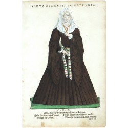
Amman, Jost Vidua Senensis in HetruriaCatalog No.: 19215
Jost Amman. "Vidua Senensis in Hetruria". Orig. woodcut, J. Amman from the first edition of his work 'Habitus praecipuorum populorum ...'. Published by H. Weigel in Nuremberg, 1577. 24,5:17 cm.
3 500,00 KčFor sale -
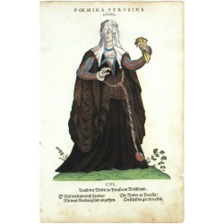
Amman, Jost Foemina Perusina in ItaliaCatalog No.: 19221
Jost Amman. "Foemina Perusina in Italia". Orig. woodcut, J. Amman from the first edition of his work 'Habitus praecipuorum populorum ...'. Published by H. Weigel in Nuremberg, 1577. 22,5:16,5 cm.
4 000,00 KčFor sale -
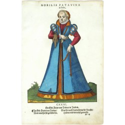
Amman, Jost Nobilis Patavina in ItaliaCatalog No.: 19203
Jost Amman. "Nobilis Patavina in Italia". Orig. woodcut, J. Amman from the first edition of his work 'Habitus praecipuorum populorum ...'. Published by H. Weigel in Nuremberg, 1577. 23:17 cm.
4 000,00 KčFor sale -
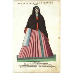
Amman, Jost Honesta Mulier Faventina in ItaliaCatalog No.: 19209
Jost Amman. "Honesta Mulier Faventina in Italia". Orig. woodcut, J. Amman from the first edition of his work 'Habitus praecipuorum populorum ...'. Published by H. Weigel in Nuremberg, 1577. 24:17 cm.
4 000,00 KčFor sale -
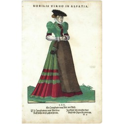
Amman, Jost Nobilis Virgo in AlsatiaCatalog No.: 19185
Jost Amman. "Nobilis Virgo in Alsatia". Orig. woodcut, J. Amman from the first edition of his work 'Habitus praecipuorum populorum ...'. Published by H. Weigel in Nuremberg, 1577. 23,5:17 cm.
4 000,00 KčFor sale -
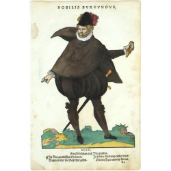
Amman, Jost Nobilis BurgundusCatalog No.: 19305
Jost Amman. "Nobilis Burgundus". Orig. woodcut, J. Amman from the first edition of his work 'Habitus praecipuorum populorum ...'. Published by H. Weigel in Nuremberg, 1577. 25:17 cm.
3 500,00 KčFor sale -
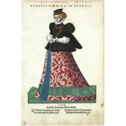
Amman, Jost Nobilis Foemina in AlsatiaCatalog No.: 19335
Jost Amman. "Nobilis Foemina in Alsatia". Orig. woodcut, J. Amman from the first edition of his work 'Habitus praecipuorum populorum ...'. Published by H. Weigel in Nuremberg, 1577. 23,5:17 cm.
3 500,00 KčFor sale -
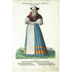
Amman, Jost Honesti Civis Uxor Halensi in SueviaCatalog No.: 19341
Jost Amman. "Honesti Civis Uxor Halensi in Suevia. Eins Burgers Weib von Schwäbischen Hall am Köcher". Orig. woodcut, J. Amman from the first edition of his work 'Habitus praecipuorum populorum ...'. Published by H. Weigel in Nuremberg, 1577. 22,5:17 cm.
3 500,00 KčFor sale -
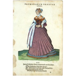
Amman, Jost Patriciarum Ornatus in choraeisCatalog No.: 19347
Jost Amman. "Patriciarum Ornatus in choraeis". Orig. woodcut, J. Amman from the first edition of his work 'Habitus praecipuorum populorum ...'. Published by H. Weigel in Nuremberg, 1577. 22:17 cm.
3 500,00 KčFor sale -
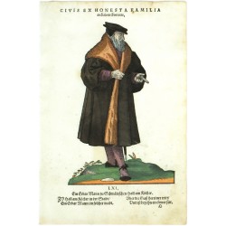
Amman, Jost Civis ex Honesta Familia in Salinis SueuicisCatalog No.: 19359
Jost Amman. "Civis ex Honesta Familia in Salinis Sueuicis". Orig. woodcut, J. Amman from the first edition of his work 'Habitus praecipuorum populorum ...'. Published by H. Weigel in Nuremberg, 1577. 22,5:15 cm.
3 500,00 KčFor sale -
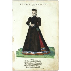
Amman, Jost Ad Convivium Eunits ornatusCatalog No.: 19275
Jost Amman. "Ad Convivium Eunits ornatus. Ein Fraw wann sie zu Gast gehet". Orig. woodcut, J. Amman (1539-1591) from the first edition of his work 'Habitus praecipuorum populorum ...'. Published by H. Weigel in Nuremberg, 1577. 21,5:17 cm.
3 500,00 KčFor sale -
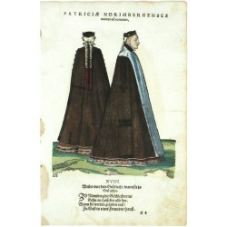
Amman, Jost Patriciae Norimbergenses euntes ad conviviaCatalog No.: 19407
Jost Amman. "Patriciae Norimbergenses euntes ad convivia. Weiber von dem Geschlecht, wann sie zu Gast gehen". Orig. woodcut, J. Amman from the first edition of his work 'Habitus praecipuorum populorum ...'. Published by H. Weigel in Nuremberg, 1577. 20,5:17 cm.
3 500,00 KčFor sale -
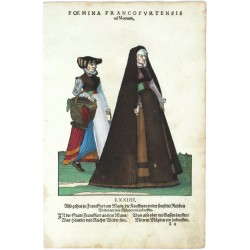
Amman, Jost Foemina Francofurtensis ad MoenumCatalog No.: 19401
Jost Amman. "Foemina Francofurtensis ad Moenum ...". Orig. woodcut, J. Amman (1539-1591) from the first edition of his work 'Habitus praecipuorum populorum ...'. Published by H. Weigel in Nuremberg, 1577. 19:16,5 cm.
3 500,00 KčFor sale

