No products
Europe
- Austria
-
Belgium, the Netherlands, Luxembourg
- Amsterdam
- Antwerp
- Belgium and Luxembourg
- Bergen op Zoom
- Blokzijl
- Bommenede
- Brabant
- Brugge
- Brussels
- Charleroi
- Courtrai
- Delft
- Dinant
- Dordrecht
- Elburg
- Flandres
- Fort Rammekens
- Friesland
- Friesland and Groningen
- Gelderland
- Geraardsbergen
- Grave
- Groningen
- Hainaut
- Harderwijk
- Harlingen
- Holland
- Hulst
- Huy
- Liege
- Lier
- Limbourg
- Limburg
- Louvain
- Luxemburg
- Maastricht
- Mechelen
- Middelburg
- Mons
- Namur
- Netherlands
- Netherlands and Belgium
- Nijmegen
- Ostend
- Overijssel
- Rotterdam
- Spa
- Stavoren
- The Hague
- Tiel
- Utrecht
- Veere
- Veurne
- Ypres
- Zaltbommel
- Zeeland
- Zieriksee
- Zierikzee
- Zutphen
- Zype
-
Bohemia, Moravia and Silesia
- Beroun
- Bohemia
- Bohemia, Moravia and Silesia
- Brandýs nad Labem
- Branná (okr. Šumperk)
- Brno
- Brodce (okr. Mladá Boleslav)
- Broumov
- Carlsbad
- Čáslav
- Čelákovice
- Cheb
- Chlumec nad Cidlinou
- Chomutov
- Děčín
- Dolní Olešnice - Nové Zámky
- Dvůr Králové nad Labem
- Františkovy Lázně
- Frýdlant
- Hasištejn
- Házmburk
- Hostinné
- Hradec Králové
- Hřensko
- Jáchymov
- Jaroměř
- Jihlava
- Jindřichův Hradec
- Jižní Čechy
- Kamýk u Litoměřic
- Karlštejn
- Kolín
- Konopiště
- Kostelec nad Labem
- Křivoklát
- Krkonoše
- Krupka
- Kunětická Hora
- Kutna Hora
- Kyšperk
- Lednice
- Liberec
- Libochovany
- Lipnice nad Sázavou
- Litoměřice
- Litomyšl
- Loket
- Louny
- Lovosice
- Lysá nad Labem
- Mariánské Lázně
- Mělník
- Mladá Boleslav
- Mladoboleslavsko
- Moravia
- Most
- Nymburk
- Okoř
- Olomouc
- Ostrov nad Ohří
- Plzeň
- Poděbrady
- Polná
- Prácheňsko
- Prague
- Přelouč
- Přerovsko
- Rabí
- Rakovnicko
- Rakovník
- Roudnice nad Labem
- Rožmberk
- Rožnov pod Radhoštěm
- Rychmburk
- Sedlec
- Slaný
- Smečno
- Smiřice
- Štětí
- Šumava
- Švamberk (Krasíkov)
- Tábor
- Tepl
- Teplice
- Terezín
- Třeboň
- Týnec nad Labem
- Uničov
- Valdštejn
- Vinec
- Vrabinec
- Vrchlabí
- Vyšší Brod
- Zákupy
- Žampach (zámek)
- Želiv
- Žireč
- Žleby
- Znojmo
- Zvíkov
- Central Europe
- Danube
- Eastern and Southeastern Europe, Balkan
- Europe (continent)
-
France
- Albi
- Anjou
- Artois
- Bar-le-Duc
- Berry
- Blois
- Bourbourg
- Bourgogne-Franche-Comté
- Bresse
- Cambrai
- Cassel
- Château de Lichtenberg
- Chaumont
- Compiegne and Noyon
- Corsica
- Dauphiné
- Elsass
- Gascogne
- Gâstinais and Senonais
- Gravelines
- Hauts-de-France
- Ile de France
- La Bassée - Hesdin
- Languedoc
- Lille
- Limoges
- Lorraine
- Lyon
- Maine
- Marseille
- Metz
- Montmélian
- Mulhouse
- Nancy
- Nice
- Normandie
- Paris
- Perche
- Picardy
- Poitou
- Provence
- Re and Oleron
- Reims - Rethel
- Saint-Omer
- Saintonge and Aunis
- Savoy
- Strasbourg
- Tarn (department)
- Vexin
-
Germany
-
Baden-Württemberg
- Bad Teinach-Zavelstein
- Balingen
- Biberach an der Riß
- Böblingen
- Bodensee
- Breisgau
- Calw
- Dornhan
- Esslingen
- Geislingen an der Steige
- Grafschaft Limpurg
- Heidelberg
- Heilbronn
- Hohenlohe
- Karlsruhe
- Mannheim
- Möckmühl
- Nagold
- Neuenbürg
- Nord-Württemberg
- Oberschwaben
- Offenburg
- Reutlingen
- Rheinpfalz
- Schwäbisch Gmünd
- Schwäbisch Hall
- Singen
- St. Blasien
- Stuttgart
- Swabia
- Tübingen
- Ulm
- Vaihingen a. d. Enz
- Wangen im Allgäu
- Weinheim
- Württemberg
-
Bavaria
- Aschaffenburg
- Augsburg
- Aurach
- Bad Abbach
- Bamberg
- Bogenberg (Wallfahrtskirche)
- Cham
- Coburg
- Donauwörth
- Eichstätt
- Forchheim
- Franken
- Freising
- Friedberg (Schwaben)
- Füssen
- Gräfenberg (Oberfranken)
- Höchstädt an der Donau
- Ingolstadt
- Kelheim
- Kempten
- Lauingen
- Lenggries
- Lindau
- Memmingen
- Mindelheim
- Mühldorf am Inn
- München
- Nabburg
- Natternberg (Schloss)
- Neuburg an der Donau
- Neumarkt in der Oberpfalz
- Neuötting
- Neustadt an der Donau
- Nördlingen
- Nürnberg
- Oberpfalz
- Pappenheim
- Passau
- Pfaffenhofen
- Pöttmes
- Rain am Lech
- Regensburg
- Saal an der Donau
- Schongau
- Schrobenhausen
- Straubing
- Thurnau
- Velden
- Vilshofen an der Donau
- Wackerstein
- Wasserburg am Inn
- Weilheim / links Polling
- Weissenburg in Bayern
- Weltenburg
- Würzburg
- Berlin
- Brandenburg
- Bremen
- Hamburg
- Hessen
- Mecklenburg-Vorpommern/Pommern
-
Niedersachsen
- Aurich
- Bad Bentheim
- Bad Gandersheim
- Bodenwerder
- Braunschweig
- Braunschweig-Lüneburg
- Celle
- Cuxhaven
- Emden
- Hann. Münden
- Hannover
- Hildesheim
- Hoya
- Liebenau an der Weser
- Lüneburg
- Niedersächsischer Kreis
- Nienburg a. d. Weser
- Oldenburg
- Osnabrück
- Osterode
- Osterwieck
- Ostfriesland
- Schnackenburg
- Schöppenstedt
- Stolzenau
- Walsrode
- Winsen an der Luhe
- Wolfenbüttel
- Nordrhein-Westfalen
- Northern Germany
- Rheinland-Pfalz
- Sachsen
- Sachsen-Anhalt
- Schleswig-Holstein
- Thüringen
-
Baden-Württemberg
-
Great Britain and Ireland
- Bedford and Buckinghamshire
- Berkshire and Hampshire
- Cambridgeshire
- Cornwall
- Cumberland
- Denbigh and Flint
- Derbyshire
- Devon
- Dorset
- Durham (County)
- England
- Essex
- Gloucestershire
- Great Britain and Ireland
- Herefordshire
- Hertfordshire
- Hertfordshire and Middlesex
- Huntingdonshire
- Ireland
- Isle of Wight
- Kent
- Leicestershire
- Lincolnshire
- London
- Middlesex
- Norfolk
- Northampton
- Northeastern England
- Northern England
- Northumberland
- Northwestern England
- Nottinghamshire
- Oxfordshire
- Scotland
- Shropshire and Staffordshire
- Somerset
- Southeastern England
- Southwestern England
- Staffordshire
- Surrey
- Sussex
- Wales
- Westmorland
- Wiltshire
- Worcestershire and Warwickshire
- Yorkshire
- Greece, Mediterranean Sea
-
Italy
- Abruzzo
- Ancona
- Apulia (Puglia)
- Arcevia
- Bari and Basilicata
- Bergamo
- Bologna
- Brescia
- Brescia and Crema
- Cadore
- Cagliari
- Caiazzo
- Calabria
- Campania
- Capitanata
- Carmagnola
- Catania
- Central Italy
- Civitavecchia
- Crema
- Cremona
- Cuneo
- Elba
- Emilia Romagna
- Faenza
- Fano
- Ferrara
- Florence
- Fondi
- Friuli
- Gaeta
- Gallipoli
- Genoa
- Ischia
- Italy
- Lazio
- Lerici
- Liguria (Italian Riviera)
- Livorno
- Lombardia
- Loreto
- Lucca
- Mantua
- Mantua
- Marche (Ancona)
- Merano
- Messina
- Milan
- Mirandola
- Modena
- Molise
- Monferrato
- Naples
- Netuno
- Nocera Umbra
- Northern Italy
- Orvieto
- Orvieto and Loreto
- Otranto
- Padua
- Palermo
- Parma
- Pavia
- Perugia
- Pesaro
- Piacenza
- Piedmont
- Pinerolo
- Piombino
- Pisa
- Po
- Pozzuoli
- Reggio di Calabria
- Reggio Emilia
- Rimini
- Rome
- Rovigo
- San Marino
- Sardinia
- Sicily
- Sicily and Malta
- Sicily and Sardinia
- Siena
- Southern Italy
- Spoleto
- Sulmona
- Taranto
- Terracina
- Tivoli
- Torino
- Tortona
- Trapani
- Trentino-Alto Adige / Südtirol
- Trento
- Treviso
- Tuscany
- Tyrol
- Udine
- Umbria
- Urbino
- Velletri
- Venice
- Vercelli
- Verona
- Vicenza
- Viterbo
- Labe
- Mediterranean Sea
- Monaco
- Poland, Silesia, Russia and the Baltic republics
- Rhine
- Scandinavia and Iceland
- Spain and Portugal
- Switzerland
Europe There are 1758 items.
Subcategories
-
Seutter, Matthäus Delineatio geographica Comitatus...Catalog No.: 01609
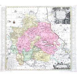
Saxony. "Delineatio geographica Comitatus Mansfeldensis ad jurisdictionem tum Saxonicam tum Brandenburgicam spectans, cum praefectura Sangerhusana, Querfurtensi, Sittenbacensi, Allstaedensi ...". Altkol. Kupf.-Kte. von T. C. Lotter bei M. Seutter,...
5 200,00 KčFor sale -
Schapuzet, Ioh. Carolus Comitatus Hohenloici Tabulam hanc...Catalog No.: 01594
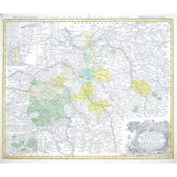
"... Comitatus Hohenloici Tabulam hanc Geographicam ...". Altkol. Kupf.-Kte. von Ioh. Carolus Schapuzet bei Homann Erben, dat. 1748. Mit Titelkopfleiste, unten rechts Titelkartusche mit Wappen. Links oben und unten Insetkarten. 47:57,5 cm.
7 200,00 KčFor sale -
Schenk, Peter & Valck, Gerard Accurate Geographische Delineation des...Catalog No.: 01588
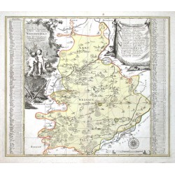
Weißenfels. "Accurate Geographische Delineation des Hochfs. Sachß. Amtes Weissenfels ...". Altkol. Kupferstich Karte bei P. Schenk Jun., Amsterdam, ca. 1750. 48,5:57,5 cm.
4 000,00 KčFor sale -
Homann, Johann Baptist Protoparchiae Mindelhemensis Nova Tabula...Catalog No.: 01579
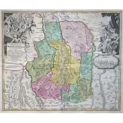
"Protoparchiae Mindelhemensis Nova Tabula Geographica ...". Altkol. Kupf.-Kte. bei J. B. Homann, (um 1720). Oben links von Putten gehaltene Titelkartusche. Rechts Kartusche mit Ansicht von der Stadt Mindelheim. 49:58,5 cm.
6 800,00 KčFor sale -
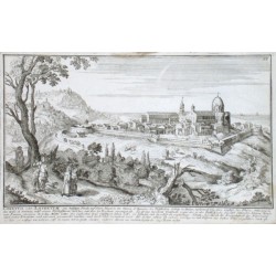
Bodenehr, Gabriel Loretto oder Lauretum eine befestige Stadt...Catalog No.: 01521
"Loretto oder Lauretum eine befestige Stadt ... in der Marca d'Ancona". Copper plate engraving by G. Bodenehr (1664-1758), printed ca. 1710. 17,5:28,5 cm.
2 500,00 KčFor sale -
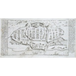
Bodenehr, Gabriel Cagliari oder Calaris die Haupt und...Catalog No.: 01515
"Cagliari oder Calaris die Haupt und Residenz Statt des Vice Königs in Sardinien". View of the city on Sardinia. Copper plate engraving by G. Bodenehr (1664-1758), printed ca. 1710. With explanations. 15:31 cm.
3 500,00 KčFor sale -
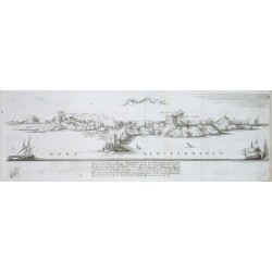
Bodenehr, Gabriel PiombinoCatalog No.: 01500
"Piombino". Panoramatic view of the city. Copper plate engraving by G. Bodenehr (1664-1758), printed ca. 1710. 16,5:50,5 cm.
3 500,00 KčFor sale -
Bodenehr, Gabriel RapperswylCatalog No.: 01497
"Rapperswyl". View of the city Rapperswil near by Lake of Zürich. Copper-engraving by G. Bodenehr (1664-1758), printed ca. 1720. With 3 coat-of-arms and explanatory notes by the sides. 15:29,5 cm (6 x 11 1/2 inch.).
4 500,00 KčFor sale -
Bodenehr, Gabriel Geneve GenffCatalog No.: 01494
"Geneve Genff". View of the city. Copper plate engraving by G. Bodenehr (1664-1758), printed ca. 1710. With small coat-of-arms and explanations. 14,5:40,5 cm.
6 000,00 KčFor sale -
Bodenehr, Gabriel Bethune In der Graffschaft ArtoisCatalog No.: 01488
Béthune. "Bethune In der Graffschaft Artois". Orig. copperplate engraving by G. Bodenehr, 1720. With title cartouche and explanatory notes with accompanying text under the picture. 16:50 cm.
1 200,00 KčFor sale -
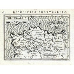
Bertius, Petrus PortugalliaCatalog No.: 01464
Portugal. "Portugallia". Orig. copper-engraving, P. Bertius. Published in Amsterdam by J. Hondius, 1616-18. With small ornamental cartouche and Latin title above the map. 9,3:13,2 cm.
1 800,00 KčFor sale -
Bodenehr, Gabriel StulweissenburgCatalog No.: 01413
Székesfehérvár. "Stulweissenburg". Orig. copperplate engraving, G. Bodenehr, Augsburg, ca. 1720. With explanatory notes on the side. 16,5:22,5 cm.
1 800,00 KčFor sale -
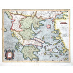
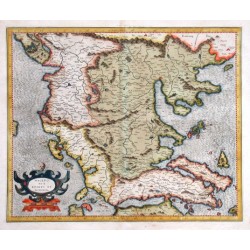
Mercator, Gerardus GraeciaCatalog No.: 01395
Greece. "Graecia". Orig. copper-engraving, G. Mercator (1512-1594). Published in Amsterdam, ca. 1590. Original old colouring. With coloured ornamental title-cartouche. 36,5:47 cm (14 1/2 x 18 1/2 inch.).
18 000,00 KčFor sale -
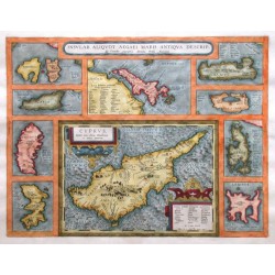
Ortelius, Abraham Cyprus and Aegean Islands - Insular....Catalog No.: 01391
Cyprus and Aegean Islands. "Insular. aliquot Aegaei maris antiqua descrip.". Orig. copper-engraving, A. Ortelius, 1584. Coloured. With 3 ornametal cartouches. 36:47 cm (14 1/4 x 18 1/2 inch.).
21 000,00 KčFor sale -
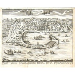
Stridbeck, Johann jun. MessinaCatalog No.: 01353
Messina. "Messina". Orig. copper-engraving by Joan Stridbeck jun. (1707-1772), printed ca. 1740. Birds-eye-view of the city and the port with many ships and with description under the picture. 15:19,5 cm.
3 000,00 KčFor sale -
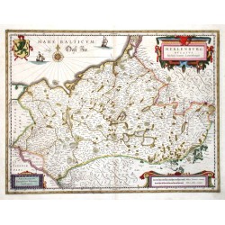
Janssonius, Johannes Meklenburg DucatusCatalog No.: 01340
Mecklenburg. "Meklenburg Ducatus". Altkol. Kupf.-Kte. nach J. Laurenberg von J. Janssonius, um 1635. Mit 3 ausgem. ornamnet. Kart., farb. Wappen u. maritimer Staffage. 37:48 cm.
6 200,00 KčFor sale -
Janssonius, Johannes Beschreibung des Theils in Flandern, das...Catalog No.: 01337
Flanders. ("Beschreibung des Theils in Flandern, das dem Roemischen Reich zugehoeret"). Orig. copperplate engraving, (G. Mercator and J. Hondius published by J. Janssonius), ca. 1635. Original old colouring. With title on verso. 40:51 cm.
4 000,00 KčFor sale -
Janssonius van Waesberge, Johannes Hollandiae Meridionalis Pars II. continens...Catalog No.: 01331
Southeast Holland. "Hollandiae Meridionalis Pars II. continens novissimam Insularum Dordracensis, Alblasser, Crimper et Clundert". Orig. copperplate engraving published by Janssonius-Waesberge, M. Pitt and S. Swart, ca. 1680. Original old colouring. 45:55 cm.
6 800,00 KčFor sale -
Hondius, Henricus Fossa Eugeniana quae a Rheno ad Mosam duci...Catalog No.: 01325
Fossa Eugeniana. "Fossa Eugeniana quae a Rheno ad Mosam duci coepta est". Altkol. Kupf.-Kte. von H. Hondius, dat. 1627. Bei P. Schenk & G. Valck, um 1710. Mit 3 ornament. Kart. 36,5:48,5 cm.
6 000,00 KčFor sale -
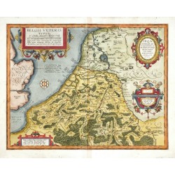
Ortelius, Abraham Belgii veteris typusCatalog No.: 01316
Belgium. "Belgii Veteris Typus". Orig. copper-engraving, A. Ortelius, 1594. Orig. old colouring. With 4 ornamental cartouches. 38:48,5 cm.
12 500,00 KčFor sale -
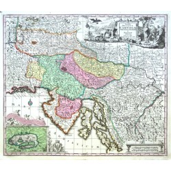
Seutter, Matthäus Slovenia, Croatia - Exactissima Ducatus...Catalog No.: 01298
Slovenia and Croatia. "Exactissima Ducatus Carniolae Vinidorum Marchiä et Histriae delineatio". Orig. copper-engraving by M. Seutter, Augsburg, ca. 1730. Original old colouring. With great figure title-cartouche, a cartouche with inset map of Cerknica Lake with...
9 000,00 KčFor sale -
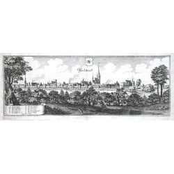
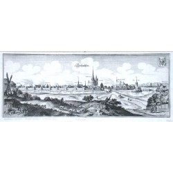
Merian, Kaspar PerleberckCatalog No.: 01296
"Perleberck". Gesamtansicht. Kupf. von C. Merian, 1652. Mit Wappen und Legende (A-K). 14:38,5 cm.
2 400,00 KčFor sale -
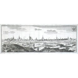
Merian, Kaspar PrentzlowCatalog No.: 01293
"Prentzlow". Gesamtansicht. Kupf. bei Merian, 1652. Mit Wappen und Legende (A-I). 13,5:38 cm.
2 400,00 KčFor sale -
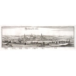
Merian, Kaspar Neusatatt an der OrlaCatalog No.: 01290
"Neusatatt an der Orla". Gesamtansicht. Kupf. bei Merian, 1650. 9:31,5 cm.
2 100,00 KčFor sale -
Mercator, Gerardus Macedonia, Epirus et AchaiaCatalog No.: 01289
Greece, Mediterranean Sea."Macedonia, Epirus et Achaia". Copper-engraving by G. Mercator (from Mercator's atlas, 1589-1595). Original old colouring. With col. ornamental cartouche. 36:43,5 cm (14 1/4 x 17 inch.).
9 000,00 KčFor sale -
Merian, Kaspar SeehausenCatalog No.: 01284
"Seehausen". Gesamtansicht. Kupf. bei Merian, 1652. Mit Wappen. 14,5:38,5 cm.
2 100,00 KčFor sale -
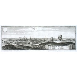
Merian, Kaspar OschatzCatalog No.: 01281
"Oschatz". Kupferstich von C. Merian, 1650. Mit Wappen (nicht ausgefüllt) und legende (A-I). 10,5:32 cm.
2 500,00 KčFor sale -
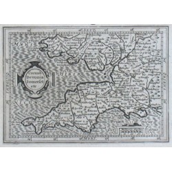
Bertius, Petrus Cornub. Devonia Somerset etc.Catalog No.: 01278
"Cornub. Devonia Somerset etc.". Copper-engraving by P. Bertius published by J. Hondius, 1616-18. With small ornamental cartouche and "Miliaria Anglica". 9,5:13,5 cm (3 3/4 x 5 1/4 inch.).
2 100,00 KčFor sale -
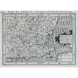
Bertius, Petrus Warwicum Northapton Hunting. etc.Catalog No.: 01272
"Warwicum Northapton Hunting. etc.". Copper-engraving by P. Bertius published by J. Hondius, 1616-18. With small ornamental cartouche and "Miliaria Anglica". 9,5:13,5 cm (3 3/4 x 5 1/4 inch.).
2 100,00 KčFor sale -
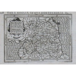
Bertius, Petrus Nothuumbr. Cumberlan. Dunelm. Episcop.Catalog No.: 01269
"Nothuumbr. Cumberlan. Dunelm. Episcop.". Copper-engraving by P. Bertius published by J. Hondius, 1616-18. With small ornamental cartouche and "Miliaria Anglica". 9,5:13,5 cm (3 3/4 x 5 1/4 inch.).
2 100,00 KčFor sale -
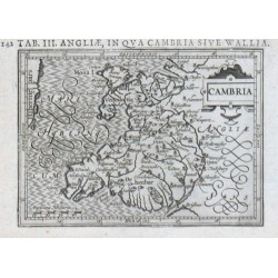
Bertius, Petrus CambriaCatalog No.: 01260
"Cambria". Copper-engraving by P. Bertius published by J. Hondius, 1616-18. With small ornamental cartouche and "Anglicana Milliaria". 9,6:13,3 cm (3 3/4 x 5 1/4 inch.).
2 100,00 KčFor sale -
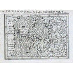
Bertius, Petrus Westmorland: Lancastria Cestria etc.Catalog No.: 01257
"Westmorland: Lancastria Cestria etc.". Orig. copper-engraving by P. Bertius published by J. Hondius, 1616-18. With small ornamental cartouche and "Miliaria Anglica". 9,5:13,5 cm (3 3/4 x 5 1/4 inch.).
2 100,00 KčFor sale -
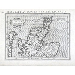
Bertius, Petrus Scotia Septentrion.Catalog No.: 01251
"Scotia Septentrion.". Copper-engraving by P. Bertius published by J. Hondius, 1616-18. With small ornamental cartouche, the scale of map ("Miliaria Scotica") and Latin heading-title. 9,5:13,3 cm (3 3/4 x 5 1/4 inch.).
2 100,00 KčFor sale -
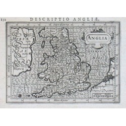
Bertius, Petrus AngliaCatalog No.: 01245
"Anglia". Copper-engraving after P. Bertius engraved by S. Rogiers published by J. Hondius, 1616-18. With small ornamental cartouche and "Miliaria Anglica". 9,5:13,3 cm (3 3/4 x 5 1/4 inch.).
2 700,00 KčFor sale -
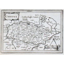
Bertius, Petrus UdroneCatalog No.: 01242
"Udrone". Orig. copper-engraving by P. Bertius published by J. Hondius, 1616-18. With small ornamental cartouche and "Milliaria Anglica". 9,6:13,9 cm (3 3/4 x 5 1/2 inch.).
2 100,00 KčFor sale -
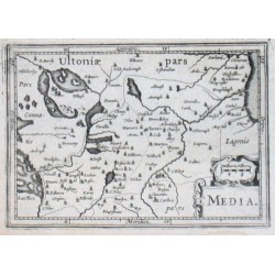
Bertius, Petrus MediaCatalog No.: 01239
"Media". Orig. copper-engraving by P. Bertius published by J. Hondius, 1616-18. With small ornamental cartouche and "Milliaria Hibern.". 9,3:13,5 cm (3 3/4 x 5 1/4 inch.).
2 100,00 KčFor sale -
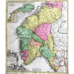
Homann, Johann Baptist Regni Norvegiae accurata tabulaCatalog No.: 01232
"Regni Norvegiae accurata tabula". Orig. copper-engraving published by J. B. Homann, published ca. 1720. Old colouring. With coloured side-map of northern part of Norway ("Norvegiae pars septentrionalis ...") and two figure and ornamental cartouches. 57,5:49,5...
14 000,00 KčFor sale -
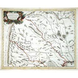
Sanson, Nicolas Partie occidentale de la Lapponie SuedoiseCatalog No.: 01211
Northern Sweden - Lapland. "Partie occidentale de la Lapponie Suedoise". Orig. copperplate engraving, N. Sanson. Published by P. Mariette, Paris, 1666. Original old colouring. With figure title cartouche. 43,5:55 cm.
6 000,00 KčFor sale -
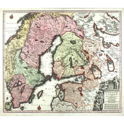
Seutter, Matthäus Nova Mappa Geographica Sueciae ac Gothiae...Catalog No.: 01205
Sweden, Finland, St. Petersburg, Estonia. "Nova Mappa Geographica Sueciae ac Gothiae Regna ut et Finlandiae ...". Orig. copperplate engraving, M. Seutter ca. 1730. Orig. old colouring. With heraldical title cartouche. 49,5:57,5 cm.
7 000,00 KčFor sale -
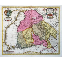
Janssonius, Johannes Magnus Ducatus Finlandiae nova et accurata...Catalog No.: 01202
Finland. "Magnus Ducatus Finlandiae nova et accurata delineatio". Orig. copperplate engraving, J. Janssonius. Published by G. Valk & P. Schenk in Amsterdam ca. 1700. Original old colouring. With 2 coloured figure cartouches with many coats of arms. 43,5:53 cm.
24 000,00 KčFor sale -
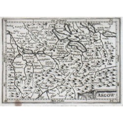
Bertius, Petrus ArgowCatalog No.: 01185
"Argow". Copper-engraving by P. Bertius published by J. Hondius, 1616-18. With small ornamental cartouche and "Miliare Helvet". 9,5:13,2 cm.
1 500,00 KčFor sale -
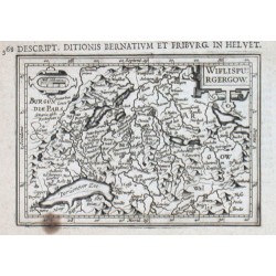
Bertius, Petrus WiflispurgergowCatalog No.: 01182
"Wiflispurgergow". Copper-engraving by P. Bertius published by J. Hondius, 1616-18. With small ornamental cartouche and "Mill. Helvetica". 9,5:13,5 cm.
1 500,00 KčFor sale -
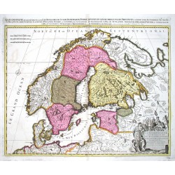
Schenk, Peter & Valck, Gerard La Scandinavie et les Environs, ou sont...Catalog No.: 01169
Scandinavia. "La Scandinavie et les Environs, ou sont Les Royaumes de Suede, de Danemark et de Norwege ...". Orig. copperplate engraving, P. Schenk, Amsterdam ca. 1700. Original old colouring. 49:59 cm.
8 500,00 KčFor sale -
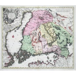
Seutter, Matthäus Magni ducatus FinlandiaeCatalog No.: 01151
Finland. "Magni ducatus Finlandiae Russiae partim, partim Sueciae subjecti- Sinus item Bothnici ac Finnici nova et accurata delineatio". Orig. copper-engraving published by M. Seutter, ca. 1740. Original old colouring. With figure and heraldic title cartouche....
16 800,00 KčFor sale -
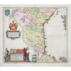
Blaeu, Joan Nordlandiae et quibies Gestricia et...Catalog No.: 01148
"Nordlandiae et quibies Gestricia et Helsingicae regiones". Copper-engraving by A. Bure published by J. Blaeu, ca. 1670. Original old colouring. With 2 coloured figure and heraldic cartouches and 2 coats-of-arms. 40,5:47 cm (16 x 18 1/2 inch.).
15 000,00 KčFor sale -
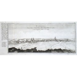
Bodenehr, Gabriel Naumburg. Eine ihrer Jaehrlichen Petri...Catalog No.: 01143
"Naumburg. Eine ihrer Jaehrlichen Petri Pauli Messe halber weith beruffene Statt an der Saale". Kupferstich von G. Bodenehr (1673-1765), um 1720. Gesamtansicht der Stadt mit Legende bei der Seite. 15,5:37,5 cm.
4 000,00 KčFor sale -
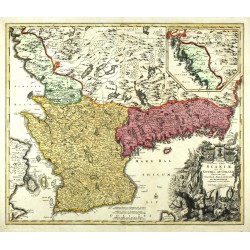
Homann, Johann Baptist Nova Tabula ScaniaeCatalog No.: 01142
South Sweden. "Nova Tabula Scaniae,". Orig. copperplate engraving, J. B. Homann, ca. 1720. Orig. old colouring. With figure title cartouche and an inset map of the northern part of Halland province. 47,5:56,5 cm.
6 500,00 KčFor sale -
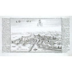
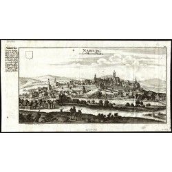
Bodenehr, Gabriel Nabburg in der Oberen PfaltzCatalog No.: 01140
Nabburg. "Nabburg in der Oberen Pfaltz". Orig. copperplate engraving, G. Bodenehr, 1720. With engraved title, a blank shield and explanatory notes on the left. 16,5:34 cm.
1 500,00 KčFor sale -
Homann, Johann Baptist Regni SueciaeCatalog No.: 01139
Sweden, Finland, St. Petersburg, Estonia. "Regni Sueciae". Orig. copperplate engraving published by J. B. Homann, ca. 1720. Orig. old colouring. With figure title cartouche with a coat of arms. 49:57,5 cm.
4 500,00 KčFor sale -
Bodenehr, Gabriel Neumarck in der Oberen PfaltzCatalog No.: 01137
Neumarkt in der Oberpfalz. "Neumarck in der Oberen Pfaltz". Orig. copperplate engraving, G. Bodenehr, 1720. With engraved title, a coat of arms and explanatory notes on the left. 16,5:36 cm.
4 800,00 KčFor sale

