No products
Europe
- Austria
-
Belgium, the Netherlands, Luxembourg
- Amsterdam
- Antwerp
- Belgium and Luxembourg
- Bergen op Zoom
- Blokzijl
- Bommenede
- Brabant
- Brugge
- Brussels
- Charleroi
- Courtrai
- Delft
- Dinant
- Dordrecht
- Elburg
- Flandres
- Fort Rammekens
- Friesland
- Friesland and Groningen
- Gelderland
- Geraardsbergen
- Grave
- Groningen
- Hainaut
- Harderwijk
- Harlingen
- Holland
- Hulst
- Huy
- Liege
- Lier
- Limbourg
- Limburg
- Louvain
- Luxemburg
- Maastricht
- Mechelen
- Middelburg
- Mons
- Namur
- Netherlands
- Netherlands and Belgium
- Nijmegen
- Ostend
- Overijssel
- Rotterdam
- Spa
- Stavoren
- The Hague
- Tiel
- Utrecht
- Veere
- Veurne
- Ypres
- Zaltbommel
- Zeeland
- Zieriksee
- Zierikzee
- Zutphen
- Zype
-
Bohemia, Moravia and Silesia
- Beroun
- Bohemia
- Bohemia, Moravia and Silesia
- Brandýs nad Labem
- Branná (okr. Šumperk)
- Brno
- Brodce (okr. Mladá Boleslav)
- Broumov
- Carlsbad
- Čáslav
- Čelákovice
- Cheb
- Chlumec nad Cidlinou
- Chomutov
- Děčín
- Dolní Olešnice - Nové Zámky
- Dvůr Králové nad Labem
- Františkovy Lázně
- Frýdlant
- Hasištejn
- Házmburk
- Hostinné
- Hradec Králové
- Hřensko
- Jáchymov
- Jaroměř
- Jihlava
- Jindřichův Hradec
- Jižní Čechy
- Kamýk u Litoměřic
- Karlštejn
- Kolín
- Konopiště
- Kostelec nad Labem
- Křivoklát
- Krkonoše
- Krupka
- Kunětická Hora
- Kutna Hora
- Kyšperk
- Lednice
- Liberec
- Libochovany
- Lipnice nad Sázavou
- Litoměřice
- Litomyšl
- Loket
- Louny
- Lovosice
- Lysá nad Labem
- Mariánské Lázně
- Mělník
- Mladá Boleslav
- Mladoboleslavsko
- Moravia
- Most
- Nymburk
- Okoř
- Olomouc
- Ostrov nad Ohří
- Plzeň
- Poděbrady
- Polná
- Prácheňsko
- Prague
- Přelouč
- Přerovsko
- Rabí
- Rakovnicko
- Rakovník
- Roudnice nad Labem
- Rožmberk
- Rožnov pod Radhoštěm
- Rychmburk
- Sedlec
- Slaný
- Smečno
- Smiřice
- Štětí
- Šumava
- Švamberk (Krasíkov)
- Tábor
- Tepl
- Teplice
- Terezín
- Třeboň
- Týnec nad Labem
- Uničov
- Valdštejn
- Vinec
- Vrabinec
- Vrchlabí
- Vyšší Brod
- Zákupy
- Žampach (zámek)
- Želiv
- Žireč
- Žleby
- Znojmo
- Zvíkov
- Central Europe
- Danube
- Eastern and Southeastern Europe, Balkan
- Europe (continent)
-
France
- Albi
- Anjou
- Artois
- Bar-le-Duc
- Berry
- Blois
- Bourbourg
- Bourgogne-Franche-Comté
- Bresse
- Cambrai
- Cassel
- Château de Lichtenberg
- Chaumont
- Compiegne and Noyon
- Corsica
- Dauphiné
- Elsass
- Gascogne
- Gâstinais and Senonais
- Gravelines
- Hauts-de-France
- Ile de France
- La Bassée - Hesdin
- Languedoc
- Lille
- Limoges
- Lorraine
- Lyon
- Maine
- Marseille
- Metz
- Montmélian
- Mulhouse
- Nancy
- Nice
- Normandie
- Paris
- Perche
- Picardy
- Poitou
- Provence
- Re and Oleron
- Reims - Rethel
- Saint-Omer
- Saintonge and Aunis
- Savoy
- Strasbourg
- Tarn (department)
- Vexin
-
Germany
-
Baden-Württemberg
- Bad Teinach-Zavelstein
- Balingen
- Biberach an der Riß
- Böblingen
- Bodensee
- Breisgau
- Calw
- Dornhan
- Esslingen
- Geislingen an der Steige
- Grafschaft Limpurg
- Heidelberg
- Heilbronn
- Hohenlohe
- Karlsruhe
- Mannheim
- Möckmühl
- Nagold
- Neuenbürg
- Nord-Württemberg
- Oberschwaben
- Offenburg
- Reutlingen
- Rheinpfalz
- Schwäbisch Gmünd
- Schwäbisch Hall
- Singen
- St. Blasien
- Stuttgart
- Swabia
- Tübingen
- Ulm
- Vaihingen a. d. Enz
- Wangen im Allgäu
- Weinheim
- Württemberg
-
Bavaria
- Aschaffenburg
- Augsburg
- Aurach
- Bad Abbach
- Bamberg
- Bogenberg (Wallfahrtskirche)
- Cham
- Coburg
- Donauwörth
- Eichstätt
- Forchheim
- Franken
- Freising
- Friedberg (Schwaben)
- Füssen
- Gräfenberg (Oberfranken)
- Höchstädt an der Donau
- Ingolstadt
- Kelheim
- Kempten
- Lauingen
- Lenggries
- Lindau
- Memmingen
- Mindelheim
- Mühldorf am Inn
- München
- Nabburg
- Natternberg (Schloss)
- Neuburg an der Donau
- Neumarkt in der Oberpfalz
- Neuötting
- Neustadt an der Donau
- Nördlingen
- Nürnberg
- Oberpfalz
- Pappenheim
- Passau
- Pfaffenhofen
- Pöttmes
- Rain am Lech
- Regensburg
- Saal an der Donau
- Schongau
- Schrobenhausen
- Straubing
- Thurnau
- Velden
- Vilshofen an der Donau
- Wackerstein
- Wasserburg am Inn
- Weilheim / links Polling
- Weissenburg in Bayern
- Weltenburg
- Würzburg
- Berlin
- Brandenburg
- Bremen
- Hamburg
- Hessen
- Mecklenburg-Vorpommern/Pommern
-
Niedersachsen
- Aurich
- Bad Bentheim
- Bad Gandersheim
- Bodenwerder
- Braunschweig
- Braunschweig-Lüneburg
- Celle
- Cuxhaven
- Emden
- Hann. Münden
- Hannover
- Hildesheim
- Hoya
- Liebenau an der Weser
- Lüneburg
- Niedersächsischer Kreis
- Nienburg a. d. Weser
- Oldenburg
- Osnabrück
- Osterode
- Osterwieck
- Ostfriesland
- Schnackenburg
- Schöppenstedt
- Stolzenau
- Walsrode
- Winsen an der Luhe
- Wolfenbüttel
- Nordrhein-Westfalen
- Northern Germany
- Rheinland-Pfalz
- Sachsen
- Sachsen-Anhalt
- Schleswig-Holstein
- Thüringen
-
Baden-Württemberg
-
Great Britain and Ireland
- Bedford and Buckinghamshire
- Berkshire and Hampshire
- Cambridgeshire
- Cornwall
- Cumberland
- Denbigh and Flint
- Derbyshire
- Devon
- Dorset
- Durham (County)
- England
- Essex
- Gloucestershire
- Great Britain and Ireland
- Herefordshire
- Hertfordshire
- Hertfordshire and Middlesex
- Huntingdonshire
- Ireland
- Isle of Wight
- Kent
- Leicestershire
- Lincolnshire
- London
- Middlesex
- Norfolk
- Northampton
- Northeastern England
- Northern England
- Northumberland
- Northwestern England
- Nottinghamshire
- Oxfordshire
- Scotland
- Shropshire and Staffordshire
- Somerset
- Southeastern England
- Southwestern England
- Staffordshire
- Surrey
- Sussex
- Wales
- Westmorland
- Wiltshire
- Worcestershire and Warwickshire
- Yorkshire
- Greece, Mediterranean Sea
-
Italy
- Abruzzo
- Ancona
- Apulia (Puglia)
- Arcevia
- Bari and Basilicata
- Bergamo
- Bologna
- Brescia
- Brescia and Crema
- Cadore
- Cagliari
- Caiazzo
- Calabria
- Campania
- Capitanata
- Carmagnola
- Catania
- Central Italy
- Civitavecchia
- Crema
- Cremona
- Cuneo
- Elba
- Emilia Romagna
- Faenza
- Fano
- Ferrara
- Florence
- Fondi
- Friuli
- Gaeta
- Gallipoli
- Genoa
- Ischia
- Italy
- Lazio
- Lerici
- Liguria (Italian Riviera)
- Livorno
- Lombardia
- Loreto
- Lucca
- Mantua
- Mantua
- Marche (Ancona)
- Merano
- Messina
- Milan
- Mirandola
- Modena
- Molise
- Monferrato
- Naples
- Netuno
- Nocera Umbra
- Northern Italy
- Orvieto
- Orvieto and Loreto
- Otranto
- Padua
- Palermo
- Parma
- Pavia
- Perugia
- Pesaro
- Piacenza
- Piedmont
- Pinerolo
- Piombino
- Pisa
- Po
- Pozzuoli
- Reggio di Calabria
- Reggio Emilia
- Rimini
- Rome
- Rovigo
- San Marino
- Sardinia
- Sicily
- Sicily and Malta
- Sicily and Sardinia
- Siena
- Southern Italy
- Spoleto
- Sulmona
- Taranto
- Terracina
- Tivoli
- Torino
- Tortona
- Trapani
- Trentino-Alto Adige / Südtirol
- Trento
- Treviso
- Tuscany
- Tyrol
- Udine
- Umbria
- Urbino
- Velletri
- Venice
- Vercelli
- Verona
- Vicenza
- Viterbo
- Labe
- Mediterranean Sea
- Monaco
- Poland, Silesia, Russia and the Baltic republics
- Rhine
- Scandinavia and Iceland
- Spain and Portugal
- Switzerland
Europe There are 1758 items.
Subcategories
-
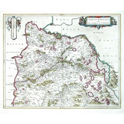
Blaeu, Joan (author) Pont, Timothy (other authors) Caricta BorealisCatalog No.: 09363
Scotland. Carrick. "Caricta Borealis Vulgo The north part of Carrick". Orig. copperplate engraving after T. Pont's map. Published by J. Blaeu in Amsterdam, 1654. Original old colouring. 42:52,5 cm.
5 200,00 KčFor sale -
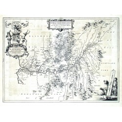
Blaeu, Joan (author) Pont, Timothy (other authors) Nithia VicecomitatusCatalog No.: 09348
Scotland. Nithsdale. "Nithia Vicecomitatus. The Shirifdome of Nidis-Dail". Orig. copperplate engraving after T. Pont's map. Published by J. Blaeu in Amsterdam, 1654. 39:53,5 cm.
4 800,00 KčFor sale -
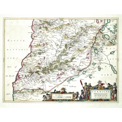
Blaeu, Joan (author) Pont, Timothy (other authors) Carricta MeridionalisCatalog No.: 09342
Scotland. Carrick. "Carricta Meridionalis. The South part of Carrick". Orig. copperplate engraving after T. Pont's map. Published by J. Blaeu in Amsterdam, 1654. Original old colouring. 38,5:53 cm.
5 200,00 KčFor sale -
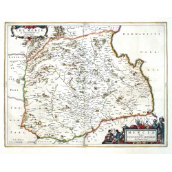
Blaeu, Joan (author) Pont, Timothy (other authors) Mercia Vulgo Vicecomitatus BervicensisCatalog No.: 09339
Scotland. Berwickshire. "Mercia Vulgo Vicecomitatus Bervicensis. The Merce or Shirrefdome of Berwick". Orig. copperplate engraving after T. Pont's map. Published by J. Blaeu in Amsterdam, 1654. Original old colouring. 38,5:50 cm.
5 200,00 KčFor sale -
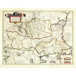
Blaeu, Willem Janszoon (author) Mercator, Gerardus (other authors) Walachia, Servia, Bulgaria, RomaniaCatalog No.: 09285
Eastern Balkans. "Walachia, Servia, Bulgaria, Romania". Orig. copperplate engraving after G. Mercator's map of the region. Published by W. J. Blaeu, 1635. Orig. old colouring. 38,5:50,5 cm.
5 800,00 KčFor sale -
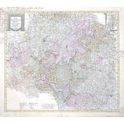
Probst, Johann Michael Der Fraenkische KreisCatalog No.: 09279
Bayern. Franken. "Der Fraenkische Kreis. Nach seiner dermaligen Länder Eintheilung". Altkol. kupferstich Karte bei J. M. Probst, Augsburg, 1789. Gest. von J. G. Probst. Mit dekorative Titelkart., kl. Nebenkarte (9:7 cm), Meilenanzeiger und Erklärungen. 50:57 cm.
5 200,00 KčFor sale -
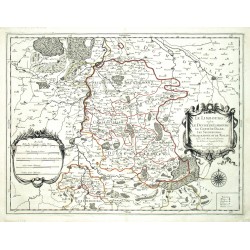
Sanson, Nicolas Le Limbourg, ou sont Le Duche de Limbourg,...Catalog No.: 09267
Limburg. "Le Limbourg, ou sont ...". Orig. copperplate engraving, N. Sanson. Published by A.-H. Jaillot in Paris, 1674. Orig. old colouring. 43:57,5 cm
4 200,00 KčFor sale -
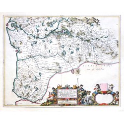
Blaeu, Joan (author) Pont, Timothy (other authors) Praefectura Kircubriensis, quae...Catalog No.: 09264
Scotland. Kirkcudbrightshire. "Praefectura Kircubriensis, quae Gallovidiae maxime orientalis pars est. The Steuartrie of Kircubright, Orig. copperplate engraving after T. Pont's map. Published by J. Blaeu in Amsterdam, 1654. Original old colouring. 42,5:54,5 cm.
6 000,00 KčFor sale -
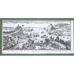
La Citta e il Porto di Lerice nella...Catalog No.: 09234
"La Citta e il Porto di Lerice nella Riviera di Levante dello Stato di Genova". Orig. copper engraving, ca. 1700. With many figures, ships and Lerici Castello in the foreground. 17:36,5 cm (6 3/4 x 14 1/2 inch.).
3 800,00 KčFor sale -
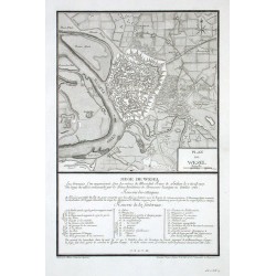
Therbu Plan de WeselCatalog No.: 09222
"Plan de Wesel". Orig. Kupferstich nach Therbu- gest. von G. J. Cöntgen. Mainz, 1763. Befestigungsplan von Wesel mit Fr. Erklärungen unten ("Siege de Wesel"). 36:23,5 cm.
1 800,00 KčFor sale -
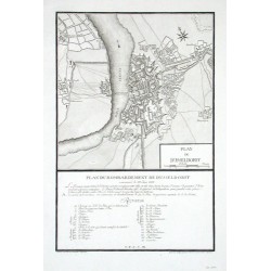
Therbu Plan de DusseldorffCatalog No.: 09219
"Plan de Dusseldorff". Orig. Kupferstich nach Therbu- gest. von G. J. Cöntgen. Mainz, 1763. Befestigungsplan vom bombardierten Düsseldorf mit Fr. Erklärungen unten ("Plan du bombardement de Dusseldorf commence le 28. Juin 1758"). 35,5:23,5 cm.
2 400,00 KčFor sale -
Merian, Matthäus Franckfurt. SachsenhausenCatalog No.: 09213
"Franckfurt. Sachsenhausen". Orig. Kupferstich von M. Merian, um 1640. Mit gest. Titel. 24,5:35 cm.
9 000,00 KčFor sale -
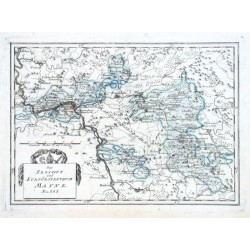
Reilly, F. J. J. von Des Erzstifts und Kurfürstenthums MaynzCatalog No.: 09210
"Des Erzstifts und Kurfürstenthums Maynz. Nro. 223.". Altkol. Kupf.-Karte von F. J. J. von Reilly, (1791). Mit ornament. Titelkart. und Meillenanzeiger. 21,5:30 cm.
3 500,00 KčFor sale -
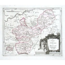
Reilly, F. J. J. von Die Staaten des Fürsten zu Nassau UsingenCatalog No.: 09207
"Die Staaten des Fürsten zu Nassau Usingen. Nro. 256.". Altkol. Kupf.-Karte von F. J. J. von Reilly, (1791). Mit dekorative Titelkart., kl. Nebenkarte und Meillenanzeiger. 22:27,5 cm.
4 000,00 KčFor sale -
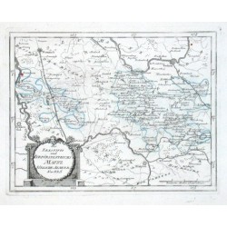
Reilly, F. J. J. von Des Erzstifts und Kurfürstenthums Maynz...Catalog No.: 09204
"Des Erzstifts und Kurfürstenthums Maynz Südliche Aemter. Nro. 225.". Grenzkol. Kupf.-Karte von F. J. J. von Reilly, (1791). Mit ornament. Titelkart. und Meillenanzeiger. 21,5:28 cm.
3 500,00 KčFor sale -
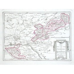
Reilly, F. J. J. von Die Staaten der Fürsten und Grafen von...Catalog No.: 09201
"Die Staaten der Fürsten und Grafen von Ysenburg zu Birstein, Büdingen, Waechtersbach und Meerholz. Nro. 259.". Altkol. Kupf.-Karte von F. J. J. von Reilly, (1791). Mit ornament. Titelkart. und Meillenanzeiger. 21,5:32 cm.
4 000,00 KčFor sale -
Reilly, F. J. J. von Die Staaten des Fürsten zu Nassau...Catalog No.: 09198
"Die Staaten des Fürsten zu Nassau Weilburg. Die Ländereyen des Freyherrn von Riedesel. Nro. 257.". Altkol. Kupf.-Karten von F. J. J. von Reilly, (1791). Mit 2 ornament. Titelkart., 4 Nebenkarten und 2 Meillenanzeiger. 21,5:32 cm.
4 000,00 KčFor sale -
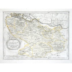
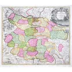
Reilly, F. J. J. von Des Fürstenthums Lüneburg Nördliche AemterCatalog No.: 09195
"Des Fürstenthums Lüneburg Nördliche Aemter. Nro. 311.". Grenzkol. Kupf.-Karte von F. J. J. von Reilly, (1791). Mit dekorative Titelkart. und Meillenanzeiger. 25:34,5 cm.
2 500,00 KčFor sale -
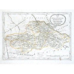
Reilly, F. J. J. von Des Fürstenthums Lüneburg Oestliche AemterCatalog No.: 09192
"Des Fürstenthums Lüneburg Oestliche Aemter. Nro. 312.". Grenzkol. Kupf.-Karte von F. J. J. von Reilly, (1791). Mit dekorative Titelkart. und Meillenanzeiger. 22,5:32 cm.
2 500,00 KčFor sale -
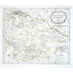
Reilly, F. J. J. von Das Fürstenthum Lüneburg oder CelleCatalog No.: 09189
"Das Fürstenthum Lüneburg oder Celle. Nro. 310.". Grenzkol. Kupf.-Karte von F. J. J. von Reilly, (1791). Mit dekorative Titelkart. und Meillenanzeiger. 21,5:30,5 cm.
2 500,00 KčFor sale -
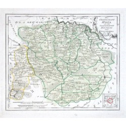
Reilly, F. J. J. von Die Grafschaft HoyaCatalog No.: 09183
"Die Grafschaft Hoya mit den Grafschaften Die Pholz und Spiegelberg. Nro. 289.". Altkol. Kupf.-Karte von F. J. J. von Reilly, (1791). Mit ornament. Titelkart., kl. Nebenkarte und Meillenanzeiger. 24:28,5 cm.
2 700,00 KčFor sale -
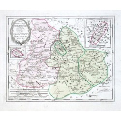
Reilly, F. J. J. von Des Hochstifts Osnabrück südliche AemterCatalog No.: 09177
"Des Hochstifts Osnabrück südliche Aemter mit der Grafschaft Teckelenburg. Nro. 279.". Altkol. Kupf.-Karte von F. J. J. von Reilly, (1791). Mit ornament. Titelkart., 2 Nebenkarten und Meillenanzeiger. 23:29 cm.
3 200,00 KčFor sale -
Seutter, Matthäus Braunschweig - Ducatus BrunsuicensisCatalog No.: 09105
Braunschweig. "Ducatus Brunsuicensis juxta tres suos Principatus Calenbergic ... et Grubenhagens ... ac Guelperhbitanum ... accurate distinctus". Orig. copper-emgraving. Published by M. Seutter, Augsburg, ca. 1730. With great figure title-cartouche with 9...
4 200,00 KčFor sale -
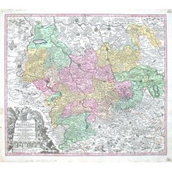
Homann, Johann Baptist Ducatus BrunsuicensisCatalog No.: 09102
"Ducatus Brunsuicensis in tres Pricipatus Calenbergicum ..., Grubenhag & Gulepherbitanum ... divisi". Orig. copper-emgraving. Published by J. B. Homann, Nürnberg, ca. 1720. With great figure title-cartouche with 9 coats-of-arms and with many...
4 500,00 KčFor sale -
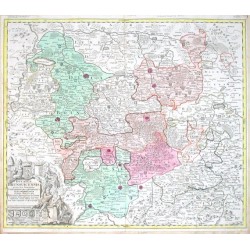
Homann, Johann Baptist Ducatus Luneburgici et Comitatus...Catalog No.: 09099
"Ducatus Luneburgici et Comitatus Dannebergensis accurata Descriptio". Orig. copper-engraving published by J. B. Homann, Nürnberg, ca. 1710. With great figure title-cartouche with a coat-of arms and the scale of map. 48,5:57,5 cm (19 x 22 3/4...
4 800,00 KčFor sale -
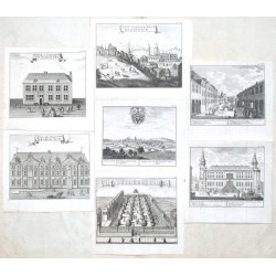
Amusemens des eaux d'Aix-la-ChapelleCatalog No.: 09096
"Profil de la Ville d'Aix la chapelle. Gezigt van de Keyserlyke Stad Aken" (12:14,5 cm), "Vue de la Fontaine et de la Place d'Aix la Chapelle. Gezigt van de warme Fontein en Plaats van Aken" (12:14,5 cm), "Bains des Seigneurs. Heeren Bad" (13:16...
8 000,00 KčFor sale -
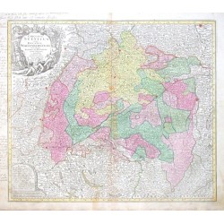
Lotter, Tobias Conrad Circulus Suevicus in quo Ducatus...Catalog No.: 09090
"Circulus Suevicus in quo Ducatus Wirtenbergensis cum reliquis Statibus et Provinciis curate designatus proponitur ...". Altkol. Kupf.-Karte von T. C. Lotter (1717-1777), Augsburg, um 1760. Mit fig. Titelkartusche oben links und Kartusche mit...
6 000,00 KčFor sale -
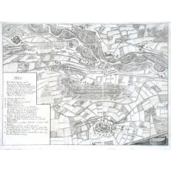
Merian, Matthäus Plan De la Batille de CasaneCatalog No.: 09081
"Plan De la Batille de Casane ... 1705". Orig. copper-engraving from Merian's Theatrum Europaeum, 1718. With great descriptive title-cartouche to the left and another cartouche with the scale of map ("Eschelle de deux Mile Ditalie") in lower...
4 500,00 KčFor sale -
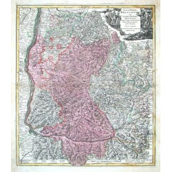
Seutter, Matthäus Breisgau - Accurata Delineatio BrisgoviaeCatalog No.: 08934
Breisgau. "Accurata Delineatio Brisgoviae". Orig. copper-engraving published by M. Seutter, ca. 1730. With great figure title cartouche and explanatory notes at the bottom of the map. 58,5:50 cm (23 x 19 3/4 inch.).
4 800,00 KčFor sale -
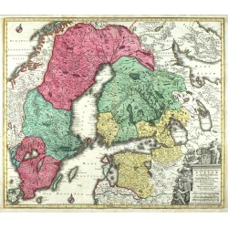
Lotter, Tobias Conrad Nova Mappa Geographica Sueciae ac Gothiae...Catalog No.: 08907
Sweden, Finland, St. Petersburg, Estonia. "Nova Mappa Geographica Sueciae ac Gothiae Regna ut et Finlandiae ...". Orig. copperplate engraving, T. C. Lotter, ca. 1750. Orig. old colouring. With heraldical title cartouche. 50:58 cm.
6 500,00 KčFor sale -
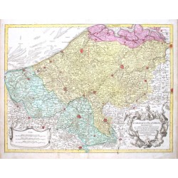
de L'Isle, Gerard Comitatus Flandriae descriptioCatalog No.: 08904
"Comitatus Flandriae descriptio". Orig. copper-engraving, T. C. Lotter (1717-1777), Augsburg, ca. 1750. Orig. old colouring. With figure title-cartouche and ornamental cartouche with the scale of map ("Scalae"). 49:64,5 cm (19 1/2 x 25 1/2 inch.).
4 500,00 KčFor sale -
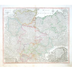
Lotter, Tobias Conrad Saxoniae Inferioris CirculusCatalog No.: 08817
"Saxoniae Inferioris Circulus exhibens Ducatus Brunswic. Lüneburg. Magdeburg. Bremens. Mechlinoburg. et Holsat. nec non Marchionatum Brandenburg: cum aliis Statibus et Principatibus atque Regionibus adjacentibus". Orig. copper-engraving, T. C....
4 000,00 KčFor sale -
Lotter, Georg Friedrich Nouvelle Carte du Cercle de BourgogneCatalog No.: 08793
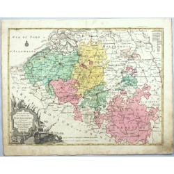
Belgium and Luxemburg. "Nouvelle Carte du Cercle de Bourgogne ou l'on voit toutes les Possessions de la Maison d'Autriche dans les Pays Bas". Orig. copper-engraving, published by Lotter Brothers, Augsburg, ca. 1780. Orig. old colouring. With great decorative...
4 800,00 KčFor sale -
Vogt, Johann Georg GlatzCatalog No.: 08697
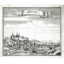
Kłodzko. "Glatz". Orig. Kupferstich nach J. M. Vogt aus seinem Werk "Das jetzt-lebende Königreich Böhmen", Frankfurtu am Main und Leipzig, 1712. Mit Titelkart. 14:16,5 cm.
1 200,00 KčFor sale -
Lotter, Tobias Conrad Archiepiscopatus et Electoratus...Catalog No.: 08679
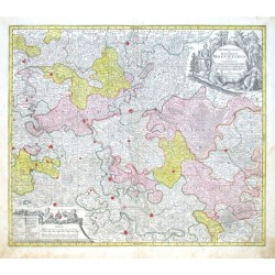
"Archiepiscopatus et Electoratus Moguntinus, ut et Comitatus Uterq. Catimelibocens, Wertheimensis Erpacens ... accuratißime delineatae". Altkol. Kupf.-Kte. von T. C. Lotter (1717-1777), Augsburg, ca. 1750. Mit gr. herald. und figur. Titelkart....
5 200,00 KčFor sale -
Lotter, Tobias Conrad Mappa geographica, continens Electoratum...Catalog No.: 08676
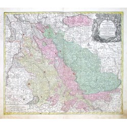
Nordrhein-Westfalen. "Mappa geographica, continens Archiepiscopatum et Electoratum Coloniensem, cum Conterminis Ducatibus Iuliacensi et Montensi, nec non Comitatu Mursano". Altkol. Kupf.-Kte. von T. C. Lotter (1717-1777), Augsburg, ca. 1750. Mit gr. herald. und...
5 400,00 KčFor sale -
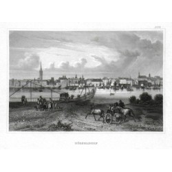
DüsseldorfCatalog No.: 08652
Düsseldorf. "Düsseldorf". Orig. steel-engraving. Published by Bibliogr. Institut in Hildburghausen, ca. 1835. With several figures and horses in the foreground. 10,5:16 cm (4 1/4 x 6 1/4 inch.).
1 500,00 KčFor sale -
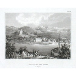
Battina an der Donau in UngarnCatalog No.: 08649
"Battina an der Donau in Ungarn". Orig. steel-engraving. Published by Bibliogr. Institut in Hildburghausen, ca. 1835. With several figures and a ship in the foreground. 10,5:14,5 cm (4 1/4 x 5 3/4 inch.).
600,00 KčFor sale -
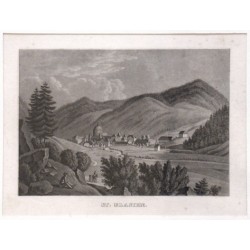
St. BlasienCatalog No.: 08634
"St. Blasien". Gesamtansicht mit der ehem. Benediktinerabtei. Orig. Aquatinta aus Badenia, 1839. 11:15,5 cm.
1 200,00 KčFor sale -
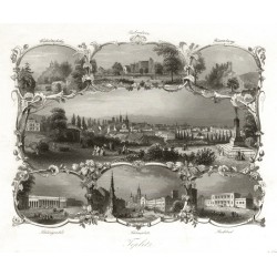
Payne, Albert Henry Teplice - Teplitz, ocelorytina, 1840Catalog No.: 08454
Teplice. "Teplitz". Pův. ocelorytina. Vyd. A. H. Payne, ca. 1840. Celkový pohled na Teplice a 6 teplických pamětihodností ve florální bordúře. 16,5:19 cm.
600,00 KčFor sale -
Pohled na Teplice ze Špitálského vrchuCatalog No.: 08445
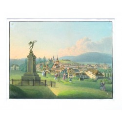
Pohled na Teplice ze Špitálského vrchu (dnes Letná). Anonymní akvarel a kresba tuší, ca. 1840. S již nestojícím pomníkem pruského krále Bedřicha Viléma III. a půvabnými figurkami v popředí. 20,5:27,5 cm.
4 800,00 KčFor sale -
Mercator, Gerardus Slavonia Croatia Bosnia. Dalmat.Catalog No.: 08262
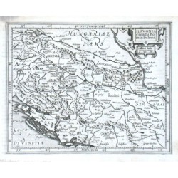
"Slavonia Croatia Bosnia. Dalmat.". Orig. copper-engraving from G. Mercator's Atlas Minor. Published in Amsterdam by J. Hondius, with C. Claesz. and Jan Jansz., 1607. With ornamental title-cartouche with the scale of map ("Milliaria Italica")....
2 100,00 KčFor sale -
Ortelius, Abraham Hungary - HungariaCatalog No.: 08259
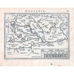
Hungary. "Hungaria". Orig. copper-engraving from the French edition of A. Ortelius' Epitome. Published in Antwerpen by J. B. Vrienst, 1602. With decorative title-cartouche with the scale of map ("Scala milliarium"). 7,5:11 cm (3 x 4 1/4 inch.).
1 800,00 KčFor sale -
Mercator, Gerardus HungariaCatalog No.: 08256
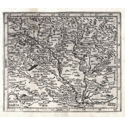
Hungary. "Hungaria". Orig. copperplate engraving after G. Mercator's map of the region. Published in Amsterdam by J. Hondius, with C. Claesz. and Jan Jansz., 1609. With ornamental title-cartouche with the scale of map ("Mill. Germanica"). 15:18 cm .
2 400,00 KčFor sale -
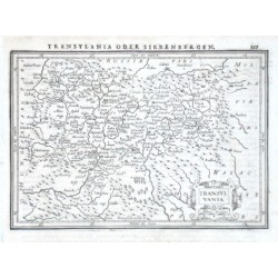
Janssonius, Johannes TransylvaniaCatalog No.: 08253
"Transylvania". Orig. copper-engraving. Published by J. Janssonius in Amsterdam, 1648-51. With ornamental title-cartouche and printed German heading-title ("Transylvania oder Siebenburgen"). 14:20 cm (5 1/2 x 7 3/4 inch.).
1 800,00 KčFor sale -
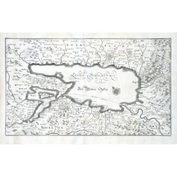
Merian, Matthäus Lacus Bodamicus. Der Boden SeeCatalog No.: 08163
"Lacus Bodamicus. Der Boden See". Orig. copper-engraving, M. Merian, ca. 1650. With engraved title and a wind-rose. 22,5:38,5 cm (8 3/4 x 15 1/4 inch.).
12 000,00 KčFor sale -
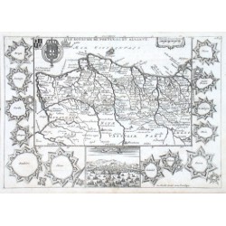
de la Feuille, Daniel Le Royaume de Portugal et AlgarveCatalog No.: 08145
"Le Royaume de Portugal et Algarve". Orig. copper-engraving. Published by D. de la Feuille, 1703. With engraved title, 2 coats-of-arms and ornamental cartouche with the scale of map. The map is surrounded by 13 fortifications plans of main...
2 800,00 KčFor sale -
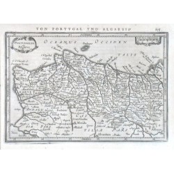
Mercator, Gerardus Portugallia et AlgarveCatalog No.: 08139
"Portugallia et Algarve". Orig. copper-engraving after G. Mercator's map of the region. Published in Amsteradam by J. Janssonius, 1648. With ornamental title-cartouche, decorative cartouche with the scale of map ("Scala leucae Hispanicarum") and...
2 100,00 KčFor sale -
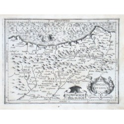
Mercator, Gerardus Biscaia et LegioCatalog No.: 08136
"Biscaia et Legio". Orig. copper-engraving after G. Mercator's map of the region. Published by J. Hondius, C. Claesz. and J. Jansz. in Amsterdam, 1607. With ornamental title-cartouche, another ornamental cartouche with the scale of map ("Leucae...
2 400,00 KčFor sale -
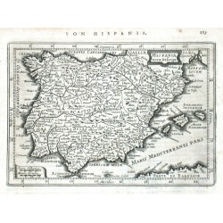
Keere, Pieter van den (Petrus Kaerius) Hispania nova Descript.Catalog No.: 08130
Spain. "Hispania nova Descript.". Orig. copperplate engraving by P. van den Keere (Kaerius). Published in Amsteradam by J. Janssonius, 1648. With ornamental title cartouche. 13,5:19,5 cm.
2 100,00 KčFor sale

