Keine Artikel
Kategorien
-
Alte Landkarten und Stadtansichten
- Afrika
- Amerika
- Asien und Australien
- Atlases
-
Europa
-
Belgien, Niederlande, Luxemburg
- Amsterdam
- Antwerpen
- Belgien und Luxemburg
- Bergen op Zoom
- Blokzijl
- Bommenede
- Brabant
- Brugge
- Brüssel
- Charleroi
- Delft
- Den Haag
- Dinant
- Dordrecht
- Elburg
- Flandern
- Fort Rammekens
- Friesland
- Friesland und Groningen
- Gelderland
- Geraardsbergen
- Grave
- Groningen
- Hainaut
- Harderwijk
- Harlingen
- Holland
- Hulst
- Huy
- Kortryk
- Lier
- Limbourg
- Limburg
- Löwen
- Lüttich
- Luxemburg
- Maastricht
- Mechelen
- Middelburg
- Mons
- Namur
- Niederlande
- Niederlande und Belgien
- Nijmegen
- Ostende
- Overijssel
- Rotterdam
- Spa
- Stavoren
- Tiel
- Utrecht
- Veere
- Veurne
- Ypern
- Zaltbommel
- Zeeland
- Zieriksee
- Zierikzee
- Zutphen
- Zype
-
Böhmen, Mähren und Schlesien
- Arnau
- Beraun
- Böhmen
- Brandýs nad Labem
- Branná (okr. Šumperk)
- Brodce (okr. Mladá Boleslav)
- Broumov
- Brünn
- Bürglitz
- Čáslav
- Čelákovice
- Český Krumlov
- Cheb
- Chlumec nad Cidlinou
- Chomutov
- Děčín
- Dolní Olešnice - Nové Zámky
- Dvůr Králové nad Labem
- Františkovy Lázně
- Frýdlant
- Graupen
- Hassenstein
- Házmburk
- Herrnskretschen
- Hohenelbe
- Hradec Králové
- Jáchymov
- Jaromirsch
- Jihlava
- Jižní Čechy
- Kamaick
- Karlsbad
- Karlstein
- Kolín
- Kostelec nad Labem
- Krkonoše
- Kunětická Hora
- Kuttenberg
- Kyšperk
- Laun
- Lednice
- Liberec
- Libochovany
- Litoměřice
- Litoměřicko
- Litomyšl
- Lobositz
- Loket
- Lysá nad Labem
- Mähren
- Marienbad
- Melnik
- Mladá Boleslav
- Mladoboleslavsko
- Most
- Náchod
- Neuhaus
- Nimburg
- Okoř
- Olmütz
- Ostrov nad Ohří
- Pardubice
- Plzeň
- Podiebrad
- Polná
- Prácheňsko
- Prag
- Przelautsch
- Rabí
- Rakovnicko
- Rakovník
- Roudnice nad Labem
- Rožmberk
- Rožnov pod Radhoštěm
- Rychmburk
- Schlan
- Schwamberg
- Sedlec
- Smečna
- Smirschitz
- Šumava
- Tábor
- Teplá
- Teplice
- Theresienstadt
- Třeboň
- Týnec nad Labem
- Uničov
- Valdštejn
- Vinec
- Vrabinec
- Vyšší Brod
- Wegstädtl
- Zákupy
- Žampach (zámek)
- Želiv
- Žireč
- Žleb
- Znojmo
- Zvíkov
- Deutschland
- Donau
- Europa (Kontinent)
-
Frankreich
- Albi
- Anjou
- Artois
- Bar-le-Duc
- Berry
- Blois
- Bourbourg
- Bresse
- Burgund-Freigrafschaft
- Cambrai
- Cassel
- Château de Lichtenberg
- Chaumont
- Compiegne und Noyon
- Dauphiné
- Département Tarn
- Elsass
- Gascogne
- Gâstinais and Senonais
- Gravelines
- Hauts-de-France
- Ile de France
- Korsika
- La Bassée - Hesdin
- Languedoc
- Lille
- Limoges
- Lothringen
- Lyon
- Maine
- Marseille
- Metz
- Montmélian
- Mülhausen
- Nancy
- Nice
- Normandie
- Paris
- Perche
- Picardie
- Poitou
- Provence
- Re und Oleron
- Reims - Rethel
- Saint-Omer
- Saintonge und Aunis
- Savoyen
- Strassburg
- Vexin
- Griechenland, Mittelmeer
-
Grossbritannien und Irland
- Bedford und Buckinghamshire
- Berkshire und Hampshire
- Cambridgeshire
- Cornwall
- Cumberland
- Denbigh und Flint
- Derbyshire
- Devon
- Dorset
- Durham (Grafschaft)
- England
- Essex
- Gloucestershire
- Großbritannien und Irland
- Herefordshire
- Hertfordshire
- Hertfordshire and Middlesex
- Huntingdonshire
- Irland
- Isle of Wight
- Kent
- Leicestershire
- Lincolnshire
- London
- Middlesex
- Nordengland
- Nordostengland
- Nordwestengland
- Norfolk
- Northampton
- Northumberland
- Nottinghamshire
- Oxfordshire
- Schottland
- Shropshire und Staffordshire
- Somerset
- Staffordshire
- Südostengland
- Südwestengland
- Surrey
- Sussex
- Wales
- Westmorland
- Wiltshire
- Worcestershire und Warwickshire
- Yorkshire
-
Italien
- Abruzzen
- Ancona
- Apulien (Puglia)
- Arcevia
- Bari und Basilikata
- Bergamo
- Bologna
- Brescia
- Brescia und Crema
- Cadore
- Cagliari
- Caiazzo
- Capitanata
- Carmagnola
- Catania
- Civitavecchia
- Crema
- Cremona
- Cuneo
- Elba
- Emilia Romagna
- Faenza
- Fano
- Ferrara
- Florenz
- Fondi
- Friaul
- Gaeta
- Gallipoli
- Genua
- Ischia
- Italien
- Kalabrien
- Kampanien
- Lazio
- Lerici
- Ligurien (Italienische Riviera)
- Livorno
- Lombardei
- Loreto
- Lucca
- Mailand
- Mantua
- Mantua
- Marche (Ancona)
- Meran
- Messina
- Mirandola
- Mittelitalien
- Modena
- Molise
- Monferrato
- Neapel
- Netuno
- Nocera Umbra
- Norditalien
- Orvieto
- Orvieto und Loreto
- Otranto
- Padua
- Palermo
- Parma
- Pavia
- Perugia
- Pesaro
- Piacenza
- Piemont
- Pinerolo
- Piombino
- Pisa
- Po
- Pozzuoli
- Reggio di Calabria
- Reggio Emilia
- Rimini
- Rom
- Rovigo
- San Marino
- Sardinien
- Siena
- Sizilien
- Sizilien und Malta
- Sizilien und Sardinien
- Spoleto
- Süditalien
- Sulmona
- Taranto
- Terracina
- Tirol
- Tivoli
- Tortona
- Toskana
- Trapani
- Trentino
- Trentino-Alto Adige / Südtirol
- Treviso
- Turin
- Udine
- Umbria
- Urbino
- Velletri
- Venedig
- Vercelli
- Verona
- Vicenza
- Viterbo
- Labe
- Mitteleuropa
- Mittelmeer
- Monaco
- Österreich
- Polen, Schlesien, Rußland, Blatikum
- Rhein
- Schweiz
- Skandinavien und Island
- Spanien und Portugal
- Südost- und Osteuropa, Balkan
-
Belgien, Niederlande, Luxemburg
- Inseln (Sonderkatalog)
- Welt, Ozeane, Pole und Sternbildkarten
-
Bücher
- 17., 18. a 19. století - Bohemika, Moravika, České národní obrození
- 17., 18. und 19. Jhdt. - Literatur, Illustrierte etc. - Ausland
- 20. Jhdt. - Literatur, Poesie, Pressendrucke etc. - Ausland
- 20. Jhdt. - Literatur, Poesie, Pressendrucke, Buchbinderei etc. - Tschechisch
- Alte Drucke (15. - 16. Jahrhundert)
- Bildende Kunst und Architektur
- Geschichte und Recht
- Kinder- und Jugendbücher
- Kulturgeschichte, Varia
- Natur und Naturwissenschaften
- Philosophie, Theologie, Pädagogik, Ökonomie, Soziologie
- Topographie, Reisen und Geographie
-
Graphik und Zeichnungen
- Alte Graphik, Zeichnungen und dekorative
- Alte Meistergrafik
- Devotionalien und kleine Gebrauchsgrafiken (Andachtsbilder, Glückwünsche usw.)
- Europeische moderne Kunst (Graphik, Ex-libris, Zeichnungen)
- Japanische Holzschnitte
-
Tschechische Kunst des 20. Jhdt. (Graphik, Ex-libris, Zeichnungen)
- Bouda, Cyril (1901-1984)
- Fischerová-Kvěchová, Marie (1892-1984)
- Hodek, Josef mladší (1888-1973)
- Holler, Josef (1903-1982)
- Jiřincová, Ludmila (1912-1994)
- Konůpek, Jan (1883-1950)
- Lhoták, Kamil (1912-1990)
- Obrátil, Karel Jaroslav
- Rambousek, Jan (1895-1976)
- Seydl, Zdenek (1916-1978)
- Stretti, Viktor (1878-1957)
- Švabinský, Max (1873-1962)
- Váchal, Josef (1884-1969)
- Vondrouš, Jan Charles (1884-1970)
- Varia
Liste der Werke von Autor: Keere, Pieter van den (Petrus Kaerius)
Pieter van den Keere (lateinisch: Petrus Kaerius; 1571 in Gent - ca. 1646) war ein flämischer Kartograf, Kupferstecher und Verleger.
-
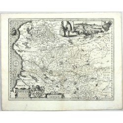
Keere, Pieter van den (Petrus Kaerius) (Autor) Surhon, Jean (Andere Autoren) Artesia DescriptioBestell-Nr .: 00230
Artois. "Artesia Descriptio". Orig. Kupferstich nach J. Surhons Karte. P. van den Keere, Amsterdem, 1617. Mit ornament. Titelkart. 37:48 cm.
6 500,00 KčZu verkaufen -
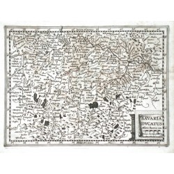
Keere, Pieter van den (Petrus Kaerius) Bavaria DucatusBestell-Nr .: 05619
Bayern. "Bavaria Ducatus". Orig. Kupferstich Karte von P. van den Keere bei J. Janssonius van Waesbergen, 1673. Mit ornament. Titelkart. 18,5:25,5 cm.
1 800,00 KčZu verkaufen -
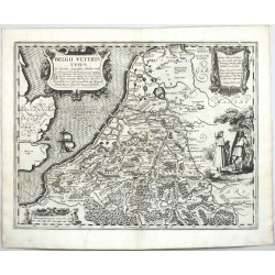
Keere, Pieter van den (Petrus Kaerius) (Autor) Ortelius, Abraham (Andere Autoren) Belgii Veteris TypusBestell-Nr .: 00222
Benelux. "Belgii Veteris Typus". Orig. Kupferstich Karte nach A. Ortelius. Von und bei P. van den Keere, Amsterdam, 1617. Mit gr. ornament. Titelkart. 37,5:49 cm.
8 000,00 KčZu verkaufen -
Hondius, Henricus (Autor) Keere, Pieter van den (Petrus Kaerius) (Andere Autoren) Belgisch FlandernBestell-Nr .: 25420
Belgisch Flandern. "Habes hic Novam & accuratissimam descriptionem tractus illius Flandriae per que superioribus ...". Orig. Kupferstich Karte bei H. Hondius, Amsterdam, 1630. Gestochen von P. Kaerius. 37:51,5 cm.
7 000,00 KčZu verkaufen -
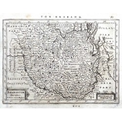
Keere, Pieter van den (Petrus Kaerius) Brabantiae DucatusBestell-Nr .: 20589
Brabant. "Brabantiae Ducatus". Orig. Kupferstich Karte von P. Kaerius (van der Keere). Bei J. Janssonius, Amsterdam, 1648-51. Mit ornament. Titelkart. 15:20,5 cm.
1 600,00 KčZu verkaufen -
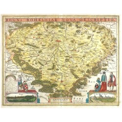
Keere, Pieter van den (Petrus Kaerius) Čechy - Kaerius - Regni Bohemiae nova...Bestell-Nr .: 26434
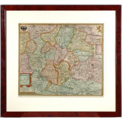
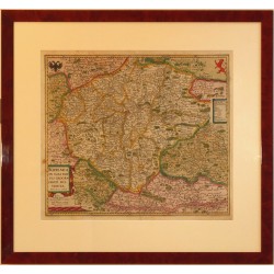
Čechy. "Regni Bohemiae nova descriptio". Pův., staře kolorovaná mědirytina, P. Kaerius (van den Keere). Vydal E. Cloppenburg v Amsterdamu, (1642). S titulní lištou nad mapou. 38,5:50 cm
45 000,00 KčZu verkaufen -
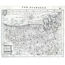
Keere, Pieter van den (Petrus Kaerius) Comitatus Flandriae Nova TabulaBestell-Nr .: 20586
Flandern. "Comitatus Flandriae Nova Tabula". Orig. Kupferstich Karte P. van der Keere. Bei J. Janssonius, Amsterdam, 1648-51. Mit ornament. Titelkart. (mit "Milliaria Germanica"). 15,5:20,5 cm.
1 800,00 KčZu verkaufen -
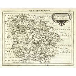
Mercator, Gerardus (Autor) Keere, Pieter van den (Petrus Kaerius) (Andere Autoren) Comitatus HerefordiensisBestell-Nr .: 05472
Herefordshire. "Comitatus Herefordiensis ... Kaerius Caela.". Orig. copperplate engraving, P. van den Keere from Mercator's Atlas Minor published in Amsterdam by J. Janssonius, 1648. 15,5:21 cm.
1 800,00 KčZu verkaufen -
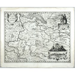
Keere, Pieter van den (Petrus Kaerius) Comitatus ZutphaniaBestell-Nr .: 00223
Zutphen. "Comitatus Zutphania". Orig. Kupferstich Karte, P. van den Keere, Amsterdem, 1617. Mit dekorative Titelkart. 37,5:49 cm.
7 500,00 KčZu verkaufen -
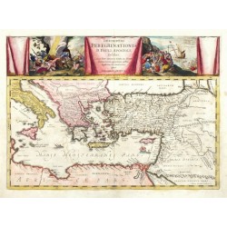
Ortelius, Abraham (Autor) Keere, Pieter van den (Petrus Kaerius) (Andere Autoren) Descriptio Peregrinationis D. Pauli, ApostoliBestell-Nr .: 24588
Östliches Mittelmeer - Missionsreisen des Paulus. "Descriptio Peregrinationis D. Pauli, Apostoli". Orig. copperplate engraving after A. Ortelius map of the region. Published by J. Janssonius in Amsterdam, 1652 or later. Engraved by P. van den Keere. Orig. old colouring. 36,5:51 cm.
15 000,00 KčZu verkaufen -
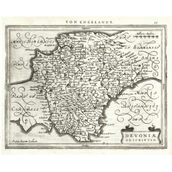
Mercator, Gerardus (Autor) Keere, Pieter van den (Petrus Kaerius) (Andere Autoren) Devoniae DescriptioBestell-Nr .: 05460
Devon. "Devoniae Descriptio. Petrus Kaerius Caelavit". Orig. copperplate engraving, P. van den Keere from Mercator's Atlas Minor published in Amsterdam by J. Janssonius, 1648. 16:21 cm.
1 800,00 KčZu verkaufen -
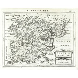
Mercator, Gerardus (Autor) Keere, Pieter van den (Petrus Kaerius) (Andere Autoren) Essexiae DescriptioBestell-Nr .: 05448
Essex. "Essexiae Descriptio. Pe. Kaerius Caelavit". Orig. copperplate engraving by P. van den Keere from Mercator's Atlas Minor published in Amsterdam by J. Janssonius, 1648. 16:21 cm.
2 100,00 KčZu verkaufen -
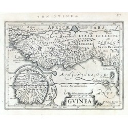
Mercator, Gerardus (Autor) Keere, Pieter van den (Petrus Kaerius) (Andere Autoren) GuineaBestell-Nr .: 21631
Guinea. "Guinea". Orig. copper-engraving from G. Mercator's Atlas Minor. Engraved by P. Kaerius (van den Keere). Published in Amsterdam by J. Janssonius, 1648-51. With ornamental title-cartouche, the scale of map and a cartouche with inset map of Saint Thomas (São Tomé) Island. 14:18,5 cm.
2 500,00 KčZu verkaufen -
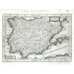
Keere, Pieter van den (Petrus Kaerius) Hispania nova Descript.Bestell-Nr .: 08130
Spanien. "Hispania nova Descript.". Orig. copperplate engraving by P. van den Keere (Kaerius). Published in Amsteradam by J. Janssonius, 1648. With ornamental title cartouche. 13,5:19,5 cm.
2 100,00 KčZu verkaufen -
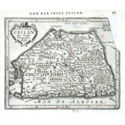
Keere, Pieter van den (Petrus Kaerius) (Autor) Mercator, Gerardus (Andere Autoren) Insula Ceilan quae incolis Tenarisin diciturBestell-Nr .: 13983
Ceylon (Sri Lanka). "Insula Ceilan quae incolis Tenarisin dicitur". Orig. copperplate engraving, P. van den Keere from G. Mercator's Atlas Minor. Published in Amsterdam by J. Janssonius, 1651. With ornamental title cartouche. 14,5:18,5 cm.
3 200,00 KčZu verkaufen -
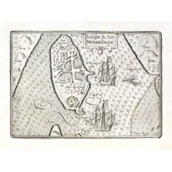
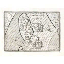
Keere, Pieter van den (Petrus Kaerius) Insulae & Ars MosambiqueBestell-Nr .: 18594
Mosambikinsel (Mosambik)."Insulae & Ars Mosambique". Orig. copper-engraving by P. Kaerius. Published by C. J. Visscher in Amsterdam, 1649 (in Tabulae Geographicae Contrare). With ornamental title-cartouche, 2 ships and a boat. 9:12,5 cm.
2 100,00 KčZu verkaufen -
Keere, Pieter van den (Petrus Kaerius) Insulae & Ars MosambiqueBestell-Nr .: 18597
Mosambikinsel."Insulae & Ars Mosambique". Orig. copper-engraving by P. Kaerius. Published by C. J. Visscher in Amsterdam, 1649 (in Tabulae Geographicae Contrare). With ornamental title-cartouche, 2 ships and a boat. 9:12,5 cm.
2 100,00 KčZu verkaufen -
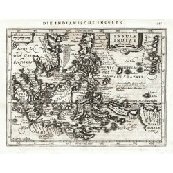
Keere, Pieter van den (Petrus Kaerius) (Autor) Mercator, Gerardus (Andere Autoren) Insulae Indiae orientalisBestell-Nr .: 25534
Südostasien. "Insulae Indiae Orientalis". Orig. copperplate engraving from Mercator's Atlas Minor. Published by J. Janssonius in Amsterdam, 1648. With ornamental title cartouche. 14,5:19,5 cm.
9 000,00 KčZu verkaufen -
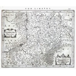
Keere, Pieter van den (Petrus Kaerius) Limburg DucatusBestell-Nr .: 20595
Limburg. "Limburg Ducatus". Orig. Kupferstich Karte P. Kaerius (van der Keere). Bei J. Janssonius, Amsterdam, 1648-51. Mit ornament. Titelkart.. 16:20 cm.
1 800,00 KčZu verkaufen -
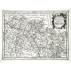
Keere, Pieter van den (Petrus Kaerius) Loediensis Dioecesis typusBestell-Nr .: 05640
Lüttich. "Loediensis Dioecesis typus". Orig. Kupferstich Karte von P. van den Keere bei J. Janssonius van Waesbergen in Amsterdam, 1673. Mit ornament. Titelkart. 18,5:25 cm.
2 100,00 KčZu verkaufen -
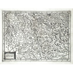
Keere, Pieter van den (Petrus Kaerius) Lorraine vers le midyBestell-Nr .: 05637
Lothringen. "Lorraine vers le midy". Orig. Kupferstich Karte von P. van den Keere bei J. Janssonius van Waesbergen in Amsterdam, 1673. Mit ornament. Titelkart. 18:24,5 cm.
1 500,00 KčZu verkaufen -
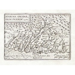
Visscher, Claes Jansz. (Autor) Keere, Pieter van den (Petrus Kaerius) (Andere Autoren) Marcha Anconae olim Picenum. 1572Bestell-Nr .: 21327
Marche (Ancona). "Marcha Anconae olim Picenum. 1572". Orig. copperplate engraving. Published by C. J. Visscher in Amsterdam, 1649 (in Tabulae Geographicae Contractae). 9:12,5 cm.
2 100,00 KčZu verkaufen -
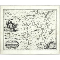
Keere, Pieter van den (Petrus Kaerius) MechliniaBestell-Nr .: 00226
Mechelen. "Mechlinia". Orig. Kupferstich Karte, P. van den Keere, Amsterdem, 1617. Mit Titelkart mit einem Trachtenpaar. 37,5:48,5 cm.
10 800,00 KčZu verkaufen -
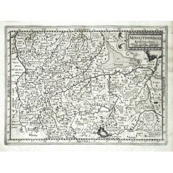
Keere, Pieter van den (Petrus Kaerius) Monasteriensis EpiscopatusBestell-Nr .: 05631
Münster. "Monasteriensis Episcopatus". Orig. Kupferstich Karte von P. Kaerius bei J. Janssonius van Waesbergen, 1673. Mit ornament. Titelkart. 18,5:25,5 cm.
2 100,00 KčZu verkaufen -
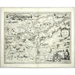
Keere, Pieter van den (Petrus Kaerius) (Autor) Surhon, Jean (Andere Autoren) Namurcum ComitatusBestell-Nr .: 00225
Namur. "Namurcum Comitatus". Orig. Kupferstich nach J. Surhons Karte. P. van den Keere, Amsterdem, 1617. Mit dekorative Titelkart. 38:49,5 cm.
9 000,00 KčZu verkaufen -
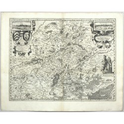
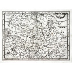
Keere, Pieter van den (Petrus Kaerius) (Autor) Surhon, Jean (Andere Autoren) Nobilis. Hannoniae Com. DescriptioBestell-Nr .: 00165
Hainaut. "Nobilis. Hannoniae Com. Descriptio". Orig. Kupferstich Karte nach J. Surhon. Von und bei P. van den Keere, Amsterdam, 1617. 37:48 cm.
10 800,00 KčZu verkaufen -
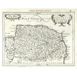
Mercator, Gerardus (Autor) Keere, Pieter van den (Petrus Kaerius) (Andere Autoren) Norfolciae DescriptioBestell-Nr .: 05439
Norfolk. "Norfolciae Descriptio ... Kaerius Caelavit". Orig. copperplate engraving, P. van den Keere from Mercator's Atlas Minor published in Amsterdam by J. Janssonius, 1648. 16:21 cm.
1 800,00 KčZu verkaufen -
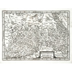
Keere, Pieter van den (Petrus Kaerius) Palatinatus BavariaeBestell-Nr .: 05622
Oberpfalz (Bayern). "Palatinatus Bavariae". Orig. Kupferstich Karte von P. van den Keere bei J. Janssonius van Waesbergen, 1673. Mit ornament. Titelkart. 18,5:25,5 cm.
1 800,00 KčZu verkaufen -
Keere, Pieter van den (Petrus Kaerius) Palatinatus RheniBestell-Nr .: 05625
Baden-Württemberg. "Palatinatus Rheni". Orig. copperplate engraving by P. van den Keere. Published by J. Janssonius van Waesbergen in Amsterdam, 1673. With ornamental title cartouche. 18,5:25 cm.
2 100,00 KčZu verkaufen -
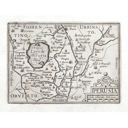
Visscher, Claes Jansz. (Autor) Keere, Pieter van den (Petrus Kaerius) (Andere Autoren) PerusiaBestell-Nr .: 21330
Pergia. "Perusia". Orig. copperplate engraving. Published by C. J. Visscher in Amsterdam, 1649 (in Tabulae Geographicae Contractae). 9:12,5 cm.
2 100,00 KčZu verkaufen -
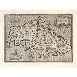
Keere, Pieter van den (Petrus Kaerius) RhodiBestell-Nr .: 18477
Rhodos (Griechenland). "Rhodi". Orig. copper-engraving by P. Kaerius. Published by C. J. Visscher in Amsterdam, 1649 (in Tabulae Geographicae Contrare). With ornamental title-cartouche, another ornamental cartouche with the scale of map...
2 400,00 KčZu verkaufen -
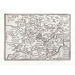
Visscher, Claes Jansz. (Autor) Keere, Pieter van den (Petrus Kaerius) (Andere Autoren) Romanum territoriumBestell-Nr .: 21326
Rom. "Romanum territorium". Orig. copperplate engraving. Published by C. J. Visscher in Amsterdam, 1649 (in Tabulae Geographicae Contractae). 8,5:12,5 cm.
2 100,00 KčZu verkaufen -
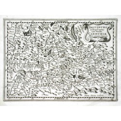
Keere, Pieter van den (Petrus Kaerius) Saltzburg archiepiscopatus cum ducatu...Bestell-Nr .: 05616
Salzburgerland. "Saltzburg archiepiscopatus cum ducatu Carinthiae". Orig. Kupferstich Karte von P. van den Keere bei J. Janssonius van Waesbergen, 1673. Mit ornament. Titelkart. 18,5:25,5 cm.
2 100,00 KčZu verkaufen -
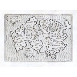
Keere, Pieter van den (Petrus Kaerius) ScioBestell-Nr .: 18483
Chios (Griechenland)."Scio". Orig. copper-engraving. Published by C. J. Visscher in Amsterdam, 1649 (in Tabulae Geographicae Contrare). With ornamental title-cartouche and a sea-creature. 9:12,5 cm.
2 400,00 KčZu verkaufen -
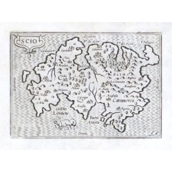
Keere, Pieter van den (Petrus Kaerius) ScioBestell-Nr .: 18486
"Scio". Orig. copper-engraving. Published by C. J. Visscher in Amsterdam, 1649 (in Tabulae Geographicae Contrare). With ornamental title-cartouche and a sea-creature. 9:12,5 cm.
2 400,00 KčZu verkaufen -
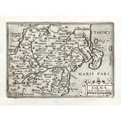
Visscher, Claes Jansz. (Autor) Keere, Pieter van den (Petrus Kaerius) (Andere Autoren) SienaBestell-Nr .: 21328
Siena. "Siena". Orig. copperplate engraving from N. Visscher's "Tabulae Geographicae Contractae". Published in Amsterdam by C. J. Visscher, 1649. 9:12,5 cm.
2 100,00 KčZu verkaufen -
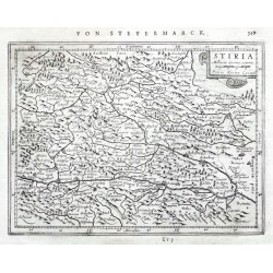
Keere, Pieter van den (Petrus Kaerius) StiriaBestell-Nr .: 20583
Steiermark. "Stiria". Orig. Kupferstich Karte P. van der Keere. Bei J. Janssonius, Amsterdam, 1648-51. Mit ornament. Titelkart. (mit "Milliaria Germa. commu."). 14,5:19,5 cm.
1 600,00 KčZu verkaufen -
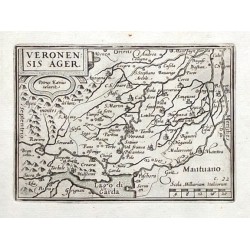
Visscher, Claes Jansz. (Autor) Keere, Pieter van den (Petrus Kaerius) (Andere Autoren) Veronensis AgerBestell-Nr .: 21329
Verona. "Veronensis Ager". Orig. copperplate engraving. Published by C. J. Visscher in Amsterdam, 1649 (in Tabulae Geographicae Contractae). 9:12,5 cm.
2 100,00 KčZu verkaufen -
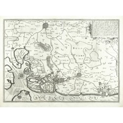
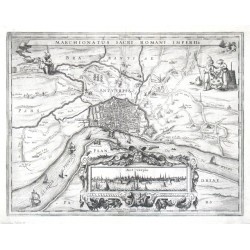
Keere, Pieter van den (Petrus Kaerius) Antwerpen - Marchionatus Sacri Romani ImperiiBestell-Nr .: 00218
Antwerpen. "Marchionatus Sacri Romani Imperii". Stadtplan mit Umgebung, unten eingesetzt in gr. ornament. Kart. Stadtansicht ("Antverpia", 5:20 cm). Orig. Kupferstich bei P. Kaerius, Amsterdanm, 1617 aus seinem Atlas "Germania Inferior". Oben...
-
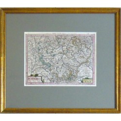
Keere, Pieter van den (Petrus Kaerius) BohemiaBestell-Nr .: 10173
"Bohemia". Orig. copper-engraving by P. Kaerius (van den Keere) from G. Mercator's Atlas published in Amsterdam by J. E. Cloppenburch, 1632. Orig. old colouring. With ornamental title-cartouche, another rnamental cartouche with the scale of map...
-
Keere, Pieter van den (Petrus Kaerius) (Autor) Sadeler, Aegidius (Andere Autoren) Bohemia in suas partes geographicé distinctaBestell-Nr .: 26486
Čechy. "Bohemia in suas partes geographicé distincta". Pův. kolorovaná mědirytina. Podle A. Sadelerovy předlohy ryl P. Kaerius. Vydal J. Janssonius v Amsterdamu, 1630. S ornamentální tit. kartuší. 41:47 cm.
-
Keere, Pieter van den (Petrus Kaerius) (Autor) Sadeler, Aegidius (Andere Autoren) Bohemia in suas partes geographicé distinctaBestell-Nr .: 22741
Čechy. "Bohemia in suas partes geographicé distincta". Pův., staře kol. mědiryt. Ryl P. Kaerius (Pieter van den Keere) podle A. Sadelerovy předlohy. Vydal J. Janssonius v Amsterdamu, 1630. S ornamentální tit. kartuší, vysvětlivkami ("Notarum Explicatio") a českým lvem a moravskou orlicí v horních rozích mapy. 41:47 cm.
-
Keere, Pieter van den (Petrus Kaerius) (Autor) Sadeler, Aegidius (Andere Autoren) Bohemia in suas partes geographicé distinctaBestell-Nr .: 25844
Čechy. "Bohemia in suas partes geographicé distincta". Pův., staře kol. mědirytina. Podle A. Sadelerovy předlohy ryl P. Kaerius. Vydal J. Janssonius v Amsterdamu, 1630. S ornamentální tit. kartuší. 41:47 cm.
-
Keere, Pieter van den (Petrus Kaerius) (Autor) Sadeler, Aegidius (Andere Autoren) Bohemia in suas partes geographicé...Bestell-Nr .: 24277
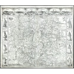
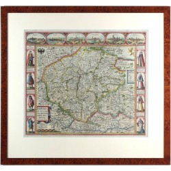
Čechy. "Bohemia in suas partes geographicé distincta ... Anno 1620". Původní mědirytina, P. Kaerius (Pieter van den Keere) podle E. Sadelera. Vydal J. Janssonius v Amsterdamu, 1630. S ornamentální tit. kartuší, Českým lvem a Moravskou orlicí a dekoratvními lištami nahoře a po stranách. 47:56 cm.
-
Keere, Pieter van den (Petrus Kaerius) (Autor) Sadeler, Aegidius (Andere Autoren) Bohemia in suas partes geographicé...Bestell-Nr .: 23541
Čechy. "Bohemia in suas partes geographicé distincta". Pův., staře kol. mědiryt, P. Kaerius (Pieter van den Keere) podle E. Sadelera, 1620. Vydal J. Janssonius v Amsterdamu, 1630. S ornamentální tit. kartuší, Českým lvem a Moravskou orlicí a dekoratvními lištami nahoře a po stranách. 47:56 cm.
-
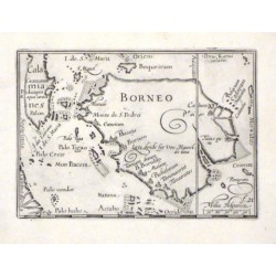
Visscher, Claes Jansz. (Autor) Keere, Pieter van den (Petrus Kaerius) (Andere Autoren) BorneoBestell-Nr .: 10041
"Borneo". Orig. copper-engraving by P. Kaerius (van den Keere), published by C. J. Visscher in Amsterdam, 1649. With engraved title in map and the scale of map ("Millia. Hispanica"). 9:13 cm.
-
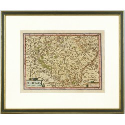
Keere, Pieter van den (Petrus Kaerius) Čechy - Mercator, Kaerius - BohemiaBestell-Nr .: 26517
Čechy. "Bohemia". Původní, staře kol. mědirytina z Mercatorova Atlasu. Ryl. P. Kareius, vyd. J. E. Cloppenburgh v Amsterdamu, 1630. S ornament. titulní kartuší a další kartuší s měřítkem mapy. 18,5:25,5 cm.
-
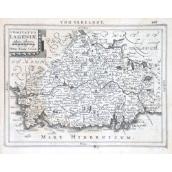
Keere, Pieter van den (Petrus Kaerius) Comitatus LageniaeBestell-Nr .: 04695
"Comitatus Lageniae". Copper-engraving by P. Kaerius published by J. Janssonius, 1648-51. With ornamental title-cartouche and German heading title ("Von Irrlandt") above the map. 15,5:20,5 cm.

