Keine Artikel
Alte Landkarten und Stadtansichten
- Afrika
- Amerika
- Amerika (Kontinent)
- Antillen
- Argentinien
- Bermudainseln
- Brasilien
- Chile
- Florida
- Guyana
- Hawaiiinseln
- Honduras
- Kalifornien
- Kanada
- Kolumbien
- Louisiana
- Magellanstraße
- Mexico
- Mittelamerika und Antillen
- Neuengland
- New York
- Nordamerika
- Nordkaroline
- Panama
- Paraguay
- Pennsylvania
- Peru
- Südamerika
- Uruguay
- Venezuela
- Vereinigte Staaten (USA)
- Alabama
- Arkansas
- Boston
- Connecticut
- Florida
- Georgia
- Illinois
- Iowa
- Kentucky
- Louisiana
- Maine
- Maryland und Delaware
- Massachusetts und Rhode Island
- Michigan
- Mississippi
- Missouri
- New Hampshire und Vermont
- New Jersey
- New York
- Ohio
- Ostküste von USA
- Pennsylvania
- Philadelphia
- Rhode Island
- South Carolina
- Tennessee
- Texas
- Virginia
- Wisconsin
- Virginia
- Asien und Australien
- Asien (Kontinent)
- Australien
- Burma
- China
- Französisch-Polynesien
- Golf von Bengalen
- Indien
- Indien, China, Nepal
- Indischer Ozean
- Indonesien
- Israel / Palästina
- Japan
- Kaspische Meer
- Korea
- Malaysien
- Mikronesien
- Naher Osten
- Neuseeland
- Nordostasien
- Ostasien
- Pakistan
- Philippinnen
- Polynesien
- Sri Lanka (Ceylon)
- Südostasien
- Südwestasien
- Türkei
- Atlases
- Europa
- Belgien, Niederlande, Luxemburg
- Alkmaar
- Amsterdam
- Antwerpen
- Arnhem
- Belgien und Luxemburg
- Bergen op Zoom
- Blokzijl
- Bommenede
- Brabant
- Breda
- Brielle
- Brugge
- Brüssel
- Charleroi
- Delft
- Den Haag
- Dinant
- Doornik
- Dordrecht
- Drenthe
- Drenthe und Overijseel
- Elburg
- Flandern
- Fort Rammekens
- Friesland
- Friesland und Groningen
- Geertruidenberg
- Gelderland
- Geraardsbergen
- Grave
- Groningen
- Haarlem
- Hainaut
- Hannut
- Harderwijk
- Harlingen
- Holland
- Hulst
- Huy
- Kortryk
- Leeuwarden
- Leiden
- Lier
- Limbourg
- Limburg
- Löwen
- Lüttich
- Luxemburg
- Luxemburg (Stadt)
- Maastricht
- Mechelen
- Menin
- Middelburg
- Mons
- Namur
- Niederlande
- Niederlande und Belgien
- Nijmegen
- Ostende
- Overijssel
- Rotterdam
- Ruremonde
- s-Hertogenbosch
- Spa
- Stavoren
- Steenwijk
- Tiel
- Utrecht
- Veere
- Veurne
- Vlissingen
- Ypern
- Zaltbommel
- Zeeland
- Zieriksee
- Zierikzee
- Zutphen
- Zwolle
- Zype
- Böhmen, Mähren, Schlesien und Lausitz
- Adršpach
- Andělská Hora (hrad)
- Arnau
- Aussig
- Bad Liebwerda
- Bechyňsko
- Beraun
- Berounsko
- Berounsko a Plzeňsko
- Bílina
- Blansko
- Blatná
- Böhmen
- Böhmen, Mähren und Schlesien
- Bollechowitz
- Bömisch Aicha
- Borotín
- Bösig
- Boskovice
- Bouzov
- Brandýs nad Labem
- Branná (okr. Šumperk)
- Břeclav
- Březnice
- Brněnsko
- Brněnsko a Uherskohardišťsko
- Brodce (okr. Mladá Boleslav)
- Broumov
- Brtnice
- Brünn
- Budeč (hradiště)
- Budweis
- Bürglitz
- Buštěhrad
- Buzice (tvrz)
- Čáslav
- Čáslavsko
- Čelákovice
- Česká Lípa
- České Švýcarsko
- Český Brod
- Český Krumlov
- Český Šternberk
- Cheb
- Chebsko a Žatecko
- Chlum (okr. Kutná Hora)
- Chlum Svaté Máří
- Chlumec nad Cidlinou
- Chodová Planá
- Chomutov
- Choustníkovo Hradiště (zřícenina hradu)
- Chrudim
- Chrudimsko
- Chrudimsko, Čáslavsko, Kouřimsko
- Děčín
- Dívčí Hrad
- Doksany (okr. Litoměřice)
- Dolní Olešnice - Nové Zámky
- Dolní Životice (okr. Opava)
- Doupov
- Dubí
- Duchcov
- Dvojhradí (Mstišov)
- Dvůr Králové nad Labem
- Eger - und Elbogenland
- Egerberg
- Egerberk (Klášterec nad Ohří)
- Felixburg (Klášterec nad Ohří)
- Františkovy Lázně
- Frauenberg in Böhmen
- Frenštát pod Radhošťem
- Friedrichsthal
- Frýdlant
- Graupen
- Habrovany
- Hartenberg (Hřebeny, okr. Sokolov)
- Hassenstein
- Hauenštejn (Horní hrad, okr. Karlovy Vary)
- Házmburk
- Helfštýn
- Herrnskretschen
- Hlavačov (Hlaváčov, Rakovník)
- Hohenelbe
- Hořice (v Podkrkonoší)
- Hradec Králové
- Hranice na Moravě
- Hrubá Skála
- Hukvaldy
- Jáchymov
- Jankov
- Jánský Vrch
- Jánský Vrch (Javorník)
- Jaromirsch
- Jenstein
- Jeseník
- Jestřebí
- Jezeří
- Jičín
- Jihlava
- Jižní Čechy
- Johannesbad
- Kaceřov (Plzeň-sever)
- Kadaň
- Kamaick
- Karlsbad
- Karlstein
- Kasejovice - Řesanice
- Klabava (Ejpovice, okr. Rokycany)
- Kladno
- Kladruby
- Klatovy
- Kokořín
- Kolín
- Kondrac
- Konojedy (u Litoměřic)
- Konopiště
- Kopidlno (okr. Jičín)
- Kost
- Kostelec nad Labem
- Kostenblatt
- Kouřimsko
- Krakovec
- Králíky
- Královéhradecko
- Krásný Dvůr (okr. Louny)
- Krašov (hrad)
- Kratochvíle (zámek)
- Křečov (okr. Louny)
- Křepenice
- Krkonoše
- Krnov
- Kroměříž
- Krušné hory
- Kuks
- Kumburk
- Kunětická Hora
- Kunžvart (Šumava)
- Kuttenberg
- Kynšperk nad Ohří
- Kynžvart (zámek)
- Kyselka
- Kyšperk
- Lanšperk
- Laun
- Lázně Libverda
- Ledeč nad Sázavou
- Lednice
- Libá (okr. Cheb)
- Libějovice
- Liberec
- Liběšice
- Liblín (okr. Rokycany)
- Libochovany
- Libochovice
- Libštejn
- Lina (Vroutek, okr. Louny)
- Lipnice nad Sázavou
- Litoměřice
- Litoměřicko
- Litomyšl
- Littitz
- Lobositz
- Loket
- Luhačovice
- Lužice
- Lysá nad Labem
- Mähren
- Marienbad
- Melnik
- Mikulov
- Milčany
- Milešov (Velemín)
- Milešovka
- Miletín
- Milíčeves (okr. Jičín)
- Mladá Boleslav
- Mladoboleslavsko
- Mladoboleslavsko a Litoměřicko
- Mnichovo Hradiště
- Most
- Mšec
- Mšeno
- Mühlhausen an der Moldau
- Mürau
- Náchod
- Napajedla
- Návarov
- Nepomuk
- Neuhaus
- Nimburg
- Nové Hrady (okr. Ústí nad Orlicí)
- Nový Bor
- Okoř
- Olmütz
- Olomoucko
- Ondrášov (Moravský Beroun)
- Opava
- Orlík nad Vltavou
- Osek
- Ostrov nad Ohří
- Pardubice
- Patzau
- Pavlov
- Pecka (hrad)
- Pernstein
- Petrohrad (Petršpurk, okr. Louny)
- Písek
- Plaňany
- Plasy
- Plzeň
- Plzeňsko
- Podiebrad
- Polná
- Prachatice
- Prácheňsko
- Prag
- Praha - Cheb
- Praha a okolí
- Prerau
- Přerovsko
- Pressnitz
- Proboštov
- Proseč u Pošné (okr. Pelhřimov)
- Protivín
- Przelautsch
- Pullitz
- Raabstein
- Rabí
- Račice (Vyškov)
- Radim (okr. Kolín)
- Rájec nad Svitavou
- Rajhrad
- Rakovnicko
- Rakovník
- Ronov (okr. Česká Lípa)
- Ronov nad Sázavou
- Rosstein
- Roudnice nad Labem
- Rožmberk nad Vltavou
- Rožnov pod Radhoštěm
- Rudolfov (České Budějovice)
- Rychmburk
- Rychnov nad Kněžnou
- Rýzmburk (hrad)
- Rzeczkowitz
- Schellenberg
- Schlan
- Schreckenstein
- Schwamberg
- Sedlec
- Severní Čechy
- Skuteč
- Slavkov u Brna
- Sloup (hrad)
- Smečna
- Smidary (okr. Hradec Králové)
- Smirschitz
- Sovinec (hrad)
- Šternberk (Ledce)
- Strakonice
- Štramberk
- Šumava
- Šumburk (Šumná)
- Šumperk
- Svatý Jan pod Skalou
- Svojanov (hrad)
- Svojšice
- Tábor
- Táborsko a Českobudějovicko
- Tachov
- Telenice - Varvažov
- Teplá
- Teplice
- Theresienstadt
- Toužetín
- Třebel
- Třeboň
- Trhanov (okr. Domažlice)
- Trosky
- Tuchoraz
- Týn nad Vltavou
- Týnec nad Labem
- Uherské Hradiště
- Újezdec (hrad)
- Uničov
- Úvaly
- Valdštejn
- Valkeřice
- Valtice
- Vartenberk - Stráž pod Ralskem (okr. Česká Lípa)
- Velehrad
- Velhartice
- Velké Meziříčí
- Velké Žernoseky
- Veveří
- Vinec
- Višňová (okr. Liberec)
- Vlastislav
- Vlkava
- Vltava
- Vrabinec
- Vřeskovice
- Východní a Severovýchodní Čechy
- Vysoké Mýto
- Vyšší Brod
- Wegstädtl
- Winterberg
- Žacléř
- Zahájí
- Zákupy
- Žampach (zámek)
- Zámrsk
- Západní Čechy
- Žatec
- Žatecko
- Žebrák a Točník
- Želiv
- Žireč
- Žleb
- Zlenice (Hláska)
- Znojemsko a Jihlavsko
- Znojmo
- Zornstein
- Zvíkov
- Zvířetice
- Deutschland
- Baden-Württemberg
- Bad Mergentheim
- Bad Säckingen
- Bad Teinach-Zavelstein
- Baden-Baden
- Balingen
- Biberach an der Riß
- Böblingen
- Bodensee
- Breisach am Rhein
- Breisgau
- Bretten
- Calw
- Donaueschingen
- Dornhan
- Dornstetten
- Ellwangen
- Esslingen
- Freiburg
- Geislingen an der Steige
- Giengen
- Grafschaft Limpurg
- Heidelberg
- Heilbronn
- Hohenlohe
- Karlsruhe
- Konstanz
- Landshut
- Leutkirch
- Mainau
- Mannheim
- Marbach am Neckar
- Maulburg
- Möckmühl
- Nagold
- Neckarlauf
- Neuenbürg
- Nord-Württemberg
- Oberschwaben
- Offenburg
- Pforzheim
- Philippsburg
- Reutlingen
- Rheinpfalz
- Rottweil
- Schwabenl
- Schwäbisch Gmünd
- Schwäbisch Hall
- Singen
- St. Blasien
- Stuttgart
- Tübingen
- Tuttlingen
- Überlingen
- Ulm
- Vaihingen a. d. Enz
- Wangen im Allgäu
- Weinheim
- Wiesensteig
- Württemberg
- Bayern
- Amberg
- Ansbach
- Aschaffenburg
- Augsburg
- Aurach
- Bad Abbach
- Bamberg
- Bogenberg (Wallfahrtskirche)
- Brettheim
- Burg Rabeneck
- Cham
- Coburg
- Dachau
- Dillingen
- Dinkelsbühl
- Donauwörth
- Eichstätt
- Forchheim
- Franken
- Freising
- Friedberg (Schwaben)
- Füssen
- Gerolzhofen
- Gräfenberg (Oberfranken)
- Günzburg
- Höchstädt an der Donau
- Ingolstadt
- Kelheim
- Kempten
- Kitzingen
- Kulmbach
- Landsberg am Lech
- Lauingen
- Lenggries
- Lichtenau (Mittelfranken)
- Lindau
- Lohr am Main
- Marxheim
- Memmingen
- Mindelheim
- Mühldorf am Inn
- München
- Nabburg
- Natternberg (Schloss)
- Neuburg an der Donau
- Neumarkt in der Oberpfalz
- Neuötting
- Neustadt an der Donau
- Niederaltaich (Kloster)
- Niederbayern
- Nordgau
- Nördlingen
- Nürnberg
- Oberaltaich
- Oberbayern
- Oberpfalz
- Oettingen
- Pappenheim
- Passau
- Pfaffenhofen
- Pöttmes
- Rain am Lech
- Regensburg
- Saal an der Donau
- Schongau
- Schrobenhausen
- Straubing
- Thurnau
- Velden
- Vilshofen an der Donau
- Wackerstein
- Wasserburg am Inn
- Weiden
- Weilheim / links Polling
- Weissenburg in Bayern
- Weltenburg
- Wörth an der Donau
- Würzburg
- Wüstenstein
- Berlin
- Brandenburg
- Bremen
- Hamburg
- Hessen
- Bad Homburg vor der Höhe
- Bad Schwalbach
- Bensheim
- Büdingen
- Darmstadt
- Dillenburg
- Eltville
- Eschwege
- Frankenberg an der Eder
- Frankfurt am Main
- Friedberg
- Fritzlar
- Fulda
- Giessen
- Hanau
- Heppenheim
- Hersfeld
- Hessen - Kassel (Landgrafschaft)
- Homberg (Efze)
- Isenburg
- Kassel
- Kelsterbach
- Mainz (Erzstift)
- Marburg
- Nassau, Weilburg, Riedesel
- Oberhessen
- Offenbach
- Usingen
- Wiesbaden
- Mecklenburg-Vorpommern/Pommern
- Niedersachsen
- Aurich
- Bad Bentheim
- Bad Gandersheim
- Bad Pyrmont
- Bentheim
- Bodenwerder
- Braunschweig
- Braunschweig-Lüneburg
- Celle
- Cuxhaven
- Emden
- Hann. Münden
- Hannover
- Hessisch Oldendorf
- Hildesheim
- Hitzacker (Elbe)
- Hoya
- Lichtenberg
- Liebenau an der Weser
- Lüneburg
- Lutter am Barenberge
- Niedersächsischer Kreis
- Nienburg a. d. Weser
- Oldenburg
- Osnabrück
- Osterode
- Osterwieck
- Ostfriesland
- Schnackenburg
- Schöppenstedt
- Stolzenau
- Verden
- Walsrode
- Winsen an der Luhe
- Wolfenbüttel
- Norddeutschland
- Nordrhein-Westfalen
- Rheinland-Pfalz
- Sachsen
- Augustusburg
- Bad Schandau
- Baruth bei Bautzen
- Bastei
- Belgern
- Bernstadt auf dem Eigen
- Berthelsdorf
- Bertsdorf-Hörnitz
- Brand
- Brauna (Schönteichen)
- Breitenfelden
- Bretnig-Hauswalde
- Burkau
- Burkersdorf (Schlegel)
- Colditz
- Cosel (Schwepnitz)
- Crostau
- Crostwitz
- Cunewalde
- Dittersbach auf dem Eigen
- Döbeln
- Dresden
- Dürrhennersdorf
- Ebersbach
- Eibau
- Eilenburg
- Elstra
- Erzgebirge
- Frankenstein (Oederan)
- Frankenthal
- Freiberg
- Friedersdorf an der Spree
- Gaußig (Bautzen)
- Gersdorf (Haselbachtal)
- Görlitz
- Grimma
- Großgrabe
- Großpostwitz
- Großschönau
- Grossenhain
- Grosssedlitz (Heidenau)
- Herrnhut
- Hirschfelde (Zittau)
- Hirschstein (Schloss)
- Jonsdorf
- Kamenz
- Kemnitz (Bernstadt auf dem Eigen)
- Klix (Großdubrau)
- Königsbrück
- Königstein
- Kottmarsdorf
- Lausitz
- Lawalde
- Leipzig
- Leuba (Ostritz)
- Leutersdorf
- Liebenwerda
- Lilienstein
- Marienberg
- Meißen
- Milkel
- Nebelschütz
- Neschwitz
- Neukirch (bei Königsbrück)
- Neukirch/Lausitz
- Niedercunnersdorf
- Niederlichtenau und Reichenbach (bei Königsbrück)
- Nostitz (Weißenberg)
- Ober Lausitz
- Obercunnersdorf
- Oberseifersdorf
- Oppach
- Oschatz
- Ostritz
- Ostro (Panschwitz-Kuckau)
- Oybin
- Panschwitz-Kuckau
- Penig
- Pirna
- Plauen
- Pöhla (Schwarzenberg)
- Prettin (Lichtenburg)
- Pulsnitz
- Purschwitz
- Radebeul
- Rammenau
- Reichenau (bei Königsbrück)
- Reichenau (Hartmannsdorf)
- Reichenbach (bei Königsbrück)
- Riesa
- Ruppersdorf
- Sachsen-Thüringen-Anhalt
- Sächsische Schweiz
- Scharfenberg
- Schönau-Berzdorf auf dem Eigen
- Schönbach
- Schönbach - Neudorf
- Schönburg
- Schwazenberg-Wolkenstein-Grünhain
- Schwepnitz
- Seifhennersdorf
- Seitendorf bei Hirschfelde (Zittau)
- Siebeneichen (Meissen)
- Sohland an der Spree
- Spitzkunnersdorf
- Spreedorf (Ebersbach)
- Stadt Wehlen
- Strehla
- Taubenheim/Spree
- Torgau
- Walddorf (Eibau)
- Waltersdorf (Großschönau)
- Wurzen
- Zittau
- Zschopau
- Zwickau
- Sachsen-Anhalt
- Aken (Elbe)
- Anhalt
- Annaburg
- Arneburg
- Barby
- Barleben
- Bitterfeld, Delitsch, Zörbig
- Coswig
- Dessau
- Elbingerode
- Freyburg (Unstrut)
- Halberstadt
- Havelberg
- Landkreis Harz
- Lutherstadt Wittenberg
- Lützen
- Magdeburg
- Magdeburg - Halle
- Mansfeld
- Merseburg
- Naumburg an der Saale
- Pretzsch a. d. Elbe
- Querfurt
- Rosslau
- Sandau (Elbe)
- Schönebeck
- Seehausen (in Altmark)
- Stolberg
- Tangermünde
- Weissenfels
- Werben
- Wittenberg
- Wittgendorf (Schnaudertal)
- Wörlitz
- Zeitz
- Zerbst
- Schleswig-Holstein
- Thüringen
- Baden-Württemberg
- Donau
- Europa (Kontinent)
- Frankreich
- Albi
- Anjou
- Arras
- Artois
- Auvergne
- Avignon
- Bar-le-Duc
- Beauce
- Beauvais
- Berry
- Blois
- Bordeaux
- Bourbonnais
- Bourbourg
- Bresse
- Brie
- Burgund-Freigrafschaft
- Calais
- Cambrai
- Cassel
- Champagne
- Château de Lichtenberg
- Chaumont
- Compiegne und Noyon
- Dauphiné
- Département Tarn
- Dombes
- Douai
- Dünkirchen
- Elsass
- Fontainebleau
- Gascogne
- Gâstinais and Senonais
- Gravelines
- Hauts-de-France
- Hondschoote
- Ile de France
- Iles de Lérins
- Korsika
- La Bassée - Hesdin
- La Rochelle
- Languedoc
- Lille
- Limoges
- Lothringen
- Lyon
- Maine
- Marseille
- Metz
- Montmélian
- Mülhausen
- Nancy
- Nevers
- Nice
- Normandie
- Orange
- Paris
- Perche
- Perpignan
- Picardie
- Poitou
- Provence
- Quercy
- Re und Oleron
- Reims - Rethel
- Rethel
- Saint-Germain-en-Laye
- Saint-Omer
- Saintonge und Aunis
- Sarlat
- Savoyen
- Savoyen und Osten Burgund (Franche - Comte)
- Strassburg
- Südfrankreich
- Südostfrankreich
- Thérouanne
- Touraine
- Valenciennes
- Vexin
- Westfrankreich
- Wissembourg
- Griechenland, Mittelmeer
- Grossbritannien und Irland
- Bedford und Buckinghamshire
- Berkshire und Hampshire
- Cambridgeshire
- Cheshire
- Cornwall
- Cumberland
- Denbigh und Flint
- Derbyshire
- Devon
- Dorset
- Durham (Grafschaft)
- England
- Essex
- Exeter
- Gloucestershire
- Großbritannien und Irland
- Hampshire
- Herefordshire
- Hertfordshire
- Hertfordshire and Middlesex
- Holy Island und Farne Island
- Huntingdonshire
- Irland
- Isle of Man
- Isle of Wight
- Kent
- Lancashire
- Leicestershire
- Lincolnshire
- London
- Middlesex
- Nordengland
- Nordostengland
- Nordwestengland
- Norfolk
- Northampton
- Northumberland
- Nottinghamshire
- Orkneys und Shetland
- Oxfordshire
- Portsmouth
- Rutland
- Schottland
- Aberdeen und Banff
- Annandale
- Argyll und Bute
- Argyllshire
- Arran
- Berwickshire
- Bute
- Caithness
- Carrick
- Clydesdale
- Cunningham
- Fife
- Galloway
- Hebriden
- Islay
- Jura
- Kintyre
- Knapdale
- Lauderdale
- Lennox
- Lewis - Harris und Skye
- Lewis and Harris
- Lothian
- Mull
- Nithsdale
- Nordschottland
- Ostschottland
- Scottish Borders
- Skye
- Strath-Navern
- Südschottland
- Sutherland
- Tayside
- Tweedail
- Uist
- Westschottland
- Shropshire
- Shropshire und Staffordshire
- Somerset
- Staffordshire
- Südostengland
- Südwestengland
- Surrey
- Sussex
- Wales
- Westmorland
- Wiltshire
- Worcestershire und Warwickshire
- Yorkshire
- Italien
- Abruzzen
- Acquapendente
- Ancona
- Apulien (Puglia)
- Arcevia
- Assisi
- Bari und Basilikata
- Belluno und Feltre
- Bergamo
- Bologna
- Bracciano
- Brescia
- Brescia und Crema
- Cadore
- Cagliari
- Caiazzo
- Camerino
- Capitanata
- Carmagnola
- Catania
- Civitavecchia
- Crema
- Cremona
- Cuneo
- Elba
- Emilia Romagna
- Faenza
- Fano
- Ferrara
- Florenz
- Fondi
- Friaul
- Gaeta
- Gallipoli
- Genua
- Ischia
- Italien
- Kalabrien
- Kampanien
- Lago di Como
- Lago Maggiore
- Lazio
- Lerici
- Ligurien (Italienische Riviera)
- Livorno
- Lombardei
- Loreto
- Lucca
- Mailand
- Mantua
- Mantua
- Marche (Ancona)
- Meran
- Messina
- Mirandola
- Mittelitalien
- Modena
- Molise
- Monferrato
- Neapel
- Netuno
- Nocera Umbra
- Norditalien
- Orvieto
- Orvieto und Loreto
- Otranto
- Padua
- Palermo
- Parma
- Parma und Piacenza
- Pavia
- Perugia
- Pesaro
- Piacenza
- Piemont
- Pinerolo
- Piombino
- Pisa
- Po
- Pozzuoli
- Puglia und Calabria
- Ravenna
- Reggio di Calabria
- Reggio Emilia
- Rimini
- Rom
- Romagna
- Rovereto
- Rovigo
- San Marino
- Sardinien
- Siena
- Sizilien
- Sizilien und Malta
- Sizilien und Sardinien
- Spoleto
- Süditalien
- Sulmona
- Taranto
- Terracina
- Tirol
- Tivoli
- Tortona
- Toskana
- Trapani
- Trentino
- Trentino-Alto Adige / Südtirol
- Treviso
- Tricarico
- Triest
- Turin
- Udine
- Umbria
- Urbino
- Velletri
- Venedig
- Vercelli
- Verona
- Vicenza
- Viterbo
- Labe
- Mitteleuropa
- Mittelmeer
- Monaco
- Nordeuropa
- Österreich
- Güssing (Burgenland)
- Innsbruck
- Kärnten
- Niederösterreich
- Oberösterreich
- Aschach an der Donau
- Bad Ischl
- Baumgartenberg
- Enns
- Gmunden
- Greinburg (Schloss)
- Katzenberg (Schloss in Kirchdorf am Inn)
- Linz
- Neuhaus an der Donau (Schloss)
- Ottensheim (Schloss)
- Peuerbach
- Rannariedl (Schloss)
- Riegerting (Schloss bei Mehrnbach)
- Schönburg an der Donau
- Schwendt
- St. Nikola an der Donau
- Steyr
- Wels
- Rechnitz (Burgenland)
- Salzburg
- Salzburg und Kärnten
- Salzburger Land
- Steiermark
- Tirol
- Vorarlberg
- Wien
- Ostsee
- Polen, Schlesien, Rußland, Blatikum
- Galizien
- Kaukasus
- Lettland und Estland
- Litauen und Weissrussland
- Litauen, Lettland, Estland
- Ostbrandenburg
- Polen
- Auschwitz
- Bogatynia
- Breslau
- Danzig
- Działoszyn (Bogatynia)
- Elbing
- Jauer
- Kalwaria Zebrzydowska
- Kleinschönau
- Krakow
- Liegnitz - Neiße
- Lowicz
- Lublin
- Neisse
- Oberullersdorf
- Ośno Lubuskie (Drossen)
- Posen
- Posen und Krosno
- Przemyśl
- Radomierzyce (Stift Joachimstein)
- Rybarzowice
- Sandomierz und Biecz
- Stettin
- Teschen
- Thorn
- Türchau
- Warschau
- West-Polen
- Zamosc
- Polen und Litauen
- Pommern
- Preussen
- Russland
- Schlesien
- St. Petersburg
- Weißrussland
- Rhein
- Schweiz
- Skandinavien und Island
- Spanien und Portugal
- Andalusien
- Andalusien und Granada
- Aragonien
- Azoren
- Balearen
- Barcelona
- Barcelona und Ecija
- Burgos
- Cadiz
- Cordoba
- Extremadura
- Galizien
- Gibraltar
- Granada
- Kanarische Inseln
- Kastilien
- Katalanien
- Leon und Asturien
- Lissabon
- Madeira
- Madrid
- Navarra
- Nordostspanien
- Nordspanien
- Nordwestlichen Spanien
- Portugal
- Roses
- Sevilla
- Spanien
- Toledo und Valladolid
- Valencia
- Südost- und Osteuropa, Balkan
- Albanien
- Bulgarien und Türkei
- Dnepr
- Istrien
- Osteuropa
- Rumänien
- Rumänien, Moldavien und Ukraine
- Schwarzes Meer
- Slowakei
- Slowenien, Kroatien, Bosnien und Herzegowina, Serbien und Montenegro
- Südosteuropa
- Ukraine
- Ungarn
- Budapest
- Dregelypalank
- Eger
- Esztergom (Gran)
- Győr
- Gyula
- Hatvan
- Komitat Baranya
- Komitat Csongrád
- Komitat Heves
- Komitat Jász-Nagykun-Szolnok
- Komitat Vas
- Mohács
- Pécs
- Sárospatak
- Sopron
- Szeged
- Székesfehérvár (Stuhlweissenburg)
- Szendrő
- Szentgotthárd
- Szigetvár
- Szikszó
- Szolnok
- Tata
- Tokaj
- Törökszentmiklós
- Veszprém
- Visegrád
- Belgien, Niederlande, Luxemburg
- Inseln (Sonderkatalog)
- Welt, Ozeane, Pole und Sternbildkarten
Alte Landkarten und Stadtansichten Es gibt 8735 Artikel.
Unterkategorien
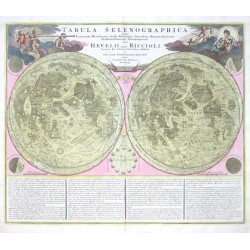
- Doppelmayr, J. G. Tabula Selenographica in qua Lunarium...Bestell-Nr .: 02658
Doppelmayr."Tabula Selenographica in qua Lunarium Macularum exacta Descriptio ...". Altkol. Kupf.-Kte. von J. G. Doppelmayr bei J. B. Homann, um 1720. Mondkarte in 2 Hemisphären, umgeben von kl. Darst. von Mondfinsternissen- in den Oberecken...
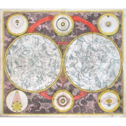
Verkauft - Eimmart, G. C. Planisphaerium CoelesteBestell-Nr .: 02661
"Planisphaerium Coeleste". Altkol. Kupf.-Kte. nach G. C. Eimmart bei D. Funck, Nürnberg, um 1700. Sternbildkarte in 2 Hemisphären, umgeben von 6 astronom. Diagrammen im Rund und Wolkenornamentik. 48,5:56 cm.
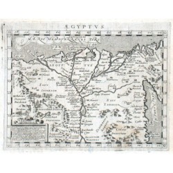
Verkauft - Magini, Giovanni Antonio AegyptusBestell-Nr .: 02619
Ägypten."Aegyptus". Orig. copper-engraving from G. A. Magini's Geographiae Universae. Engraved by G. Porro. Published in Nuremberg by P. Keschedt, 1597. 12,5:17 cm.
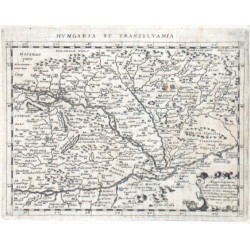
Verkauft - Magini, Giovanni Antonio Hungaria et TransylvaniaBestell-Nr .: 02622
"Hungaria et Transylvania". Copper-engraving by G. Porro, published by G. Magini, 1597. With ornamental cartouche in lower right corner. 12,5:17 cm (4.9 x 6.7 inch.).
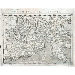
Verkauft - Magini, Giovanni Antonio Forum Iulii et HistriaBestell-Nr .: 02625
"Forum Iulii et Histria". Copper-engraving by G. Porro, published by G. Magini, 1597. With small ornamental cartouche in upper right corner. 12,5:17 cm (4.9 x 6.7 inch.).
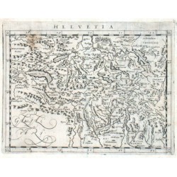
Verkauft - Magini, Giovanni Antonio HelvetiaBestell-Nr .: 02628
"Helvetia". Copper-engraving by G. Porro, published by G. Magini, 1597. 12,5:17 cm (4.9 x 6.7 inch.).
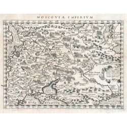
Verkauft - Magini, Giovanni Antonio Moscoviae ImperiumBestell-Nr .: 02631
"Moscoviae Imperium". Copper-engraving by G. Porro, published by G. Magini, 1597. 12,5:17 cm (4.9 x 6.7 inch.).
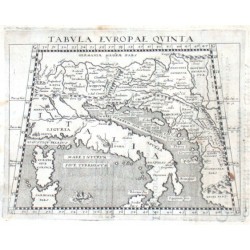
Verkauft - Porro, Girolamo (Autor) Ptolemaios (Ptolemy, Ptolemäus) (Andere Autoren) Slowenien, Croatien - Tabula Europae...Bestell-Nr .: 02634
"Tabula Europae quinta". Copper-engraving by G. Porro according to C. Ptolemaeus' map of the region, published by G. Magini, 1597. With sea-creatures. 12:16,5 (4.7 x 6.5 inch.).
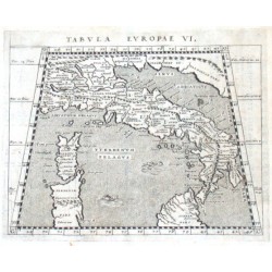
Verkauft - Ptolemaios (Ptolemy, Ptolemäus) Tabula Europae VI.Bestell-Nr .: 02637
"Tabula Europae VI.". Copper-engraving by G. Porro according to C. Ptolemaeus' map of the region, published by G. Magini, 1597. With sea-creatures. 12,5:17 (4.9 x 6.7 inch.).
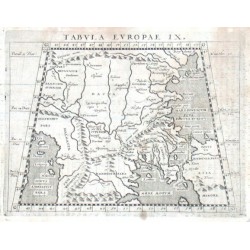
Verkauft - Ptolemaios (Ptolemy, Ptolemäus) Tabula Europae IX.Bestell-Nr .: 02640
"Tabula Europae IX.". Copper-engraving by G. Porro according to C. Ptolemaeus' map of the region, published by G. Magini, 1597. 12,5:17 (4.9 x 6.7 inch.).
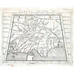
Verkauft - Ptolemaios (Ptolemy, Ptolemäus) Tabula Asiae X.Bestell-Nr .: 02643
Indien."Tabula Asiae X.". Copper-engraving by G. Porro according to C. Ptolemaeus' map of the region, published by G. Magini, 1597. 12,5:17 cm.
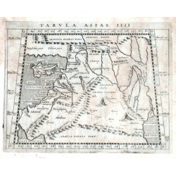
Verkauft - Ptolemaios (Ptolemy, Ptolemäus) Tabula Asiae IIIIBestell-Nr .: 02649
"Tabula Asiae IIII". Copper-engraving by G. Porro after C. Ptolemaeus' map of the region, published by G. Magini, 1597. With sea-creatures. 12,5:17 cm.
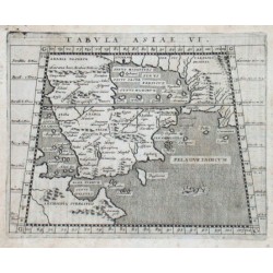
Verkauft - Ptolemaios (Ptolemy, Ptolemäus) Tabula Asiae VI.Bestell-Nr .: 02601
"Tabula Asiae VI.". Copper-engraving by G. Porro after C. Ptolemaeus' map of the region, published by G. Magini, 1597. 13,5:17 cm (5.3 x 6.7 inch.).
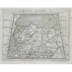
Verkauft - Ptolemaios (Ptolemy, Ptolemäus) Tabula Asiae I.Bestell-Nr .: 02604
"Tabula Asiae I.". Copper-engraving by G. Porro according to C. Ptolemaeus' map of the region, published by G. Magini, 1597. 13,5:17,5 cm (5.3 x 6.9 inch.).
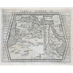
Verkauft - Ptolemaios (Ptolemy, Ptolemäus) Tabula Africae. IIII.Bestell-Nr .: 02607
Nordafrika."Tabula Africae. IIII.". Copper-engraving by G. Porro after C. Ptolemaeus' map of the region, published by G. Magini, 1597. 13,7:17,8 cm (5.4 x 7 inch.).
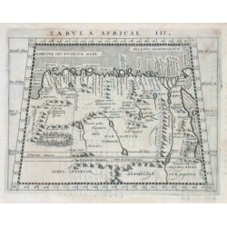
Verkauft - Ptolemaios (Ptolemy, Ptolemäus) Tabula Africae III.Bestell-Nr .: 02610
Ägypten."Tabula Africae III.". Copper-engraving by G. Porro after C. Ptolemaeus' map of the region, published by G. Magini, 1597. 13,6:17,5 cm (5.4 x 6.9 inch.).
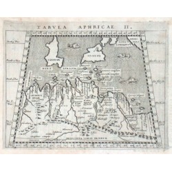
Verkauft - Ptolemaios (Ptolemy, Ptolemäus) Tabula Aphricae II.Bestell-Nr .: 02613
Nordafrika."Tabula Aphricae II.". Copper-engraving by G. Porro after C. Ptolemaeus' map of the region, published by G. Magini, 1597. With sea-creatures. 13,6:17,5 cm (5.4x6.9 inch).
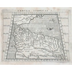
Verkauft - Ptolemaios (Ptolemy, Ptolemäus) Tabula Aphricae I.Bestell-Nr .: 02616
Nordafrika."Tabula Aphricae I.". Copper-engraving by G. Porro according to C. Ptolemaeus' map of the region, published by G. Magini, 1597. With sea-creatures. 13,5:17,5 cm (5.3 x 6.9 inch.).
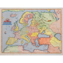
Verkauft - Ortelius, Abraham EuropaeBestell-Nr .: 02583
"Europae". Copper-engraving from A. Ortelius, ca. 1575. Coloured. With figure title-cartouche. 34,5:46,5 cm.
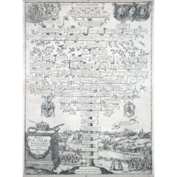
Verkauft - Albizzi, Antonio Reges Poloniae. Potentiss. Poloniae, et...Bestell-Nr .: 02577
"Reges Poloniae. Potentiss. Poloniae, et Sueciae, etc. Regi. Sigismvndo. III". Copper-engraving by Antonio Albizzi (1547-1626), published in Augsburg, 1608. Shows the family tree of sovereings of Poland with a view of Grodno (Grodna) in the...
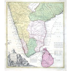
Verkauft - Homann Heirs Peninsula Indiae Malabar & Coromandel...Bestell-Nr .: 02565
Indien."Peninsula Indiae citra Gangem, hoc est Orae celeberrimae Malabar & Coromandel cum adiacente Insula ... Ceylon". Altkol. Kupf.-Kte. bei Homann Erben, 1733. Mit fig. Kart. 55:48,5 cm.
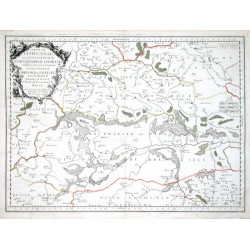
Verkauft - Sanson, Nicolas Partie de Lithuanie. ou est le Palatianat...Bestell-Nr .: 02568
Belarus. "Partie de Lithuanie. ou est le Palatianat de Nowogrodeck Litawiski, subddivise en ses Chastellenies. le Palatinat de Bressici en Polesie, Avec les Duches de Neswies, et Sluck, et Partie du Palatinat de Minsk". Grenzkol. Kupf.-Kte. von N. Sanson...
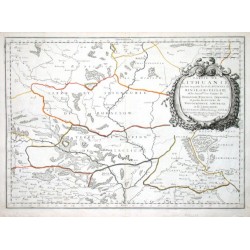
Verkauft - Sanson, Nicolas Partie de Lithuanie, ou sont en partie les...Bestell-Nr .: 02571
"Partie de Lithuanie, ou sont en partie les Palatinats de Minsk, et Mseislaw, et ... Rohaczow, Rzeczica, Zernobel et partie des duches de Novogrodeck Sewierski, et de Zernihow". Grenzkol. Kupf.-Kte. nach N. Sanson (gest. von A. Peyrounin) bei P....
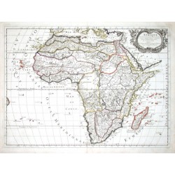
Verkauft - Sanson, Nicolas AfriqueBestell-Nr .: 02574
Afrika."Afrique". Grenzkol. Kupf.-Kte. nach N. Sanson bei P. Mariette, 1669. Mit ornament. Titelkart mit 2 Putten. 40,5:56 cm.
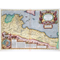
Verkauft - Ortelius, Abraham Africae propriae tabulaBestell-Nr .: 02553
Nordafrika."Africae propriae tabula ... 1590". Altkol. Kupf.-Kte. von A. Ortelius (1527-1598). Mit 2 gr. ausgem. Rollwerkskart., davon eine mit Vogelschauansicht von Karthago. 33,5:48,5 cm.
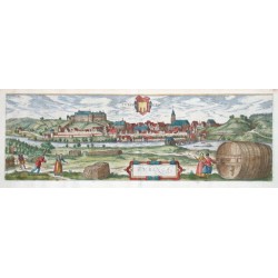
Verkauft - Braun, Georg - Hogenberg, Frans Tubingen - TubingaBestell-Nr .: 02556
"Tubingen - Tubinga". Altkol. Kupferstich (aus Braun & Hogenberg, um 1585). Mit ausgem. Rollwerkskart., farb. Wappen u. Trachtenfiguren. 15,5:47 cm.
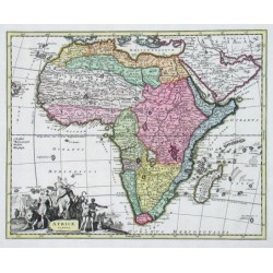
Verkauft - Weigel, Christoph der Ältere Africae tabulaBestell-Nr .: 02547
Afrika. "Africae tabula". Altkol. Kupf.-Kte. bei Ch. Weigel (1654 - 1725), um 1720. Mit fig. Titelkart. 27:34 cm.
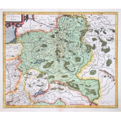
Verkauft - Mercator, Gerardus LithuaniaBestell-Nr .: 02550
"Lithuania". Altkol. Kupf.-Kte. von G. Mercator (1512 - 1594), um 1595. Mit ornamental Titelkart. 37:44 cm.
Verkauft - Hoefnagel, Joris Georgius Hoefnagle elegantissimi ad mare...Bestell-Nr .: 02505
"Georgius Hoefnagle elegantissimi ad mare Tyrrhenum Gaietae prospectus depictor...". Copperengraving by Georg Hoefnagel and Abraham Ortelius. From the atlas "Civitates Orbis Terrarum" published by Braun and Hogenberg. Cologne, ca. 1580. With 2...
Verkauft - Blaeu, Willem Janszoon HelvetiaBestell-Nr .: 02496
"Helvetia cum finitimis regionibus confoederatis." Kol. Kupf-Kte. von G. Blaeu, ca. 1635. Mit ornament. Titkart. und 2 Kart. von Milliaria. 39 x 51 cm.
Verkauft - Mercator, Gerardus Helvetia cum finitimis regionibus...Bestell-Nr .: 02499
Schweiz."Helvetia cum finitimis regionibus confoederatis." Orig. copper-engraving after G. Mercator's map of Switzerland. Published in Amsterdam by W. J. Blaeu, ca. 1635. Orig. old colouring. With ornamental title cartouche, figure cartouche with...
Verkauft - Mercator, Gerardus AndaluziaBestell-Nr .: 02481
"Andaluzia". Original copperplate by Gerardus Mercator (1512-1594) published by Jodocus Hondius in Amsterdam, 1609. With ornamental title-cartouche. 13,5:18,5 cm.
2 400,00 KčVerkauft Verkauft - Mercator, Gerardus Castiliae Veteris Et Novae DescriptioBestell-Nr .: 02484
"Castiliae Veteris Et Novae Descriptio". Original copperplate (dated 1606) by Gerardus Mercator (1512-1594) published by Henricus Hondius and/or Johannes Janssonius in Amsterdam, 1633. With 3 ornamental cartouches (title-cartouche with...
Verkauft - Sanson, Nicolas Les Estas De La Couronne De Castille,...Bestell-Nr .: 02487
"Les Estas De La Couronne De Castille, ... Castille Nouvelle, Andalousie, Grenade, et Murcie". Original copperplate by N. Sanson d'Abbéville, engraved by I. Sommer and published in Paris by P. Mariette, 1650. Withe decorative title-cartouche in...
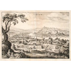
Verkauft - Merian, Matthäus Lyon - MerianBestell-Nr .: 02466
"Lyon". Gesamtansicht. Orig. Kupferstich von M. Merian, ca. 1640. Mit zahlr. Figuren und kl. Wappen unten links. 24:34,5 cm.
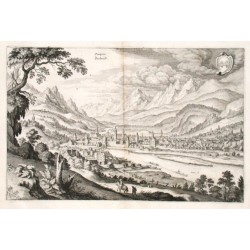
Verkauft - Merian, Matthäus Oenipons - Insbruck - MerianBestell-Nr .: 02469
"Oenipons - Insbruck". Gesamtansicht. Kupf.-Kte von M. Merian, ca. 1640. Mit Wappen oben rechts und Inn Fluss. 21,5:33 cm.
Verkauft - Merian, Matthäus Burgos - MerianBestell-Nr .: 02472
"Burgos". Orig. Kupferstich von M. Merian, ca. 1640. 19:31 cm.
Verkauft - Merian, Matthäus Hvngaria RenvmBestell-Nr .: 02475
"Hungaria Regnum". Kupf. von M. Merian, um 1640. Unten links Titelkartusche mit Wappen. 27:32,5 cm.
Verkauft - Sanson, Nicolas Estats du Duc de SavoyeBestell-Nr .: 02478
Savoyen. "Estats du Duc de Savoye au della des Alpes, et vers l'Italie- qui passent communem sous le nom Piemont ...". Grenzkol. Kupf.-Kte. von N. Sanson d'Abbeville, bei P. Mariette, 1665. Mit ornament. Titelkart. 54,5:43 cm.
Verkauft - Merian, Matthäus Stato della Chiesa, con la ToscanaBestell-Nr .: 02460
Toskana. "Stato della Chiesa, con la Toscana. Herschafften der Röm: Kirchen, und Großhertzogthumb Florenz". Kupf. von M. Merian, ca. 1635. Mit 2 fig. und herald. Kart., Sciffe und Wappen. 27,5:35,5 cm.
Verkauft - Geiger, Hans Conrad Die Eydtgnoschafft Pünten und Wallis....Bestell-Nr .: 02463
"Die Eydtgnoschafft Pünten und Wallis. Helvetia cum Confinijs". Kupf. von H. C. Geiger, bei M. Merian, um 1640. Oben links dekorative Kartusche mit Kartentitel- oben rechts Kartusche mit 33 Wappen. 27,5:35 cm.
Verkauft - Merian, Matthäus MarpurgBestell-Nr .: 02457
Marburg. "Marpurg". Gesamtansicht. Kst. (von M. Merian, 1646). Mit 2 Wappen. 21:33,5 cm.
Verkauft - Danckerts, Cornelis Comitatus Tirolis, Episcopatus et...Bestell-Nr .: 02439
"Comitatus Tirolis, Episcopatus et Comitatus Tridentinus, Episcopatus Brixensis". Altkol. Kupf.-Kte. von Cornelis Danckerts, um 1680. Mit Titelleiste. 56:48 cm.
Verkauft - Merian, Matthäus Silvanectum-Senlis. Lemovicum-LimogesBestell-Nr .: 02442
Senlis und Limoges. "Silvanectum - Senlis. Lemovicum - Limoges". Original copperplate engravings by M. Merian, ca. 1635. With several figures and engraved Lat.-Fr. titles. 19:31 cm.
Verkauft - Merian, Matthäus Dubrovnik und Chalcis - Ragusa....Bestell-Nr .: 02445
Dubrovnik und Chalcis. "Ragusa. Negroponte". Original copper engraving by M. Merian, published ca. 1640. View of Dubrovnik (11,5:30,5 cm) and Chalki (8:30,5 cm). Both together: 21:30,5 cm.
Verkauft - Homann Erben Geographica Descriptio Montani cuiusdam...Bestell-Nr .: 02433
"Geographica Descriptio Montani cuiusdam Districtus in Franconia in quo Illustrissimorum S. R. I. Comitum a Giech Particulare Territorium". Atkol. Kupf.-Kte. bei Hoamann Erben, (um 1735). Mit gr. fig. u. herald. Titelkart., kl. Ansicht von...
Verkauft - Seutter, Matthäus Germaniae Inferioris sive Belgii Pars...Bestell-Nr .: 02421
"Germaniae inferioris sive Belgii pars meridionalis exhibens X. Provincias Catholic. cum Confiniis Galliae Germ. Hollandiae". Altkol. Kupf.-Kte. von M. Seutter, (um 1730). Mit 2 fig. Kart. u. kl. Plan von Ostende. 49,5:57,5 cm.
Verkauft - l'Isle, Guillaume de Mappae Imperii Moscovitici pars...Bestell-Nr .: 02424
"Mappae Imperii Moscovitici pars Septentrionalis". Altkol. Kupf.-Kte. nach G. de l'Isle von M. Seutter, um 1740. Mit fig. Titelkart. 50:58 cm.
Verkauft - Maas, Abraham Nova Maris Caspii et Regionis UsbeckBestell-Nr .: 02427
Kaspisches Meer."Nova Maris Caspii et Regionis Usbeck cum Provincijs adjacentibus ver Delineatio". Altkol. Kupf.-Kte. nach A. Maas bei Homann Erben, 1735. Mit fig. Titelkart. 49:59 cm.
Verkauft