Keine Artikel
Alte Landkarten und Stadtansichten
- Afrika
- Amerika
- Amerika (Kontinent)
- Antillen
- Argentinien
- Bermudainseln
- Brasilien
- Chile
- Florida
- Guyana
- Hawaiiinseln
- Honduras
- Kalifornien
- Kanada
- Kolumbien
- Louisiana
- Magellanstraße
- Mexico
- Mittelamerika und Antillen
- Neuengland
- New York
- Nordamerika
- Nordkaroline
- Panama
- Paraguay
- Pennsylvania
- Peru
- Südamerika
- Uruguay
- Venezuela
- Vereinigte Staaten (USA)
- Alabama
- Arkansas
- Boston
- Connecticut
- Florida
- Georgia
- Illinois
- Iowa
- Kentucky
- Louisiana
- Maine
- Maryland und Delaware
- Massachusetts und Rhode Island
- Michigan
- Mississippi
- Missouri
- New Hampshire und Vermont
- New Jersey
- New York
- Ohio
- Ostküste von USA
- Pennsylvania
- Philadelphia
- Rhode Island
- South Carolina
- Tennessee
- Texas
- Virginia
- Wisconsin
- Virginia
- Asien und Australien
- Asien (Kontinent)
- Australien
- Burma
- China
- Französisch-Polynesien
- Golf von Bengalen
- Indien
- Indien, China, Nepal
- Indischer Ozean
- Indonesien
- Israel / Palästina
- Japan
- Kaspische Meer
- Korea
- Malaysien
- Mikronesien
- Naher Osten
- Neuseeland
- Nordostasien
- Ostasien
- Pakistan
- Philippinnen
- Polynesien
- Sri Lanka (Ceylon)
- Südostasien
- Südwestasien
- Türkei
- Atlases
- Europa
- Belgien, Niederlande, Luxemburg
- Alkmaar
- Amsterdam
- Antwerpen
- Arnhem
- Belgien und Luxemburg
- Bergen op Zoom
- Blokzijl
- Bommenede
- Brabant
- Breda
- Brielle
- Brugge
- Brüssel
- Charleroi
- Delft
- Den Haag
- Dinant
- Doornik
- Dordrecht
- Drenthe
- Drenthe und Overijseel
- Elburg
- Flandern
- Fort Rammekens
- Friesland
- Friesland und Groningen
- Geertruidenberg
- Gelderland
- Geraardsbergen
- Grave
- Groningen
- Haarlem
- Hainaut
- Hannut
- Harderwijk
- Harlingen
- Holland
- Hulst
- Huy
- Kortryk
- Leeuwarden
- Leiden
- Lier
- Limbourg
- Limburg
- Löwen
- Lüttich
- Luxemburg
- Luxemburg (Stadt)
- Maastricht
- Mechelen
- Menin
- Middelburg
- Mons
- Namur
- Niederlande
- Niederlande und Belgien
- Nijmegen
- Ostende
- Overijssel
- Rotterdam
- Ruremonde
- s-Hertogenbosch
- Spa
- Stavoren
- Steenwijk
- Tiel
- Utrecht
- Veere
- Veurne
- Vlissingen
- Ypern
- Zaltbommel
- Zeeland
- Zieriksee
- Zierikzee
- Zutphen
- Zwolle
- Zype
- Böhmen, Mähren, Schlesien und Lausitz
- Adršpach
- Andělská Hora (hrad)
- Arnau
- Aussig
- Bad Liebwerda
- Bechyňsko
- Beraun
- Berounsko
- Berounsko a Plzeňsko
- Bílina
- Blansko
- Blatná
- Böhmen
- Böhmen, Mähren und Schlesien
- Bollechowitz
- Bömisch Aicha
- Borotín
- Bösig
- Boskovice
- Bouzov
- Brandýs nad Labem
- Branná (okr. Šumperk)
- Břeclav
- Březnice
- Brněnsko
- Brněnsko a Uherskohardišťsko
- Brodce (okr. Mladá Boleslav)
- Broumov
- Brtnice
- Brünn
- Budeč (hradiště)
- Budweis
- Bürglitz
- Buštěhrad
- Buzice (tvrz)
- Čáslav
- Čáslavsko
- Čelákovice
- Česká Lípa
- České Švýcarsko
- Český Brod
- Český Krumlov
- Český Šternberk
- Cheb
- Chebsko a Žatecko
- Chlum (okr. Kutná Hora)
- Chlum Svaté Máří
- Chlumec nad Cidlinou
- Chodová Planá
- Chomutov
- Choustníkovo Hradiště (zřícenina hradu)
- Chrudim
- Chrudimsko
- Chrudimsko, Čáslavsko, Kouřimsko
- Děčín
- Dívčí Hrad
- Doksany (okr. Litoměřice)
- Dolní Olešnice - Nové Zámky
- Dolní Životice (okr. Opava)
- Doupov
- Dubí
- Duchcov
- Dvojhradí (Mstišov)
- Dvůr Králové nad Labem
- Eger - und Elbogenland
- Egerberg
- Egerberk (Klášterec nad Ohří)
- Felixburg (Klášterec nad Ohří)
- Františkovy Lázně
- Frauenberg in Böhmen
- Frenštát pod Radhošťem
- Friedrichsthal
- Frýdlant
- Graupen
- Habrovany
- Hartenberg (Hřebeny, okr. Sokolov)
- Hassenstein
- Hauenštejn (Horní hrad, okr. Karlovy Vary)
- Házmburk
- Helfštýn
- Herrnskretschen
- Hlavačov (Hlaváčov, Rakovník)
- Hohenelbe
- Hořice (v Podkrkonoší)
- Hradec Králové
- Hranice na Moravě
- Hrubá Skála
- Hukvaldy
- Jáchymov
- Jankov
- Jánský Vrch
- Jánský Vrch (Javorník)
- Jaromirsch
- Jenstein
- Jeseník
- Jestřebí
- Jezeří
- Jičín
- Jihlava
- Jižní Čechy
- Johannesbad
- Kaceřov (Plzeň-sever)
- Kadaň
- Kamaick
- Karlsbad
- Karlstein
- Kasejovice - Řesanice
- Klabava (Ejpovice, okr. Rokycany)
- Kladno
- Kladruby
- Klatovy
- Kokořín
- Kolín
- Kondrac
- Konojedy (u Litoměřic)
- Konopiště
- Kopidlno (okr. Jičín)
- Kost
- Kostelec nad Labem
- Kostenblatt
- Kouřimsko
- Krakovec
- Králíky
- Královéhradecko
- Krásný Dvůr (okr. Louny)
- Krašov (hrad)
- Kratochvíle (zámek)
- Křečov (okr. Louny)
- Křepenice
- Krkonoše
- Krnov
- Kroměříž
- Krušné hory
- Kuks
- Kumburk
- Kunětická Hora
- Kunžvart (Šumava)
- Kuttenberg
- Kynšperk nad Ohří
- Kynžvart (zámek)
- Kyselka
- Kyšperk
- Lanšperk
- Laun
- Lázně Libverda
- Ledeč nad Sázavou
- Lednice
- Libá (okr. Cheb)
- Libějovice
- Liberec
- Liběšice
- Liblín (okr. Rokycany)
- Libochovany
- Libochovice
- Libštejn
- Lina (Vroutek, okr. Louny)
- Lipnice nad Sázavou
- Litoměřice
- Litoměřicko
- Litomyšl
- Littitz
- Lobositz
- Loket
- Luhačovice
- Lužice
- Lysá nad Labem
- Mähren
- Marienbad
- Melnik
- Mikulov
- Milčany
- Milešov (Velemín)
- Milešovka
- Miletín
- Milíčeves (okr. Jičín)
- Mladá Boleslav
- Mladoboleslavsko
- Mladoboleslavsko a Litoměřicko
- Mnichovo Hradiště
- Most
- Mšec
- Mšeno
- Mühlhausen an der Moldau
- Mürau
- Náchod
- Napajedla
- Návarov
- Nepomuk
- Neuhaus
- Nimburg
- Nové Hrady (okr. Ústí nad Orlicí)
- Nový Bor
- Okoř
- Olmütz
- Olomoucko
- Ondrášov (Moravský Beroun)
- Opava
- Orlík nad Vltavou
- Osek
- Ostrov nad Ohří
- Pardubice
- Patzau
- Pavlov
- Pecka (hrad)
- Pernstein
- Petrohrad (Petršpurk, okr. Louny)
- Písek
- Plaňany
- Plasy
- Plzeň
- Plzeňsko
- Podiebrad
- Polná
- Prachatice
- Prácheňsko
- Prag
- Praha - Cheb
- Praha a okolí
- Prerau
- Přerovsko
- Pressnitz
- Proboštov
- Proseč u Pošné (okr. Pelhřimov)
- Protivín
- Przelautsch
- Pullitz
- Raabstein
- Rabí
- Račice (Vyškov)
- Radim (okr. Kolín)
- Rájec nad Svitavou
- Rajhrad
- Rakovnicko
- Rakovník
- Ronov (okr. Česká Lípa)
- Ronov nad Sázavou
- Rosstein
- Roudnice nad Labem
- Rožmberk nad Vltavou
- Rožnov pod Radhoštěm
- Rudolfov (České Budějovice)
- Rychmburk
- Rychnov nad Kněžnou
- Rýzmburk (hrad)
- Rzeczkowitz
- Schellenberg
- Schlan
- Schreckenstein
- Schwamberg
- Sedlec
- Severní Čechy
- Skuteč
- Slavkov u Brna
- Sloup (hrad)
- Smečna
- Smidary (okr. Hradec Králové)
- Smirschitz
- Sovinec (hrad)
- Šternberk (Ledce)
- Strakonice
- Štramberk
- Šumava
- Šumburk (Šumná)
- Šumperk
- Svatý Jan pod Skalou
- Svojanov (hrad)
- Svojšice
- Tábor
- Táborsko a Českobudějovicko
- Tachov
- Telenice - Varvažov
- Teplá
- Teplice
- Theresienstadt
- Toužetín
- Třebel
- Třeboň
- Trhanov (okr. Domažlice)
- Trosky
- Tuchoraz
- Týn nad Vltavou
- Týnec nad Labem
- Uherské Hradiště
- Újezdec (hrad)
- Uničov
- Úvaly
- Valdštejn
- Valkeřice
- Valtice
- Vartenberk - Stráž pod Ralskem (okr. Česká Lípa)
- Velehrad
- Velhartice
- Velké Meziříčí
- Velké Žernoseky
- Veveří
- Vinec
- Višňová (okr. Liberec)
- Vlastislav
- Vlkava
- Vltava
- Vrabinec
- Vřeskovice
- Východní a Severovýchodní Čechy
- Vysoké Mýto
- Vyšší Brod
- Wegstädtl
- Winterberg
- Žacléř
- Zahájí
- Zákupy
- Žampach (zámek)
- Zámrsk
- Západní Čechy
- Žatec
- Žatecko
- Žebrák a Točník
- Želiv
- Žireč
- Žleb
- Zlenice (Hláska)
- Znojemsko a Jihlavsko
- Znojmo
- Zornstein
- Zvíkov
- Zvířetice
- Deutschland
- Baden-Württemberg
- Bad Mergentheim
- Bad Säckingen
- Bad Teinach-Zavelstein
- Baden-Baden
- Balingen
- Biberach an der Riß
- Böblingen
- Bodensee
- Breisach am Rhein
- Breisgau
- Bretten
- Calw
- Donaueschingen
- Dornhan
- Dornstetten
- Ellwangen
- Esslingen
- Freiburg
- Geislingen an der Steige
- Giengen
- Grafschaft Limpurg
- Heidelberg
- Heilbronn
- Hohenlohe
- Karlsruhe
- Konstanz
- Landshut
- Leutkirch
- Mainau
- Mannheim
- Marbach am Neckar
- Maulburg
- Möckmühl
- Nagold
- Neckarlauf
- Neuenbürg
- Nord-Württemberg
- Oberschwaben
- Offenburg
- Pforzheim
- Philippsburg
- Reutlingen
- Rheinpfalz
- Rottweil
- Schwabenl
- Schwäbisch Gmünd
- Schwäbisch Hall
- Singen
- St. Blasien
- Stuttgart
- Tübingen
- Tuttlingen
- Überlingen
- Ulm
- Vaihingen a. d. Enz
- Wangen im Allgäu
- Weinheim
- Wiesensteig
- Württemberg
- Bayern
- Amberg
- Ansbach
- Aschaffenburg
- Augsburg
- Aurach
- Bad Abbach
- Bamberg
- Bogenberg (Wallfahrtskirche)
- Brettheim
- Burg Rabeneck
- Cham
- Coburg
- Dachau
- Dillingen
- Dinkelsbühl
- Donauwörth
- Eichstätt
- Forchheim
- Franken
- Freising
- Friedberg (Schwaben)
- Füssen
- Gerolzhofen
- Gräfenberg (Oberfranken)
- Günzburg
- Höchstädt an der Donau
- Ingolstadt
- Kelheim
- Kempten
- Kitzingen
- Kulmbach
- Landsberg am Lech
- Lauingen
- Lenggries
- Lichtenau (Mittelfranken)
- Lindau
- Lohr am Main
- Marxheim
- Memmingen
- Mindelheim
- Mühldorf am Inn
- München
- Nabburg
- Natternberg (Schloss)
- Neuburg an der Donau
- Neumarkt in der Oberpfalz
- Neuötting
- Neustadt an der Donau
- Niederaltaich (Kloster)
- Niederbayern
- Nordgau
- Nördlingen
- Nürnberg
- Oberaltaich
- Oberbayern
- Oberpfalz
- Oettingen
- Pappenheim
- Passau
- Pfaffenhofen
- Pöttmes
- Rain am Lech
- Regensburg
- Saal an der Donau
- Schongau
- Schrobenhausen
- Straubing
- Thurnau
- Velden
- Vilshofen an der Donau
- Wackerstein
- Wasserburg am Inn
- Weiden
- Weilheim / links Polling
- Weissenburg in Bayern
- Weltenburg
- Wörth an der Donau
- Würzburg
- Wüstenstein
- Berlin
- Brandenburg
- Bremen
- Hamburg
- Hessen
- Bad Homburg vor der Höhe
- Bad Schwalbach
- Bensheim
- Büdingen
- Darmstadt
- Dillenburg
- Eltville
- Eschwege
- Frankenberg an der Eder
- Frankfurt am Main
- Friedberg
- Fritzlar
- Fulda
- Giessen
- Hanau
- Heppenheim
- Hersfeld
- Hessen - Kassel (Landgrafschaft)
- Homberg (Efze)
- Isenburg
- Kassel
- Kelsterbach
- Mainz (Erzstift)
- Marburg
- Nassau, Weilburg, Riedesel
- Oberhessen
- Offenbach
- Usingen
- Wiesbaden
- Mecklenburg-Vorpommern/Pommern
- Niedersachsen
- Aurich
- Bad Bentheim
- Bad Gandersheim
- Bad Pyrmont
- Bentheim
- Bodenwerder
- Braunschweig
- Braunschweig-Lüneburg
- Celle
- Cuxhaven
- Emden
- Hann. Münden
- Hannover
- Hessisch Oldendorf
- Hildesheim
- Hitzacker (Elbe)
- Hoya
- Lichtenberg
- Liebenau an der Weser
- Lüneburg
- Lutter am Barenberge
- Niedersächsischer Kreis
- Nienburg a. d. Weser
- Oldenburg
- Osnabrück
- Osterode
- Osterwieck
- Ostfriesland
- Schnackenburg
- Schöppenstedt
- Stolzenau
- Verden
- Walsrode
- Winsen an der Luhe
- Wolfenbüttel
- Norddeutschland
- Nordrhein-Westfalen
- Rheinland-Pfalz
- Sachsen
- Augustusburg
- Bad Schandau
- Baruth bei Bautzen
- Bastei
- Belgern
- Bernstadt auf dem Eigen
- Berthelsdorf
- Bertsdorf-Hörnitz
- Brand
- Brauna (Schönteichen)
- Breitenfelden
- Bretnig-Hauswalde
- Burkau
- Burkersdorf (Schlegel)
- Colditz
- Cosel (Schwepnitz)
- Crostau
- Crostwitz
- Cunewalde
- Dittersbach auf dem Eigen
- Döbeln
- Dresden
- Dürrhennersdorf
- Ebersbach
- Eibau
- Eilenburg
- Elstra
- Erzgebirge
- Frankenstein (Oederan)
- Frankenthal
- Freiberg
- Friedersdorf an der Spree
- Gaußig (Bautzen)
- Gersdorf (Haselbachtal)
- Görlitz
- Grimma
- Großgrabe
- Großpostwitz
- Großschönau
- Grossenhain
- Grosssedlitz (Heidenau)
- Herrnhut
- Hirschfelde (Zittau)
- Hirschstein (Schloss)
- Jonsdorf
- Kamenz
- Kemnitz (Bernstadt auf dem Eigen)
- Klix (Großdubrau)
- Königsbrück
- Königstein
- Kottmarsdorf
- Lausitz
- Lawalde
- Leipzig
- Leuba (Ostritz)
- Leutersdorf
- Liebenwerda
- Lilienstein
- Marienberg
- Meißen
- Milkel
- Nebelschütz
- Neschwitz
- Neukirch (bei Königsbrück)
- Neukirch/Lausitz
- Niedercunnersdorf
- Niederlichtenau und Reichenbach (bei Königsbrück)
- Nostitz (Weißenberg)
- Ober Lausitz
- Obercunnersdorf
- Oberseifersdorf
- Oppach
- Oschatz
- Ostritz
- Ostro (Panschwitz-Kuckau)
- Oybin
- Panschwitz-Kuckau
- Penig
- Pirna
- Plauen
- Pöhla (Schwarzenberg)
- Prettin (Lichtenburg)
- Pulsnitz
- Purschwitz
- Radebeul
- Rammenau
- Reichenau (bei Königsbrück)
- Reichenau (Hartmannsdorf)
- Reichenbach (bei Königsbrück)
- Riesa
- Ruppersdorf
- Sachsen-Thüringen-Anhalt
- Sächsische Schweiz
- Scharfenberg
- Schönau-Berzdorf auf dem Eigen
- Schönbach
- Schönbach - Neudorf
- Schönburg
- Schwazenberg-Wolkenstein-Grünhain
- Schwepnitz
- Seifhennersdorf
- Seitendorf bei Hirschfelde (Zittau)
- Siebeneichen (Meissen)
- Sohland an der Spree
- Spitzkunnersdorf
- Spreedorf (Ebersbach)
- Stadt Wehlen
- Strehla
- Taubenheim/Spree
- Torgau
- Walddorf (Eibau)
- Waltersdorf (Großschönau)
- Wurzen
- Zittau
- Zschopau
- Zwickau
- Sachsen-Anhalt
- Aken (Elbe)
- Anhalt
- Annaburg
- Arneburg
- Barby
- Barleben
- Bitterfeld, Delitsch, Zörbig
- Coswig
- Dessau
- Elbingerode
- Freyburg (Unstrut)
- Halberstadt
- Havelberg
- Landkreis Harz
- Lutherstadt Wittenberg
- Lützen
- Magdeburg
- Magdeburg - Halle
- Mansfeld
- Merseburg
- Naumburg an der Saale
- Pretzsch a. d. Elbe
- Querfurt
- Rosslau
- Sandau (Elbe)
- Schönebeck
- Seehausen (in Altmark)
- Stolberg
- Tangermünde
- Weissenfels
- Werben
- Wittenberg
- Wittgendorf (Schnaudertal)
- Wörlitz
- Zeitz
- Zerbst
- Schleswig-Holstein
- Thüringen
- Baden-Württemberg
- Donau
- Europa (Kontinent)
- Frankreich
- Albi
- Anjou
- Arras
- Artois
- Auvergne
- Avignon
- Bar-le-Duc
- Beauce
- Beauvais
- Berry
- Blois
- Bordeaux
- Bourbonnais
- Bourbourg
- Bresse
- Brie
- Burgund-Freigrafschaft
- Calais
- Cambrai
- Cassel
- Champagne
- Château de Lichtenberg
- Chaumont
- Compiegne und Noyon
- Dauphiné
- Département Tarn
- Dombes
- Douai
- Dünkirchen
- Elsass
- Fontainebleau
- Gascogne
- Gâstinais and Senonais
- Gravelines
- Hauts-de-France
- Hondschoote
- Ile de France
- Iles de Lérins
- Korsika
- La Bassée - Hesdin
- La Rochelle
- Languedoc
- Lille
- Limoges
- Lothringen
- Lyon
- Maine
- Marseille
- Metz
- Montmélian
- Mülhausen
- Nancy
- Nevers
- Nice
- Normandie
- Orange
- Paris
- Perche
- Perpignan
- Picardie
- Poitou
- Provence
- Quercy
- Re und Oleron
- Reims - Rethel
- Rethel
- Saint-Germain-en-Laye
- Saint-Omer
- Saintonge und Aunis
- Sarlat
- Savoyen
- Savoyen und Osten Burgund (Franche - Comte)
- Strassburg
- Südfrankreich
- Südostfrankreich
- Thérouanne
- Touraine
- Valenciennes
- Vexin
- Westfrankreich
- Wissembourg
- Griechenland, Mittelmeer
- Grossbritannien und Irland
- Bedford und Buckinghamshire
- Berkshire und Hampshire
- Cambridgeshire
- Cheshire
- Cornwall
- Cumberland
- Denbigh und Flint
- Derbyshire
- Devon
- Dorset
- Durham (Grafschaft)
- England
- Essex
- Exeter
- Gloucestershire
- Großbritannien und Irland
- Hampshire
- Herefordshire
- Hertfordshire
- Hertfordshire and Middlesex
- Holy Island und Farne Island
- Huntingdonshire
- Irland
- Isle of Man
- Isle of Wight
- Kent
- Lancashire
- Leicestershire
- Lincolnshire
- London
- Middlesex
- Nordengland
- Nordostengland
- Nordwestengland
- Norfolk
- Northampton
- Northumberland
- Nottinghamshire
- Orkneys und Shetland
- Oxfordshire
- Portsmouth
- Rutland
- Schottland
- Aberdeen und Banff
- Annandale
- Argyll und Bute
- Argyllshire
- Arran
- Berwickshire
- Bute
- Caithness
- Carrick
- Clydesdale
- Cunningham
- Fife
- Galloway
- Hebriden
- Islay
- Jura
- Kintyre
- Knapdale
- Lauderdale
- Lennox
- Lewis - Harris und Skye
- Lewis and Harris
- Lothian
- Mull
- Nithsdale
- Nordschottland
- Ostschottland
- Scottish Borders
- Skye
- Strath-Navern
- Südschottland
- Sutherland
- Tayside
- Tweedail
- Uist
- Westschottland
- Shropshire
- Shropshire und Staffordshire
- Somerset
- Staffordshire
- Südostengland
- Südwestengland
- Surrey
- Sussex
- Wales
- Westmorland
- Wiltshire
- Worcestershire und Warwickshire
- Yorkshire
- Italien
- Abruzzen
- Acquapendente
- Ancona
- Apulien (Puglia)
- Arcevia
- Assisi
- Bari und Basilikata
- Belluno und Feltre
- Bergamo
- Bologna
- Bracciano
- Brescia
- Brescia und Crema
- Cadore
- Cagliari
- Caiazzo
- Camerino
- Capitanata
- Carmagnola
- Catania
- Civitavecchia
- Crema
- Cremona
- Cuneo
- Elba
- Emilia Romagna
- Faenza
- Fano
- Ferrara
- Florenz
- Fondi
- Friaul
- Gaeta
- Gallipoli
- Genua
- Ischia
- Italien
- Kalabrien
- Kampanien
- Lago di Como
- Lago Maggiore
- Lazio
- Lerici
- Ligurien (Italienische Riviera)
- Livorno
- Lombardei
- Loreto
- Lucca
- Mailand
- Mantua
- Mantua
- Marche (Ancona)
- Meran
- Messina
- Mirandola
- Mittelitalien
- Modena
- Molise
- Monferrato
- Neapel
- Netuno
- Nocera Umbra
- Norditalien
- Orvieto
- Orvieto und Loreto
- Otranto
- Padua
- Palermo
- Parma
- Parma und Piacenza
- Pavia
- Perugia
- Pesaro
- Piacenza
- Piemont
- Pinerolo
- Piombino
- Pisa
- Po
- Pozzuoli
- Puglia und Calabria
- Ravenna
- Reggio di Calabria
- Reggio Emilia
- Rimini
- Rom
- Romagna
- Rovereto
- Rovigo
- San Marino
- Sardinien
- Siena
- Sizilien
- Sizilien und Malta
- Sizilien und Sardinien
- Spoleto
- Süditalien
- Sulmona
- Taranto
- Terracina
- Tirol
- Tivoli
- Tortona
- Toskana
- Trapani
- Trentino
- Trentino-Alto Adige / Südtirol
- Treviso
- Tricarico
- Triest
- Turin
- Udine
- Umbria
- Urbino
- Velletri
- Venedig
- Vercelli
- Verona
- Vicenza
- Viterbo
- Labe
- Mitteleuropa
- Mittelmeer
- Monaco
- Nordeuropa
- Österreich
- Güssing (Burgenland)
- Innsbruck
- Kärnten
- Niederösterreich
- Oberösterreich
- Aschach an der Donau
- Bad Ischl
- Baumgartenberg
- Enns
- Gmunden
- Greinburg (Schloss)
- Katzenberg (Schloss in Kirchdorf am Inn)
- Linz
- Neuhaus an der Donau (Schloss)
- Ottensheim (Schloss)
- Peuerbach
- Rannariedl (Schloss)
- Riegerting (Schloss bei Mehrnbach)
- Schönburg an der Donau
- Schwendt
- St. Nikola an der Donau
- Steyr
- Wels
- Rechnitz (Burgenland)
- Salzburg
- Salzburg und Kärnten
- Salzburger Land
- Steiermark
- Tirol
- Vorarlberg
- Wien
- Ostsee
- Polen, Schlesien, Rußland, Blatikum
- Galizien
- Kaukasus
- Lettland und Estland
- Litauen und Weissrussland
- Litauen, Lettland, Estland
- Ostbrandenburg
- Polen
- Auschwitz
- Bogatynia
- Breslau
- Danzig
- Działoszyn (Bogatynia)
- Elbing
- Jauer
- Kalwaria Zebrzydowska
- Kleinschönau
- Krakow
- Liegnitz - Neiße
- Lowicz
- Lublin
- Neisse
- Oberullersdorf
- Ośno Lubuskie (Drossen)
- Posen
- Posen und Krosno
- Przemyśl
- Radomierzyce (Stift Joachimstein)
- Rybarzowice
- Sandomierz und Biecz
- Stettin
- Teschen
- Thorn
- Türchau
- Warschau
- West-Polen
- Zamosc
- Polen und Litauen
- Pommern
- Preussen
- Russland
- Schlesien
- St. Petersburg
- Weißrussland
- Rhein
- Schweiz
- Skandinavien und Island
- Spanien und Portugal
- Andalusien
- Andalusien und Granada
- Aragonien
- Azoren
- Balearen
- Barcelona
- Barcelona und Ecija
- Burgos
- Cadiz
- Cordoba
- Extremadura
- Galizien
- Gibraltar
- Granada
- Kanarische Inseln
- Kastilien
- Katalanien
- Leon und Asturien
- Lissabon
- Madeira
- Madrid
- Navarra
- Nordostspanien
- Nordspanien
- Nordwestlichen Spanien
- Portugal
- Roses
- Sevilla
- Spanien
- Toledo und Valladolid
- Valencia
- Südost- und Osteuropa, Balkan
- Albanien
- Bulgarien und Türkei
- Dnepr
- Istrien
- Osteuropa
- Rumänien
- Rumänien, Moldavien und Ukraine
- Schwarzes Meer
- Slowakei
- Slowenien, Kroatien, Bosnien und Herzegowina, Serbien und Montenegro
- Südosteuropa
- Ukraine
- Ungarn
- Budapest
- Dregelypalank
- Eger
- Esztergom (Gran)
- Győr
- Gyula
- Hatvan
- Komitat Baranya
- Komitat Csongrád
- Komitat Heves
- Komitat Jász-Nagykun-Szolnok
- Komitat Vas
- Mohács
- Pécs
- Sárospatak
- Sopron
- Szeged
- Székesfehérvár (Stuhlweissenburg)
- Szendrő
- Szentgotthárd
- Szigetvár
- Szikszó
- Szolnok
- Tata
- Tokaj
- Törökszentmiklós
- Veszprém
- Visegrád
- Belgien, Niederlande, Luxemburg
- Inseln (Sonderkatalog)
- Welt, Ozeane, Pole und Sternbildkarten
Alte Landkarten und Stadtansichten Es gibt 8735 Artikel.
Unterkategorien
- Grodecki, W. Poloniae finitimarumque locorum descriptioBestell-Nr .: 02979
"Poloniae finitimarumque locorum descriptio". Copper-engraving (from M. Quad's Fasciculus Geographicus) according to W. Grodecki's map of the region, published by J. Bussemacher, Köln, 1608. With title-cartiouche in lower left corner and "Scala...
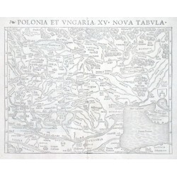
Verkauft - Ptolemaios (Ptolemy, Ptolemäus) Polonia et Vngaria, XV. Nova TabulaBestell-Nr .: 02940
"Polonia et Ungaria, XV. Nova Tabula". Holzschnittkarte (aus C. Ptolemaeus Geographia von S. Münster, EA, 1540). Mit lat. Kopftitel. 25,5:34,5 cm.
Verkauft - Mercator, Gerardus LithuaniaBestell-Nr .: 02943
"Lithuania". Kupf.-Kte. von G. Mercator (1512 - 1594), um 1595. Mit ornamental Titelkart. 37:44 cm.
Verkauft - Mercator, Gerardus Polonia et SilesiaBestell-Nr .: 02946
"Polonia et Silesia". Kupf.-Kte. von G. Mercator (1595) bei H. Hondius. Mit ornament. Titelkart. 34,5:46 cm.
Verkauft - Bruyn, Cornelis de Route d'Amsterdam a Moscow et de la a...Bestell-Nr .: 02949
"Route d'Amsterdam a Moscow et de la a Ispahan et Gamron". Copper-engraving by J. Keiser from C. de Bruyn, ca. 1710. With architectural title cartouche. 28:37,5 cm.
Verkauft - Wit, Frederik de Scotia RegnumBestell-Nr .: 02913
"Scotia Regnum divisum in Partem Septentrionalem et Meridionalem. Subdivisas in Comitatus, Vicecomitatus Provincias Praefecturas Dominia et Insulas". Copper-engraving engraved and published by Frederick de Witt, ca. 1680. Original old colouring....
Verkauft - Greger, Jan Řehoř Ansicht des Schlosses Boskowitz in MährenBestell-Nr .: 02844
"Ansicht des Schlosses Boskowitz in Mähren". Litografie od Jana Řehoře Gregera (1802-1835). Z "Malerische Darstellungen der österr. Monarchie", Wien: A. F. Kunike, ca. 1830. 25,5 x 33,5 cm.
Verkauft - Greger, Jan Řehoř Ansicht des Schlosses Habrowan in MährenBestell-Nr .: 02847
"Ansicht des Schlosses Habrowan in Mähren". Litografie od Jana Řehoře Gregera (1802-1835). Z "Malerische Darstellungen der österr. Monarchie", Wien: A. F. Kunike, 1833. 25 x 32,5 cm.
Verkauft - Greger, Jan Řehoř Ansicht des Schlosses Napagedl in MährenBestell-Nr .: 02850
"Ansicht des Schlosses Napagedl in Mähren". Litografie od Jana Řehoře Gregera (1802-1835). Z "Malerische Darstellungen der österr. Monarchie", Wien: A. F. Kunike, ca. 1830. 24,5:32,5 cm.
Verkauft - Greger, Jan Řehoř Ansicht des Schlosses Tauschetin in BöhmenBestell-Nr .: 02853
"Ansicht des Schlosses Tauschetin in Böhmen". Litografie od Jana Řehoře Gregera (1802-1835). Z "Malerische Darstellungen der österr. Monarchie", Wien: A. F. Kunike, ca. 1830. 25,5 x 32 cm.
Verkauft - Kunike, Adolph Friedrich Ansicht des Schlosses Gross- Meseritsch in...Bestell-Nr .: 02856
"Ansicht des Schlosses Gross- Meseritsch in Mähren". Litografie od Adolfa Friedricha Kunikeho (1777-1838) z jeho "Malerische Darstellungen der österr. Monarchie", Wien: A. F. Kunike, ca. 1830. 24,5 x 32,5 cm.
Verkauft - Sadeler, Aegidius Bohemia in suas partes geographicé distinctaBestell-Nr .: 02835
"Bohemia in suas partes geographicé distincta". Kol. mědiryt od P. Kaeria podle E. Sadelera, 1630. Vydal J. Janssonius. Ornamentální tit. kartuše, "Notarum Explicatio", Český lev a orlice v horních rozích. 41:47 cm.
Verkauft - Danckwerth, C. Newe Landtcarte Von dem Ampte Steiborg....Bestell-Nr .: 02829
"Newe Landtcarte Von dem Ampte Steiborg. Der Kremper, Undt Wilstermarsch. Anno 1651". Kupf.-Kte. nach J. Mejer von M. u. N. Petersen (bei C. Danckwerth, 1652). Mit 2 ornament. Kart., gr. Figur, "Notarum Expli." und Plan von Glückstadt. 40,5:57...
Verkauft - Rzechka, I. D. Pohled na Prahu s Petřína - Panorama von...Bestell-Nr .: 02817
"Pohled na Prahu s Petřína - Panorama von Prag vom Laurentiusberge aus gesehen". Pův. oceloryt od J. D. Rzechky, vydal B. Krečmár v Praze, 1848. 15:40 cm (39:62 cm s rámem).
Verkauft - Speed, John BohemiaBestell-Nr .: 02820
"Bohemia". Pův., staře kolorovaný mědiryt, J. Speed, 1626. Nad mapou lišta s 5 důležitými českými městy tehdejší doby (Čáslav, Chomutov, Praha, Polná, Slaný, Louny) a Hradčany, po stranách lišty s postavami různých stavů v...
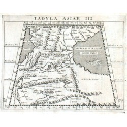
Verkauft - Magini, Giovanni Antonio (Autor) Ptolemaios (Ptolemy, Ptolemäus) (Andere Autoren) Tabvla Asiae IIIBestell-Nr .: 02784
"Tabula Asiae III". Orig. copper-engraving from G. A. Magini's Geographiae Universae. Engraved by G. Porro. Published in Nuremberg by P. Keschedt, 1597. 12,5:17 cm.
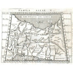
Verkauft - Ptolemaios (Ptolemy, Ptolemäus) Tabula Asiae V.Bestell-Nr .: 02787
"Tabula Asiae V.". Copper-engraving by G. Porro after C. Ptolemaeus' map of the region, published by G. Magini, 1597. 12,5:17 cm.
Verkauft - Magini, Giovanni Antonio Tabula Asiae VIIIBestell-Nr .: 02790
Himalaya, Tibet, Nepal, Indien, China. "Tabula Asiae VIII". Orig. copper-engraving by G. Porro after C. Ptolemy's map of the region. From G. A. Magini's "Geographicae Cl. Ptolemaei ...". Published in Cologne by P. Keschedt, 1597. 13,5:17 cm.
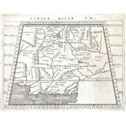
Verkauft - Magini, Giovanni Antonio (Autor) Ptolemaios (Ptolemy, Ptolemäus) (Andere Autoren) Tabvla Asiae IXBestell-Nr .: 02793
"Tabula Asiae IX". Orig. copper-engraving from G. A. Magini's Geographiae Universae. Engraved by G. Porro. Published in Nuremberg by P. Keschedt, 1597. 12,5:17 cm.
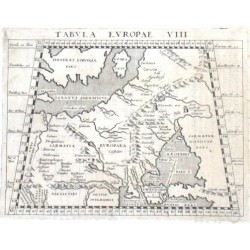
Verkauft - Ptolemaios (Ptolemy, Ptolemäus) Tabula Europae VIIIBestell-Nr .: 02796
"Tabula Europae VIII". Copper-engraving by G. Porro according to C. Ptolemaeus' map of the region, published by G. Magini, 1597. 12,5:17 cm.
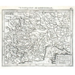
Verkauft - Hondius, Jodocus Pedemontana Regio, cum Genuensium...Bestell-Nr .: 02808
"Pedemontana Regio, cum Genuensium territorio et Montisfferrati Marchionatu.". Orig. copper-engraving by J. Hondius, published in Amsterdam, 1608. With ornamental cartouche and "Milliaria Italiaca" in upper left corner. 14,5:18 cm.
Verkauft - Ortelius, Abraham Sloweine - Slavonia, Kupferstich Karte,...Bestell-Nr .: 02769
"Slavonia". Copper-engraving by A. Ortelius, 1598. With textual title cartouche in lower left cornerand "Scala milliar." in lower right corner. 7,5:11 cm.
Verkauft - Ortelius, Abraham Sloweinin, Croatiaen - Illyricum,...Bestell-Nr .: 02772
"Illyricum". Copper-engraving by A. Ortelius, 1601. With ornamental title cartouche in lower left corner and "Scala milliar." in lower right corner. 9:12,5 cm.
Verkauft - Mercator, Gerardus Forum Iulium. Karstia. Carniola, Histria etc.Bestell-Nr .: 02775
"Forum Iulium. Karstia. Carniola, Histria etc.". Copper-engraving by G. Mercator, published by J. Hondius, 1607. With ornamental title-cartouche and "Milliaria Italica" in another ornametal cartouche. 14,5:18 cm.
Verkauft - Magini, Giovanni Antonio Tabvla Asiae VIIBestell-Nr .: 02778
"Tabula Asiae VII". Orig. copper-engraving from G. A. Magini's Geographiae Universae. Engraved by G. Porro. Published in Nuremberg by P. Keschedt, 1597. 12,5:17 cm.
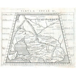
Verkauft - Ptolemaios (Ptolemy, Ptolemäus) Tabula Asiae IIBestell-Nr .: 02781
"Tabula Asiae II". Copper-engraving by G. Porro according to C. Ptolemaeus' map of the region, published by G. Magini, 1597. 12,5:17 cm.
Verkauft - Dietell, Ch. Die Landschaft Syrien - Der Berg Libanus...Bestell-Nr .: 02763
Naher Osten."Die Landschaft Syrien". Copper - engraving, ca. 1720 by C(hristoph) Dietell. With ornamental title - cartouche and inset chart of "Der Berg Libanus und das Land Kesroan" with another ornamental cartouche. 27:25,5 cm.
Verkauft - Sicard, Claudius Land - Tafel über Nider - Thebais Und über...Bestell-Nr .: 02766
Ägypten."Land - Tafel über Nider - Thebais Und über den Auszug deren Israeliten aus Aegypten". Copper - engraving by C.(hristoph) Dietell, ca. 1720 according to C. Sicard's map of the region. With textual cartouche and 2 views of monasteries...
Verkauft - Münster, Sebastian Von den vierzehn Regionen oder Creysen in...Bestell-Nr .: 02754
"Von den vierzehn Regionen oder Creysen in welche die Statt Rom war abgetheilet. - Situs Urbis Romae". Orig. woodcut by S. Munster from German edition of his Cosmographia, Basel: Henric Petri, ca.1580. With 2 ornamental cartouches (one of them...
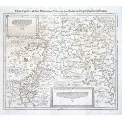
Verkauft - Münster, Sebastian Syria / Cypern / Palestina / Mesopotamia /...Bestell-Nr .: 02757
"Syria / Cypern / Palestina / Mesopotamia / Babylonia / zwey Arabia / mit Bergen / Waesseren und Stetten". Orig. woodcut by S. Munster from German edition of his Cosmographia, Basel: Henric Petri, ca.1580. With 2 textual cartouches. 30,5:36 cm...
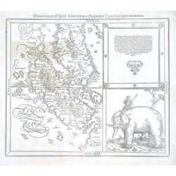
Verkauft - Münster, Sebastian Sumatra ein grosse Insel / so von den...Bestell-Nr .: 02760
"Sumatra ein grosse Insel / so von den alten Geographen Taprobana genennet worden". Orig. woodcut by S. Munster from German edition of his Cosmographia, Basel: Henric Petri, ca.1580. With great textual cartouche and a picture of an elephanth with...
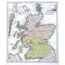
Verkauft - Weigel, Christoph der Ältere Scotia Cambdeni et SibbaldiBestell-Nr .: 02742
"Scotia Cambdeni et Sibbaldi". Copper-engraving by M(ichael) K(auffer), published by Christoph Weigel, Nurnberg, ca. 1720. Original old colouring. With figure title cartouche. 38,5:32,5 cm.
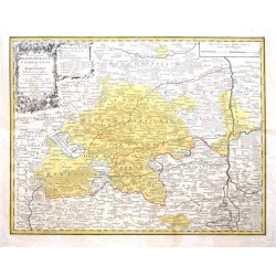
Verkauft - Cnopf, Matthäus Ferdinand Principatus Brandenburgico - Culmbacensis...Bestell-Nr .: 02751
"Principatus Brandenburgico - Culmbacensis vel Baruthini Tabula Geographica quoad partem inferiorem expressus". Altkol. Kupf.-Kte. bei Homann Erben, 1763. Oben links ornament. Titelkartusche mit 4 Wappen und "Erklaerung der Zeichen" in floral....
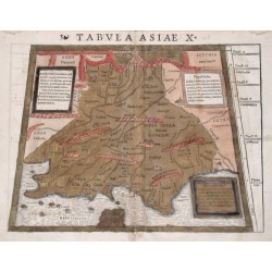
Verkauft - Ptolemaios (Ptolemy, Ptolemäus) Tabula Asiae XBestell-Nr .: 02730
Indien."Tabula Asiae X". Altkol. Holzschn. - Karte aus Ptolemäus "Geographia" bei S. Münster, 1540. Mit 3 Textkartuschen. 25:25 (35) cm, Trapezformat.
Verkauft - Merian, Matthäus nova descriptio AfricaeBestell-Nr .: 02733
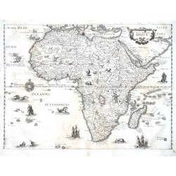
Afrika."nova descriptio Africae". Copper-engraving by M. Merian (1593-1650), published ca. 1640. With ornamental title-cartouche, animals and rich maritime illustrations. 27:36 cm.
Verkauft - Ortelius, Abraham Aegyptus AntiquaBestell-Nr .: 02736
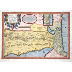
Ägypten."Aegyptus Antiqua". Copper-engraving by A. Ortelius, 1595. Original old colouring. With great ornamental title cartouche, "Incertae positionis loca" in round cartouche, the environs of Alexandria in small ornamental cartouche and 2 ships...
Verkauft - Ptolemaios (Ptolemy, Ptolemäus) Totius Africae tabula & descriptio...Bestell-Nr .: 02727
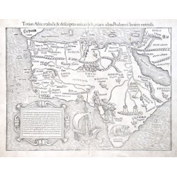
Afrika."Totius Africae tabula & descriptio universalis, etiam ultra Ptolemaei limites extensa". Original wood-cut after C. Ptolemaeus' map of Africa published by Sebastian Munster, ca. 1550. With Latin heading title, ornamental cartouche and rich...
Verkauft - Seutter, Matthäus (Autor) Lotter, Tobias Conrad (Andere Autoren) Diversi Globi Terr - AqueiBestell-Nr .: 02715
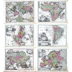
"Diversi Globi Terr - Aquei... + Africa + Nov Orbis sive America Septentrionalis + America Meridionalis + Asia + Europa". Copper - engravings (each one ca. 19,5:25,5 cm) by T. C. Lotter and A. Silbereisen according to A. C. Seutter. Published by...
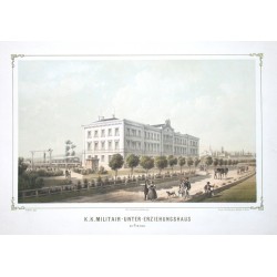
Verkauft - Doderer, W. von K. k. Militair - Unter - Erziehungshaus zu...Bestell-Nr .: 02697
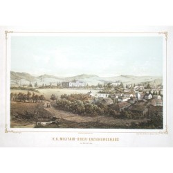
"K. k. Militair - Unter - Erziehungshaus zu Prerau". Barevná litografie podle W. von Dodedrera. Vídeň: Reiffenstein & Rösch, ca. 1850 - 1860 ("Die k.k. Militair-Erziehungs-Anstalten"). 26,5:43,5 cm.
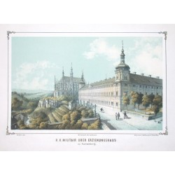
Verkauft - Doderer, W. von K. k. Militair Ober Erziehungshaus zu...Bestell-Nr .: 02700
"K. k. Militair Ober Erziehungshaus zu Kuttenberg". Barevná litografie podle W. von Dodedrera. Vídeň: Reiffenstein & Rösch, ca. 1850 - 1860 ("Die k.k. Militair-Erziehungs-Anstalten"). 26,5:43 cm.
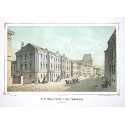
Verkauft - Doderer, W. von K. k. Infanterie - Schulcompagnie zu OlmützBestell-Nr .: 02703
"K. k. Infanterie - Schulcompagnie zu Olmütz". Barevná litografie podle W. von Dodedrera. Vídeň: Reiffenstein & Rösch, ca. 1850 - 1860 ("Die k.k. Militair-Erziehungs-Anstalten"). 26,5:44 cm.
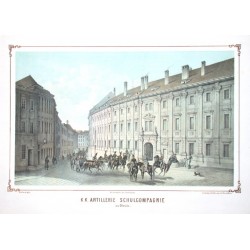
Verkauft - Doderer, W. von K. k. Artillerie Schulcompagnie zu OlmützBestell-Nr .: 02706
"K. k. Artillerie Schulcompagnie zu Olmütz". Barevná litografie podle W. von Dodedrera. Vídeň: Reiffenstein & Rösch, ca. 1850 - 1860 ("Die k.k. Militair-Erziehungs-Anstalten"). 26,5:44 cm.
Verkauft - Doderer, W. von K. k. Militair - Ober - Erziehungshaus zu...Bestell-Nr .: 02709
"K. k. Militair - Ober - Erziehungshaus zu Kaschau". Barevná litografie podle W. von Dodedrera, ryl J. Varoni. Vídeň: Reiffenstein & Rösch, ca. 1850 - 1860 ("Die k.k. Militair-Erziehungs-Anstalten"). 26,5:44 cm.
Verkauft - Greger, Jan Řehoř Ansicht des Schlosses und der Stadt...Bestell-Nr .: 02712
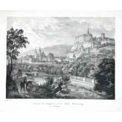
"Ansicht des Schlosses und der Stadt Winterberg in Böhmen". Litografie od Jana Řehoře Gregera (1802-1835). Z "Malerische Darstellungen der österr. Monarchie", Wien: A. F. Kunike, ca. 1830. 24:32 cm.
Verkauft - Homann Stadt und Vestung StrasburgBestell-Nr .: 02673
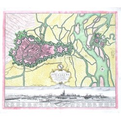
"Stadt und Vestung Strasburg". Gesamtansicht der Stadt mit Erklärungen (10,5:56,5 cm) und Befestigungsplan von Strasburg. Altkol. Kupf. bei Homann Erben, 1734. Mit ornament. Titelkart. mit Wappen. 47,5:56,5 cm.
Verkauft - Seutter, Matthäus Praga - PragBestell-Nr .: 02676
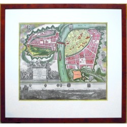
"Praga celeberrima et maxima totius Bohemiae Metropolis et Universitas Florentißima ad Muldau Fl.". Gesamtansicht (nach Hollar- 11:56 cm) und Befestigungsplan von Prag. Altkol. Kupferstich, M. Seutter, um 1740. Mit gr. fig. Titelkart. und...
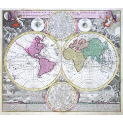
Verkauft - Homann, J. B. Planiglobii Terrestris cum utroq....Bestell-Nr .: 02664
Die Welt."Planiglobii Terrestris cum utroq. Hemisphaerio Caelesti Generalis Exhibitio". Altkol. Kupf.-Kte. in 2 Hemisphären, J. B. Homann, Nürnberg, um 1720. Mit 2 Sternbildkarten in der Mitte. 48:54,5 cm.
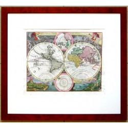
Verkauft - Homann, Johann Baptist Planiglobium Terrestre MinusBestell-Nr .: 02667
"Planiglobium Terrestre Minus". Altkol. Kupf.-Kte. von der Welt in 2 Hemisphären nach J. B. Homann bei C. Weigel, Nürnberg, um 1730. Mit 2 Karten von Nord- und Südpol in der Mitte. 28:35,5 cm.
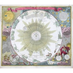
Verkauft - Doppelmayr, J. G. Systema solare et planetarium ex hypothesi...Bestell-Nr .: 02652
"Systema solare et planetarium ex hypothesi Copernicana ...". Altkol. Kupf.-Kte. von J. B. Homann nach J. G. Doppelmayr, um 1720. Darstellung des Universums nach Kopernikus. Mit Abbildung des Sonnenfinsternis im Jahre 1706 auf der nördl....
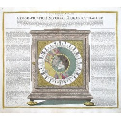
Verkauft - Landteck, Zacharias Geographische Universal - Zeig und Schlag...Bestell-Nr .: 02655
Die Welt. "Geographische Universal - Zeig und Schlag - Uhr". Altkol. Kupf. bei J. B. Homann, um 1720. 49:58 cm.
Verkauft