Keine Artikel
Alte Landkarten und Stadtansichten
- Afrika
- Amerika
- Amerika (Kontinent)
- Antillen
- Argentinien
- Bermudainseln
- Brasilien
- Chile
- Florida
- Guyana
- Hawaiiinseln
- Honduras
- Kalifornien
- Kanada
- Kolumbien
- Louisiana
- Magellanstraße
- Mexico
- Mittelamerika und Antillen
- Neuengland
- New York
- Nordamerika
- Nordkaroline
- Panama
- Paraguay
- Pennsylvania
- Peru
- Südamerika
- Uruguay
- Venezuela
- Vereinigte Staaten (USA)
- Alabama
- Arkansas
- Boston
- Connecticut
- Florida
- Georgia
- Illinois
- Iowa
- Kentucky
- Louisiana
- Maine
- Maryland und Delaware
- Massachusetts und Rhode Island
- Michigan
- Mississippi
- Missouri
- New Hampshire und Vermont
- New Jersey
- New York
- Ohio
- Ostküste von USA
- Pennsylvania
- Philadelphia
- Rhode Island
- South Carolina
- Tennessee
- Texas
- Virginia
- Wisconsin
- Virginia
- Asien und Australien
- Asien (Kontinent)
- Australien
- Burma
- China
- Französisch-Polynesien
- Golf von Bengalen
- Indien
- Indien, China, Nepal
- Indischer Ozean
- Indonesien
- Israel / Palästina
- Japan
- Kaspische Meer
- Korea
- Malaysien
- Mikronesien
- Naher Osten
- Neuseeland
- Nordostasien
- Ostasien
- Pakistan
- Philippinnen
- Polynesien
- Sri Lanka (Ceylon)
- Südostasien
- Südwestasien
- Türkei
- Atlases
- Europa
- Belgien, Niederlande, Luxemburg
- Alkmaar
- Amsterdam
- Antwerpen
- Arnhem
- Belgien und Luxemburg
- Bergen op Zoom
- Blokzijl
- Bommenede
- Brabant
- Breda
- Brielle
- Brugge
- Brüssel
- Charleroi
- Delft
- Den Haag
- Dinant
- Doornik
- Dordrecht
- Drenthe
- Drenthe und Overijseel
- Elburg
- Flandern
- Fort Rammekens
- Friesland
- Friesland und Groningen
- Geertruidenberg
- Gelderland
- Geraardsbergen
- Grave
- Groningen
- Haarlem
- Hainaut
- Hannut
- Harderwijk
- Harlingen
- Holland
- Hulst
- Huy
- Kortryk
- Leeuwarden
- Leiden
- Lier
- Limbourg
- Limburg
- Löwen
- Lüttich
- Luxemburg
- Luxemburg (Stadt)
- Maastricht
- Mechelen
- Menin
- Middelburg
- Mons
- Namur
- Niederlande
- Niederlande und Belgien
- Nijmegen
- Ostende
- Overijssel
- Rotterdam
- Ruremonde
- s-Hertogenbosch
- Spa
- Stavoren
- Steenwijk
- Tiel
- Utrecht
- Veere
- Veurne
- Vlissingen
- Ypern
- Zaltbommel
- Zeeland
- Zieriksee
- Zierikzee
- Zutphen
- Zwolle
- Zype
- Böhmen, Mähren, Schlesien und Lausitz
- Adršpach
- Andělská Hora (hrad)
- Arnau
- Aussig
- Bad Liebwerda
- Bechyňsko
- Beraun
- Berounsko
- Berounsko a Plzeňsko
- Bílina
- Blansko
- Blatná
- Böhmen
- Böhmen, Mähren und Schlesien
- Bollechowitz
- Bömisch Aicha
- Borotín
- Bösig
- Boskovice
- Bouzov
- Brandýs nad Labem
- Branná (okr. Šumperk)
- Břeclav
- Březnice
- Brněnsko
- Brněnsko a Uherskohardišťsko
- Brodce (okr. Mladá Boleslav)
- Broumov
- Brtnice
- Brünn
- Budeč (hradiště)
- Budweis
- Bürglitz
- Buštěhrad
- Buzice (tvrz)
- Čáslav
- Čáslavsko
- Čelákovice
- Česká Lípa
- České Švýcarsko
- Český Brod
- Český Krumlov
- Český Šternberk
- Cheb
- Chebsko a Žatecko
- Chlum (okr. Kutná Hora)
- Chlum Svaté Máří
- Chlumec nad Cidlinou
- Chodová Planá
- Chomutov
- Choustníkovo Hradiště (zřícenina hradu)
- Chrudim
- Chrudimsko
- Chrudimsko, Čáslavsko, Kouřimsko
- Děčín
- Dívčí Hrad
- Doksany (okr. Litoměřice)
- Dolní Olešnice - Nové Zámky
- Dolní Životice (okr. Opava)
- Doupov
- Dubí
- Duchcov
- Dvojhradí (Mstišov)
- Dvůr Králové nad Labem
- Eger - und Elbogenland
- Egerberg
- Egerberk (Klášterec nad Ohří)
- Felixburg (Klášterec nad Ohří)
- Františkovy Lázně
- Frauenberg in Böhmen
- Frenštát pod Radhošťem
- Friedrichsthal
- Frýdlant
- Graupen
- Habrovany
- Hartenberg (Hřebeny, okr. Sokolov)
- Hassenstein
- Hauenštejn (Horní hrad, okr. Karlovy Vary)
- Házmburk
- Helfštýn
- Herrnskretschen
- Hlavačov (Hlaváčov, Rakovník)
- Hohenelbe
- Hořice (v Podkrkonoší)
- Hradec Králové
- Hranice na Moravě
- Hrubá Skála
- Hukvaldy
- Jáchymov
- Jankov
- Jánský Vrch
- Jánský Vrch (Javorník)
- Jaromirsch
- Jenstein
- Jeseník
- Jestřebí
- Jezeří
- Jičín
- Jihlava
- Jižní Čechy
- Johannesbad
- Kaceřov (Plzeň-sever)
- Kadaň
- Kamaick
- Karlsbad
- Karlstein
- Kasejovice - Řesanice
- Klabava (Ejpovice, okr. Rokycany)
- Kladno
- Kladruby
- Klatovy
- Kokořín
- Kolín
- Kondrac
- Konojedy (u Litoměřic)
- Konopiště
- Kopidlno (okr. Jičín)
- Kost
- Kostelec nad Labem
- Kostenblatt
- Kouřimsko
- Krakovec
- Králíky
- Královéhradecko
- Krásný Dvůr (okr. Louny)
- Krašov (hrad)
- Kratochvíle (zámek)
- Křečov (okr. Louny)
- Křepenice
- Krkonoše
- Krnov
- Kroměříž
- Krušné hory
- Kuks
- Kumburk
- Kunětická Hora
- Kunžvart (Šumava)
- Kuttenberg
- Kynšperk nad Ohří
- Kynžvart (zámek)
- Kyselka
- Kyšperk
- Lanšperk
- Laun
- Lázně Libverda
- Ledeč nad Sázavou
- Lednice
- Libá (okr. Cheb)
- Libějovice
- Liberec
- Liběšice
- Liblín (okr. Rokycany)
- Libochovany
- Libochovice
- Libštejn
- Lina (Vroutek, okr. Louny)
- Lipnice nad Sázavou
- Litoměřice
- Litoměřicko
- Litomyšl
- Littitz
- Lobositz
- Loket
- Luhačovice
- Lužice
- Lysá nad Labem
- Mähren
- Marienbad
- Melnik
- Mikulov
- Milčany
- Milešov (Velemín)
- Milešovka
- Miletín
- Milíčeves (okr. Jičín)
- Mladá Boleslav
- Mladoboleslavsko
- Mladoboleslavsko a Litoměřicko
- Mnichovo Hradiště
- Most
- Mšec
- Mšeno
- Mühlhausen an der Moldau
- Mürau
- Náchod
- Napajedla
- Návarov
- Nepomuk
- Neuhaus
- Nimburg
- Nové Hrady (okr. Ústí nad Orlicí)
- Nový Bor
- Okoř
- Olmütz
- Olomoucko
- Ondrášov (Moravský Beroun)
- Opava
- Orlík nad Vltavou
- Osek
- Ostrov nad Ohří
- Pardubice
- Patzau
- Pavlov
- Pecka (hrad)
- Pernstein
- Petrohrad (Petršpurk, okr. Louny)
- Písek
- Plaňany
- Plasy
- Plzeň
- Plzeňsko
- Podiebrad
- Polná
- Prachatice
- Prácheňsko
- Prag
- Praha - Cheb
- Praha a okolí
- Prerau
- Přerovsko
- Pressnitz
- Proboštov
- Proseč u Pošné (okr. Pelhřimov)
- Protivín
- Przelautsch
- Pullitz
- Raabstein
- Rabí
- Račice (Vyškov)
- Radim (okr. Kolín)
- Rájec nad Svitavou
- Rajhrad
- Rakovnicko
- Rakovník
- Ronov (okr. Česká Lípa)
- Ronov nad Sázavou
- Rosstein
- Roudnice nad Labem
- Rožmberk nad Vltavou
- Rožnov pod Radhoštěm
- Rudolfov (České Budějovice)
- Rychmburk
- Rychnov nad Kněžnou
- Rýzmburk (hrad)
- Rzeczkowitz
- Schellenberg
- Schlan
- Schreckenstein
- Schwamberg
- Sedlec
- Severní Čechy
- Skuteč
- Slavkov u Brna
- Sloup (hrad)
- Smečna
- Smidary (okr. Hradec Králové)
- Smirschitz
- Sovinec (hrad)
- Šternberk (Ledce)
- Strakonice
- Štramberk
- Šumava
- Šumburk (Šumná)
- Šumperk
- Svatý Jan pod Skalou
- Svojanov (hrad)
- Svojšice
- Tábor
- Táborsko a Českobudějovicko
- Tachov
- Telenice - Varvažov
- Teplá
- Teplice
- Theresienstadt
- Toužetín
- Třebel
- Třeboň
- Trhanov (okr. Domažlice)
- Trosky
- Tuchoraz
- Týn nad Vltavou
- Týnec nad Labem
- Uherské Hradiště
- Újezdec (hrad)
- Uničov
- Úvaly
- Valdštejn
- Valkeřice
- Valtice
- Vartenberk - Stráž pod Ralskem (okr. Česká Lípa)
- Velehrad
- Velhartice
- Velké Meziříčí
- Velké Žernoseky
- Veveří
- Vinec
- Višňová (okr. Liberec)
- Vlastislav
- Vlkava
- Vltava
- Vrabinec
- Vřeskovice
- Východní a Severovýchodní Čechy
- Vysoké Mýto
- Vyšší Brod
- Wegstädtl
- Winterberg
- Žacléř
- Zahájí
- Zákupy
- Žampach (zámek)
- Zámrsk
- Západní Čechy
- Žatec
- Žatecko
- Žebrák a Točník
- Želiv
- Žireč
- Žleb
- Zlenice (Hláska)
- Znojemsko a Jihlavsko
- Znojmo
- Zornstein
- Zvíkov
- Zvířetice
- Deutschland
- Baden-Württemberg
- Bad Mergentheim
- Bad Säckingen
- Bad Teinach-Zavelstein
- Baden-Baden
- Balingen
- Biberach an der Riß
- Böblingen
- Bodensee
- Breisach am Rhein
- Breisgau
- Bretten
- Calw
- Donaueschingen
- Dornhan
- Dornstetten
- Ellwangen
- Esslingen
- Freiburg
- Geislingen an der Steige
- Giengen
- Grafschaft Limpurg
- Heidelberg
- Heilbronn
- Hohenlohe
- Karlsruhe
- Konstanz
- Landshut
- Leutkirch
- Mainau
- Mannheim
- Marbach am Neckar
- Maulburg
- Möckmühl
- Nagold
- Neckarlauf
- Neuenbürg
- Nord-Württemberg
- Oberschwaben
- Offenburg
- Pforzheim
- Philippsburg
- Reutlingen
- Rheinpfalz
- Rottweil
- Schwabenl
- Schwäbisch Gmünd
- Schwäbisch Hall
- Singen
- St. Blasien
- Stuttgart
- Tübingen
- Tuttlingen
- Überlingen
- Ulm
- Vaihingen a. d. Enz
- Wangen im Allgäu
- Weinheim
- Wiesensteig
- Württemberg
- Bayern
- Amberg
- Ansbach
- Aschaffenburg
- Augsburg
- Aurach
- Bad Abbach
- Bamberg
- Bogenberg (Wallfahrtskirche)
- Brettheim
- Burg Rabeneck
- Cham
- Coburg
- Dachau
- Dillingen
- Dinkelsbühl
- Donauwörth
- Eichstätt
- Forchheim
- Franken
- Freising
- Friedberg (Schwaben)
- Füssen
- Gerolzhofen
- Gräfenberg (Oberfranken)
- Günzburg
- Höchstädt an der Donau
- Ingolstadt
- Kelheim
- Kempten
- Kitzingen
- Kulmbach
- Landsberg am Lech
- Lauingen
- Lenggries
- Lichtenau (Mittelfranken)
- Lindau
- Lohr am Main
- Marxheim
- Memmingen
- Mindelheim
- Mühldorf am Inn
- München
- Nabburg
- Natternberg (Schloss)
- Neuburg an der Donau
- Neumarkt in der Oberpfalz
- Neuötting
- Neustadt an der Donau
- Niederaltaich (Kloster)
- Niederbayern
- Nordgau
- Nördlingen
- Nürnberg
- Oberaltaich
- Oberbayern
- Oberpfalz
- Oettingen
- Pappenheim
- Passau
- Pfaffenhofen
- Pöttmes
- Rain am Lech
- Regensburg
- Saal an der Donau
- Schongau
- Schrobenhausen
- Straubing
- Thurnau
- Velden
- Vilshofen an der Donau
- Wackerstein
- Wasserburg am Inn
- Weiden
- Weilheim / links Polling
- Weissenburg in Bayern
- Weltenburg
- Wörth an der Donau
- Würzburg
- Wüstenstein
- Berlin
- Brandenburg
- Bremen
- Hamburg
- Hessen
- Bad Homburg vor der Höhe
- Bad Schwalbach
- Bensheim
- Büdingen
- Darmstadt
- Dillenburg
- Eltville
- Eschwege
- Frankenberg an der Eder
- Frankfurt am Main
- Friedberg
- Fritzlar
- Fulda
- Giessen
- Hanau
- Heppenheim
- Hersfeld
- Hessen - Kassel (Landgrafschaft)
- Homberg (Efze)
- Isenburg
- Kassel
- Kelsterbach
- Mainz (Erzstift)
- Marburg
- Nassau, Weilburg, Riedesel
- Oberhessen
- Offenbach
- Usingen
- Wiesbaden
- Mecklenburg-Vorpommern/Pommern
- Niedersachsen
- Aurich
- Bad Bentheim
- Bad Gandersheim
- Bad Pyrmont
- Bentheim
- Bodenwerder
- Braunschweig
- Braunschweig-Lüneburg
- Celle
- Cuxhaven
- Emden
- Hann. Münden
- Hannover
- Hessisch Oldendorf
- Hildesheim
- Hitzacker (Elbe)
- Hoya
- Lichtenberg
- Liebenau an der Weser
- Lüneburg
- Lutter am Barenberge
- Niedersächsischer Kreis
- Nienburg a. d. Weser
- Oldenburg
- Osnabrück
- Osterode
- Osterwieck
- Ostfriesland
- Schnackenburg
- Schöppenstedt
- Stolzenau
- Verden
- Walsrode
- Winsen an der Luhe
- Wolfenbüttel
- Norddeutschland
- Nordrhein-Westfalen
- Rheinland-Pfalz
- Sachsen
- Augustusburg
- Bad Schandau
- Baruth bei Bautzen
- Bastei
- Belgern
- Bernstadt auf dem Eigen
- Berthelsdorf
- Bertsdorf-Hörnitz
- Brand
- Brauna (Schönteichen)
- Breitenfelden
- Bretnig-Hauswalde
- Burkau
- Burkersdorf (Schlegel)
- Colditz
- Cosel (Schwepnitz)
- Crostau
- Crostwitz
- Cunewalde
- Dittersbach auf dem Eigen
- Döbeln
- Dresden
- Dürrhennersdorf
- Ebersbach
- Eibau
- Eilenburg
- Elstra
- Erzgebirge
- Frankenstein (Oederan)
- Frankenthal
- Freiberg
- Friedersdorf an der Spree
- Gaußig (Bautzen)
- Gersdorf (Haselbachtal)
- Görlitz
- Grimma
- Großgrabe
- Großpostwitz
- Großschönau
- Grossenhain
- Grosssedlitz (Heidenau)
- Herrnhut
- Hirschfelde (Zittau)
- Hirschstein (Schloss)
- Jonsdorf
- Kamenz
- Kemnitz (Bernstadt auf dem Eigen)
- Klix (Großdubrau)
- Königsbrück
- Königstein
- Kottmarsdorf
- Lausitz
- Lawalde
- Leipzig
- Leuba (Ostritz)
- Leutersdorf
- Liebenwerda
- Lilienstein
- Marienberg
- Meißen
- Milkel
- Nebelschütz
- Neschwitz
- Neukirch (bei Königsbrück)
- Neukirch/Lausitz
- Niedercunnersdorf
- Niederlichtenau und Reichenbach (bei Königsbrück)
- Nostitz (Weißenberg)
- Ober Lausitz
- Obercunnersdorf
- Oberseifersdorf
- Oppach
- Oschatz
- Ostritz
- Ostro (Panschwitz-Kuckau)
- Oybin
- Panschwitz-Kuckau
- Penig
- Pirna
- Plauen
- Pöhla (Schwarzenberg)
- Prettin (Lichtenburg)
- Pulsnitz
- Purschwitz
- Radebeul
- Rammenau
- Reichenau (bei Königsbrück)
- Reichenau (Hartmannsdorf)
- Reichenbach (bei Königsbrück)
- Riesa
- Ruppersdorf
- Sachsen-Thüringen-Anhalt
- Sächsische Schweiz
- Scharfenberg
- Schönau-Berzdorf auf dem Eigen
- Schönbach
- Schönbach - Neudorf
- Schönburg
- Schwazenberg-Wolkenstein-Grünhain
- Schwepnitz
- Seifhennersdorf
- Seitendorf bei Hirschfelde (Zittau)
- Siebeneichen (Meissen)
- Sohland an der Spree
- Spitzkunnersdorf
- Spreedorf (Ebersbach)
- Stadt Wehlen
- Strehla
- Taubenheim/Spree
- Torgau
- Walddorf (Eibau)
- Waltersdorf (Großschönau)
- Wurzen
- Zittau
- Zschopau
- Zwickau
- Sachsen-Anhalt
- Aken (Elbe)
- Anhalt
- Annaburg
- Arneburg
- Barby
- Barleben
- Bitterfeld, Delitsch, Zörbig
- Coswig
- Dessau
- Elbingerode
- Freyburg (Unstrut)
- Halberstadt
- Havelberg
- Landkreis Harz
- Lutherstadt Wittenberg
- Lützen
- Magdeburg
- Magdeburg - Halle
- Mansfeld
- Merseburg
- Naumburg an der Saale
- Pretzsch a. d. Elbe
- Querfurt
- Rosslau
- Sandau (Elbe)
- Schönebeck
- Seehausen (in Altmark)
- Stolberg
- Tangermünde
- Weissenfels
- Werben
- Wittenberg
- Wittgendorf (Schnaudertal)
- Wörlitz
- Zeitz
- Zerbst
- Schleswig-Holstein
- Thüringen
- Baden-Württemberg
- Donau
- Europa (Kontinent)
- Frankreich
- Albi
- Anjou
- Arras
- Artois
- Auvergne
- Avignon
- Bar-le-Duc
- Beauce
- Beauvais
- Berry
- Blois
- Bordeaux
- Bourbonnais
- Bourbourg
- Bresse
- Brie
- Burgund-Freigrafschaft
- Calais
- Cambrai
- Cassel
- Champagne
- Château de Lichtenberg
- Chaumont
- Compiegne und Noyon
- Dauphiné
- Département Tarn
- Dombes
- Douai
- Dünkirchen
- Elsass
- Fontainebleau
- Gascogne
- Gâstinais and Senonais
- Gravelines
- Hauts-de-France
- Hondschoote
- Ile de France
- Iles de Lérins
- Korsika
- La Bassée - Hesdin
- La Rochelle
- Languedoc
- Lille
- Limoges
- Lothringen
- Lyon
- Maine
- Marseille
- Metz
- Montmélian
- Mülhausen
- Nancy
- Nevers
- Nice
- Normandie
- Orange
- Paris
- Perche
- Perpignan
- Picardie
- Poitou
- Provence
- Quercy
- Re und Oleron
- Reims - Rethel
- Rethel
- Saint-Germain-en-Laye
- Saint-Omer
- Saintonge und Aunis
- Sarlat
- Savoyen
- Savoyen und Osten Burgund (Franche - Comte)
- Strassburg
- Südfrankreich
- Südostfrankreich
- Thérouanne
- Touraine
- Valenciennes
- Vexin
- Westfrankreich
- Wissembourg
- Griechenland, Mittelmeer
- Grossbritannien und Irland
- Bedford und Buckinghamshire
- Berkshire und Hampshire
- Cambridgeshire
- Cheshire
- Cornwall
- Cumberland
- Denbigh und Flint
- Derbyshire
- Devon
- Dorset
- Durham (Grafschaft)
- England
- Essex
- Exeter
- Gloucestershire
- Großbritannien und Irland
- Hampshire
- Herefordshire
- Hertfordshire
- Hertfordshire and Middlesex
- Holy Island und Farne Island
- Huntingdonshire
- Irland
- Isle of Man
- Isle of Wight
- Kent
- Lancashire
- Leicestershire
- Lincolnshire
- London
- Middlesex
- Nordengland
- Nordostengland
- Nordwestengland
- Norfolk
- Northampton
- Northumberland
- Nottinghamshire
- Orkneys und Shetland
- Oxfordshire
- Portsmouth
- Rutland
- Schottland
- Aberdeen und Banff
- Annandale
- Argyll und Bute
- Argyllshire
- Arran
- Berwickshire
- Bute
- Caithness
- Carrick
- Clydesdale
- Cunningham
- Fife
- Galloway
- Hebriden
- Islay
- Jura
- Kintyre
- Knapdale
- Lauderdale
- Lennox
- Lewis - Harris und Skye
- Lewis and Harris
- Lothian
- Mull
- Nithsdale
- Nordschottland
- Ostschottland
- Scottish Borders
- Skye
- Strath-Navern
- Südschottland
- Sutherland
- Tayside
- Tweedail
- Uist
- Westschottland
- Shropshire
- Shropshire und Staffordshire
- Somerset
- Staffordshire
- Südostengland
- Südwestengland
- Surrey
- Sussex
- Wales
- Westmorland
- Wiltshire
- Worcestershire und Warwickshire
- Yorkshire
- Italien
- Abruzzen
- Acquapendente
- Ancona
- Apulien (Puglia)
- Arcevia
- Assisi
- Bari und Basilikata
- Belluno und Feltre
- Bergamo
- Bologna
- Bracciano
- Brescia
- Brescia und Crema
- Cadore
- Cagliari
- Caiazzo
- Camerino
- Capitanata
- Carmagnola
- Catania
- Civitavecchia
- Crema
- Cremona
- Cuneo
- Elba
- Emilia Romagna
- Faenza
- Fano
- Ferrara
- Florenz
- Fondi
- Friaul
- Gaeta
- Gallipoli
- Genua
- Ischia
- Italien
- Kalabrien
- Kampanien
- Lago di Como
- Lago Maggiore
- Lazio
- Lerici
- Ligurien (Italienische Riviera)
- Livorno
- Lombardei
- Loreto
- Lucca
- Mailand
- Mantua
- Mantua
- Marche (Ancona)
- Meran
- Messina
- Mirandola
- Mittelitalien
- Modena
- Molise
- Monferrato
- Neapel
- Netuno
- Nocera Umbra
- Norditalien
- Orvieto
- Orvieto und Loreto
- Otranto
- Padua
- Palermo
- Parma
- Parma und Piacenza
- Pavia
- Perugia
- Pesaro
- Piacenza
- Piemont
- Pinerolo
- Piombino
- Pisa
- Po
- Pozzuoli
- Puglia und Calabria
- Ravenna
- Reggio di Calabria
- Reggio Emilia
- Rimini
- Rom
- Romagna
- Rovereto
- Rovigo
- San Marino
- Sardinien
- Siena
- Sizilien
- Sizilien und Malta
- Sizilien und Sardinien
- Spoleto
- Süditalien
- Sulmona
- Taranto
- Terracina
- Tirol
- Tivoli
- Tortona
- Toskana
- Trapani
- Trentino
- Trentino-Alto Adige / Südtirol
- Treviso
- Tricarico
- Triest
- Turin
- Udine
- Umbria
- Urbino
- Velletri
- Venedig
- Vercelli
- Verona
- Vicenza
- Viterbo
- Labe
- Mitteleuropa
- Mittelmeer
- Monaco
- Nordeuropa
- Österreich
- Güssing (Burgenland)
- Innsbruck
- Kärnten
- Niederösterreich
- Oberösterreich
- Aschach an der Donau
- Bad Ischl
- Baumgartenberg
- Enns
- Gmunden
- Greinburg (Schloss)
- Katzenberg (Schloss in Kirchdorf am Inn)
- Linz
- Neuhaus an der Donau (Schloss)
- Ottensheim (Schloss)
- Peuerbach
- Rannariedl (Schloss)
- Riegerting (Schloss bei Mehrnbach)
- Schönburg an der Donau
- Schwendt
- St. Nikola an der Donau
- Steyr
- Wels
- Rechnitz (Burgenland)
- Salzburg
- Salzburg und Kärnten
- Salzburger Land
- Steiermark
- Tirol
- Vorarlberg
- Wien
- Ostsee
- Polen, Schlesien, Rußland, Blatikum
- Galizien
- Kaukasus
- Lettland und Estland
- Litauen und Weissrussland
- Litauen, Lettland, Estland
- Ostbrandenburg
- Polen
- Auschwitz
- Bogatynia
- Breslau
- Danzig
- Działoszyn (Bogatynia)
- Elbing
- Jauer
- Kalwaria Zebrzydowska
- Kleinschönau
- Krakow
- Liegnitz - Neiße
- Lowicz
- Lublin
- Neisse
- Oberullersdorf
- Ośno Lubuskie (Drossen)
- Posen
- Posen und Krosno
- Przemyśl
- Radomierzyce (Stift Joachimstein)
- Rybarzowice
- Sandomierz und Biecz
- Stettin
- Teschen
- Thorn
- Türchau
- Warschau
- West-Polen
- Zamosc
- Polen und Litauen
- Pommern
- Preussen
- Russland
- Schlesien
- St. Petersburg
- Weißrussland
- Rhein
- Schweiz
- Skandinavien und Island
- Spanien und Portugal
- Andalusien
- Andalusien und Granada
- Aragonien
- Azoren
- Balearen
- Barcelona
- Barcelona und Ecija
- Burgos
- Cadiz
- Cordoba
- Extremadura
- Galizien
- Gibraltar
- Granada
- Kanarische Inseln
- Kastilien
- Katalanien
- Leon und Asturien
- Lissabon
- Madeira
- Madrid
- Navarra
- Nordostspanien
- Nordspanien
- Nordwestlichen Spanien
- Portugal
- Roses
- Sevilla
- Spanien
- Toledo und Valladolid
- Valencia
- Südost- und Osteuropa, Balkan
- Albanien
- Bulgarien und Türkei
- Dnepr
- Istrien
- Osteuropa
- Rumänien
- Rumänien, Moldavien und Ukraine
- Schwarzes Meer
- Slowakei
- Slowenien, Kroatien, Bosnien und Herzegowina, Serbien und Montenegro
- Südosteuropa
- Ukraine
- Ungarn
- Budapest
- Dregelypalank
- Eger
- Esztergom (Gran)
- Győr
- Gyula
- Hatvan
- Komitat Baranya
- Komitat Csongrád
- Komitat Heves
- Komitat Jász-Nagykun-Szolnok
- Komitat Vas
- Mohács
- Pécs
- Sárospatak
- Sopron
- Szeged
- Székesfehérvár (Stuhlweissenburg)
- Szendrő
- Szentgotthárd
- Szigetvár
- Szikszó
- Szolnok
- Tata
- Tokaj
- Törökszentmiklós
- Veszprém
- Visegrád
- Belgien, Niederlande, Luxemburg
- Inseln (Sonderkatalog)
- Welt, Ozeane, Pole und Sternbildkarten
Alte Landkarten und Stadtansichten Es gibt 8735 Artikel.
Unterkategorien
- Poppel, Johann Die St. Bartholomaeuskirche in KollinBestell-Nr .: 08085
"Die St. Bartholomaeuskirche in Kollin". Pův., velmi jemně staře kolorovaný oceloryt. Podle C. Würbse ryl J. Poppel, vyd. G. G. Lange v Darmstadtu, ca. 1835. 10,5:15,5 cm.
Verkauft - Montanus, Arnoldus Melite Insula vulgo MaltaBestell-Nr .: 08088
"Melite Insula vulgo Malta". Orig. copper-engraving, J. Ogilby, ca. 1670. With great allegorical title-cartouche, ships and a battle scene. 28:36,5 cm.
Verkauft - Dampier, William Indiae Orientalis Tabula. Land Karte von...Bestell-Nr .: 08061
Südostasien."Indiae Orientalis Tabula. Land Karte von Ost Indien". Orig. copper-engraving after W. Dampier's map of East Indies and Australia. Published 1703. With ornamental Latin-German title cartouche. 15:27 cm.
Verkauft - Dampier, William Reise des Cap. Dampier, nach Neu-Holland...Bestell-Nr .: 08064
Asien und Australien."Reise des Cap. Dampier, nach Neu-Holland etc. Anno 1699". Orig. copper-engraving after W. Dampier's map of Asia, Africa and Australia. Published 1703. With ornamental German title cartouche. 16,5:28,5 cm.
Verkauft - Bertelli, Pietro ItaliaBestell-Nr .: 08067
Italien."Italia". Orig. copper-engraving by Pietro Bertelli. Published in "Theatrum Urbium Italicarum", Venice, 1599. With ornamental title-cartouche. 13,5:18,5 cm.
Verkauft - Bodenehr, Gabriel Der Neuen Welt Begriff. Bestehend in Der...Bestell-Nr .: 08070
Die Welt."Der Neuen Welt Begriff. Bestehend in 2 Haubt Theilen als Nord America und Sud America. Der Alte Welt Begriff bestehend in 3 Haubt Theilen als Africa, Europa, Asia". Orig., old coloured copper-engraving by G. Bodenehr (1664-1758),...
Verkauft - Bodenehr, Gabriel Geographische Vorstellung der Königreiche...Bestell-Nr .: 08079
"Geographische Vorstellung der Königreiche Grosbrittannien und Irland". Orig., old coloured copper-engraving by G. Bodenehr (1664-1758), published in Augsburg ca. 1720. With figure title-cartouche, coat-of-arms, 2 ornamental cartouches and...
Verkauft - TöplitzBestell-Nr .: 08055
Teplice. "Töplitz". Pův. oceloryt. Vydal Bibliogr. Institut v Hidburghausenu, ca. 1840. 10:15 cm (pouze obrázek).
Verkauft - Riedel, J. Zur Erinnerung für Freunde der...Bestell-Nr .: 08043
"Zur Erinnerung für Freunde der Evangelischen Gemeinde zu Teplitz". Pův. litografie, J. Riedel, ca. 1840. List na památku: celkem 13 pohledů na teplické pamětihodnosti tištěných z jedné desky na žlutý podklad. Lito. titul pod...
Verkauft - Witt, L. Goldener Schlüssel. Eisenhandlung &...Bestell-Nr .: 08046
"Goldener Schlüssel. Eisenhandlung & Schlosserei. Alois Langer Senior". Kresba tuší a akvarel, L. Witt, 1889. Pohled na zámečnictví a železářskou továrnu A. Langera v Teplicích. S mnoha figurami, kočáry a koňským povozem v...
Verkauft - Bürger, Robert Das Schlangenbad in Teplitz. Le...Bestell-Nr .: 08052
"Das Schlangenbad in Teplitz. Le Schlangenbad a Teplitz". Pův. litografie, R. Bürger podle kresby O. Wagnera. Vyd. Adler und Dietze v Drážďanech, ca. 1840. S mnoha figurami v popředí a německo-francouzským titulem pod obrázkem. 16,5:24...
Verkauft - de la Feuille, Daniel L AsieBestell-Nr .: 08019
Asien."L Asie". Orig. copper-engraving published by D. de la Feuille in Amsterdam, ca. 1705. With decorative figure title-cartouche. 13,5:19 cm.
Verkauft - de la Feuille, Daniel L'Evrope Selon les Auth. les plus ModernesBestell-Nr .: 08022
"L'Europe Selon les Auth. les plus Modernes". Orig. copper-engraving published by D. de la Feuille in Amsterdam, ca. 1705. With allegorical title-cartouche (Zeus riding a bull). The map is bounded on either side by twenty armorial shields of...
Verkauft - La Feuille, Daniel de L'Amerique SeptentrionaleBestell-Nr .: 08025
Nordamerika."L'Amerique Septentrionale". Orig. copper-engraving published by D. de La Feuille in Amsterdam, ca. 1705. With decorative title-cartouche (natives, a crocodile and a serpent). 14:19 cm.
Verkauft - de la Croix, F. Mappa Mundi Plani-Sphaerica oder Carta...Bestell-Nr .: 08028
"Mappa Mundi Plani-Sphaerica oder Carta Generalis Mundi". Orig. copper-engraving published by F. de la Croix, 1705. With engraved heading-title. 13:22 cm.
Verkauft - Ptolemaios (Ptolemy, Ptolemäus) Tabvla Asiae XIIBestell-Nr .: 08013
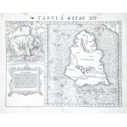
"Tabula Asiae XII". Original wood-cut after C. Ptolemaeus' map of Sri Lanka (Ceylon) by Sebastian Munster, published 1540. With Latin heading title, large depiction of an elephant and ornamental cartouche. 27:34,5 cm.
Verkauft - Ptolemaios (Ptolemy, Ptolemäus) Tabvla Evropae VIIBestell-Nr .: 08016
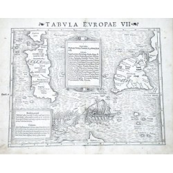
"Tabula Europae VII". Original wood-cut after C. Ptolemaeus' map of the region by Sebastian Munster, published 1540. With Latin heading title, 2 decorative cartouches and depiction of a naval battle scene. 27,5:36 cm.
Verkauft - Janssonius, Johannes Marchia Nova - Vulgo New Marck in March:...Bestell-Nr .: 07995
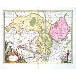
"Marchia Nova- Vulgo New Marck in March: Brandenburg:". Altkol. Kupf.-Kte. von J. Janssonius bei P. Schenk und G. Valk, Amsterdam, ca. 1700. Mit 2 kol. fig. Kart.. 39:50,5 cm.
Verkauft - Komenský, Jan Amos (Comenius) Moravia MarchionatvsBestell-Nr .: 07998
"Moravia Marchionatus". Pův. mědiryt podle J. A. Komenského. Vyd. J. Blaeu v Amsterdamu, 1663. Pův. staré kolorování. S ornament. tit. kartuší s moravským erbem a další ornament. kartuší s vysvětlivkami ("Notarum explicatio") a...
Verkauft - Visscher, Nicolaes Orbis Terrarum Nova et Accuratissima TabulaBestell-Nr .: 07980
"Orbis Terrarum Nova et Accuratissima Tabula. Auctore Nicolao Visscher". N. J. Visscher's very decorative map of the world in two hemispheres. Orig. copper-engraving, published by J. Janssonius in Amsterdam, 1658. Orig. old colouring. With...
Verkauft - Montanus, Arnoldus Insulae Americanae in Oceano SeptentrionaliBestell-Nr .: 07959
Mittelamerika und Antillen."Insulae Americanae in Oceano Septentrionali, cum Terris adiacentibus". Orig. copper-engraving after A. Montanus' map of the region from J. Ogilby's "America". Published in Leiden, 1671. With figure title-cartouche,...
Verkauft - Blome, Richard Carte de la IamaiqueBestell-Nr .: 07962
"Carte de la Iamaique Nouvellement reveuë, Divisee en ses Gouvernements, ou Paroisses, avec ses Ports, Bayes, etc.". Orig. copper-engraving, R. Blome. Published in Amsterdam by A. Wolfgang, 1688. With ornamental title-cartouche, a wind-rose, 5...
Verkauft - Bellin, Jacques Nicolas Karte von dem Eylande HaytiBestell-Nr .: 07965
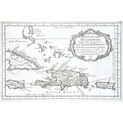
"Karte von dem Eylande Hayti heutiges Tages Espagnola oder die Insel St. Domingo Nebst den benachbarten Eylanden. Nach der Entdeckung vom Jahre 1492 und den ersten Niederlaßungen der Spanier". Orig. copper-engraving, J. N. Bellin, 1754. With...
Verkauft - Bonne, Rigobert Isles de Cuba et de la JamaiqueBestell-Nr .: 07968
"Isles de Cuba et de la Jamaique". Orig. copper-engraving (engraved by André) after R. Bonne, ca. 1780. With engraved French title and the scales of map. 24:35 cm.
Verkauft - Visscher, Nicolaes Insularum Cubae, Hispaniolae Jucatanae &...Bestell-Nr .: 07947
Antillen."Insularum Cubae, Hispaniolae Jucatanae & circumjacentium descriptio". Orig. copper-engraving from N. Visscher's "Tabularum Geographicarum ...". Published in Amsterdam by C. J. Visscher, 1649. With decorative title cartouche and the...
Verkauft - Visscher, Nicolaes Cuba InsulaBestell-Nr .: 07950
"Cuba Insula". Orig. copper-engraving from N. Visscher's "Tabularum Geographicarum ...". Engraved by P. van den Keere (Kaerius). Published in Amsterdam by C. J. Visscher, 1649. With decorative title cartouche with the scale of map ("Milliaria...
Verkauft - Mercator, Gerardus GuineaBestell-Nr .: 07920
Westafrika."Gvinea". Orig. copper-engraving after G. Mercator's map of the region. Published in Amsterdam by J. Hondius, C. Claesz. and J, Jansz., 1613. With French heading-title ("Gvinee"), ornamental title-cartouche, a sea-creature and...
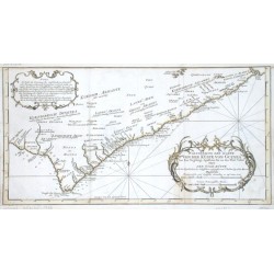
Verkauft - Bellin, Jacques Nicolas Fortsetzung der Karte von der Küste von...Bestell-Nr .: 07923
Ghana. "Fortsetzung der Karte von der Küste von Guinea von dem Vorgebirge Apollonia bis an den Fluß Volta oder Der Gold Küste". Grenzkol. Kupf.-Kte. bei J. N. Bellin, um 1750. Mit ornament. Titelkart und andere ornament. Kart. mit Erklärungen...
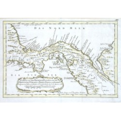
Verkauft - Bellin, Jacques Nicolas Karte von der Erdenge PanamaBestell-Nr .: 07926
Mittelamerika."Karte von der Erdenge Panama und den Provinzen Vergua, Terra Firma und Darien". Grenzkol. Kupf.-Kte. bei J. N. Bellin, dat. 1754. Mit ornament. Titelkart. 19,5:29,5 cm.
Verkauft - Montanus, Arnoldus Sinus Omnium SanctorumBestell-Nr .: 07935
"Sinus Omnium Sanctorum". Orig. copper-engraving from J. Ogilby's "America". Published in Leiden, 1671. With decorative title-cartouche, Latin explanatory notes (A.-N.) and many sailing ships in the foreground. 28:35,5 cm.
Verkauft - Montanus, Arnoldus Olinda de PhernambucoBestell-Nr .: 07938
"Olinda de Phernambuco". Orig. copper-engraving from J. Ogilby's "America". Published in Leiden, 1671. With Latin title, explanatory notes (A.-M.) and many sailing ships in the foreground. 28,5:35,5 cm.
Verkauft - Montanus, Arnoldus De Stadt Alexandrie of Scanderik. The City...Bestell-Nr .: 07908
"De Stadt Alexandrie of Scanderik. The City Alexandria or Scanderik". Orig. copper-engraving from J. Ogilby's "Africa". Published in Leiden, 1668. With Dutch/English title and explanatory notes (A.-P.) and many sailing ships in the foreground....
Verkauft - Montanus, Arnoldus The City Cairus. De Stadt CairusBestell-Nr .: 07911
"The City Cairus. De Stadt Cairus". Orig. copper-engraving from J. Ogilby's "Africa". Published in Leiden, 1668. With Dutch/English title and explanatory notes (A.-L.) and many figures and animals in foreground. 23,5:34,5 cm.
Verkauft - Montanus, Arnoldus GvineaBestell-Nr .: 07914
Westafrika."Guinea". Orig. copper-engraving from J. Ogilby's "Africa". Published in Leiden, 1668. With figure title-cartouche, the scale of map in an elephant tusk held by 2 Negro boys, many ships and animals. 26:36 cm.
Verkauft - Montanus, Arnoldus Aethiopia Inferior vel ExteriorBestell-Nr .: 07917
Südafrika."Aethiopia Inferior vel Exterior". Orig. copper-engraving from J. Ogilby's "Africa". Published in Leiden, 1668. With figure title-cartouche with the scale of map and many ships and animals. 28,5:36 cm.
Verkauft - Martini, Martinus Qvangsi, Sinarum Imperii Provincia...Bestell-Nr .: 07884
"Quangsi, Sinarum Imperii Provincia decimatertia". Orig. copper-engraving after M. Martini's map of the region. Published by J. Blaeu in Amsterdam, 1655. Original old colouring. With figure title-cartouche with the scale of map in upper left...
Verkauft - Martini, Martinus Xensi, Imperii Sinarvm Provincia tertiaBestell-Nr .: 07887
"Xensi, Imperii Sinarum Provincia tertia". Orig. copper-engraving after M. Martini's map of the region. Published by J. Blaeu in Amsterdam, 1655. Original old colouring. With figure title-cartouche, ornamental carouche of the scale of map with an...
Verkauft - Martini, Martinus Honan, Imperii Sinarvm Provincia qvintaBestell-Nr .: 07890
"Honan, Imperii Sinarum Provincia quinta". Orig. copper-engraving after M. Martini's map of the region. Published by J. Blaeu in Amsterdam, 1655. Original old colouring. With great figure title-cartouche and explanatory notes ("Notarum...
Verkauft - Martini, Martinus Qvantvng, Imperii Sinarvm Provincia dvodecimaBestell-Nr .: 07893
"Quantung, Imperii Sinarum Provincia duodecima". Orig. copper-engraving after M. Martini's map of the region. Published by J. Blaeu in Amsterdam, 1655. Original old colouring. With great figure title-cartouche and explanatory notes ("Notarum...
Verkauft - Martini, Martinus Hvqvang, Imperii Sinarvm Provincia septimaBestell-Nr .: 07896
"Huquang, Imperii Sinarum Provincia septima". Orig. copper-engraving after M. Martini's map of the region. Published by J. Blaeu in Amsterdam, 1655. Original old colouring. With great figure title-cartouche and explanatory notes ("Notarum...
Verkauft - Martini, Martinus Fokien, Imperii Sinarvm Provincia vndecimaBestell-Nr .: 07899
"Fokien, Imperii Sinarum Provincia undecima". Orig. copper-engraving after M. Martini's map of the region. Published by J. Blaeu in Amsterdam, 1655. Original old colouring. With great figure title-cartouche, ornamental cartouche with the scale of...
Verkauft - Martini, Martinus Qveichev, Imperii Sinarvm Provincia...Bestell-Nr .: 07902
"Queicheu, Imperii Sinarum Provincia decimaquarta". Orig. copper-engraving after M. Martini's map of the region. Published by J. Blaeu in Amsterdam, 1655. Original old colouring. With great figure title-cartouche, ornamental cartouche of the...
Verkauft - Martini, Martinus Chekiang, Imperii Sinarum Provincia decimaBestell-Nr .: 07878
"Chekiang, Imperii Sinarum Provincia decima". Orig. copper-engraving after M. Martini's map of the region. Published by J. Blaeu in Amsterdam, 1655. Original old colouring. With figure title-cartouche with the scale of map and explanatory notes....
Verkauft - Stöcklein, Joseph Land-Taffel der Insel Sanciano. Grab-Statt...Bestell-Nr .: 07869
"Land-Taffel der Insel Sanciano. Grab-Statt des Heiligen Franc. Xaverii auf der Insel Sanciano". Orig. copper-engraving nach J. Stöcklein, engraved by C. Dietell, 1729. A map (21,5:21 cm) of the southern coast of China with Macau, the Xiachuan...
Verkauft - Orlandi, Giovanni Il vero disegno della citta di BvdaBestell-Nr .: 07872
"Il vero disegno della citta di Buda Metropoli dell Ungheria et di Pesto situato sopra l'altr riva del Danubio. Hora recuperata dall' Imperiali l'anno 1598 a di 9 d'ottobre". Orig. etching, G. Orlandi, ca. 1600 (engraved by J. Matus). With...
Verkauft - Mercator, Gerardus Natolia, quae olim Asia minorBestell-Nr .: 07851
"Natolia, quae olim Asia minor". Orig. copper-engraving after G. Mercator's map of the region. Published by J. Janssonius, 1648-51. With ornamental title-cartouche, another ornament. cartouche with the scale of map ("Milliaria Germanica") and...
Verkauft - Mercator, Gerardus Turcici Imperii ImagoBestell-Nr .: 07854
"Turcici Imperii Imago". Orig. copper-engraving by P. Kaerius after G. Mercator's map of the region. Published by J. Janssonius, 1648-51. With ornamental title-cartouche, the scale of map ("Milliaria Germanica", "Milliaria Italica") and with...
Verkauft - Lotter, Tobias Conrad Magni Turcarum Dominatoris ImperiumBestell-Nr .: 07857
"Magni Turcarum Dominatoris Imperium". Orig. copper-engraving by T. C. Lotter after A. C. Seutter's map of the region. Published by M. Seutter in Augsburg, ca. 1740. Orig. old colouring. With great figure title-cartouche with the scale of map...
Verkauft - Mercator, Gerardus NatoliaBestell-Nr .: 07860
"Natolia". Orig. copper-engraving after G. Mercator's map of the region. Published by J. Hondius, 1607. With ornamental title-cartouche and another ornament. cartouche with the scale of map ("Milliaria Germanica"). 15:19 cm.
Verkauft - Mercator, Gerardus ChinaBestell-Nr .: 07863
China."China". Orig. copper engraving after G. Mercator's map of the region. Published by J. Hondius, 1609. With ornamental title-cartouche with the scale of map ("Milliaria Germanica") and French heading-title ("Le Royaume de la Chine"). 15:19 cm.
Verkauft