Keine Artikel
Europa
-
Belgien, Niederlande, Luxemburg
- Amsterdam
- Antwerpen
- Belgien und Luxemburg
- Bergen op Zoom
- Blokzijl
- Bommenede
- Brabant
- Brugge
- Brüssel
- Charleroi
- Delft
- Den Haag
- Dinant
- Dordrecht
- Elburg
- Flandern
- Fort Rammekens
- Friesland
- Friesland und Groningen
- Gelderland
- Geraardsbergen
- Grave
- Groningen
- Hainaut
- Harderwijk
- Harlingen
- Holland
- Hulst
- Huy
- Kortryk
- Lier
- Limbourg
- Limburg
- Löwen
- Lüttich
- Luxemburg
- Maastricht
- Mechelen
- Middelburg
- Mons
- Namur
- Niederlande
- Niederlande und Belgien
- Nijmegen
- Ostende
- Overijssel
- Rotterdam
- Spa
- Stavoren
- Tiel
- Utrecht
- Veere
- Veurne
- Ypern
- Zaltbommel
- Zeeland
- Zieriksee
- Zierikzee
- Zutphen
- Zype
-
Böhmen, Mähren und Schlesien
- Arnau
- Beraun
- Böhmen
- Böhmen, Mähren und Schlesien
- Brandýs nad Labem
- Branná (okr. Šumperk)
- Břeclav
- Brodce (okr. Mladá Boleslav)
- Brünn
- Bürglitz
- Čáslav
- Čelákovice
- Cheb
- Chlumec nad Cidlinou
- Chomutov
- Děčín
- Dolní Olešnice - Nové Zámky
- Dvůr Králové nad Labem
- Františkovy Lázně
- Frýdlant
- Graupen
- Hassenstein
- Házmburk
- Herrnskretschen
- Hohenelbe
- Hradec Králové
- Jáchymov
- Jaromirsch
- Jihlava
- Jižní Čechy
- Kamaick
- Karlsbad
- Karlstein
- Kolín
- Kostelec nad Labem
- Krkonoše
- Kunětická Hora
- Kuttenberg
- Kyšperk
- Laun
- Lednice
- Liberec
- Libochovany
- Litoměřice
- Litoměřicko
- Lobositz
- Loket
- Lysá nad Labem
- Mähren
- Marienbad
- Melnik
- Mladá Boleslav
- Mladoboleslavsko
- Most
- Náchod
- Neuhaus
- Nimburg
- Okoř
- Olmütz
- Ostrov nad Ohří
- Pardubice
- Plzeň
- Podiebrad
- Polná
- Prachatice
- Prácheňsko
- Prag
- Przelautsch
- Rabí
- Rakovnicko
- Rakovník
- Roudnice nad Labem
- Rožmberk
- Rožnov pod Radhoštěm
- Rychmburk
- Schlan
- Schwamberg
- Sedlec
- Smečna
- Smirschitz
- Šumava
- Tábor
- Teplá
- Teplice
- Theresienstadt
- Třeboň
- Týnec nad Labem
- Valdštejn
- Vinec
- Vrabinec
- Vyšší Brod
- Wegstädtl
- Zákupy
- Žampach (zámek)
- Žireč
- Žleb
- Znojmo
- Zvíkov
-
Deutschland
-
Baden-Württemberg
- Bad Teinach-Zavelstein
- Balingen
- Biberach an der Riß
- Böblingen
- Bodensee
- Breisgau
- Calw
- Dornhan
- Esslingen
- Geislingen an der Steige
- Grafschaft Limpurg
- Heidelberg
- Heilbronn
- Hohenlohe
- Karlsruhe
- Mannheim
- Möckmühl
- Nagold
- Neuenbürg
- Nord-Württemberg
- Oberschwaben
- Offenburg
- Reutlingen
- Rheinpfalz
- Schwabenl
- Schwäbisch Gmünd
- Schwäbisch Hall
- Singen
- St. Blasien
- Stuttgart
- Tübingen
- Ulm
- Vaihingen a. d. Enz
- Wangen im Allgäu
- Weinheim
- Württemberg
-
Bayern
- Aschaffenburg
- Augsburg
- Aurach
- Bad Abbach
- Bamberg
- Bogenberg (Wallfahrtskirche)
- Cham
- Coburg
- Donauwörth
- Eichstätt
- Forchheim
- Franken
- Freising
- Friedberg (Schwaben)
- Füssen
- Gräfenberg (Oberfranken)
- Höchstädt an der Donau
- Ingolstadt
- Kelheim
- Kempten
- Lauingen
- Lenggries
- Lindau
- Memmingen
- Mindelheim
- Mühldorf am Inn
- München
- Nabburg
- Natternberg (Schloss)
- Neuburg an der Donau
- Neumarkt in der Oberpfalz
- Neuötting
- Neustadt an der Donau
- Nördlingen
- Nürnberg
- Oberpfalz
- Pappenheim
- Passau
- Pfaffenhofen
- Pöttmes
- Rain am Lech
- Regensburg
- Saal an der Donau
- Schongau
- Schrobenhausen
- Straubing
- Thurnau
- Velden
- Vilshofen an der Donau
- Wackerstein
- Wasserburg am Inn
- Weilheim / links Polling
- Weissenburg in Bayern
- Weltenburg
- Würzburg
- Berlin
- Brandenburg
- Bremen
- Hamburg
- Hessen
- Mecklenburg-Vorpommern/Pommern
-
Niedersachsen
- Aurich
- Bad Bentheim
- Bad Gandersheim
- Bodenwerder
- Braunschweig
- Braunschweig-Lüneburg
- Celle
- Cuxhaven
- Emden
- Hann. Münden
- Hannover
- Hildesheim
- Hoya
- Liebenau an der Weser
- Lüneburg
- Niedersächsischer Kreis
- Nienburg a. d. Weser
- Oldenburg
- Osnabrück
- Osterode
- Osterwieck
- Ostfriesland
- Schnackenburg
- Schöppenstedt
- Stolzenau
- Walsrode
- Winsen an der Luhe
- Wolfenbüttel
- Norddeutschland
- Nordrhein-Westfalen
- Rheinland-Pfalz
- Sachsen
- Sachsen-Anhalt
- Schleswig-Holstein
- Thüringen
-
Baden-Württemberg
- Donau
- Europa (Kontinent)
-
Frankreich
- Albi
- Anjou
- Artois
- Bar-le-Duc
- Berry
- Blois
- Bourbourg
- Bresse
- Burgund-Freigrafschaft
- Cambrai
- Cassel
- Château de Lichtenberg
- Chaumont
- Compiegne und Noyon
- Dauphiné
- Département Tarn
- Elsass
- Gascogne
- Gâstinais and Senonais
- Gravelines
- Hauts-de-France
- Ile de France
- Korsika
- La Bassée - Hesdin
- Languedoc
- Lille
- Limoges
- Lothringen
- Lyon
- Maine
- Marseille
- Metz
- Montmélian
- Mülhausen
- Nancy
- Nice
- Normandie
- Paris
- Perche
- Picardie
- Poitou
- Provence
- Re und Oleron
- Reims - Rethel
- Saint-Omer
- Saintonge und Aunis
- Savoyen
- Strassburg
- Vexin
- Griechenland, Mittelmeer
-
Grossbritannien und Irland
- Bedford und Buckinghamshire
- Berkshire und Hampshire
- Cambridgeshire
- Cornwall
- Cumberland
- Denbigh und Flint
- Derbyshire
- Devon
- Dorset
- Durham (Grafschaft)
- England
- Essex
- Gloucestershire
- Großbritannien und Irland
- Herefordshire
- Hertfordshire
- Hertfordshire and Middlesex
- Huntingdonshire
- Irland
- Isle of Wight
- Kent
- Leicestershire
- Lincolnshire
- London
- Middlesex
- Nordengland
- Nordostengland
- Nordwestengland
- Norfolk
- Northampton
- Northumberland
- Nottinghamshire
- Oxfordshire
- Schottland
- Shropshire und Staffordshire
- Somerset
- Staffordshire
- Südostengland
- Südwestengland
- Surrey
- Sussex
- Wales
- Westmorland
- Wiltshire
- Worcestershire und Warwickshire
- Yorkshire
-
Italien
- Abruzzen
- Ancona
- Apulien (Puglia)
- Arcevia
- Bari und Basilikata
- Bergamo
- Bologna
- Brescia
- Brescia und Crema
- Cadore
- Cagliari
- Caiazzo
- Capitanata
- Carmagnola
- Catania
- Civitavecchia
- Crema
- Cremona
- Cuneo
- Elba
- Emilia Romagna
- Faenza
- Fano
- Ferrara
- Florenz
- Fondi
- Friaul
- Gaeta
- Gallipoli
- Genua
- Ischia
- Italien
- Kalabrien
- Kampanien
- Lazio
- Lerici
- Ligurien (Italienische Riviera)
- Livorno
- Lombardei
- Loreto
- Lucca
- Mailand
- Mantua
- Mantua
- Marche (Ancona)
- Meran
- Messina
- Mirandola
- Mittelitalien
- Modena
- Molise
- Monferrato
- Neapel
- Netuno
- Nocera Umbra
- Norditalien
- Orvieto
- Orvieto und Loreto
- Otranto
- Padua
- Palermo
- Parma
- Pavia
- Perugia
- Pesaro
- Piacenza
- Piemont
- Pinerolo
- Piombino
- Pisa
- Po
- Pozzuoli
- Reggio di Calabria
- Reggio Emilia
- Rimini
- Rom
- Rovigo
- San Marino
- Sardinien
- Siena
- Sizilien
- Sizilien und Malta
- Sizilien und Sardinien
- Spoleto
- Süditalien
- Sulmona
- Taranto
- Terracina
- Tirol
- Tivoli
- Tortona
- Toskana
- Trapani
- Trentino
- Trentino-Alto Adige / Südtirol
- Treviso
- Turin
- Udine
- Umbria
- Urbino
- Velletri
- Venedig
- Vercelli
- Verona
- Vicenza
- Viterbo
- Labe
- Mitteleuropa
- Mittelmeer
- Monaco
- Österreich
- Polen, Schlesien, Rußland, Blatikum
- Rhein
- Schweiz
- Skandinavien und Island
- Spanien und Portugal
- Südost- und Osteuropa, Balkan
Europa Es gibt 1753 Artikel.
Unterkategorien
-
Braun & Hogenberg Sarburg - PaltzBestell-Nr .: 01062
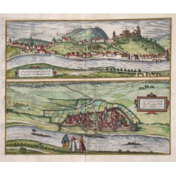
"Sarburg - Paltz". Gesamtansicht von der Stadt Saarburg mit dem Gesamtansich von Pfalzel (die Vorstadt von Trier) darunter. Kol. Kupf. aus Braun & Hogenberg, um 1580. Mit 2 Rolwerkskart. 32:39,5 cm.
12 500,00 KčZu verkaufen -
Braun & Hogenberg Calcaria, ducatus Clivensis, multis...Bestell-Nr .: 01059
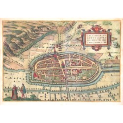
"Calcaria, ducatus Clivensis, multis dotibus, nobile opp.". Vogelschauansicht der Stadt. Altkol. Kupf. aus Braun & Hogenberg, 1575. Mit Rollwerkskart. und Trachtenpaar. 33:48 cm.
9 000,00 KčZu verkaufen -
Bertius, Petrus De ZypeBestell-Nr .: 01053
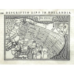
Zijpe. "De Zype". Original copperplate engraving after P. Bertius' map, published by J. Hondius, 1616-1618. With ornamental title-cartouche. 9:13 cm.
1 800,00 KčZu verkaufen -
HollandiaBestell-Nr .: 01050
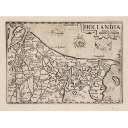
"Hollandia". Orig. Kupf-Kte aus Caert Thresoor, 1598. Mit Titelkart. und Milliaria Germanica. 9x12.5 cm.
2 300,00 KčZu verkaufen -
Schenk, Peter & Valck, Gerard Accurate Geographische Delineation derer...Bestell-Nr .: 01049
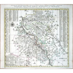
Annaburg, Prettin, Torgau, Strehla. "Accurate Geographische Delineation derer Chursächsischen Ammter Annaburg ...". Grenzkol. Kupferstich Karte, P. Schenk, um 1750. Mit Titelleiste oben. 52,5:55 cm.
3 600,00 KčZu verkaufen -
Schenk, Peter & Valck, Gerard Accurate Geographische Delineation Des...Bestell-Nr .: 01046
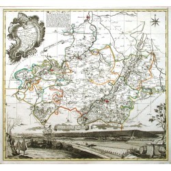
Naumburg, Weissenfels, Zeitz, Tautenburg und Pegau. "Accurate Geographische Delineation Des Stiffts Naumburg und Zeitz mit ... Schul-Ambt Pforta, Pegau, Tautenburg und Angrenzende etc.". Grenzkol. Kupf.-Kte. von P. Schenk, 1749. 50:54 cm.
7 500,00 KčZu verkaufen -
Blaeu, Willem Janszoon Fifae pars occidentalisBestell-Nr .: 00998
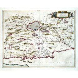
Fife. "Fifae pars occidentalis. The West part of Fife". Orig. copper-engraving published by J. Blaeu in Amsterdam, 1654. Original old colouring. With figure title-cartouche. 42:53,5 cm.
6 800,00 KčZu verkaufen -
Quad, Matthias (Autor) Bussemacher, Johann (Andere Autoren) Portugalliae que olim Lusitania, novissima...Bestell-Nr .: 00990
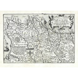
Portugal. "Portugalliae que olim Lusitania, novissima et exactissima descriptio. 1590". Orig. Kupferstich nach V. A. Seccos Karte. Aus: M. Quad. 'Europae Totius Terrarum Orbis ...'. Bei J. Bussemacher, 1594. 18,5:26,5 cm.
4 200,00 KčZu verkaufen -
Janssonius, Johannes Holy Iland - Garnesey - Farne - IarseyBestell-Nr .: 00968
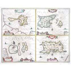
"Holy Iland - Garnesey - Farne - Iarsey". Orig. copper-engraving, J. Janssonius, ca. 1646. Original old coloring. Four maps (19:24,5 cm each) printed from one plate. Each of them with 2 figure cartouches, windrose and ships. 41:51 cm.
9 000,00 KčZu verkaufen -
Bertius, Petrus RussiaBestell-Nr .: 00957
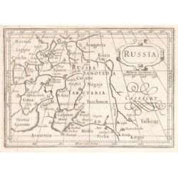
"Russia". Copper-engraving by P. Bertius published by J. Hondius, 1618. With small ornamental cartouche and the scale of map: "Milliaria Germanica co.". 9,5:13,5 cm.
1 800,00 KčZu verkaufen -
Mejer, Johannes Nordertheil vom alt Nordt Frießlande biß...Bestell-Nr .: 00953
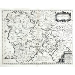
Nordfriesland. "Nordertheil vom alt Nordt Frießlande biß an das Iahr 1240". Orig. Kupferstich Karte. Gest. von M. u. N. Petersen nach J. Mejer. Bei C. Danckwerth, 1652. Mit ornament. Titelkart. 42:54,5 cm.
4 000,00 KčZu verkaufen -
Mejer, Johannes Landtcarte von dem Ambte Flensborg ohne...Bestell-Nr .: 00947
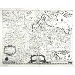
Flensburg. "Landtcarte von dem Ambte Flensborg ohne Nordgoeßherde". Orig. Kupferstich Karte. Gest. von M. u. N. Petersen nach J. Mejers Karte vom 1648. Bei C. Danckwerth, 1652. Mit ornament. Titelkart. 43:56,5 cm.
4 800,00 KčZu verkaufen -
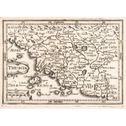
Bertius, Petrus ThusciaBestell-Nr .: 00945
"Thuscia". Copper-engraving by P. Bertius published by J. Hondius, 1618. With small ornamental cartouche and "Miliaria Italica comm.". 9,5:13,5 cm.
2 400,00 KčZu verkaufen -
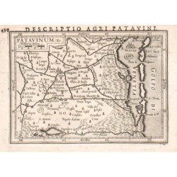
Bertius, Petrus PatavinumBestell-Nr .: 00939
"Patavinum". Copper-engraving by P. Bertius published by J. Hondius, 1618. With small ornamental cartouche and "Milliaria Italica". 9,5:13,5 cm.
2 400,00 KčZu verkaufen -
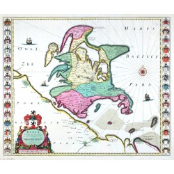
Blaeu, Willem Janszoon Rugia Insula ac Ducatus accuratissime...Bestell-Nr .: 00932
Rügen. "Rugia Insula ac Ducatus accuratissime descripta". Altkol. Kupf.-Kte. nach E. Lubin bei J. Blaeu, 1662. Mit ausgem. Wappenkart. und seitl. Leisten mit insges. 30 kol. Adelswappen. 38,5:50 cm.
12 000,00 KčZu verkaufen -
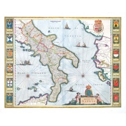
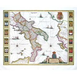
Blaeu, Willem Janszoon Regno di NapoliBestell-Nr .: 00929
"Regno di Napoli". Altkol. Kupf.-Kte. bei J. Blaeu, Amsterdam, 1659. Mit fig. Titelkart. mit einem Wappen, 6 Segelschiffe, 2 Windrosen, Meilenanzeiger ("Milliaria Italica"), gr. Wappen oben rechts und Ränder bei der Seiten, je mit...
28 000,00 KčZu verkaufen -
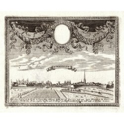
Bodenehr, Gabriel TönningenBestell-Nr .: 00873
Tönning. "Tönningen". Orig. Kupferstich, G. Bodenehr, 1720. Mit Titelkart., gr. ornament. u. floral. Bordüre und Erklärungen unten. 15,5:19,5 cm.
1 200,00 KčZu verkaufen -
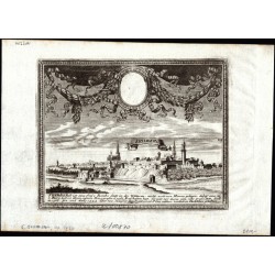
Bodenehr, Gabriel FriedbergBestell-Nr .: 00870
Friedberg. "Friedberg". Orig. Kupferstich, G. Bodenehr, Augsburg, um 1720. Gesamtansicht der Stadt mit gr. ornament. u. floral. Bordüre und Erklärungen unten. 15,5:19,5 cm.
2 100,00 KčZu verkaufen -
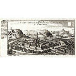
Bodenehr, Gabriel Iena in ThüringenBestell-Nr .: 00864
"Iena. Eine dero Hohen-Schuel oder Universitaet halber weitberühmte Statt, in Thüringen". Kupferstich von G. Bodenehr, um 1720. Gesamtansicht der Stadt mit Wappen (nicht ausgefühlt) und Legende bei der Seite. 16:33 cm.
2 100,00 KčZu verkaufen -
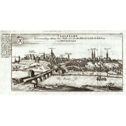
Bodenehr, Gabriel Saalfeldt in ThüringenBestell-Nr .: 00861
Saalfeld/Saale. "Saalfeldt ... in Thüringen". Orig. Kupferstich von G. Bodenehr, 1720. Mit gest. Titel, einem Wappen und Erklärungen links. 16:33,5 cm.
3 000,00 KčZu verkaufen -
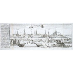
Bodenehr, Gabriel LübeckBestell-Nr .: 00852
Lübeck. "Lübeck". Kupferstich von G. Bodenehr, um 1720. Gesamtansicht der Stadt mit Erklärungen links. 13:37 cm.
4 800,00 KčZu verkaufen -
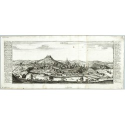
Bodenehr, Gabriel CoburgBestell-Nr .: 00849
Coburg. "Coburg". Orig. Kupferstich, G. Bodenehr, 1720. Mit gest. Titel und Erklärungen. 16,5:44,5 cm.
4 000,00 KčZu verkaufen -
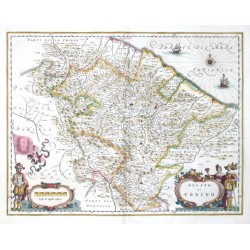
Blaeu, Joan Ducato di UrbinoBestell-Nr .: 00845
Urbino. "Ducato di Urbino". Altkol. Kupf.-Kte. bei J. und W. Blaeu, Amsterdam, 1640. Mit fig. Titelkart., andere fig. Kart. mit Meilenanzeiger ("Scala di miglia undeci"), e. Windrose und 2 Segelschiffe. 38:50 cm.
10 800,00 KčZu verkaufen -
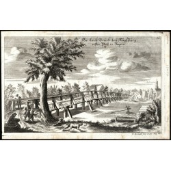
Bodenehr, Gabriel Die Lech-Brücke bey Augspurg, erster Paß...Bestell-Nr .: 00840
Augsburg-Lechhausen. "Die Lech-Brücke bey Augspurg, erster Paß in Bayern". Orig. Kupferstich, G. Bodenehr, 1720. Zeigt die Brücke über das Lech beim Lechhausen (im Hitergrund). 17,5:28,5 cm.
1 800,00 KčZu verkaufen -
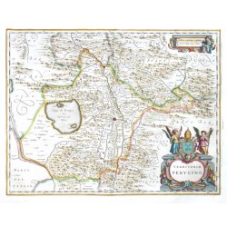
Blaeu, Joan Territorio PeruginoBestell-Nr .: 00839
Perugia. "Territorio Perugino". Altkol. Kupf.-Kte. bei J. Blaeu, Amsterdam, 1644. Mit gr. ornament. Titelkart. mit 2 Putten und einem Wappen und ornament. Kart. mit Meilenanzeiger ("Scala di Miglia cinque Italiana") und e. Putte. 38:50 cm.
9 000,00 KčZu verkaufen -
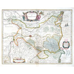
Blaeu, Joan Dvcato di FerraraBestell-Nr .: 00836
"Ducato di Ferrara". Altkol. Kupf.-Kte. bei J. Blaeu, Amsterdam, 1644. Mit fig. Titelkart., ornament. Kart. mit Meilenanzeiger ("Scala di Miglia nove"), Kart. mit Dedikation (an Andrea Brugiotto) mit einem Wappen (nicht ausgefüllt) und 2...
8 000,00 KčZu verkaufen -
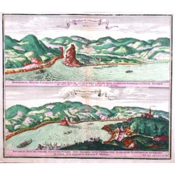
Seutter, Matthäus Der Strudl an der Donau. Der Würbel in der...Bestell-Nr .: 00831
Donau. "Der Strudl an der Donau. Der Würbel in der Donau". 2 Ansichten (je ca. 22:55 cm) untereinander von 1 Platte gedruckt. Altkol. Kupf. von M. Seutter, um 1730. Mit je 1 farb. Schriftband u. farb. Fußleiste. 49:57 cm.
6 500,00 KčZu verkaufen -
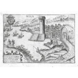
Bertelli, Pietro MolaBestell-Nr .: 00828
"Mola". Orig. copper-engraving by Pietro Bertelli. Published in "Theatrum Urbium Italicarum", Venice, ca. 1600. With ornamental cartouche, a coat-of-arms, several figures and ships. 12:18 cm.
5 000,00 KčZu verkaufen -
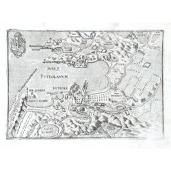
Bertelli, Pietro Mare PvteolanvmBestell-Nr .: 00813
"Mare Puteolanum - Puteoli". Orig. copper-engraving by Pietro Bertelli. Published in "Theatrum Urbium Italicarum", Venice, ca. 1600. With coat-of-arms. 13:18 cm.
3 500,00 KčZu verkaufen -
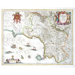
Blaeu, Joan Terra di Lavoro, olim Campania FelixBestell-Nr .: 00812
Kampanien. "Terra di Lavoro, olim Campania Felix". Altkol. Kupf.-Kte. bei J. Blaeu, Amsterdam, 1644. Mit fig. Titelkart., gr. Wappen, ornament. Kart. mit Meilenanzeiger ("Scala di miglia sette") und 2 Putten und 2 Segelschiffe. 38:50 cm.
9 500,00 KčZu verkaufen -
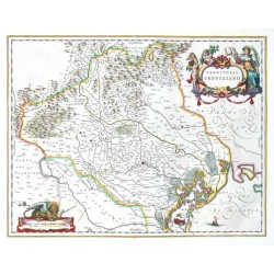
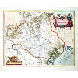
Blaeu, Joan Territorio TrevigianoBestell-Nr .: 00809
Treviso. "Territorio Trevigiano". Altkol. Kupf.-Kte. bei J. und W. Blaeu, Amsterdam, 1640. Mit fig. Titelkart., Kart. mit Meilenanzeiger ("Scala di miglia cinque Italiane") und e. Löwe, und e. Segelschiff. 38,5:50 cm.
7 500,00 KčZu verkaufen -
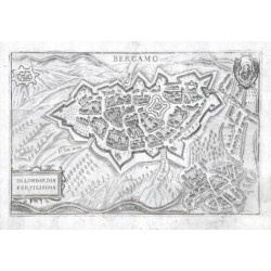
Bertelli, Pietro BergamoBestell-Nr .: 00807
"Bergamo". Orig. copper-engraving by Pietro Bertelli. Published in "Theatrum Urbium Italicarum", Venice, ca. 1600. With a coat-of-arms and ornamental cartouche. 12:18,5 cm.
9 500,00 KčZu verkaufen -
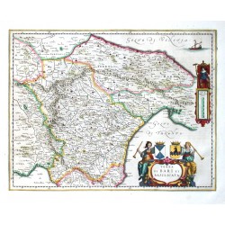
Blaeu, Joan Terra di Bari et BasilicataBestell-Nr .: 00800
Süditalien (Bari und Basilicata). "Terra di Bari et Basilicata". Altkol. Kupf.-Kte. bei W. und J. Blaeu, Amsterdam, 1644. Mit fig. Titelkart. mit 2 Wappen, andere fig. Kart mit Meilenanzeiger ("Scala di miglia undeci Italiane") und e. Segelschiff. 38:50 cm.
7 500,00 KčZu verkaufen -
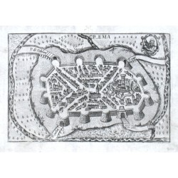
Bertelli, Pietro CremaBestell-Nr .: 00798
Crema. "Crema". Orig. copper-engraving, Pietro Bertelli, "Theatrum Urbium Italicarum", Venice, 1599. With a coat-of-arms. 12:17,5 cm.
5 500,00 KčZu verkaufen -
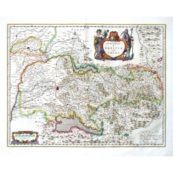
Blaeu, Joan Territorio di Brescia et di CremaBestell-Nr .: 00782
Brescia und Crema. "Territorio di Brescia et di Crema". Altkol. Kupf.-Kte. bei J. und W. Blaeu, Amsterdam, 1640. Mit fig. Titelkart. mit e. Wappen und ornament. Kart. mit Meilenanzeiger ("Scala di miglia undeci"). 38:50 cm.
13 000,00 KčZu verkaufen -
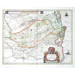
Blaeu, Joan Polesino di RovigoBestell-Nr .: 00779
Rovigo. "Polesino di Rovigo". Altkol. Kupf.-Kte. bei J. und W. Blaeu, Amsterdam, 1640. Mit ornament Titelkart. mit e. Wappen, ornament. Kart. mit Meilenanzeiger ("Scala di Quindici miglia Italiane") und 2 Segelschiffe. 38,5:50,5 cm.
7 500,00 KčZu verkaufen -
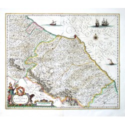
Blaeu, Joan Marca d'Ancona olim PicenumBestell-Nr .: 00773
Marche. "Marca d'Ancona olim Picenum". Altkol. Kupf.-Kte. bei W. und J. Blaeu, Amsterdam, 1644. Mit fig. Titelkart. mit e. Wappen und Meilenanzeiger ("Scala di miglia dieci"), e. Windrose und 4 Segelschiffe. 41,5:51 cm.
9 000,00 KčZu verkaufen -
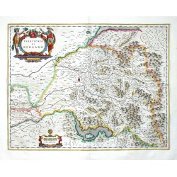
Blaeu, Joan Territorio di BergamoBestell-Nr .: 00770
Bergamo. "Territorio di Bergamo". Altkol. Kupf.-Kte. bei J. und W. Blaeu, Amsterdam, 1640. Mit fig. Titelkart. und ornament. Kart. mit Meilenanzeiger ("Scala di miglia cinque"). 38:50 cm.
15 500,00 KčZu verkaufen -
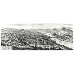
Merian, Matthäus Herbipolis - WürtzburgBestell-Nr .: 00765
Würzburg. "Herbipolis. Würtzburg". Orig. Kupferstich, M. Merian, 1648. Mit gest. Titel und Legende (1-34) unten links. 23:67 cm.
16 000,00 KčZu verkaufen -
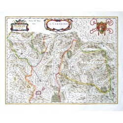
Blaeu, Joan Il CadorinoBestell-Nr .: 00761
Cadore. "Il Cadorino". Altkol. Kupf.-Kte. bei W. und J. Blaeu, Amsterdam, 1644. Mit ornament. Titelkart., von e. Putte gehaltene Kart. mit Meilenanzeiger ("Scala di miglia cinque") und gr. Wappen. 38:50 cm.
5 400,00 KčZu verkaufen -
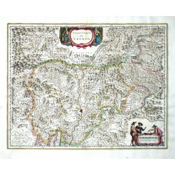
Blaeu, Willem Territorio di TrentoBestell-Nr .: 00734
Trentino - Südtirol. "Territorio di Trento". Altkol. Kupf.-Kte. bei J. und C. Blaeu, Amsterdam, 1641. Mit fig. Titelkart. und andere fig. Kart. mit Meilenanzeiger ("Scala di undeci miglia Italiane"). 38:50 cm.
8 000,00 KčZu verkaufen -
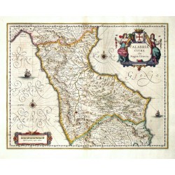
Blaeu, Joan Calabria Citra olim Magna GraeciaBestell-Nr .: 00728
Nordkalabrien. "Calabria Citra olim Magna Graecia". Altkol. Kupf.-Kte. bei J. und C. Blaeu, Amsterdam, 1641. Mit fig. Titelkart. mit einem Wappen. 38:50 cm.
7 500,00 KčZu verkaufen -
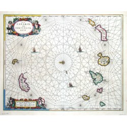
Janssonius, Johannes Insulae Canariae, olim Fortunatae DictaeBestell-Nr .: 00710
Kanarische Inseln, Madeira. "Insulae Canariae, olim Fortunatae Dictae". Altkol. Kupferstich Karte, J. Janssonius, Amsterdam, 1656. Mit zwei ausgem. fig. Kart., Windrose u. Segelschiffsstaffage. 42,5:53 cm.
12 500,00 KčZu verkaufen -
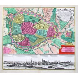
Seutter, Matthäus Brüssel - Bruxeliae Belgii cathol....Bestell-Nr .: 00668
Brüssel. "Bruxeliae Belgii cathol. ornamentum et ducatus Brabantiae metropolis". Altkol. Plan, darunter unkol. Gesamtansicht (12:56 cm). Kupf. von M. Seutter, (um 1740). Mit 2 ornament. Kart. (davon eine Ausgem.). 49,5:56 cm.
32 000,00 KčZu verkaufen -
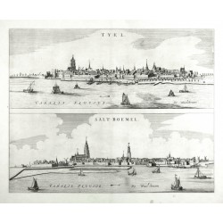
Blaeu, Joan Tyel. Salt-BoemelBestell-Nr .: 00662
Tiel - Zaltbommel. "Tyel. Salt-Boemel". Orig. Kupferstich, J. Blaeu, Amsterdam, 1649. Mit gest. Titeln und Schiffen im Vordergrund. 42,5:43,5 cm.
6 800,00 KčZu verkaufen -
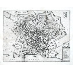
Blaeu, Joan ZutphenBestell-Nr .: 00659
Zutphen. "Zutphen". Orig. Kupfupferstich aus dem Städtebuch von J. Blaeu, 1649. Mit 2 ornament. u. herald. Kart., Wappen, reicher Schiffsstaffage u. Legende. 39:51 cm.
8 500,00 KčZu verkaufen -
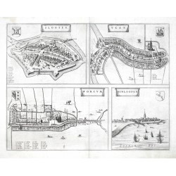
Blaeu, Joan Slooten - Ylst - Worcum - HinloopenBestell-Nr .: 00656
Friesland (Niederlande). "Slooten. Ylst. Worcum. Hinloopen". Orig. Kupferstich, J. Blaeu, Theatrum Urbium Belgicae Regiae (Städtebuch), 1649. 4 Stadtansichten aus eine Platte gedruckt. 40:51 cm.
6 800,00 KčZu verkaufen -
Blaeu, Willem Janszoon Regno di NapoliBestell-Nr .: 00647
Königreich Neapel. "Regno di Napoli". Altkol. Kupf.-Kte. bei J. Blaeu, Amsterdam, 1644. Mit fig. Titelkart. mit einem Wappen. 38:50 cm.
16 000,00 KčZu verkaufen -
Blaeu, Joan Territorio TrevigianoBestell-Nr .: 00641
Treviso. "Territorio Trevigiano". Altkol. Kupf.-Kte. bei J. Blaeu, Amsterdam, 1659. Mit fig. Titelkart., Kart. mit Meilenanzeiger ("Scala di miglia cinque Italiane") und e. Löwe, und e. Segelschiff. 38,5:50 cm.
12 000,00 KčZu verkaufen -
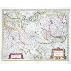
Blaeu, Willem Janszoon Mediolanum ducatusBestell-Nr .: 00635
"Mediolanum ducatus". Altkol. Kupf.-Kte. von W. Blaeu, (um 1635). Mit 2 ausgem. herald. u. ornament. Kart. 38:49 cm.
14 000,00 KčZu verkaufen

