Keine Artikel
Europa
-
Belgien, Niederlande, Luxemburg
- Amsterdam
- Antwerpen
- Belgien und Luxemburg
- Bergen op Zoom
- Blokzijl
- Bommenede
- Brabant
- Brugge
- Brüssel
- Charleroi
- Delft
- Den Haag
- Dinant
- Dordrecht
- Elburg
- Flandern
- Fort Rammekens
- Friesland
- Friesland und Groningen
- Gelderland
- Geraardsbergen
- Grave
- Groningen
- Hainaut
- Harderwijk
- Harlingen
- Holland
- Hulst
- Huy
- Kortryk
- Lier
- Limbourg
- Limburg
- Löwen
- Lüttich
- Luxemburg
- Maastricht
- Mechelen
- Middelburg
- Mons
- Namur
- Niederlande
- Niederlande und Belgien
- Nijmegen
- Ostende
- Overijssel
- Rotterdam
- Spa
- Stavoren
- Tiel
- Utrecht
- Veere
- Veurne
- Ypern
- Zaltbommel
- Zeeland
- Zieriksee
- Zierikzee
- Zutphen
- Zype
-
Böhmen, Mähren und Schlesien
- Arnau
- Beraun
- Böhmen
- Brandýs nad Labem
- Branná (okr. Šumperk)
- Brodce (okr. Mladá Boleslav)
- Broumov
- Brünn
- Bürglitz
- Čáslav
- Čelákovice
- Český Krumlov
- Cheb
- Chlumec nad Cidlinou
- Chomutov
- Děčín
- Dolní Olešnice - Nové Zámky
- Dvůr Králové nad Labem
- Františkovy Lázně
- Frýdlant
- Graupen
- Hassenstein
- Házmburk
- Herrnskretschen
- Hohenelbe
- Hradec Králové
- Jáchymov
- Jaromirsch
- Jihlava
- Jižní Čechy
- Kamaick
- Karlsbad
- Karlstein
- Kolín
- Konopiště
- Kostelec nad Labem
- Krkonoše
- Kunětická Hora
- Kuttenberg
- Kyšperk
- Laun
- Lednice
- Liberec
- Libochovany
- Lipnice nad Sázavou
- Litoměřice
- Litoměřicko
- Litomyšl
- Lobositz
- Loket
- Lysá nad Labem
- Mähren
- Marienbad
- Melnik
- Mladá Boleslav
- Mladoboleslavsko
- Most
- Náchod
- Neuhaus
- Nimburg
- Okoř
- Olmütz
- Ostrov nad Ohří
- Pardubice
- Plzeň
- Podiebrad
- Polná
- Prácheňsko
- Prag
- Przelautsch
- Rabí
- Rakovnicko
- Rakovník
- Roudnice nad Labem
- Rožmberk
- Rožnov pod Radhoštěm
- Rychmburk
- Schlan
- Schwamberg
- Sedlec
- Smečna
- Smirschitz
- Šumava
- Tábor
- Teplá
- Teplice
- Theresienstadt
- Třeboň
- Týnec nad Labem
- Uničov
- Valdštejn
- Vinec
- Vrabinec
- Vyšší Brod
- Wegstädtl
- Zákupy
- Žampach (zámek)
- Želiv
- Žireč
- Žleb
- Znojmo
- Zvíkov
-
Deutschland
-
Baden-Württemberg
- Bad Teinach-Zavelstein
- Balingen
- Biberach an der Riß
- Böblingen
- Bodensee
- Breisgau
- Calw
- Dornhan
- Esslingen
- Geislingen an der Steige
- Grafschaft Limpurg
- Heidelberg
- Heilbronn
- Hohenlohe
- Karlsruhe
- Mannheim
- Möckmühl
- Nagold
- Neuenbürg
- Nord-Württemberg
- Oberschwaben
- Offenburg
- Reutlingen
- Rheinpfalz
- Schwabenl
- Schwäbisch Gmünd
- Schwäbisch Hall
- Singen
- St. Blasien
- Stuttgart
- Tübingen
- Ulm
- Vaihingen a. d. Enz
- Wangen im Allgäu
- Weinheim
- Württemberg
-
Bayern
- Aschaffenburg
- Augsburg
- Aurach
- Bad Abbach
- Bamberg
- Bogenberg (Wallfahrtskirche)
- Cham
- Coburg
- Donauwörth
- Eichstätt
- Forchheim
- Franken
- Freising
- Friedberg (Schwaben)
- Füssen
- Gräfenberg (Oberfranken)
- Höchstädt an der Donau
- Ingolstadt
- Kelheim
- Kempten
- Lauingen
- Lenggries
- Lindau
- Memmingen
- Mindelheim
- Mühldorf am Inn
- München
- Nabburg
- Natternberg (Schloss)
- Neuburg an der Donau
- Neumarkt in der Oberpfalz
- Neuötting
- Neustadt an der Donau
- Nördlingen
- Nürnberg
- Oberpfalz
- Pappenheim
- Passau
- Pfaffenhofen
- Pöttmes
- Rain am Lech
- Regensburg
- Saal an der Donau
- Schongau
- Schrobenhausen
- Straubing
- Thurnau
- Velden
- Vilshofen an der Donau
- Wackerstein
- Wasserburg am Inn
- Weilheim / links Polling
- Weissenburg in Bayern
- Weltenburg
- Würzburg
- Berlin
- Brandenburg
- Bremen
- Hamburg
- Hessen
- Mecklenburg-Vorpommern/Pommern
-
Niedersachsen
- Aurich
- Bad Bentheim
- Bad Gandersheim
- Bodenwerder
- Braunschweig
- Braunschweig-Lüneburg
- Celle
- Cuxhaven
- Emden
- Hann. Münden
- Hannover
- Hildesheim
- Hoya
- Liebenau an der Weser
- Lüneburg
- Niedersächsischer Kreis
- Nienburg a. d. Weser
- Oldenburg
- Osnabrück
- Osterode
- Osterwieck
- Ostfriesland
- Schnackenburg
- Schöppenstedt
- Stolzenau
- Walsrode
- Winsen an der Luhe
- Wolfenbüttel
- Norddeutschland
- Nordrhein-Westfalen
- Rheinland-Pfalz
- Sachsen
- Sachsen-Anhalt
- Schleswig-Holstein
- Thüringen
-
Baden-Württemberg
- Donau
- Europa (Kontinent)
-
Frankreich
- Albi
- Anjou
- Artois
- Bar-le-Duc
- Berry
- Blois
- Bourbourg
- Bresse
- Burgund-Freigrafschaft
- Cambrai
- Cassel
- Château de Lichtenberg
- Chaumont
- Compiegne und Noyon
- Dauphiné
- Département Tarn
- Elsass
- Gascogne
- Gâstinais and Senonais
- Gravelines
- Hauts-de-France
- Ile de France
- Korsika
- La Bassée - Hesdin
- Languedoc
- Lille
- Limoges
- Lothringen
- Lyon
- Maine
- Marseille
- Metz
- Montmélian
- Mülhausen
- Nancy
- Nice
- Normandie
- Paris
- Perche
- Picardie
- Poitou
- Provence
- Re und Oleron
- Reims - Rethel
- Saint-Omer
- Saintonge und Aunis
- Savoyen
- Strassburg
- Vexin
- Griechenland, Mittelmeer
-
Grossbritannien und Irland
- Bedford und Buckinghamshire
- Berkshire und Hampshire
- Cambridgeshire
- Cornwall
- Cumberland
- Denbigh und Flint
- Derbyshire
- Devon
- Dorset
- Durham (Grafschaft)
- England
- Essex
- Gloucestershire
- Großbritannien und Irland
- Herefordshire
- Hertfordshire
- Hertfordshire and Middlesex
- Huntingdonshire
- Irland
- Isle of Wight
- Kent
- Leicestershire
- Lincolnshire
- London
- Middlesex
- Nordengland
- Nordostengland
- Nordwestengland
- Norfolk
- Northampton
- Northumberland
- Nottinghamshire
- Oxfordshire
- Schottland
- Shropshire und Staffordshire
- Somerset
- Staffordshire
- Südostengland
- Südwestengland
- Surrey
- Sussex
- Wales
- Westmorland
- Wiltshire
- Worcestershire und Warwickshire
- Yorkshire
-
Italien
- Abruzzen
- Ancona
- Apulien (Puglia)
- Arcevia
- Bari und Basilikata
- Bergamo
- Bologna
- Brescia
- Brescia und Crema
- Cadore
- Cagliari
- Caiazzo
- Capitanata
- Carmagnola
- Catania
- Civitavecchia
- Crema
- Cremona
- Cuneo
- Elba
- Emilia Romagna
- Faenza
- Fano
- Ferrara
- Florenz
- Fondi
- Friaul
- Gaeta
- Gallipoli
- Genua
- Ischia
- Italien
- Kalabrien
- Kampanien
- Lazio
- Lerici
- Ligurien (Italienische Riviera)
- Livorno
- Lombardei
- Loreto
- Lucca
- Mailand
- Mantua
- Mantua
- Marche (Ancona)
- Meran
- Messina
- Mirandola
- Mittelitalien
- Modena
- Molise
- Monferrato
- Neapel
- Netuno
- Nocera Umbra
- Norditalien
- Orvieto
- Orvieto und Loreto
- Otranto
- Padua
- Palermo
- Parma
- Pavia
- Perugia
- Pesaro
- Piacenza
- Piemont
- Pinerolo
- Piombino
- Pisa
- Po
- Pozzuoli
- Reggio di Calabria
- Reggio Emilia
- Rimini
- Rom
- Rovigo
- San Marino
- Sardinien
- Siena
- Sizilien
- Sizilien und Malta
- Sizilien und Sardinien
- Spoleto
- Süditalien
- Sulmona
- Taranto
- Terracina
- Tirol
- Tivoli
- Tortona
- Toskana
- Trapani
- Trentino
- Trentino-Alto Adige / Südtirol
- Treviso
- Turin
- Udine
- Umbria
- Urbino
- Velletri
- Venedig
- Vercelli
- Verona
- Vicenza
- Viterbo
- Labe
- Mitteleuropa
- Mittelmeer
- Monaco
- Österreich
- Polen, Schlesien, Rußland, Blatikum
- Rhein
- Schweiz
- Skandinavien und Island
- Spanien und Portugal
- Südost- und Osteuropa, Balkan
Europa Es gibt 1761 Artikel.
Unterkategorien
-
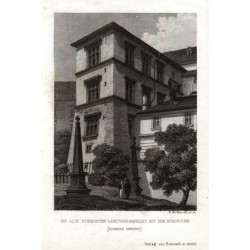
Merklas, Václav Die alte Ständische Landtags-Kanzley auf...Bestell-Nr .: 25935
Praha. Pražský hrad - Česká dvorská kancelář. "Die alte Ständische Landtags-Kanzley auf dem Hradschin". Původní ocelorytina, V. Merklas. Vyd. Borrosch a André v Praze, 1852. S půvabnou figurální stafáží v popředí a německým titulem pod obrázkem. 10:7,3 cm.
750,00 KčZu verkaufen -
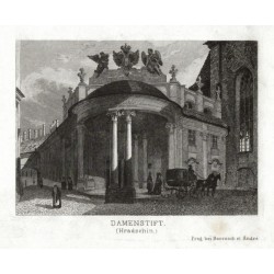
Merklas, Václav Damenstift (Hradschin)Bestell-Nr .: 25930
Praha. Ústav šlechtičen na Pražském hradě - Rožmberský palác. "Damenstift (Hradschin)". Původní ocelorytina, V. Merklas. Vyd. Borrosch a André v Praze, 1852. S půvabnou figurální stafáží v popředí a německým titulem pod obrázkem. 7,2:10 cm.
750,00 KčZu verkaufen -
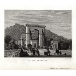
Merklas, Václav Die KettenbrückeBestell-Nr .: 25929
Praha. Most císaře Františka I. (Řetězový most). "Die Kettenbrücke". Původní ocelorytina, V. Merklas. Vyd. Borrosch a André v Praze, 1852. S půvabnou figurální stafáží v popředí a německým titulem pod obrázkem. 7:9,8 cm.
900,00 KčZu verkaufen -
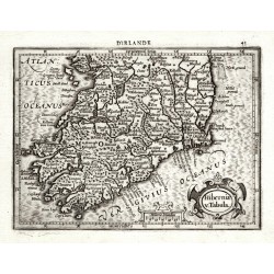
Mercator, Gerardus Hiberniae v. TabulaBestell-Nr .: 25916
Irland. "Hiberniae v. Tabula". Orig. copperplate engraving, 1607 from Mercator's Atlas Minor published by J. Hondius in Amsterdam. With ornamental title cartouche and French title above the map. 13,8:18,8 cm.
2 800,00 KčZu verkaufen -
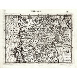
Mercator, Gerardus Ultonia Conatia et MediaBestell-Nr .: 25915
Irland. "Ultonia Conatia et Media". Orig. copperplate engraving, 1607 from Mercator's Atlas Minor published by J. Hondius in Amsterdam. With ornamental title cartouche and French title above the map. 13,5:18,5 cm.
2 800,00 KčZu verkaufen -
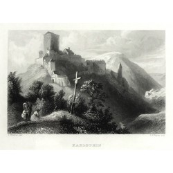
Payne, Albert Henry (Autor) Richter, L. (Andere Autoren) KarlsteinBestell-Nr .: 25891
Karlštejn. "Karlstein". Pův. ocelorytina. Podle L. Richterovy kresby ryl A. H. Payne. Vydal G. Wigand v Lipsku, 1841. S něm. titulem pod obrázkem. 10:15 cm (obrázek).
1 200,00 KčZu verkaufen -
Schmidl, Adolf Anton JungbunzlauBestell-Nr .: 25885
Mladá Boleslav. "Jungbunzlau". Původní ocelorytina z A. A. Schmidl, Das Königreich Böhmen. Vyd. J. Scheible ve Stuttgartu, 1843. S figurami v popředí a německým titulem pod obrázkem. 7,5:10 cm (obrázek).
800,00 KčZu verkaufen -
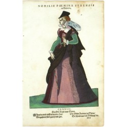
Amman, Jost Nobilis Foemina Senensis in HetruriaBestell-Nr .: 18945
Jost Amman. "Nobilis Foemina Senensis in Hetruria". Orig. Holzschnitt, J. Amman aus seinem 'Habitus praecipuorum populorum ...'. Bei H. Weigel in Nürnberg, 1577. 24:17 cm.
4 000,00 KčZu verkaufen -
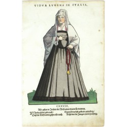
Amman, Jost Vidua Lugens in ItaliaBestell-Nr .: 18939
Jost Amman. "Vidua Lugens in Italia". Orig. Holzschnitt, J. Amman aus seinem 'Habitus praecipuorum populorum ...'. Bei H. Weigel in Nürnberg, 1577. 23:17 cm.
3 500,00 KčZu verkaufen -
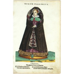
Amman, Jost Mulier FlandricaBestell-Nr .: 18957
Jost Amman. "Mulier Flandrica". Orig. Holzschnitt, J. Amman aus seinem 'Habitus praecipuorum populorum ...'. Bei H. Weigel in Nürnberg, 1577. 23,5:17 cm.
3 500,00 KčZu verkaufen -
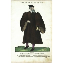
Amman, Jost Senator GenuensisBestell-Nr .: 18951
Jost Amman. "Senator Genuensis". Orig. Holzschnitt, J. Amman aus seinem 'Habitus praecipuorum populorum ...'. Bei H. Weigel in Nürnberg, 1577. 23,5:17 cm.
3 500,00 KčZu verkaufen -
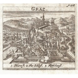
Krekwitz, Georg GräzBestell-Nr .: 25836
Graz. "Gräz". Orig. Kupferstich aus G. Krekwitz "Totius Regni Hungariae ... Descriptio", Frankfurt am Main und Nürnberk bei L. Loschge, 1686. Mit gest. Titel. 7,5:8,5 cm.
750,00 KčZu verkaufen -
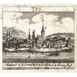
Krekwitz, Georg YpsBestell-Nr .: 25835
Ybbs an der Donau. "Yps". Orig. Kupferstich aus G. Krekwitz "Totius Regni Hungariae ... Descriptio", Frankfurt am Main und Nürnberk bei L. Loschge, 1686. Mit gest. Titel. 7,5:8,5 cm.
600,00 KčZu verkaufen -
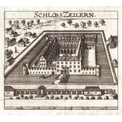
Krekwitz, Georg Schloss ZeilernBestell-Nr .: 25834
Zeillern. "Schloss Zeilern". Orig. Kupferstich aus G. Krekwitz "Totius Regni Hungariae ... Descriptio", Frankfurt am Main und Nürnberk bei L. Loschge, 1686. Mit gest. Titel. 7,5:8,5 cm.
450,00 KčZu verkaufen -
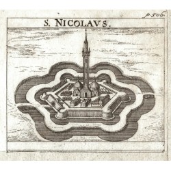
Krekwitz, Georg S. NicolausBestell-Nr .: 25832
Törökszentmiklós. "S. Nicolaus". Orig. Kupferstich aus G. Krekwitz "Totius Regni Hungariae ... Descriptio", Frankfurt am Main und Nürnberk bei L. Loschge, 1686. Mit gest. Titel. 7,5:8,5 cm.
600,00 KčZu verkaufen -
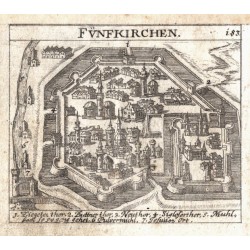
Krekwitz, Georg FünfkirchenBestell-Nr .: 25831
Pécs. "Fünfkirchen". Orig. Kupferstich aus G. Krekwitz "Totius Regni Hungariae ... Descriptio", Frankfurt am Main und Nürnberk bei L. Loschge, 1686. Mit gest. Titel. 7,5:8,5 cm.
600,00 KčZu verkaufen -
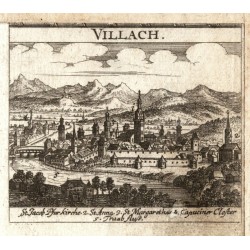
Krekwitz, Georg VillachBestell-Nr .: 25830
Villach. "Villach". Orig. Kupferstich aus G. Krekwitz "Totius Regni Hungariae ... Descriptio", Frankfurt am Main und Nürnberk bei L. Loschge, 1686. Mit gest. Titel. 7,5:8,5 cm.
750,00 KčZu verkaufen -
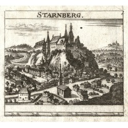
Krekwitz, Georg StarnbergBestell-Nr .: 25829
Starhemberg. "Starnberg". Orig. Kupferstich aus G. Krekwitz "Totius Regni Hungariae ... Descriptio", Frankfurt am Main und Nürnberk bei L. Loschge, 1686. Mit gest. Titel. 7,5:8,5 cm.
450,00 KčZu verkaufen -
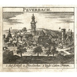
Krekwitz, Georg PeuerbachBestell-Nr .: 25827
Peuerbach. "Peuerbach". Orig. Kupferstich aus G. Krekwitz "Totius Regni Hungariae ... Descriptio", Frankfurt am Main und Nürnberk bei L. Loschge, 1686. Mit gest. Titel. 7,5:8,5 cm.
600,00 KčZu verkaufen -
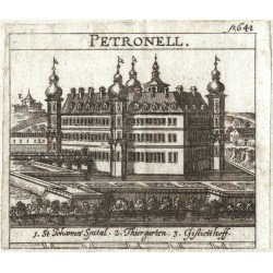
Krekwitz, Georg PetronellBestell-Nr .: 25826
Petronell-Carnuntum. "Petronell". Orig. Kupferstich aus G. Krekwitz "Totius Regni Hungariae ... Descriptio", Frankfurt am Main und Nürnberk bei L. Loschge, 1686. Mit gest. Titel. 7,5:8,5 cm.
450,00 KčZu verkaufen -
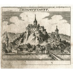
Krekwitz, Georg ThonaustauffBestell-Nr .: 25825
Donaustauf. "Thonaustauff". Orig. Kupferstich aus G. Krekwitz "Totius Regni Hungariae ... Descriptio", Frankfurt am Main und Nürnberk bei L. Loschge, 1686. Mit gest. Titel. 7,5:8,5 cm.
600,00 KčZu verkaufen -
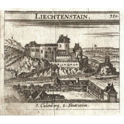
Krekwitz, Georg LiechtenstainBestell-Nr .: 25824
Liechtenstein (Wien). "Liechtenstain". Orig. Kupferstich aus G. Krekwitz "Totius Regni Hungariae ... Descriptio", Frankfurt am Main und Nürnberk bei L. Loschge, 1686. Mit gest. Titel. 7,5:8,5 cm.
450,00 KčZu verkaufen -
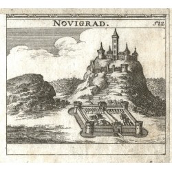
Krekwitz, Georg NovigradBestell-Nr .: 25823
Novigrad. "Novigrad". Orig. Kupferstich aus G. Krekwitz "Totius Regni Hungariae ... Descriptio", Frankfurt am Main und Nürnberk bei L. Loschge, 1686. Mit gest. Titel. 7,5:8,5 cm.
600,00 KčZu verkaufen -
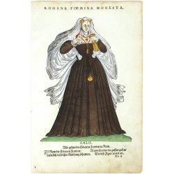
Amman, Jost Romana Foemina HonestaBestell-Nr .: 18993
Jost Amman. "Romana Foemina Honesta". Orig. Holzschnitt, J. Amman aus seinem 'Habitus praecipuorum populorum ...'. Bei H. Weigel in Nürnberg, 1577. 22,5:16,5 cm.
4 000,00 KčZu verkaufen -
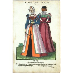
Amman, Jost Virgo Nobilis sive patricia Augustana in...Bestell-Nr .: 19287
Jost Amman. "Virgo Nobilis sive patricia Augustana in Suecia". Orig. Holzschnitt, J. Amman aus seinem 'Habitus praecipuorum populorum ...'. Bei H. Weigel in Nürnberg, 1577. 23:17 cm.
4 000,00 KčZu verkaufen -
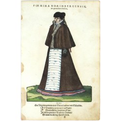
Amman, Jost Foemina Norimbergensis, in quotidiano habituBestell-Nr .: 19281
Jost Amman. "Foemina Norimbergensis, in quotidiano habitu". Orig. Holzschnitt, J. Amman aus seinem 'Habitus praecipuorum populorum ...'. Bei H. Weigel in Nürnberg, 1577. 23,5:17 cm.
3 500,00 KčZu verkaufen -
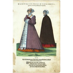
Amman, Jost Habitus Patriciae Norimbergensis, una cum...Bestell-Nr .: 19269
Jost Amman. "Habitus Patriciae Norimbergensis, una cum pedissequam nuptialis". Orig. Holzschnitt, J. Amman aus seinem 'Habitus praecipuorum populorum ...'. Bei H. Weigel in Nürnberg, 1577. 21:17 cm.
4 000,00 KčZu verkaufen -
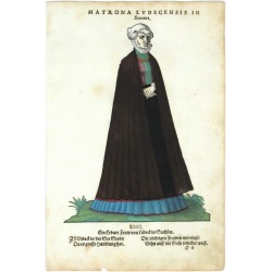
Amman, Jost Matrona Lubecensis in SaxoniaBestell-Nr .: 19251
Jost Amman. "Matrona Lubecensis in Saxonia. Ein Erbare Fraw von Lübeck in Sachsen". Orig. Holzschnitt, J. Amman aus seinem 'Habitus praecipuorum populorum ...'. Bei H. Weigel in Nürnberg, 1577. 23:16,5 cm.
3 500,00 KčZu verkaufen -
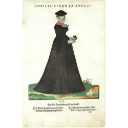
Amman, Jost Nobilis Virgo ex AngliaBestell-Nr .: 19227
Jost Amman. "Nobilis Virgo ex Anglia. Ein Edle Jungfraw auß Engellandt". Orig. Holzschnitt, J. Amman aus seinem 'Habitus praecipuorum populorum ...'. Bei H. Weigel in Nürnberg, 1577. 22:17 cm.
4 000,00 KčZu verkaufen -
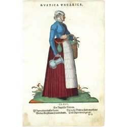
Amman, Jost Rustica UngaricaBestell-Nr .: 19245
Jost Amman. "Rustica Ungarica. Ein Ungarische Bäwrin". Orig. Holzschnitt, J. Amman aus seinem 'Habitus praecipuorum populorum ...'. Bei H. Weigel in Nürnberg, 1577. 23:17 cm.
4 000,00 KčZu verkaufen -
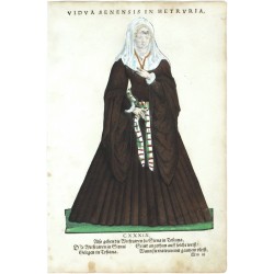
Amman, Jost Vidua Senensis in HetruriaBestell-Nr .: 19215
Jost Amman. "Vidua Senensis in Hetruria". Orig. Holzschnitt, J. Amman aus seinem 'Habitus praecipuorum populorum ...'. Bei H. Weigel in Nürnberg, 1577. 24,5:17 cm.
3 500,00 KčZu verkaufen -
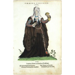
Amman, Jost Foemina Perusina in ItaliaBestell-Nr .: 19221
Jost Amman. "Foemina Perusina in Italia. Tracht der Weiber zu Perusia in Welschland". Orig. Holzschnitt, J. Amman aus seinem 'Habitus praecipuorum populorum ...'. Bei H. Weigel in Nürnberg, 1577. 22,5:16,5 cm.
4 000,00 KčZu verkaufen -
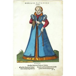
Amman, Jost Nobilis Patavina in ItaliaBestell-Nr .: 19203
Jost Amman. "Nobilis Patavina in Italia". Orig. Holzschnitt, J. Amman aus seinem 'Habitus praecipuorum populorum ...'. Bei H. Weigel in Nürnberg, 1577. 23:17 cm.
4 000,00 KčZu verkaufen -
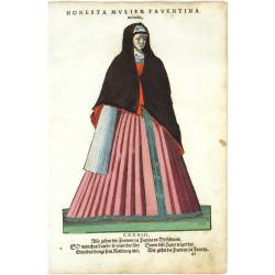
Amman, Jost Honesta Mulier Faventina in ItaliaBestell-Nr .: 19209
Jost Amman. "Honesta Mulier Faventina in Italia". Orig. Holzschnitt, J. Amman aus seinem 'Habitus praecipuorum populorum ...'. Bei H. Weigel in Nürnberg, 1577. 24:17 cm.
4 000,00 KčZu verkaufen -
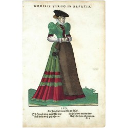
Amman, Jost Nobilis Virgo in AlsatiaBestell-Nr .: 19185
Jost Amman. "Nobilis Virgo in Alsatia. Ein Jungfraw vom Adel im Elsaß". Orig. Holzschnitt, J. Amman aus seinem 'Habitus praecipuorum populorum ...'. Bei H. Weigel in Nürnberg, 1577. 23,5:17 cm.
4 000,00 KčZu verkaufen -
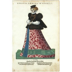
Amman, Jost Nobilis Foemina in AlsatiaBestell-Nr .: 19335
Jost Amman. "Nobilis Foemina in Alsatia". Orig. Holzschnitt, J. Amman aus seinem 'Habitus praecipuorum populorum ...'. Bei H. Weigel in Nürnberg, 1577. 23,5:17 cm.
3 500,00 KčZu verkaufen -
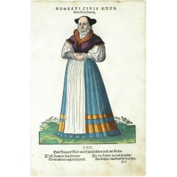
Amman, Jost Honesti Civis Uxor Halensi in SueviaBestell-Nr .: 19341
Jost Amman. "Honesti Civis Uxor Halensi in Suevia". Orig. Holzschnitt, J. Amman aus seinem 'Habitus praecipuorum populorum ...'. Bei H. Weigel in Nürnberg, 1577. 22,5:17 cm.
3 500,00 KčZu verkaufen -
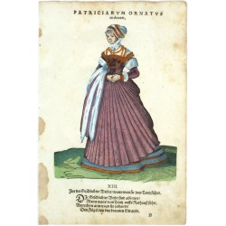
Amman, Jost Patriciarum Ornatus in choraeisBestell-Nr .: 19347
Jost Amman. "Patriciarum Ornatus in choraeis". Orig. Holzschnitt, J. Amman aus seinem 'Habitus praecipuorum populorum ...'. Bei H. Weigel in Nürnberg, 1577. 22:17 cm.
3 500,00 KčZu verkaufen -
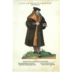
Amman, Jost Civis ex Honesta Familia in Salinis SueuicisBestell-Nr .: 19359
Jost Amman. "Civis ex Honesta Familia in Salinis Sueuicis". Orig. Holzschnitt, J. Amman aus seinem 'Habitus praecipuorum populorum ...'. Bei H. Weigel in Nürnberg, 1577. 22,5:15 cm.
3 500,00 KčZu verkaufen -
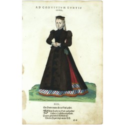
Amman, Jost Ad Convivium Eunits ornatusBestell-Nr .: 19275
Jost Amman. "Ad Convivium Eunits ornatus. Ein Fraw wann sie zu Gast gehet". Orig. Holzschnitt, J. Amman aus seinem 'Habitus praecipuorum populorum ...'. Bei H. Weigel in Nürnberg, 1577. 21,5:17 cm.
3 500,00 KčZu verkaufen -
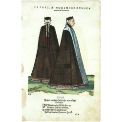
Amman, Jost Patriciae Norimbergenses euntes ad conviviaBestell-Nr .: 19407
Jost Amman. "Patriciae Norimbergenses euntes ad convivia. Weiber von dem Geschlecht, wann sie zu Gast gehen". Orig. Holzschnitt, J. Amman aus seinem 'Habitus praecipuorum populorum ...'. Bei H. Weigel in Nürnberg, 1577. 20,5:17 cm.
3 500,00 KčZu verkaufen -
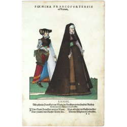
Amman, Jost Foemina Francofurtensis ad MoenumBestell-Nr .: 19401
Jost Amman. "Foemina Francofurtensis ad Moenum ...". Orig. Holzschnitt, J. Amman aus seinem 'Habitus praecipuorum populorum ...'. Bei H. Weigel in Nürnberg, 1577. 19:16,5 cm.
3 500,00 KčZu verkaufen -
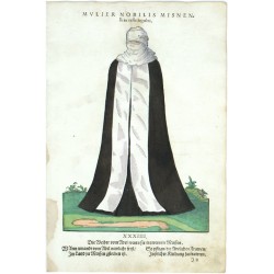
Amman, Jost Mulier Nobilis Misnensis in veste lugubriBestell-Nr .: 19377
Jost Amman. "Mulier Nobilis Misnensis in veste lugubri". Orig. Holzschnitt, J. Amman aus seinem 'Habitus praecipuorum populorum ...'. Bei H. Weigel in Nürnberg, 1577. 23,5:17 cm.
3 500,00 KčZu verkaufen -
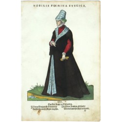
Amman, Jost Nobilis Foemina SuecicaBestell-Nr .: 19371
Jost Amman. "Nobilis Foemina Suecica. Ein Edle Fraw in Schweden". Orig. Holzschnitt, J. Amman aus seinem 'Habitus praecipuorum populorum ...'. Bei H. Weigel in Nürnberg, 1577. 23:17 cm.
3 500,00 KčZu verkaufen -
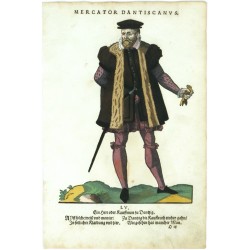
Amman, Jost Mercator DantiscanusBestell-Nr .: 19365
Jost Amman. "Mercator Dantiscanus. Ein Herr oder Kauffman zu Dantzig". Orig. Holzschnitt, J. Amman aus seinem 'Habitus praecipuorum populorum ...'. Bei H. Weigel in Nürnberg, 1577. 23:17 cm.
3 500,00 KčZu verkaufen -
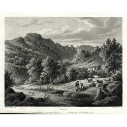
Rybička, Josef (Autor) Kandler, Vilém (Andere Autoren) ŠárkaBestell-Nr .: 25806
Praha. Šárecké údolí. "Šárka". Pův. ocelorytina. Podle W. Kandlerovy kresby ryl J. Rybička. Vydal I. L. Kober v Praze, 1865. 13:17,5 cm (obrázek).
900,00 KčZu verkaufen -
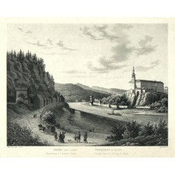
Rybička, Josef (Autor) Kandler, Vilém (Andere Autoren) Děčín nad Labem - ocelorytina, Kandler,...Bestell-Nr .: 25805
Děčín. "Děčín nad Labem. Tetschen an der Elbe". Pův. ocelorytina. Podle W. Kandlerovy kresby ryl J. Rybička. Vydal I. L. Kober v Praze, 1865. 13,5:17,5 cm (obrázek).
500,00 KčZu verkaufen -
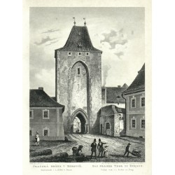
Fesca, Adolf (Autor) Kandler, Vilém (Andere Autoren) Pražská brána v Berouně. Das Prager Thor...Bestell-Nr .: 25804
Beroun. "Pražská brána v Berouně. Das Prager Thor zu Beraun". Pův. ocelorytina. Podle W. Kandlerovy kresby ryl A. Fesca. Vydal I. L. Kober v Praze, 1865. 18:13 cm (obrázek).
750,00 KčZu verkaufen -
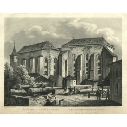
Rybička, Josef (Autor) Kandler, Vilém (Andere Autoren) Praha - Klášter sv. Anežky v Praze,...Bestell-Nr .: 25802
Praha. Klášter sv. Anežky České. "Klášter sv. Anežky v Praze. Das Agneskloster zu Prag". Pův. ocelorytina. Podle W. Kandlerovy kresby ryl J. Rybička. Vydal I. L. Kober v Praze, 1865. 13:17 cm (obrázek).
1 200,00 KčZu verkaufen -
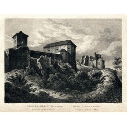
Rybička, Josef (Autor) Kandler, Vilém (Andere Autoren) Hrad Krasikov či Švamberk. Burg SchwambergBestell-Nr .: 25799
Švamberk. "Hrad Krasikov či Švamberk. Burg Schwamberg". Pův. ocelorytina. Podle W. Kandlerovy kresby ryl J. Rybička. Vydal I. L. Kober v Praze, 1865. 12,5:17,5 cm (obrázek).
500,00 KčZu verkaufen

