Keine Artikel
Europa
-
Belgien, Niederlande, Luxemburg
- Amsterdam
- Antwerpen
- Belgien und Luxemburg
- Bergen op Zoom
- Blokzijl
- Bommenede
- Brabant
- Brugge
- Brüssel
- Charleroi
- Delft
- Den Haag
- Dinant
- Dordrecht
- Elburg
- Flandern
- Fort Rammekens
- Friesland
- Friesland und Groningen
- Gelderland
- Geraardsbergen
- Grave
- Groningen
- Hainaut
- Harderwijk
- Harlingen
- Holland
- Hulst
- Huy
- Kortryk
- Lier
- Limbourg
- Limburg
- Löwen
- Lüttich
- Luxemburg
- Maastricht
- Mechelen
- Middelburg
- Mons
- Namur
- Niederlande
- Niederlande und Belgien
- Nijmegen
- Ostende
- Overijssel
- Rotterdam
- Spa
- Stavoren
- Tiel
- Utrecht
- Veere
- Veurne
- Ypern
- Zaltbommel
- Zeeland
- Zieriksee
- Zierikzee
- Zutphen
- Zype
-
Böhmen, Mähren und Schlesien
- Arnau
- Aussig
- Beraun
- Böhmen
- Böhmen, Mähren und Schlesien
- Brandýs nad Labem
- Branná (okr. Šumperk)
- Břeclav
- Brněnsko a Uherskohardišťsko
- Brodce (okr. Mladá Boleslav)
- Brünn
- Bürglitz
- Čáslav
- Čelákovice
- Cheb
- Chlumec nad Cidlinou
- Chomutov
- Děčín
- Dolní Olešnice - Nové Zámky
- Dvůr Králové nad Labem
- Františkovy Lázně
- Frýdlant
- Graupen
- Hassenstein
- Házmburk
- Herrnskretschen
- Hohenelbe
- Hradec Králové
- Jáchymov
- Jaromirsch
- Jihlava
- Jižní Čechy
- Kamaick
- Karlsbad
- Karlstein
- Kolín
- Kostelec nad Labem
- Kostenblatt
- Krkonoše
- Kunětická Hora
- Kuttenberg
- Kyšperk
- Laun
- Lednice
- Libochovany
- Litoměřice
- Lobositz
- Loket
- Lysá nad Labem
- Mähren
- Marienbad
- Melnik
- Mladá Boleslav
- Mladoboleslavsko
- Most
- Náchod
- Neuhaus
- Nimburg
- Okoř
- Olmütz
- Ostrov nad Ohří
- Pardubice
- Plzeň
- Podiebrad
- Polná
- Prachatice
- Prácheňsko
- Prag
- Przelautsch
- Rabí
- Rakovnicko
- Rakovník
- Roudnice nad Labem
- Rožmberk
- Rožnov pod Radhoštěm
- Rychmburk
- Schlan
- Schreckenstein
- Schwamberg
- Sedlec
- Smečna
- Smirschitz
- Šumava
- Tábor
- Teplá
- Teplice
- Theresienstadt
- Třeboň
- Týnec nad Labem
- Valdštejn
- Vinec
- Vrabinec
- Vyšší Brod
- Wegstädtl
- Zákupy
- Žampach (zámek)
- Žireč
- Žleb
- Zvíkov
-
Deutschland
-
Baden-Württemberg
- Bad Teinach-Zavelstein
- Balingen
- Biberach an der Riß
- Böblingen
- Bodensee
- Breisgau
- Calw
- Dornhan
- Esslingen
- Geislingen an der Steige
- Grafschaft Limpurg
- Heidelberg
- Heilbronn
- Hohenlohe
- Karlsruhe
- Konstanz
- Mannheim
- Möckmühl
- Nagold
- Neuenbürg
- Nord-Württemberg
- Oberschwaben
- Offenburg
- Reutlingen
- Rheinpfalz
- Schwabenl
- Schwäbisch Gmünd
- Schwäbisch Hall
- Singen
- St. Blasien
- Stuttgart
- Tübingen
- Ulm
- Vaihingen a. d. Enz
- Wangen im Allgäu
- Weinheim
- Württemberg
-
Bayern
- Aschaffenburg
- Augsburg
- Aurach
- Bad Abbach
- Bamberg
- Bogenberg (Wallfahrtskirche)
- Cham
- Coburg
- Donauwörth
- Eichstätt
- Forchheim
- Franken
- Freising
- Friedberg (Schwaben)
- Füssen
- Gräfenberg (Oberfranken)
- Höchstädt an der Donau
- Ingolstadt
- Kelheim
- Kempten
- Lauingen
- Lenggries
- Lindau
- Memmingen
- Mindelheim
- Mühldorf am Inn
- München
- Nabburg
- Natternberg (Schloss)
- Neuburg an der Donau
- Neumarkt in der Oberpfalz
- Neuötting
- Neustadt an der Donau
- Nördlingen
- Nürnberg
- Oberpfalz
- Pappenheim
- Passau
- Pfaffenhofen
- Pöttmes
- Rain am Lech
- Regensburg
- Saal an der Donau
- Schongau
- Schrobenhausen
- Straubing
- Thurnau
- Velden
- Vilshofen an der Donau
- Wackerstein
- Wasserburg am Inn
- Weilheim / links Polling
- Weissenburg in Bayern
- Weltenburg
- Würzburg
- Berlin
- Brandenburg
- Bremen
- Hamburg
- Hessen
- Mecklenburg-Vorpommern/Pommern
-
Niedersachsen
- Aurich
- Bad Bentheim
- Bad Gandersheim
- Bodenwerder
- Braunschweig
- Braunschweig-Lüneburg
- Celle
- Cuxhaven
- Emden
- Hann. Münden
- Hannover
- Hildesheim
- Hoya
- Liebenau an der Weser
- Lüneburg
- Niedersächsischer Kreis
- Nienburg a. d. Weser
- Oldenburg
- Osnabrück
- Osterode
- Osterwieck
- Ostfriesland
- Schnackenburg
- Schöppenstedt
- Stolzenau
- Walsrode
- Winsen an der Luhe
- Wolfenbüttel
- Norddeutschland
- Nordrhein-Westfalen
- Rheinland-Pfalz
- Sachsen
- Sachsen-Anhalt
- Schleswig-Holstein
- Thüringen
-
Baden-Württemberg
- Donau
- Europa (Kontinent)
-
Frankreich
- Albi
- Anjou
- Artois
- Bar-le-Duc
- Berry
- Blois
- Bourbourg
- Bresse
- Burgund-Freigrafschaft
- Cambrai
- Cassel
- Château de Lichtenberg
- Chaumont
- Compiegne und Noyon
- Dauphiné
- Département Tarn
- Elsass
- Gascogne
- Gâstinais and Senonais
- Gravelines
- Hauts-de-France
- Ile de France
- Korsika
- La Bassée - Hesdin
- Languedoc
- Lille
- Limoges
- Lothringen
- Lyon
- Maine
- Marseille
- Metz
- Montmélian
- Mülhausen
- Nancy
- Nice
- Normandie
- Paris
- Perche
- Picardie
- Poitou
- Provence
- Re und Oleron
- Reims - Rethel
- Saint-Omer
- Saintonge und Aunis
- Savoyen
- Strassburg
- Vexin
- Griechenland, Mittelmeer
-
Grossbritannien und Irland
- Bedford und Buckinghamshire
- Berkshire und Hampshire
- Cambridgeshire
- Cheshire
- Cornwall
- Cumberland
- Denbigh und Flint
- Derbyshire
- Devon
- Dorset
- Durham (Grafschaft)
- England
- Essex
- Gloucestershire
- Großbritannien und Irland
- Herefordshire
- Hertfordshire
- Hertfordshire and Middlesex
- Huntingdonshire
- Irland
- Isle of Man
- Isle of Wight
- Kent
- Lancashire
- Leicestershire
- Lincolnshire
- London
- Middlesex
- Nordengland
- Nordostengland
- Nordwestengland
- Norfolk
- Northampton
- Northumberland
- Nottinghamshire
- Oxfordshire
- Schottland
- Shropshire und Staffordshire
- Somerset
- Staffordshire
- Südostengland
- Südwestengland
- Surrey
- Sussex
- Wales
- Westmorland
- Wiltshire
- Worcestershire und Warwickshire
- Yorkshire
-
Italien
- Abruzzen
- Ancona
- Apulien (Puglia)
- Arcevia
- Bari und Basilikata
- Belluno und Feltre
- Bergamo
- Bologna
- Brescia
- Brescia und Crema
- Cadore
- Cagliari
- Caiazzo
- Capitanata
- Carmagnola
- Catania
- Civitavecchia
- Crema
- Cremona
- Cuneo
- Elba
- Emilia Romagna
- Faenza
- Fano
- Ferrara
- Florenz
- Fondi
- Friaul
- Gaeta
- Gallipoli
- Genua
- Ischia
- Italien
- Kalabrien
- Kampanien
- Lazio
- Lerici
- Ligurien (Italienische Riviera)
- Livorno
- Lombardei
- Loreto
- Lucca
- Mailand
- Mantua
- Mantua
- Marche (Ancona)
- Meran
- Messina
- Mirandola
- Mittelitalien
- Modena
- Molise
- Monferrato
- Neapel
- Netuno
- Nocera Umbra
- Norditalien
- Orvieto
- Orvieto und Loreto
- Otranto
- Padua
- Palermo
- Parma
- Pavia
- Perugia
- Pesaro
- Piacenza
- Piemont
- Pinerolo
- Piombino
- Pisa
- Po
- Pozzuoli
- Reggio di Calabria
- Reggio Emilia
- Rimini
- Rom
- Rovigo
- San Marino
- Sardinien
- Siena
- Sizilien
- Sizilien und Malta
- Sizilien und Sardinien
- Spoleto
- Süditalien
- Sulmona
- Taranto
- Terracina
- Tirol
- Tivoli
- Tortona
- Toskana
- Trapani
- Trentino
- Trentino-Alto Adige / Südtirol
- Treviso
- Turin
- Udine
- Umbria
- Urbino
- Velletri
- Venedig
- Vercelli
- Verona
- Vicenza
- Viterbo
- Labe
- Mitteleuropa
- Mittelmeer
- Monaco
- Österreich
- Polen, Schlesien, Rußland, Blatikum
- Rhein
- Schweiz
- Skandinavien und Island
- Spanien und Portugal
- Südost- und Osteuropa, Balkan
Europa Es gibt 1754 Artikel.
Unterkategorien
-
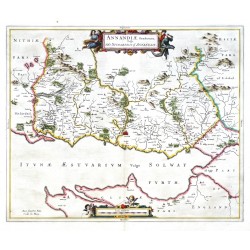
Blaeu, Joan (Autor) Pont, Timothy (Andere Autoren) Annandiae Praefectura, Vulgo The...Bestell-Nr .: 21659
Schottland. Annandale. "Annandiae Praefectura, Vulgo The Stewartrie of Annandail". Orig. copperplate engraving after T. Pont's map of the region. Published by J. Blaeu in Amsterdam, 1654. Original old colouring. 42,5:51 cm.
5 800,00 KčZu verkaufen -
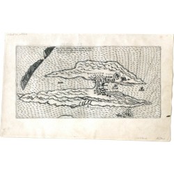
Bry, Johann Theodor de Abriß der Insel Warthuß in LappenlandtBestell-Nr .: 21604
Vardøya (Norwegen). "Abriß der Insel Warthuß in Lappenlandt". Orig. copper-engraving by J. T. de Bry, published by M. Becker in Frankfurt a. Main, 1613. With German title on verso. 13,5:26,5 cm.
4 500,00 KčZu verkaufen -
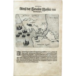
Bry, Johann Theodor de Abriß der Strassen NassauBestell-Nr .: 21602
Jugorstraße (Russland). "Abriß der Strassen Nassau, mit aller Gelegenheit". Orig. copper-engraving by J. T. de Bry, published by M. Becker in Frankfurt a. Main, 1599. With German title above the picture. 14:18 cm.
4 500,00 KčZu verkaufen -
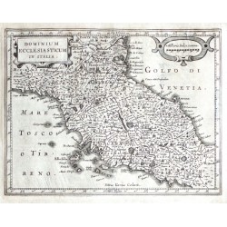
Mercator, Gerardus Dominium Ecclesiasticum in ItaliaBestell-Nr .: 21592
Kirchenstaat. "Dominium Ecclesiasticum in Italia". Orig. copper-engraving from the German edition of Mercator's Atlas Minor published in Amsterdam by J. Janssonius, 1648. Engraved by P. Kaerius. With ornamental title-cartouche and another ornamental cartouche with the scale of map.
1 800,00 KčZu verkaufen -
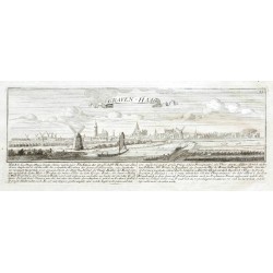
Bodenehr, Gabriel Graven-HaagBestell-Nr .: 21568
Den Haag. "Graven-Haag". Orig. copper-engraving, G. Bodenehr, Augsburg, ca. 1720. With decorative title and explanatory notes under the picture. 9,5:26 cm.
1 800,00 KčZu verkaufen -
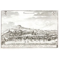
Merian, Matthäus (Autor) Merian, Caspar (Andere Autoren) GheertsbergeBestell-Nr .: 21567
Geraardsbergen. "Gheertsberge". Orig. copper-engraving, C. Merian, ca. 1650. Published in M. Zeiler's Topographia Germaniae-Inferioris by Merian, 1659. With engraved title, 2 coats-of-arms and a cartouche with explanatory notes (1.-13.) at the bottom. 19,5:29,5 cm.
1 500,00 KčZu verkaufen -
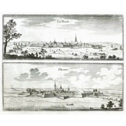
Merian, Caspar La Basse - HesdinBestell-Nr .: 21566
Nordfrankreich. "La Basse - Hesdin". Orig. copper-engraving, C. Merian, ca. 1650. Published in M. Zeiler's Topographia Germaniae-Inferioris by Merian, 1659. With engraved titles. 25:31 cm.
1 600,00 KčZu verkaufen -
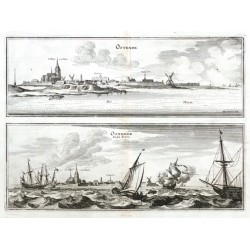
Merian, Caspar OstendeBestell-Nr .: 21565
Ostende. "Ostende. - Ostende. Andre Seiten". Orig. copper-engraving, C. Merian after J. Peeters' drawing, ca. 1650. Published in M. Zeiler's Topographia Germaniae-Inferioris by Merian, 1659. With engraved titles and many ships in the foregroung. 22,5:31 cm.
4 800,00 KčZu verkaufen -
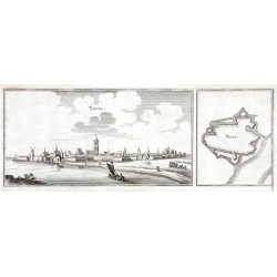
Merian, Caspar ThielBestell-Nr .: 21564
Tiel. "Thiel". Orig. copper-engraving, C. Merian, ca. 1650. Published in M. Zeiler's Topographia Germaniae-Inferioris by Merian, 1659. With engraved title and a ship in the foreground. 12,5:34,5 cm.
1 200,00 KčZu verkaufen -
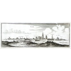
Merian, Caspar LierBestell-Nr .: 21558
Lier. "Lier". Orig. copper-engraving, C. Merian after J. Peeters' drawing, ca. 1650. Published in M. Zeiler's Topographia Germaniae-Inferioris by Merian, 1659. With engraved title. 12:33,5 cm.
1 200,00 KčZu verkaufen -
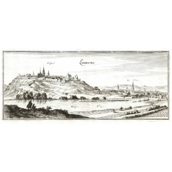
Merian, Caspar LimburgBestell-Nr .: 21557
Limbourg. "Limburg". Orig. copper-engraving, C. Merian, ca. 1650. Published in M. Zeiler's Topographia Germaniae-Inferioris by Merian, 1659. With engraved title and several figures in the foreground. 15:36 cm.
1 500,00 KčZu verkaufen -
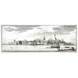
Merian, Matthäus (Autor) Merian, Caspar (Andere Autoren) GraveBestell-Nr .: 21555
Grave. "Grave". Orig. copper-engraving, C. Merian after J. Peeters' drawing, ca. 1650. Published in M. Zeiler's Topographia Germaniae-Inferioris by Merian, 1659. With engraved title and several ships and figures in the foreground. 11,5:31,5 cm.
900,00 KčZu verkaufen -
Merian, Caspar ZirickseeBestell-Nr .: 21554
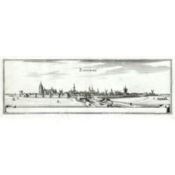
Zierikzee. "Ziricksee". Orig. copper-engraving, C. Merian, ca. 1650. Published in M. Zeiler's Topographia Germaniae-Inferioris by Merian, 1659. With engraved title and a blank cartouche at the bottom. 10,5:31,5 cm.
2 100,00 KčZu verkaufen -
Merian, Matthäus (Autor) Merian, Matthäus (Andere Autoren) ElburgBestell-Nr .: 21553
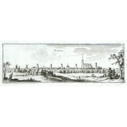
Elburg. "Elburg". Orig. copper-engraving, C. Merian, ca. 1650. Published in M. Zeiler's Topographia Germaniae-Inferioris by Merian, 1659. With engraved title and a figure in the foreground. 11:34,5 cm.
1 200,00 KčZu verkaufen -
Merian, Caspar Ter VeerBestell-Nr .: 21552
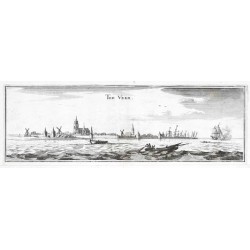
Veere. "Ter Veer". Orig. copper-engraving, C. Merian, ca. 1650. Published in M. Zeiler's Topographia Germaniae-Inferioris by Merian, 1659. With engraved title and several ships in the foreground. 10:31,5 cm.
1 200,00 KčZu verkaufen -
Merian, Caspar StavernBestell-Nr .: 21551
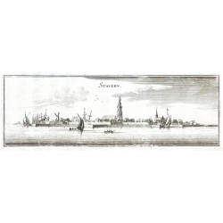
Stavoren. "Stavern". Orig. copper-engraving, C. Merian, ca. 1650. Published in M. Zeiler's Topographia Germaniae-Inferioris by Merian, 1659. With engraved title and several ships in the foreground. 11:33 cm.
1 200,00 KčZu verkaufen -
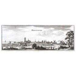
Merian, Matthäus (Autor) Merian, Caspar (Andere Autoren) HarderwyckBestell-Nr .: 21550
Harderwijk. "Harderwyck". Orig. copper-engraving, C. Merian, ca. 1650. Published in M. Zeiler's Topographia Germaniae-Inferioris by Merian, 1659. With engraved title, figures in the foreground and windmills in the background. 10,5:30 cm.
1 800,00 KčZu verkaufen -
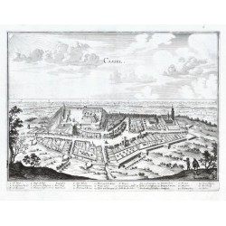
Merian, Matthäus (Autor) Merian, Caspar (Andere Autoren) CasselBestell-Nr .: 21549
Cassel. "Cassel". Orig. copper-engraving, C. Merian, ca. 1650. With engraved title and explanatory notes (1.-26.) under the picture. 25:33,5 cm.
1 800,00 KčZu verkaufen -
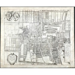
Braun, Georg - Hogenberg, Frans Hagae ComitisBestell-Nr .: 21548
Den Haag. "Hagae Comitis celeberrimi totius Evropae municipij typus". Orig. copper-engraving from the 6th part of Latin ed. of Braun and Hogenberg's "Civitates Orbis Terrarum". Published by A. Hierat in Cologne, 1618.
12 000,00 KčZu verkaufen -
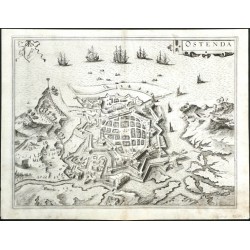
Braun, Georg - Hogenberg, Frans OstendaBestell-Nr .: 21545
Ostende. "Ostenda". Orig. copper-engraving from the 6th part of Latin ed. of Braun and Hogenberg's "Civitates Orbis Terrarum". Published by A. Hierat in Cologne, 1618.
10 500,00 KčZu verkaufen -
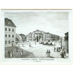
Dietrich, Fryderyk Palazzo della Municipalita in WarsaviaBestell-Nr .: 21460
Warschau. "Palazzo della Municipalita in Warsavia". Orig. Kupferstich, Florenz, 1831. Gest. von A. Verico nach F. Dietrichs Zeichnung.
1 800,00 KčZu verkaufen -
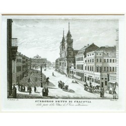
Dietrich, Fryderyk Subborgo detto di CracoviaBestell-Nr .: 21459
Warschau. "Subborgo detto di Cracovia dalla parte della Chiesa di S. Croce in Warsavia". Orig. Kupferstich, Florenz, 1831. Gest. von A. Verico nach F. Dietrichs Zeichnung.
2 400,00 KčZu verkaufen -
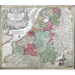
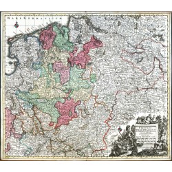
Seutter, Matthäus XVII. Provinciae Belgii sive Germaniae...Bestell-Nr .: 21450
Niederlande, Belgien und Luxemburg. "XVII. Provinciae Belgii sive Germaniae inferioris". Altkol. Kupf.-Kte. von M. Seutter, (um 1730). Mit 2 fig. u. herald. Kart (davon 1 große). 49,5:58,5 cm.
7 200,00 KčZu verkaufen -
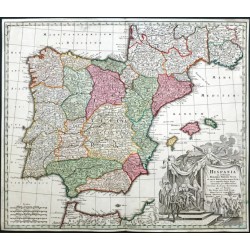
Seutter, Matthäus HispaniaBestell-Nr .: 21445
Spanien. "Hispania ex Archetypo Roderici Mendez Sylva". Orig. copper-engraving after R. Mendez Silva (1607-1675) map of Spain. Engraved by G. de l'Isle. Published in Augsburg by M. Seutter, ca. 1730. Orig. old colouring. With great figure title-cartouche...
6 200,00 KčZu verkaufen -
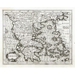
Mercator, Gerardus GraeciaBestell-Nr .: 21369
Griechenland. "Graecia". Orig. copper-engraving from Mercator's "Atlas Minor". Published in Amsterdam by J. Hondius, C. Claesz. and J. Jansz., 1607. With ornamental title-cartouche and with the scale of map ("Milliaria Italica"). 14,5:18,5 cm.
2 400,00 KčZu verkaufen -
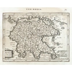
Mercator, Gerardus Morea olim PeloponensisBestell-Nr .: 21368
"Morea olim Peloponensis". Orig. copper-engraving from the German ed. of Mercator's "Atlas Minor". Published in Amsterdam by J. Janssonius, 1648-52. Engraved by P. Kaerius (van den Keere). With ornamental title-cartouche, another cartouche with the scale of map ("Milliaria Italica") and Ger. title ("Von Morea") above the map. 14:19 cm.
2 100,00 KčZu verkaufen -
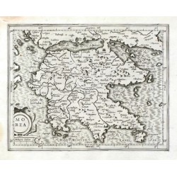
Mercator, Gerardus MoreaBestell-Nr .: 21367
"Morea". Orig. copper-engraving from Mercator's "Atlas Minor". Published in Amsterdam by J. Hondius, C. Claesz. and J. Jansz., 1607. With ornamental title-cartouche with the scale of map ("Milliaria Italica"). 13,5:17,5 cm.
2 100,00 KčZu verkaufen -
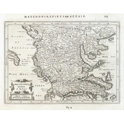
Mercator, Gerardus Macedonia, Epirus et AchaiaBestell-Nr .: 21365
Griechenland, Albanien und Mazedonien. "Macedonia, Epirus et Achaia". Orig. copper-engraving from the German ed. of Mercator's "Atlas Minor". Published in Amsterdam by J. Janssonius, 1648-52. With ornamental title-cartouche with the scale of map ("Miliaria Italica") and Ger. title ("Macedonia, Epirvs und Achaia") above the map. 14,5:20,5 cm.
2 100,00 KčZu verkaufen -
Seutter, Matthäus Circulus Westphalicus In suas Provincias...Bestell-Nr .: 21339
Westfalen. "Circulus Westphalicus In suas Provincias et Ditiones accurate distinctus et recentissime delineat. cura et caelo Matth. Seutteri Ch. Aug." Kol. Kupf.-Kte. von M. Seutter, Augsburg, um 1740. Unten rechts fig. Titelkartusche mit Meilenanzeiger. 50:58 cm.
5 200,00 KčZu verkaufen -
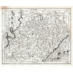
Mercator, Gerardus Abruzzo et Terra di LovoroBestell-Nr .: 21335
"Abruzzo et Terra di Lovoro". Orig. copper-engraving from G. Mercator's Atlas Minor. Published by J. Hondius, C. Claesz. and J. Jansz. in Amsterdam, 1607.
2 100,00 KčZu verkaufen -
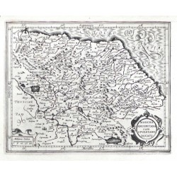
Mercator, Gerardus Marcha Anconitana cum Spoletano DucatuBestell-Nr .: 21333
"Marcha Anconitana cum Spoletano Ducatu". Orig. copper-engraving from G. Mercator's Atlas Minor. Published by J. Hondius, C. Claesz. and J. Jansz. in Amsterdam, 1607.
2 100,00 KčZu verkaufen -
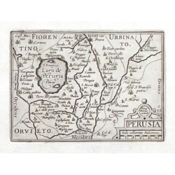
Visscher, Claes Jansz. (Autor) Keere, Pieter van den (Petrus Kaerius) (Andere Autoren) PerusiaBestell-Nr .: 21330
Pergia. "Perusia". Orig. copperplate engraving. Published by C. J. Visscher in Amsterdam, 1649 (in Tabulae Geographicae Contractae). 9:12,5 cm.
2 100,00 KčZu verkaufen -
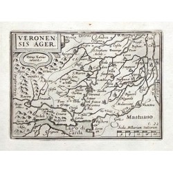
Visscher, Claes Jansz. (Autor) Keere, Pieter van den (Petrus Kaerius) (Andere Autoren) Veronensis AgerBestell-Nr .: 21329
Verona. "Veronensis Ager". Orig. copperplate engraving. Published by C. J. Visscher in Amsterdam, 1649 (in Tabulae Geographicae Contractae). 9:12,5 cm.
2 100,00 KčZu verkaufen -
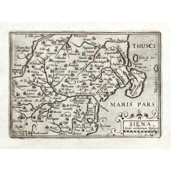
Visscher, Claes Jansz. (Autor) Keere, Pieter van den (Petrus Kaerius) (Andere Autoren) SienaBestell-Nr .: 21328
Siena. "Siena". Orig. copperplate engraving from N. Visscher's "Tabulae Geographicae Contractae". Published in Amsterdam by C. J. Visscher, 1649. 9:12,5 cm.
2 100,00 KčZu verkaufen -
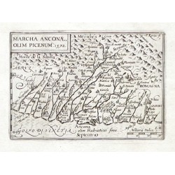
Visscher, Claes Jansz. (Autor) Keere, Pieter van den (Petrus Kaerius) (Andere Autoren) Marcha Anconae olim Picenum. 1572Bestell-Nr .: 21327
Marche (Ancona). "Marcha Anconae olim Picenum. 1572". Orig. copperplate engraving. Published by C. J. Visscher in Amsterdam, 1649 (in Tabulae Geographicae Contractae). 9:12,5 cm.
2 100,00 KčZu verkaufen -
Visscher, Claes Jansz. (Autor) Keere, Pieter van den (Petrus Kaerius) (Andere Autoren) Romanum territoriumBestell-Nr .: 21326
Rom. "Romanum territorium". Orig. copperplate engraving. Published by C. J. Visscher in Amsterdam, 1649 (in Tabulae Geographicae Contractae). 8,5:12,5 cm.
2 100,00 KčZu verkaufen -
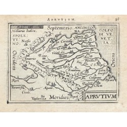
Ortelius, Abraham Abruzzen - AprutiumBestell-Nr .: 21325
Abruzzen. "Aprutium". Orig. copper-engraving from the French edition of A. Ortelius' Epitome, published in Antwerp by Plantin Press for F. Galle, 1598. With title-cartouche, a cartouche with the scale of map and Latin title above the map.
1 600,00 KčZu verkaufen -
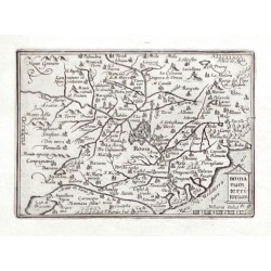
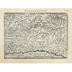
Ortelius, Abraham Piemont - Pedemontanae VicinorumqueBestell-Nr .: 21323
Piemont. "Pedemontanae Vicinorumque". Orig. copper-engraving from the French edition of A. Ortelius' Epitome, published in Antwerp by Plantin Press for F. Galle, 1598. With title-cartouche, a cartouche with the scale of map and Latin title above the map.
1 800,00 KčZu verkaufen -
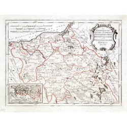
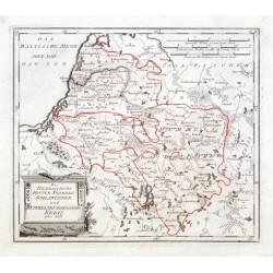
Reilly, Franz Johann Joseph von Des Herzothums HinterPommern Belgardischer...Bestell-Nr .: 21304
"Des Herzothums HinterPommern Belgardischer Neustettinischer und Fürstenthumscher Kreis. Nro. 336.". Grenzkol. Kupferstichkarte von F. J. J. von Reilly, Wien, 1791.
2 100,00 KčZu verkaufen -
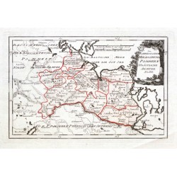
Reilly, Franz Johann Joseph von Des Herzogthums Hinterpommern Saatziger...Bestell-Nr .: 21302
"Des Herzogthums Hinterpommern Saatziger Pyritzischer und Greiffenhagischer Kreis Nro. 335.". Altkol. Kupferstichkarte von F. J. J. von Reilly, Wien, 1791.
1 350,00 KčZu verkaufen -
Reilly, Franz Johann Joseph von Des Herzogthums Hinter Pommern...Bestell-Nr .: 21300
Hinterpommern (Polen). "Des Herzogthums Hinter Pommern Schlawischer und Rummelsburgischer Kreis. Nro. 337.". Altkol. Kupferstichkarte von F. J. J. von Reilly, Wien, 1791.
1 350,00 KčZu verkaufen -
Reilly, Franz Johann Joseph von Des Schwedischen Herzogthums Pommern...Bestell-Nr .: 21299
"Des Schwedischen Herzogthums Pommern Südöstliche Aemter Nro. 331.". Altkol. Kupferstichkarte von F. J. J. von Reilly, Wien, 1789.
2 100,00 KčZu verkaufen -
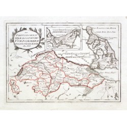
Reilly, Franz Johann Joseph von Des Preussischen Herzothums Vorpommern...Bestell-Nr .: 21298
"Des Preussischen Herzothums Vorpommern Nordwestliche Aemter Nro. 332.". Altkol. Kupferstichkarte von F. J. J. von Reilly, Wien, 1789.
2 500,00 KčZu verkaufen -
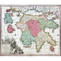
Seutter, Matthäus Peloponnesus hodie MoreaBestell-Nr .: 21201
Peloponnes (Griechenland). "Peloponnesus hodie Morea ... accuratissimae adornata, aeri incisa et venalis exposita per ... Seutter". Orig. altkol. Kupf.-Kte., M. Seutter, Augsburg, um 1730. Mit gr. fig. Kart. (der Löwe von Venedig, der die Türken im Auftrag des...
5 800,00 KčZu verkaufen -
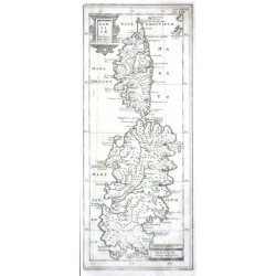
Cluver, Philipp Corsicae Antiquae Descriptio. Sardiniae...Bestell-Nr .: 21111
"Corsicae Antiquae Descriptio. Sardiniae Antiquae Descriptio". Orig. copper-engraving, P. Cluver. Published in Wolfenbüttel, 1694. With 2 ornamental title-cartouches and the scale of map ("Miliaria Italica"). 27:11 cm.
2 700,00 KčZu verkaufen -
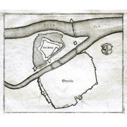
Merian, Matthäus OppelnBestell-Nr .: 21078
Oppeln. "Oppeln". Orig. Kupferstich, M. Merian. Aus M. Zeillers "Topographia Bohemiae Moraviae et Silesiae". Bei Merian, Frankfurt am Main, 1650. Mit gest. Titel und e. Wappen. 19,5:23,5 cm.
750,00 KčZu verkaufen -
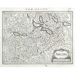
Mercator, Gerardus ArgowBestell-Nr .: 21060
"Argow". Orig. Kupf.-Kte. aus G. Mercators Atlas Minor. Bei J. Janssonius in Amsterdam, 1648. Mit dekorative Titelkart mit Meillenanzeiger ("Miliare Helveticum comm.") und dt. Titel ("Von Argow") oben. 14,5:19 cm.
2 100,00 KčZu verkaufen -
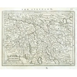
Mercator, Gerardus ZurichouBestell-Nr .: 21057
"Zurichou". Orig. Kupf.-Kte. aus G. Mercators Atlas Minor. Bei J. Janssonius in Amsterdam, 1648. Mit dekorative Titelkart mit Meillenanzeiger ("Miliare Helveticum com.") und dt. Titel ("Von Zvrchgow") oben. 14,5:19,5 cm.
2 400,00 KčZu verkaufen -
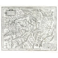
Mercator, Gerardus HelvetiaBestell-Nr .: 21054
Schweiz. "Helvetia". Orig. Kupf.-Kte. aus G. Mercators Atlas Minor. Bei J. Hondius, C. Claesz. und J. Jansz. in Amsterdam, 1609. Mit dekorative Titelkart und andere Kart. mit Meillenanzeiger ("Miliaria heluetica communia"). 15,5:19,5 cm.
2 800,00 KčZu verkaufen -
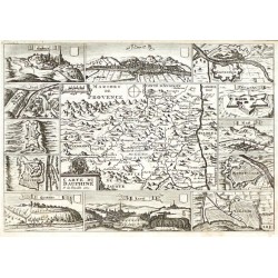
de la Feuille, Paul Carte du DauphinéBestell-Nr .: 21048
"Carte du Dauphiné". Orig. copper-engraving, P. de la Feille. Published by D. de la Feuille, Amsterdam, 1706. With ornamental title-cartouche with a coat-of-arms and a wind-rose. The map is surrounded by 7 fortifications plans and 5 views of...
2 000,00 KčZu verkaufen

