Keine Artikel
Europa
-
Belgien, Niederlande, Luxemburg
- Amsterdam
- Antwerpen
- Belgien und Luxemburg
- Bergen op Zoom
- Blokzijl
- Bommenede
- Brabant
- Brugge
- Brüssel
- Charleroi
- Delft
- Den Haag
- Dinant
- Dordrecht
- Elburg
- Flandern
- Fort Rammekens
- Friesland
- Friesland und Groningen
- Gelderland
- Geraardsbergen
- Grave
- Groningen
- Hainaut
- Harderwijk
- Harlingen
- Holland
- Hulst
- Huy
- Kortryk
- Lier
- Limbourg
- Limburg
- Löwen
- Lüttich
- Luxemburg
- Maastricht
- Mechelen
- Middelburg
- Mons
- Namur
- Niederlande
- Niederlande und Belgien
- Nijmegen
- Ostende
- Overijssel
- Rotterdam
- Spa
- Stavoren
- Tiel
- Utrecht
- Veere
- Veurne
- Ypern
- Zaltbommel
- Zeeland
- Zieriksee
- Zierikzee
- Zutphen
- Zype
-
Böhmen, Mähren und Schlesien
- Arnau
- Aussig
- Beraun
- Böhmen
- Böhmen, Mähren und Schlesien
- Brandýs nad Labem
- Branná (okr. Šumperk)
- Břeclav
- Brněnsko a Uherskohardišťsko
- Brodce (okr. Mladá Boleslav)
- Brünn
- Bürglitz
- Čáslav
- Čelákovice
- Cheb
- Chlumec nad Cidlinou
- Chomutov
- Děčín
- Dolní Olešnice - Nové Zámky
- Dvůr Králové nad Labem
- Františkovy Lázně
- Frýdlant
- Graupen
- Hassenstein
- Házmburk
- Herrnskretschen
- Hohenelbe
- Hradec Králové
- Jáchymov
- Jaromirsch
- Jihlava
- Jižní Čechy
- Kamaick
- Karlsbad
- Karlstein
- Kolín
- Kostelec nad Labem
- Kostenblatt
- Krkonoše
- Kunětická Hora
- Kuttenberg
- Kyšperk
- Laun
- Lednice
- Libochovany
- Litoměřice
- Lobositz
- Loket
- Lysá nad Labem
- Mähren
- Marienbad
- Melnik
- Mladá Boleslav
- Mladoboleslavsko
- Most
- Náchod
- Neuhaus
- Nimburg
- Okoř
- Olmütz
- Ostrov nad Ohří
- Pardubice
- Plzeň
- Podiebrad
- Polná
- Prachatice
- Prácheňsko
- Prag
- Przelautsch
- Rabí
- Rakovnicko
- Rakovník
- Roudnice nad Labem
- Rožmberk
- Rožnov pod Radhoštěm
- Rychmburk
- Schlan
- Schreckenstein
- Schwamberg
- Sedlec
- Smečna
- Smirschitz
- Šumava
- Tábor
- Teplá
- Teplice
- Theresienstadt
- Třeboň
- Týnec nad Labem
- Valdštejn
- Vinec
- Vrabinec
- Vyšší Brod
- Wegstädtl
- Zákupy
- Žampach (zámek)
- Žireč
- Žleb
- Zvíkov
-
Deutschland
-
Baden-Württemberg
- Bad Teinach-Zavelstein
- Balingen
- Biberach an der Riß
- Böblingen
- Bodensee
- Breisgau
- Calw
- Dornhan
- Esslingen
- Geislingen an der Steige
- Grafschaft Limpurg
- Heidelberg
- Heilbronn
- Hohenlohe
- Karlsruhe
- Konstanz
- Mannheim
- Möckmühl
- Nagold
- Neuenbürg
- Nord-Württemberg
- Oberschwaben
- Offenburg
- Reutlingen
- Rheinpfalz
- Schwabenl
- Schwäbisch Gmünd
- Schwäbisch Hall
- Singen
- St. Blasien
- Stuttgart
- Tübingen
- Ulm
- Vaihingen a. d. Enz
- Wangen im Allgäu
- Weinheim
- Württemberg
-
Bayern
- Aschaffenburg
- Augsburg
- Aurach
- Bad Abbach
- Bamberg
- Bogenberg (Wallfahrtskirche)
- Cham
- Coburg
- Donauwörth
- Eichstätt
- Forchheim
- Franken
- Freising
- Friedberg (Schwaben)
- Füssen
- Gräfenberg (Oberfranken)
- Höchstädt an der Donau
- Ingolstadt
- Kelheim
- Kempten
- Lauingen
- Lenggries
- Lindau
- Memmingen
- Mindelheim
- Mühldorf am Inn
- München
- Nabburg
- Natternberg (Schloss)
- Neuburg an der Donau
- Neumarkt in der Oberpfalz
- Neuötting
- Neustadt an der Donau
- Nördlingen
- Nürnberg
- Oberpfalz
- Pappenheim
- Passau
- Pfaffenhofen
- Pöttmes
- Rain am Lech
- Regensburg
- Saal an der Donau
- Schongau
- Schrobenhausen
- Straubing
- Thurnau
- Velden
- Vilshofen an der Donau
- Wackerstein
- Wasserburg am Inn
- Weilheim / links Polling
- Weissenburg in Bayern
- Weltenburg
- Würzburg
- Berlin
- Brandenburg
- Bremen
- Hamburg
- Hessen
- Mecklenburg-Vorpommern/Pommern
-
Niedersachsen
- Aurich
- Bad Bentheim
- Bad Gandersheim
- Bodenwerder
- Braunschweig
- Braunschweig-Lüneburg
- Celle
- Cuxhaven
- Emden
- Hann. Münden
- Hannover
- Hildesheim
- Hoya
- Liebenau an der Weser
- Lüneburg
- Niedersächsischer Kreis
- Nienburg a. d. Weser
- Oldenburg
- Osnabrück
- Osterode
- Osterwieck
- Ostfriesland
- Schnackenburg
- Schöppenstedt
- Stolzenau
- Walsrode
- Winsen an der Luhe
- Wolfenbüttel
- Norddeutschland
- Nordrhein-Westfalen
- Rheinland-Pfalz
- Sachsen
- Sachsen-Anhalt
- Schleswig-Holstein
- Thüringen
-
Baden-Württemberg
- Donau
- Europa (Kontinent)
-
Frankreich
- Albi
- Anjou
- Artois
- Bar-le-Duc
- Berry
- Blois
- Bourbourg
- Bresse
- Burgund-Freigrafschaft
- Cambrai
- Cassel
- Château de Lichtenberg
- Chaumont
- Compiegne und Noyon
- Dauphiné
- Département Tarn
- Elsass
- Gascogne
- Gâstinais and Senonais
- Gravelines
- Hauts-de-France
- Ile de France
- Korsika
- La Bassée - Hesdin
- Languedoc
- Lille
- Limoges
- Lothringen
- Lyon
- Maine
- Marseille
- Metz
- Montmélian
- Mülhausen
- Nancy
- Nice
- Normandie
- Paris
- Perche
- Picardie
- Poitou
- Provence
- Re und Oleron
- Reims - Rethel
- Saint-Omer
- Saintonge und Aunis
- Savoyen
- Strassburg
- Vexin
- Griechenland, Mittelmeer
-
Grossbritannien und Irland
- Bedford und Buckinghamshire
- Berkshire und Hampshire
- Cambridgeshire
- Cheshire
- Cornwall
- Cumberland
- Denbigh und Flint
- Derbyshire
- Devon
- Dorset
- Durham (Grafschaft)
- England
- Essex
- Gloucestershire
- Großbritannien und Irland
- Herefordshire
- Hertfordshire
- Hertfordshire and Middlesex
- Huntingdonshire
- Irland
- Isle of Man
- Isle of Wight
- Kent
- Lancashire
- Leicestershire
- Lincolnshire
- London
- Middlesex
- Nordengland
- Nordostengland
- Nordwestengland
- Norfolk
- Northampton
- Northumberland
- Nottinghamshire
- Oxfordshire
- Schottland
- Shropshire und Staffordshire
- Somerset
- Staffordshire
- Südostengland
- Südwestengland
- Surrey
- Sussex
- Wales
- Westmorland
- Wiltshire
- Worcestershire und Warwickshire
- Yorkshire
-
Italien
- Abruzzen
- Ancona
- Apulien (Puglia)
- Arcevia
- Bari und Basilikata
- Belluno und Feltre
- Bergamo
- Bologna
- Brescia
- Brescia und Crema
- Cadore
- Cagliari
- Caiazzo
- Capitanata
- Carmagnola
- Catania
- Civitavecchia
- Crema
- Cremona
- Cuneo
- Elba
- Emilia Romagna
- Faenza
- Fano
- Ferrara
- Florenz
- Fondi
- Friaul
- Gaeta
- Gallipoli
- Genua
- Ischia
- Italien
- Kalabrien
- Kampanien
- Lazio
- Lerici
- Ligurien (Italienische Riviera)
- Livorno
- Lombardei
- Loreto
- Lucca
- Mailand
- Mantua
- Mantua
- Marche (Ancona)
- Meran
- Messina
- Mirandola
- Mittelitalien
- Modena
- Molise
- Monferrato
- Neapel
- Netuno
- Nocera Umbra
- Norditalien
- Orvieto
- Orvieto und Loreto
- Otranto
- Padua
- Palermo
- Parma
- Pavia
- Perugia
- Pesaro
- Piacenza
- Piemont
- Pinerolo
- Piombino
- Pisa
- Po
- Pozzuoli
- Reggio di Calabria
- Reggio Emilia
- Rimini
- Rom
- Rovigo
- San Marino
- Sardinien
- Siena
- Sizilien
- Sizilien und Malta
- Sizilien und Sardinien
- Spoleto
- Süditalien
- Sulmona
- Taranto
- Terracina
- Tirol
- Tivoli
- Tortona
- Toskana
- Trapani
- Trentino
- Trentino-Alto Adige / Südtirol
- Treviso
- Turin
- Udine
- Umbria
- Urbino
- Velletri
- Venedig
- Vercelli
- Verona
- Vicenza
- Viterbo
- Labe
- Mitteleuropa
- Mittelmeer
- Monaco
- Österreich
- Polen, Schlesien, Rußland, Blatikum
- Rhein
- Schweiz
- Skandinavien und Island
- Spanien und Portugal
- Südost- und Osteuropa, Balkan
Europa Es gibt 1754 Artikel.
Unterkategorien
-
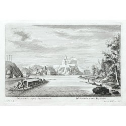
Wackerstein infra Ingolstadium. -...Bestell-Nr .: 16785
"Wackerstein infra Ingolstadium. - Wackerstein unter Ingolstatt". Orig. Kupferstich aus "Theatrum Danubii - Schauplatz des Donau-Stroms", Augsburg bei Jer. Wolff Erben, um 1730. Mit figuren auf dem Schiff vorne und lat.-dt. Titel unten. 18:29 cm.
6 500,00 KčZu verkaufen -
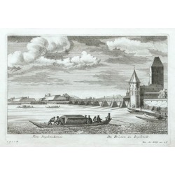
Pons Ingolstadiensis. - Die Brücken zu...Bestell-Nr .: 16782
"Pons Ingolstadiensis. - Die Brücken zu Ingolstadt". Orig. Kupferstich aus "Theatrum Danubii - Schauplatz des Donau-Stroms", Augsburg bei Jer. Wolff Erben, um 1730. Mit figuren auf Schiffe vorne und lat.-dt. Titel unten. 18:29 cm.
7 500,00 KčZu verkaufen -
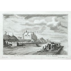
Arx Ingolstadiensis. - Schloss zu IngolstadtBestell-Nr .: 16779
"Arx Ingolstadiensis. - Schloss zu Ingolstadt". Orig. Kupferstich aus "Theatrum Danubii - Schauplatz des Donau-Stroms", Augsburg bei Jer. Wolff Erben, um 1730. Mit figuren auf Schiffe vorne und lat.-dt. Titel unten. 18:29 cm.
7 500,00 KčZu verkaufen -
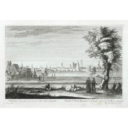
Prospectus Augustae ad Licum - Prospect...Bestell-Nr .: 16767
"Prospectus Augustae ad Licum, ubi rates alluunt. - Prospect d. Stadt Augsburg v: d. Lech - seiten, wo die Flösse abgehen". Orig. Kupferstich aus "Theatrum Danubii - Schauplatz des Donau-Stroms", Augsburg bei Jer. Wolff Erben, um 1730. Mit...
7 500,00 KčZu verkaufen -
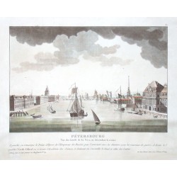
le Coeur, Louis Sankt Petersburg. PetersbourgBestell-Nr .: 16737
"Petersbourg. Vue des bords de la Neva en descendant la riviere". Orig. altkol. Aquatinta von L. le Coeur bei Bance, Paris, um 1800. Mit zahlr. Schiffe im Vordergrund und Fr. Titel unten. 22,5:33,5 cm.
12 000,00 KčZu verkaufen -
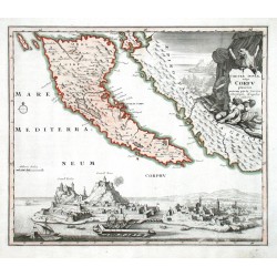
Weigel, Christoph der Ältere Corcyrae Insulae vulgo CorfuBestell-Nr .: 16590
Korfu (Kerkyra). "Corcyrae Insulae vulgo Corfu planities unacum parte Greciae". Orig. copperplate engraving, Ch. Weigel, Nuremberg, 1718. Orig. old colouring. With figure title cartouche and a view of the city of Kérkyra. 31:36,5 cm.
7 500,00 KčZu verkaufen -
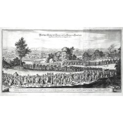
Merian, Matthäus Prächtiger Einzug dess Königs und der...Bestell-Nr .: 16503
Paris. "Prächtiger Einzug dess Königs und der Königin in Franckreich so geschehen in Paris den 26 Augusti 1660". Orig. Kupferstich aus Merians Theatrum Europaeum, Frankfurt am Main, 1667. Mit Titel oben und Kart. mit Erklärungen (a.-o.) unten. 28:53 cm.
4 000,00 KčZu verkaufen -
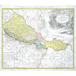
Homann Erben Tabula Geografica exhibens Regnum...Bestell-Nr .: 16440
"Tabula Geografica exhibens Regnum Sclavoniae cum Syrmii Ducatu". Altkol. Kupf.-Kte. bei Homann Erben, 1745. Mit gr. fig. Kart., Kart. mit Erklärungen ("Notarum Explicatio") und fr. Kopftitel ("Carte du Royaume d'Esclavonie et du Duche de Syrmie...
6 000,00 KčZu verkaufen -
Schenk, Peter & Valck, Gerard Ditio Trans-isulanaBestell-Nr .: 16434
Overijssel und Drenthe. "Ditio Trans-isulana". Orig. copperplate engraving, P. Schenk and G. Valck, Amsterdam, ca. 1690. Orig. old colouring. 38:48,5 cm.
4 800,00 KčZu verkaufen -
Schenk, Peter & Valck, Gerard Dalecarliae et Westmanniae Nova et...Bestell-Nr .: 16431
Südostschweden. "Dalecarliae et Westmanniae Nova et Accurata descriptio". Orig. copperplate engraving, P. Schenk and G. Valck, Amsterdam, ca. 1700. Orig. old colouring. 39:49 cm.
5 000,00 KčZu verkaufen -
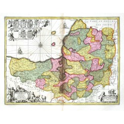
Schenk, Peter & Valck, Gerard Somersettensis Comitatus. Somerset ShireBestell-Nr .: 16428
Grafschaft Somerset. "Somersettensis Comitatus. Somerset Shire". Orig. copperplate engraving, P. Schenk and G. Valck, Amsterdam, ca. 1700. Orig. old colouring. 37,5:49 cm.
4 000,00 KčZu verkaufen -
Schenk, Peter & Valck, Gerard Leicestrensis Comitatus cum Rutlandiae....Bestell-Nr .: 16425
Grafschaften Leicestersheir und Rutland. "Leicestrensis Comitatus cum Rutlandiae. Vulgo Leicester & Rutland Shire". Orig. copperplate engraving, P. Schenk and G. Valck, Amsterdam, ca. 1700. Orig. old colouring. 43:54 cm.
5 000,00 KčZu verkaufen -
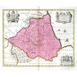
Schenk, Peter & Valck, Gerard Episcopatus Dunelmensis Vulgo The...Bestell-Nr .: 16422
Durham. "Episcopatus Dunelmensis Vulgo The Bishoprike of Durham". Orig. copperplate engraving, P. Schenk and G. Valck, Amsterdam, ca. 1700. Orig. old colouring. 40:50 cm.
4 000,00 KčZu verkaufen -
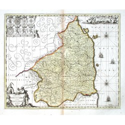
Schenk, Peter & Valck, Gerard Comitatus Northumbria vernacule...Bestell-Nr .: 16419
Northumberland. "Comitatus Northumbria vernacule Northumberland". Orig. copperplate engraving, P. Schenk and G. Valck, Amsterdam, ca. 1690. Orig. old colouring. 40:48,5 cm.
4 200,00 KčZu verkaufen -
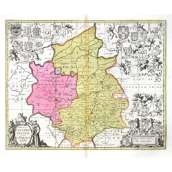
Schenk, Peter & Valck, Gerard Comitatis Cantabrigiensis, vernacule...Bestell-Nr .: 16416
Cambridgeshire. "Comitatis Cantabrigiensis- vernacule Cambridgeshire". Orig. copperplate engraving, P. Schenk and G. Valck, Amsterdam, ca. 1700. Orig. old colouring. With figure title-cartouche. 41:51 cm.
6 500,00 KčZu verkaufen -
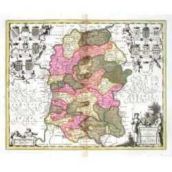
Schenk, Peter & Valck, Gerard Wiltonia sive Comitatus Wiltoniensis....Bestell-Nr .: 16413
Wiltshire. "Wiltonia sive Comitatus Wiltoniensis. Anglis Wilshire". Orig. copperplate engraving, P. Schenk and G. Valck, Amsterdam, ca. 1700. Orig. old colouring. 39,5:49 cm.
4 000,00 KčZu verkaufen -
Schenk, Peter & Valck, Gerard (Autor) Sanson, Nicolas (Andere Autoren) La Saintonge vers le MidyBestell-Nr .: 16407
Saintonge. "La Saintonge vers le Midy ...". Altkol. Kupf.-Kte. nach N. Sanson bei P. Schenk und G. Valck, Amsterdam, um 1700. Mit fig. Titelkart, Kart. mit Meilenanzeiger und 2 Segelschiffe. 43,5:55,5 cm.
3 600,00 KčZu verkaufen -
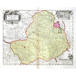
Schenk, Peter & Valck, Gerard Dioecese de Rheims et le pais de RethelBestell-Nr .: 16404
Reims - Rethel. "Dioecese de Rheims et le pais de Rethel". Altkol. Kupf.-Kte., P. Schenk und G. Valck, Amsterdam, um 1700 nach J. Jubrien. Mit dekorative Titelkart, von Putten gehalt. Kart. mit 2 Wappen und fig. Kart. mit Meilenanzeiger. 38,5:49 cm.
3 800,00 KčZu verkaufen -
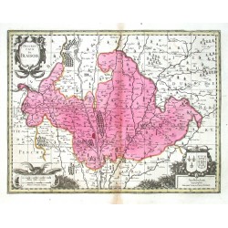
Schenk, Peter & Valck, Gerard Description Du BlaisoisBestell-Nr .: 16401
Blois. "Description Du Blaisois". Altkol. Kupferstich Karte, P. Schenk und G. Valck, Amsterdam, um 1700. Mit dekorative Titelkart, Kart. mit Verlegers Adresse mit 2 Wappen und Kart. mit Meilenanzeiger. 37,5:49,5 cm.
3 800,00 KčZu verkaufen -
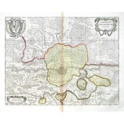
Schenk, Peter & Valck, Gerard Territorium FrancofurtenseBestell-Nr .: 16395
Frankfurt am Main. "Territorium Francofurtense". Altkol. Kupf.-Kte., P. Schenk und G. Valck, Amsterdam, um 1700. Mit ornament. Titelkart, gr. Wappen und ornament. Kart mit Verlegers Adresse. 37,:48 cm.
4 000,00 KčZu verkaufen -
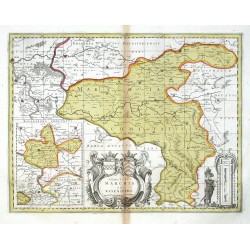
Schenk, Peter & Valck, Gerard Comitatus Marchia et RavensbergBestell-Nr .: 16392
Grafschaften Mark und Ravensberg. "Comitatus Marchia et Ravensberg". Altkol. Kupf.-Kte. bei P. Schenk und G. Valck, Amsterdam, um 1700. Mit kl. Nebenkarte ("Ravensberg Comitatus", 18,5:14,5 cm), ornament. Titelkart mit 2 Wappen und fig. Kart mit Meilenanzeiger. 37:48,5 cm.
4 500,00 KčZu verkaufen -
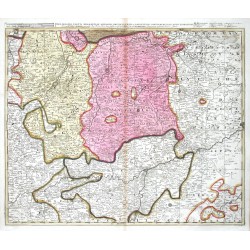
Schenk, Peter & Valck, Gerard Hassia SuperiorBestell-Nr .: 16389
Südbrabant. "Delineatio Partis Brabantiae, ...". Orig. copperplate engraving, P. Schenk, Amsterdam, ca. 1700. Orig. old colouring. With title above the map. 49:58 cm.
2 800,00 KčZu verkaufen -
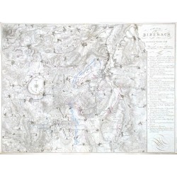
List Schlacht bey Biberach am zweiten October 1796Bestell-Nr .: 16350
"Schlacht bey Biberach am zweiten October 1796". Orig. grenzkol. Kupferstich von List nach Höhm aus "Erzherzog Karl, Grundsätze der Strategie. Erläutert durch die Darstellung des Feldzugs 1796". Wien, Strauss, 1819. Mit Titel und Erklärungen...
3 000,00 KčZu verkaufen -
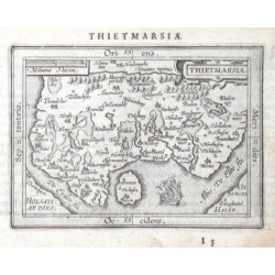
Ortelius, Abraham ThietmarsiaBestell-Nr .: 15960
Kreis Dithmarschen. "Thietmarsia". Orig. Kupferstich aus lat. Ausg. von A. Ortelius Epitome. Bei J. B. Vrienst, Antwerpen, 1609. Mit ornament. Titelkart., andere Kart mit Meilenzeiger ("Miliaria Thietm."), einem Segelschiff und lat. Titel oben. 9:12,5 cm.
1 800,00 KčZu verkaufen -
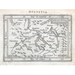
Ortelius, Abraham Schweiz - HelvetiaBestell-Nr .: 15945
Schweiz. "Helvetia". Orig. copper-engraving from the Latin edition of A. Ortelius' Epitome. Published by J. B. Vrients in Antwerp, 1609. With ornamental title-cartouche, the scale of map ("Scala milliarium") and Latin title above the map....
1 800,00 KčZu verkaufen -
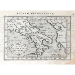
Ortelius, Abraham Süditalien - Typus Regni NeapolitaniBestell-Nr .: 15942
Süditalien. "Typus Regni Neapolitani". Orig. copper-engraving from the Latin edition of A. Ortelius' Epitome. Published by J. B. Vrients in Antwerp, 1609. With ornamental title-cartouche, the scale of map ("Milliaria Italica") and Latin title ("Regnvm...
1 500,00 KčZu verkaufen -
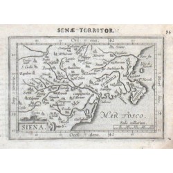
Ortelius, Abraham SienaBestell-Nr .: 15939
Siana (Provinz). "Siena". Orig. copper-engraving from the Latin edition of A. Ortelius' Epitome. Published by J. B. Vrients in Antwerp, 1609. With ornamental title-cartouche, the scale of map ("Scala milliarium") and Latin title ("Senae Territor.") above the...
1 500,00 KčZu verkaufen -
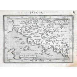
Ortelius, Abraham Toskana - TusciaBestell-Nr .: 15933
Toskana. "Tuscia". Orig. copper-engraving from the Latin edition of A. Ortelius' Epitome. Published by J. B. Vrients in Antwerp, 1609. With ornamental title-cartouche, a cartouche with the scale of map ("Scala mill. Italicor") and Latin title above the...
1 500,00 KčZu verkaufen -
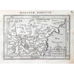
Ortelius, Abraham Campagna Romana - Romanum TeritoriumBestell-Nr .: 15930
Campagna Romana. "Romanum Teritorium". Orig. copper-engraving from the Latin edition of A. Ortelius' Epitome. Published by J. B. Vrients in Antwerp, 1609. With ornamental title-cartouche, the scale of map ("Milliaria Italica") and Latin title above the map....
1 500,00 KčZu verkaufen -
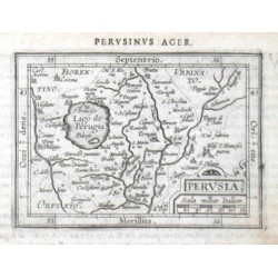
Ortelius, Abraham Perugia (Provinz) - PerusiaBestell-Nr .: 15918
Perugia. "Perusia". Orig. copper-engraving from the Latin edition of A. Ortelius' Epitome. Published by J. B. Vrients in Antwerp, 1609. With ornamental title-cartouche with the scale of map ("Scala milliar. Italicor") and Latin title above the map...
1 500,00 KčZu verkaufen -
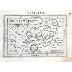
Ortelius, Abraham Orvieto - OropitumBestell-Nr .: 15915
Orvieto. "Oropitum". Orig. copper-engraving from the Latin edition of A. Ortelius' Epitome. Published by J. B. Vrients in Antwerp, 1609. With ornamental title-cartouche, the scale of map ("Milliaria Italica") and Latin title above the map ("Orvietvm")....
1 500,00 KčZu verkaufen -
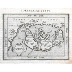
Ortelius, Abraham Korfu - CorfuBestell-Nr .: 15897
Korfu (Kerkyra). "Corfu". Orig. copper-engraving from the Latin edition of A. Ortelius' Epitome. Published by J. B. Vrients in Antwerps, 1609. With ornamental title-cartouche and Latin title above the map ("Corcyra vel Corfv"). 8,5:12 cm.
2 100,00 KčZu verkaufen -
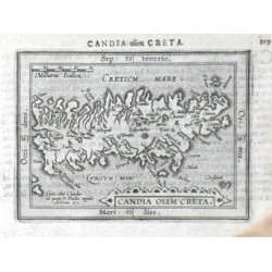
Ortelius, Abraham Kreta - Candia Olim CretaBestell-Nr .: 15894
Kreta. "Candia Olim Creta". Orig. copper-engraving from the Latin edition of A. Ortelius' Epitome. Published by J. B. Vrients in Antwerp, 1609. With ornamental title-cartouche, another cartouche with the scale of map ("Milliaria Italica") and Latin...
2 100,00 KčZu verkaufen -
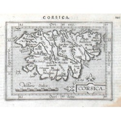
Ortelius, Abraham Korsika - CorsicaBestell-Nr .: 15888
Korsika. "Corsica". Orig. copper-engraving from the Latin edition of A. Ortelius' Epitome. Published by J. B. Vrients in Antwerp, 1609. With ornamental title-cartouche, another cartouche with the scale of map ("Milliaria Italica") and Latin title above...
2 100,00 KčZu verkaufen -
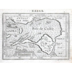
Ortelius, Abraham Cádiz - GadesBestell-Nr .: 15885
Cádiz. "Gades". Orig. copper-engraving, Orig. copper-engraving from the Latin edition of A. Ortelius' Epitome. Published by J. B. Vrients in Antwerp, 1609. With ornamental title-cartouche, another cartouche with the scale of map ("Milliare...
1 600,00 KčZu verkaufen -
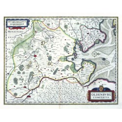
Janssonius, Johannes Oldenburg ComitatusBestell-Nr .: 15819
Oldenburg. "Oldenburg Comitatus". Altkol. Kupf.-Kte. bei J. Janssonius, Amsterdam, 1630. Mit ausgem ornament. Titelkart. mit einem Wappen, ornament. Kart. mit Meilenanzeiger und eine Windrose. 38:49 cm.
4 500,00 KčZu verkaufen -
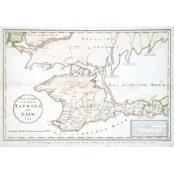
Maire, F. J. Post Karte von der Halbinsel Taurien oder...Bestell-Nr .: 15729
Krim. "Post Karte von der Halbinsel Taurien oder Krim (pour Servir de renseignemens a la Carte des Limites des trois Empires ou Theatre de la Guerre de 1787 entre la Russie et les Turcs)". Orig. copper-engraving after F. J. Maire's map of the region....
3 500,00 KčZu verkaufen -
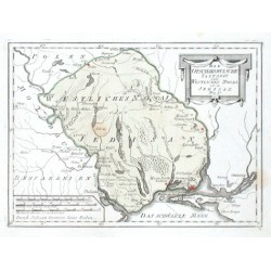
Reilly, Franz Johann Joseph Die Otschakowische Tartarey oder...Bestell-Nr .: 15699
"Die Otschakowische Tartarey oder Westliches Nogaj, auch Jedisan. Nro. 12.". Orig. copper-engraving. Published by F. J. J. von Reilly, Vienna, 1789. Orig old colouring. With decorative title-cartouche and the scale of map. 20,5:28 cm.
1 800,00 KčZu verkaufen -
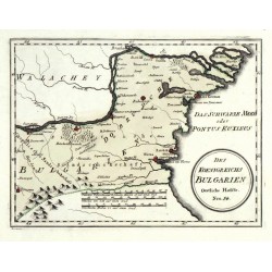
Reilly, Franz Johann Joseph von Des Koenigreichs Bulgarien Oestliche HaelfteBestell-Nr .: 15690
Bulgarien. "Des Koenigreichs Bulgarien Oestliche Haelfte". Orig. altkol. Kupferstich Karte, F. J. J. von Reilly, Wien, 1790. Mit Titelkart. und Meilenanzeiger. 21:28 cm.
1 100,00 KčVerkauft -
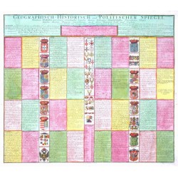
Ermeltraut, J. M. Geographisch - Historisch und Politischer...Bestell-Nr .: 15603
Europa."Geographisch - Historisch und Politischer Spiegel, Worinnen Europa mit seinen vornehmsten Landen, Stätten, Festungen, Handelschafften, Universitäten, Flüssen, Insulen, Bergen, Wappen, Einwohneren, auch deren Regenten Zahl und Conduite,...
7 500,00 KčZu verkaufen -
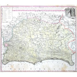
Homann Heirs Il Lazio, con Strade Antiche e ModerneBestell-Nr .: 15579
"Il Lazio, con ... Strade Antiche e Moderne ... Latium cum ... viis ... Antiqvum & novum Statum". Orig. copper-engraving. Published in Nuremberg by Homann Heirs, 1745. Orig. old colouring. With It.-Lat. title-cartouche and a cartouche with the...
6 500,00 KčZu verkaufen -
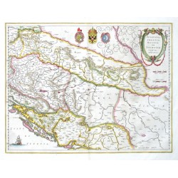
Blaeu, Willem Janszoon Sclavonia, Croatia, Bosniacum Dalmatiae parteBestell-Nr .: 15576
Slowenien, Kroatien, Bosnien und Herzegowina. "Sclavonia, Croatia, Bosniacum Dalmatiae parte". Orig. copper-engraving, W. J. Blaeu after G. Mercator's map of the region. Published in Amsterdam by J. Blaeu, 1644. Orig. old colouring. With ornamental title-cartouche, 3 coats-of-arms and ...
4 500,00 KčZu verkaufen -
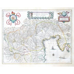
Blaeu, Joan Dominio Veneto nell' ItaliaBestell-Nr .: 15537
Venetien. "Dominio Veneto nell' Italia". Altkol. Kupf.-Kte. bei J. und C. Blaeu, Amsterdam, 1641. Mit ornament. Titelkart. mit 2 Putten, ornament. Kart mit Meilenanzeiger ("Milliaria Italica ... Germanica") und ebenso 2 Putten, gr. Wappen, Windrose und 3...
13 500,00 KčZu verkaufen -
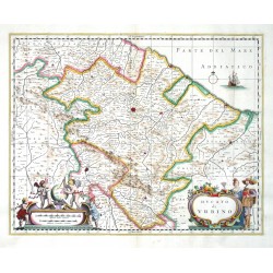
Janssonius, Johannes Ducato di UrbinoBestell-Nr .: 15534
Herzogtum Urbino. "Ducato di Urbino". Orig. copperplate engraving, J. Janssonius. Published by P. Schenk and G. Valck in Amsterdam, ca. 1700. Orig. old colouring. 37,5:48 cm.
7 500,00 KčZu verkaufen -
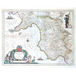
Blaeu, Joan Principato citra olim PicentiaBestell-Nr .: 15522
Picentia (Kampanien). "Principato Citra olim Picentia". Altkol. Kupf.-Kte. bei J. und C. Blaeu, Amsterdam, 1641. Mit gr. fig. Titelkart. mit e. Wappen, fig. Kart. mit Meilenanzeiger ("Scala di miglia dieci Italiane"), 4 Segelschiffe und e. Windrose. 38:50 cm.
10 000,00 KčZu verkaufen -
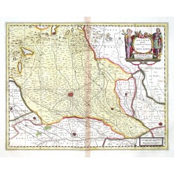
Schenk, Peter & Valck, Gerard Ducato ouero Territorio di MilanoBestell-Nr .: 15516
Herzogtum Mailand. "Ducato ouero Territorio di Milano". Orig. copperplate engraving, P. Schenk and G. Valck, Amsterdam, ca. 1700. Orig. old colouring. With figure title cartouche. 37:47,5 cm.
7 500,00 KčZu verkaufen -
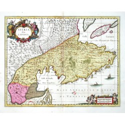
Schenk, Peter & Valck, Gerard Istria, olim LapidiaBestell-Nr .: 15510
Istrien. "Istria, olim Lapidia". Orig. copperplate engraving, P. Schenk and G. Valck, Amsterdam, ca. 1700. Orig. old colouring. With figure title cartouche. 38,5:50 cm.
9 000,00 KčZu verkaufen -
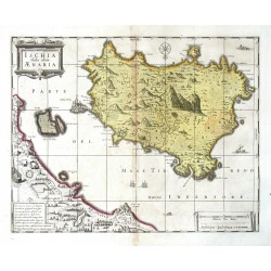
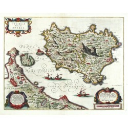
Schenk, Peter & Valck, Gerard Ischia Isola, olim AenariaBestell-Nr .: 15504
Ischia. "Ischia Isola olim Aenaria". Orig. copperplate engraving, P. Schenk and G. Valck, Amsterdam, ca. 1700. Orig. old colouring. With ornamental title-cartouche, another 2 ornamental cartouches and 3 ships. 35:45,5 cm.
9 500,00 KčZu verkaufen -
Blaeu, Joan (Autor) Jasolinus, Julius (Andere Autoren) Ischia Isola, olim AenariaBestell-Nr .: 15501
Ischia. "Ischia Isola, olim Aenaria". Orig. copper-engraving after J. Jasolinus' map of Ischia. Published in Amsterdam by J. and C. Blaeu, 1641-42. Orig. old colouring. With ornamental title-cartouche, another 2 ornamental cartouches and 3 ships. 38:49,5 cm.
10 500,00 KčZu verkaufen -
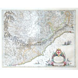
Blaeu, Willem Janszoon Riviera di Genova da PonenteBestell-Nr .: 15498
Westlichen Teil."Riviera di Genova da Ponente". Altkol. Kupf.-Kte. bei J. und C. Blaeu, Amsterdam, 1641. Mit fig. Titelkart. mit einem Wappen und Meilenanzeiger ("Scala di quindici miglia Italiane") und 3 Segelschiffe. 38:49,5 cm.
11 500,00 KčZu verkaufen

